Travel: The Cream Cellar Road (CCR) begins on the north side of Utah State Route 12, about ten miles east of Escalante. At the top of the hill just before the descent to the Escalante River near mile marker 69, watch for radio towers south of the highway. This is one mile west of Head of the Rocks Overlook. Either park in a small lot below the towers, or turn north, cross a cattle guard immediately and park. The lower end of the CCR intersects the highway at mile marker 72.8 just west the Boynton Overlook.
Distance and Elevation Gain: The CCR out-and-back is 6.3 miles with 870 feet of climbing. Roundtrip to the bridge alone is 6.4 miles with 900 feet of vertical. For both the CCR and the bridge, it is 9.0 miles with 1300 feet of elevation gain.
Time: 3:00-3:30 roundtrip to the bridge or the CCR; 5:00-5:30 for both
Difficulty: Trail, off-trail; navigation moderately challenging; the only exposure is on the bridge; carry all the water you will need.
Map: Calf Creek, UT 7.5 USGS Quad
Latest Date Hiked: October 10, 2017
Historical Note: Mormon pioneers arrived in Escalante in 1875. Ranchers built the Cream Cellar Road to haul cream out of the Escalante River pasture bottom. The road was so rough, cream in the crocks churned to butter along the way. Steve Allen, author of Utah's Canyon Country Place Names, explains that the track was the first road between the towns of Boulder and Escalante, the Old Boulder Road. "It crossed Big Flat and dropped to the Escalante River just below the mouth of Calf Creek...The difficulties the pioneers had in traveling this road were enormous. Early users planned on four to seven days from Escalante to Boulder, camping en route."
Quote: The man who found the route for this road should have a medal, or else be killed. A companion then exclaimed: Kill him, damn him. That's what I say. Sally May King, Pioneer (Utah's Canyon Country Place Names)
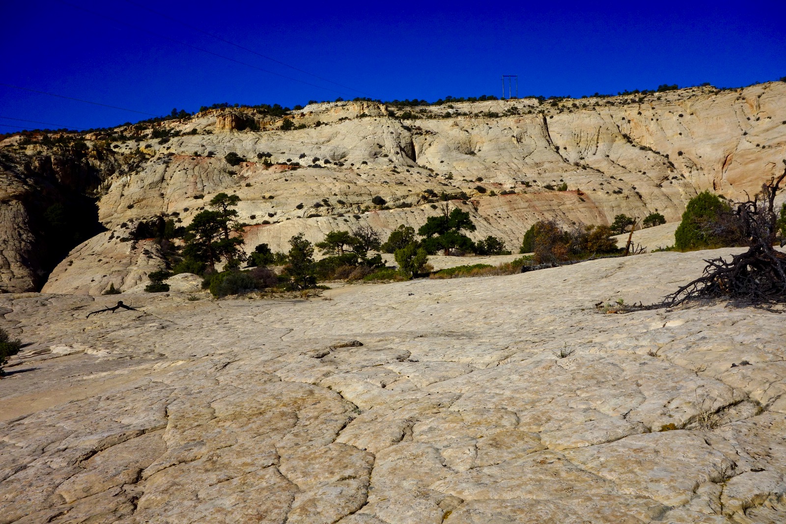
The Cream Cellar Road was cleaved into a steeply sloping Navajo Sandstone wall with characteristic sweeping cross-bed patterns.

Route: The CCR, represented with the black line, bears northeast as it descends the eastern escarpment of Big Flat. Carefully follow signs of a hewed roadbed and wagon grooves. While the historic road went to the Escalante River it is now swallowed by Highway 12 one mile before its original destination. The blue-line spur route to Escalante Natural Bridge leaves the CCR and bears northwest across open slickrock.

Cream Cellar Road
From the parking area below the radio towers, elevation 6,300 feet, cross Highway 12 and the ensuing cattle guard, shown. The CCR is not visible in this location, neither is there a social trail. After crossing the guard turn right/east and parallel a wire fenceline 20 feet to its north.

The historic road will materialize within 100 feet. Piñon-juniper and rabbitbrush contrast with the red shale of the Carmel Formation. The choppy crimson rock was mined and hauled as road base to smooth the bedrock track. Pass by a rock and timber ruin and walk under power lines, shown. Off in the east are the Henry Mountains and Navajo Mountain.

The road makes a descending traverse under the rim. Its width is still intact except at 0.5 mile where it has collapsed into a defile. (THW, photo)

Hacking the road into the stone wall proved a structural challenge. Curbing and retaining walls were fashioned with large flat stones still in place today. (THW, photo)

The track takes aim at the head of the amphitheater and at 0.6 mile makes a pronounced switchback diving ever deeper into the sandstone bowl.

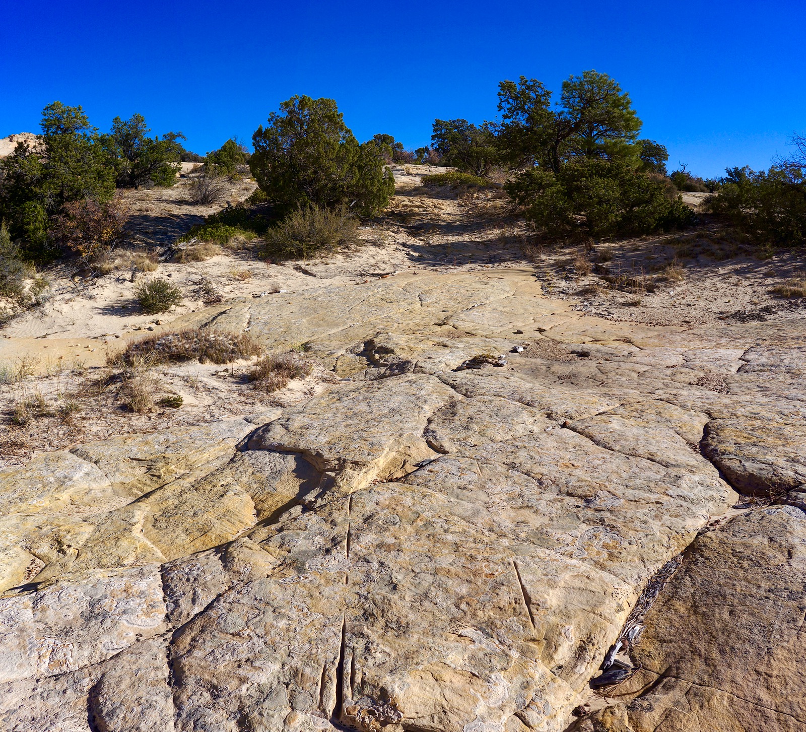
The road is washed out again at the lower end of the aforementioned trench. Walk down a furrowed rib with chiseled side walls, shown. Note the linear grooves in the pavement. They occur sporadically all along so search for them if you get off-track. There are only a few cairns and some are ill-placed. Let the road be your guide.

This image looks back on the wagon road. The troublesome chasm is on the left. Very old and stately ponderosa grow in sand island gardens.
The track curves around the east rampart of a complicated and incised apricot-splashed sandstone structure topped by Point 6,248'.

Be a sleuth making every effort to follow the grooves, divots, chisel marks, and horizontal gouges ground in by steel wheels. While road engineers made every effort to stay on bedrock, the track traverses sandy sections as well.
At 1.5 miles, pass left of the "Survivor Tree," a positively ancient ponderosa. (THW, photo)

Cross a shallow but unmistakable dry waterway at 1.9 miles. This is where the route to the bridge leaves the CCR bearing northwest. Continuing on, the CCR plows into sand. It takes a little more attention to follow the old roadbed but it is still visible. When islands of bedrock emerge so do the reassuring gouge imprints.

The CCR turns east at 2.5 miles. Our attention is riveted on a red and white striated fossilized dome field. At river level some domes have a distinctly purple color indicating they are in the Kayenta Formation. Across the river an unnamed north tributary appears and then Calf Creek to its east. Our excitement grows when we look down on the Escalante River Trail and the armored walls of the broad canyon. The CCR is not documented in hiking literature and we fully expect it to take us all the way to the river.

The sound of vehicles rushing along on Highway 12 dash our hopes and at 3.2 miles the CCR ends abruptly at the pavement. There is no sign of the historic road continuing on in the vicinity so we surmise it got consumed when the highway was built. The image below locates the CCR in reference to the highway. It meets the road at mile marker 72.8. There are no cairns to mark this significant location. The Boynton Overlook is right around the bend.

Escalante Natural Bridge
For years we wondered whether we could reach Escalante Natural Bridge from above. We thought it highly unlikely we'd get anywhere near the structure. So we were thrilled to not only find it but to walk across the glorious span. Do not attempt to locate the bridge unless you are capable of finding your way across open slickrock with few distinctive landscape markers.
The image below was taken by my hiking partner years earlier while standing under the barrier fall that created the bridge. (THW, photo)

Whether you walked the length of the CCR or have descended straight from Big Flat, locate the shallow drainage 1.9 miles into the hike, elevation 5,860 feet. The bridge is 1.3 miles from here. The blue line on the map above is our exit route which was spot on. What I don't show is our traipse down the wrong canyon that left us cliffed out at a mighty pouroff. We retreated and walked the rim west. Your strategy will be to descend "Bridge Canyon." After locating the barrier fall that created the bridge, head a vertical-walled crack to access the slope that leads onto the span, shown. The bridge was hard to find but not difficult to access, an unexpected joy.

The top of the span is perfectly flat with straight edges at the drop. It is about 18 feet wide and perhaps 50 feet across. Measured from the bottom it is 130 feet tall and spans 100 feet. It is the fifth largest bridge in the Glen Canyon region. Rainbow Bridge and the three magnificent spans at Natural Bridges National Monument are larger. (THW, photo)

The creation pouroff is a two-tiered vertical spillway. (THW, photo)

Look out over the Escalante River and the trail leading to the bottom of the bridge. (THW, photo)

Retrace your steps to Bridge Canyon and ascend the pink, polygonal feeder bowl. Step up the canyon effortlessly on Navajo bedding planes. On this October day, tanks were water filled.

Elaborate and bizarre iron concretions decorate the bedrock in the upper reaches of the broadening drainageway. Leave the canyon and bear southeast, working the slickrock until you relocate the CCR, presumably close to where you branched off.

Here's the traditional view of Escalante Natural Bridge from the river. (THW, photo)

An important note from author Steve Allen about protecting endangered National Monuments in Southern Utah.
I wandered in this area about five years ago and was so puzzled by what looked like an improbable road to nowhere. Now I get it! Hope to hike from where it joins Highway 12 at the bottom to the natural bridge next time.
ReplyDeleteExcellent! That will be a beautiful hike. Thanks for your comment. Debra
DeleteToday we hiked the Cream Shelter Road from HW12 to the junction with the Bridge D-tour and back to HW12 with some slickrock excursions in between. We found a well established social trail at the start and in the sand sections of the road. We highly enjoyed the slickrock scenery along the route.
ReplyDeleteThanks for the exellent description of the historic background.
Hans R. Zeller, Switzerland.
Hi Hans, I'm just now getting your comment. Thank you for the helpful note about the social trail. I'm so pleased you enjoyed this astonishing stone landscape. Debra
DeleteThanks very much for this description. I have hiked most of this section now thanks to your directions. Have also stumbled across the next section up from the river towards Boulder, accessed with permission from private property. I wonder how to find the Boulder end? Probably also private property. I'm not a local so these directions are very useful.
ReplyDeleteI'm pleased to know you are out there exploring this wondrous landscape and that Earthline has been helpful in your wondering. Debra
Delete