Travel: The Alamo Canyon Trail begins from the Alamo Canyon Campground. From the turnoff for the Organ Pipe visitor center, drive north on AZ-85 for 9.9 miles (mile marker 65.3). Turn east on unsigned Alamo Canyon Road. For those traveling from Why, AZ, drive 11.9 miles south from the main intersection on AZ-85. The access road is just north of Alamo Wash. The 3.3 mile graded road is suitable for 2WD vehicles. The trailhead is on the right by the outhouse. No water.
Distance and Elevation Gain: 5.0 miles; 1,960 feet of climbing
Total Time: 4:00 to 5:30
Difficulty: Primarily off-trail; navigation moderate; Class 2+ with no exposure; carry all the water you will need.
Map: Mount Ajo, AZ 7.5' USGS Quad
Date Hiked: February 6, 2019
Quote: Be still, and the earth will speak to you. Navajo Proverb
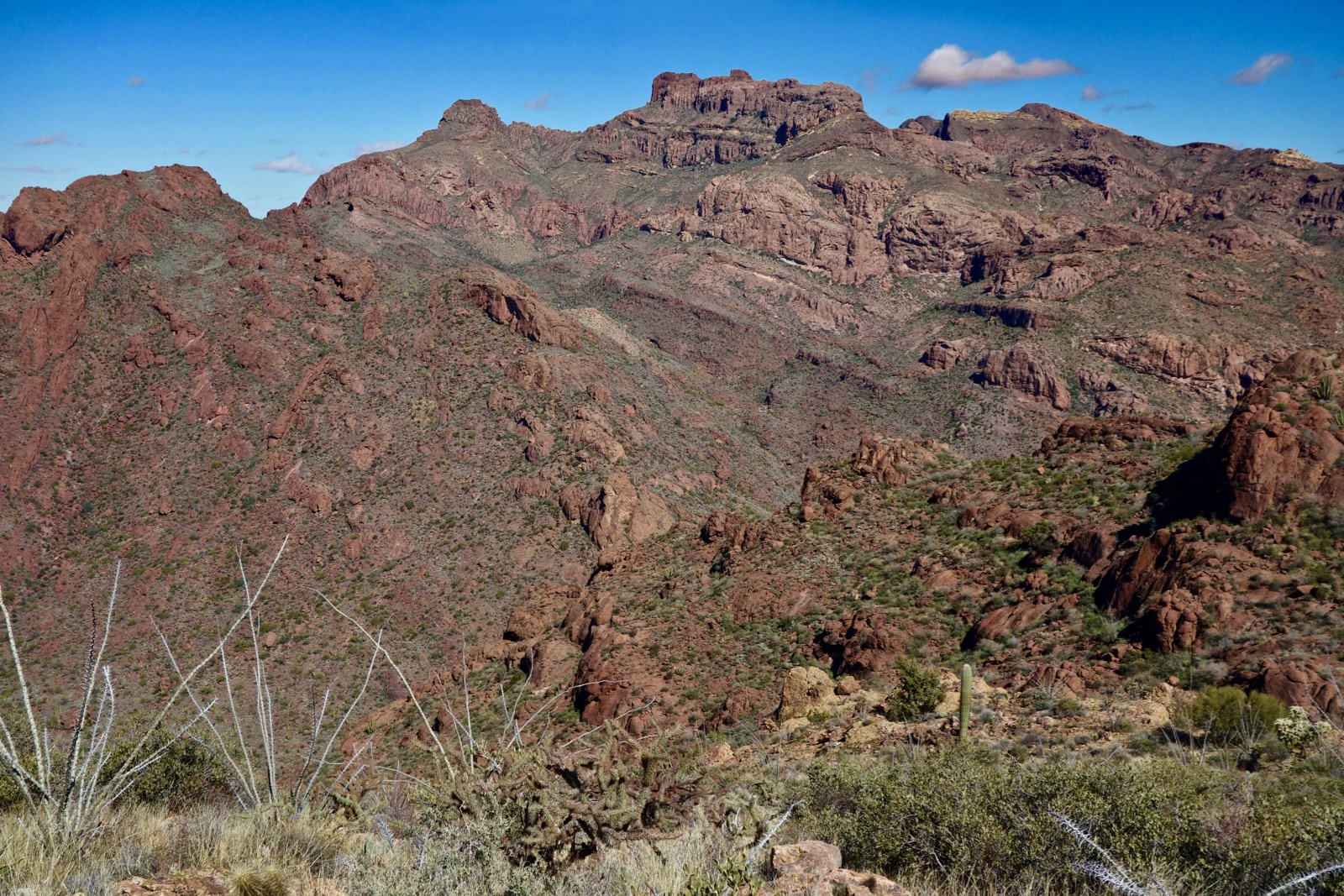
From the platform at the top of the Arch Canyon Trail, Peak 4,158' is irresistible. While you may climb the south slopes, shown, this hike approaches from the north. The eponymous arch may be seen in the shadows below.

Route: Walk southeast up Alamo Canyon. Leave the trail and ascend south in a swale to a westward lateral ridge. Climb east to gain the north ridge of Peak 4,158' and hike south to the summit. Return as you came. Want a shorter climb? See the note at the end of this post.
From the Alamo Canyon Trailhead, elevation 2,280 feet, walk east on an old roadbed up the north side of Alamo Wash. Organ pipe cactus are in their glory, saguaro are plump, and chainfruit cholla tower overhead. Also present are jojoba, creosotebush, mesquite, and paloverde. Volcanism is capable of creating fascinating structures such as the rhyolite towers on the north wall of the canyon.

Looking at the route from the trail it ascends the swale, image-center. To its left is the north ridge of Peak 4,158'.

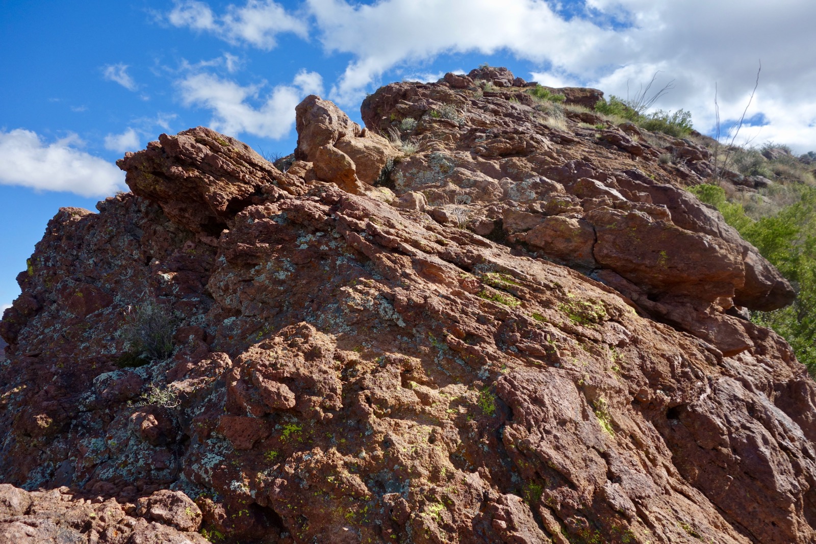
We took different routes to access the swale going and coming. Initially, we crossed Alamo Wash a couple hundred yards from the trailhead and cut across the open and pleasant bajada. As we closed in on the swale we were slowed by ultra large breccia boulders that had rolled off the mountain. Breccia is created when volcanic rhyolite flows over the earth's surface gathering up rocks and cementing them together to form new rock as it cools.
(Thomas Holt Ward, photo)

On our return trip we avoided the boulder field. As indicated on the map above, leave the road at 0.65 mile. (If you'd like to see Bill and Birdy Miller's historic line shack, stay on the road for another 0.1 mile and then double back.) Drop into the wash and weave through a creosote thicket and up onto the bajada.
The Swale
Reach the bottom of the swale at 0.8 mile. From here it is hiker's choice. Again, our route up and down varied. The track on the map and the following description is the best route we found but there is plenty of room for variation. The slope is steep enough that rocks roll out from underfoot, especially on the descent. Brush obscures footing in places. On the lower slope, the east side is a lot less boulder jumbled than the west so stay left of swale-center.

You will naturally gravitate toward the center of the ravine eventually; it is troubled with cliffs and rock features. Flank the large outcrop in the center of this image close to its east wall. Next, pitch up a rock slab and then cross over to the west side at 2,740 feet. The transit was easy on stone and resurrection moss. (THW, photo)

Two small ravines drain the upper bowl. Climbing the stone throat of the east channel was more challenging than the west, shown. Work your way onto the west slope and skirt the rectangular block at skyline on its right.

Next time I'd like to try simply climbing the north ridge from the bajada. If you do so, please leave a comment.

Gain the west trending lateral ridge at 1.3 miles, 3,260 feet. (THW, photo)

The lateral ridge is an unparalleled lookout north to Peaks 4,180' and 4,220', climbed from Alamo Canyon. This circuit is one of my all-time favorite desert hikes.
Peak 4,158' may be seen for the first time, image-right. Hike east up a pleasant slope to the north ridge.

North Ridge to Summit
Gain the ridge at first opportunity so you don't miss out on fascinating rock formations, 3,560 feet, 1.6 miles.

Ridge walking for the next mile is fun, exhilarating, and glorious. (THW, photo)

The ridge drops sharply on the east but slopes gently to the west so you can control the degree of exposure.


Scamper up the stone spine.
This image looks back on the climb. There are no obstacles; the ridge is pure delight. (THW, photo)

Watch carefully for a small aperture in the cliff rock. On the horizon left of image-center is Peak 4,540', the third highest of the 23 ranked summits in the Ajo Range. It is a seriously rugged endeavor from Arch Canyon.


It is a fun, short Class 2+ scramble up the boulders in the break. (THW, photo)

If you got this far, you will have no trouble with the final pitch.

Top out on the solid stone summit at 2.5 miles. From the generous and relatively flat crest look out over some amazing territory--the tallest peaks in the Ajo Range. To the north, the spire right of image-center is Peak 4,088' on the Tohono O'odham Nation. (THW, photo)

Looking south, far below is Arch Canyon with its mighty earth pillar thrusting from the valley floor. On the jagged skyline, from the left is Peak 4,540', Mount Ajo, Peak 4,740' (ranked second tallest in the range), its subsidiary Peak 4,700', and the terminus of the Arch Canyon trail at Platform 3,780'. (THW, photo)

Peak 4,158' is at the center of the linear range. It is a serene bastion of solitude and silence. The peak register was placed in 2015 and contains only a few signatures.
Alternative Route From The South
Soon after we did our hike a group of friends climbed the south slopes from Arch Canyon, shown. They said it was faster and easier (and clearly shorter). "The only downer was all the trash left by migrants along a use trail going up to the saddle east of Peak 4,158'. That social trail made our climb much easier, however, so there was a silver lining." I will add that they missed hiking on the ridge, the most charming aspect of this ascent. This image was shot from the Arch Canyon Trail.

No comments:
Post a Comment