Travel: The Arch Canyon Trailhead is 9.2 miles out the 21-mile, one-way Ajo Mountain Drive. 2WD is sufficient on the improved dirt road. The scenic drive begins directly across AZ-85 from the park turnoff. The trailhead has a pit toilet and picnic table but no water. No dogs, no bikes on the trail.
Twin Peaks Campground: Reservations required year round. The peaceful village has 208 sites, solar showers, and starry nights.
Distance and Elevation Gain: 6.8 miles 2,600 feet of climbing
Total Time: 7:00 to 9:00
Difficulty: Primarily off-trail; navigation most challenging; One Class 3 wall; mild exposure; expect to be hiking for a full day and carry all the water you will need; this hike must be done in cool temperatures.
Map: Mount Ajo, AZ 7.5' USGS Quad
Date Hiked: March 28, 2019
Quote: By speaking of greater forces than we can possibly invoke, and by confronting us with greater spans of time than we can possibly envisage, mountains refute our excessive trust in the man-made. They pose profound questions about our durability and the importance of our schemes. They induce, I suppose, a modesty in us. Robert Macfarlane
Point 4,700' and Peak 4,740' appear as a nearby butterfly from Mount Ajo, the highest summit in the range. Passage from one to the other is prohibited due to a series of faceted cliffs and palisades. (Thomas Holt Ward, photo)

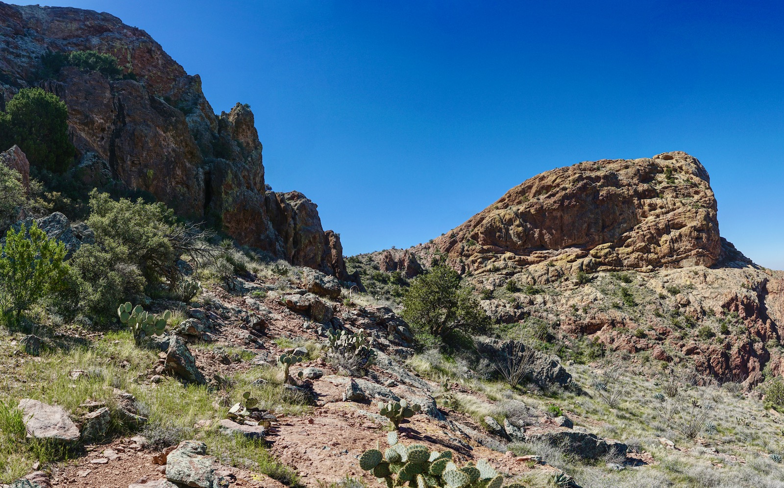
Route Image: This image was taken from Peak 4,158' on the north side of Arch Canyon. The next day we attempted to climb Peak 4,740' from the upper end of the Arch Canyon Trail but that proved technical. This route probes deep into Arch Canyon and then gains the saddle between the butterfly wings.

Route: Walk east on the Arch Canyon Trail. When the trail turns south, continue east and descend to the canyon floor. Scramble on creek-bottom boulders while following the main waterway as it turns south. Leave the defile and weave through a series of cliffs while ascending to the saddle between the two prominences. Climb both and return as you came.

The eponymous arch is clearly visible from the trailhead at elevation 2,560 feet. The large skylight is directly below a much smaller aperture. Volcanism is capable of creating fascinating structures and you will see fountains of rhyolite standing on bright yellow ash-fall tuff. The trail maintenance crew working in winter, 2019, built beautiful stone staircases that rival anything crafted by the masterful Civilian Conservation Corps.

After a wet winter the wildflowers were abundant alongside the trail. I listed 20 varieties in the first ten minutes. Poppies! (THW, photo)

Leave the footpath at 0.7 mile at a directional sign for the Arch Canyon Trail. A cautionary sign warns that smuggling and migrants are common--do not hike alone. Within Arch Canyon we saw considerable trash: clothing, black water bottles, and food wrappers. A wildcat trail descends to the canyon floor and disappears.

Curve with the main waterway to the right. Scramble up the narrow channel jumping from one water-polished boulder to the next. Massive breccia spheres are spectacular, a wild mix of cemented color scavenged by flowing rhyolite. On a spring morning the inner canyon was dark and cool shaded by barrier walls, turbinella oak, and encroaching vegetation. Arch Canyon has a couple of pretty spots, such as the one seen below, but I think of it as an access corridor rather than a destination. Boulders grow bigger and brush becomes an impediment.

At one mile, pass under an earth pillar with organ pipe cactus and saguaro rooted on microledges. The sentinel is definitely worth a trip and a good turn-around for casual hikers.

At 1.3 miles, a tributary enters upcanyon-right. Stay in the main canyon bearing east. After passing under a large cave a short bypass trail on the left avoids a snarly troubled section. The inner canyon narrows and is blocked by a chockstone. In 2018, the channel was dry and we climbed the ten-foot wall on the left. There are plenty of small ledges for feet and hands.

In 2019, the wall was wet and slippery so we bypassed upcanyon-right. Take a good look; at the proper level the platform and holds are stable and exposure is mild. This image was shot on the return.

At 1.8 miles, the drainageway swings distinctly south. Notice a break in the cliffs, upcanyon-left. This is where the route to Peak 4,540' leaves the canyon floor. It is the third highest of the 23 ranked summits in the Ajo Range. In 2018, we thought we'd climb both Peaks 4,540' and 4,740' together. But, the rugged and difficult five-mile climb to Peak 4,540' was enough for one day.
To climb 4,740', go with the main canyon as it bears south. It is thinner now but the challenges are about the same--trees to duck and big boulders to negotiate. The image below was shot above the canyon floor on the way to Peak 4,540'. Peak 4,740' is on horizon-right. Our route stays in the brushy corridor until the cliffs dissipate along the right hand wall.

In a tenth of a mile the canyon branches again; stay pointed south. The ravine becomes seriously choked. At about 2.1 miles, 3,620 feet, the cliff that's been on upcanyon-right bends to create an opening. This is a critical juncture; watch for cairn stacks. Leave the drainage and climb south-southwest. The remainder of the route was sparsely cairned at the time we climbed. Work your way to the right and get up against the escarpment where there is less brush and more bedrock slabs.

Hold your bearing and move out onto an open, red stone slope. Pick you route carefully. While there are small ledges for footsteps, there is some debris and it is steep enough to feel a little exposed. This shot was taken on the return. It shows the canyon floor, the initial scarp and the red slope.

This was the safest route up through this section.

The stone sheet pitches up even more so at 3,900 feet we traversed left. Cross the rock, shown, and bear right. That's 4,740', right of image-center. Do not be tempted by the green slope on its left.

At 4,160 feet, emerge onto a small flat seen on the map above. From here Point 4,700' and the saddle are visible, shown. A rugged and possibly impassible ravine prevents going directly from the flat to the saddle. Our immediate goal is to get on top of the cliff tier shown, image-left.

The terrain is confusing and you will need to feel it out. Make a 90 degree turn to the left. Hug the sidewall, shown, and go up a short crack filled with beargrass.

You will emerge on another small flat. Your next goal is to work your way to the base of the next rampart on the left/southeast. There are a couple of strategies for doing this; stay high or drop to a lower sloping bench. (THW, photo)
Aim for the base of the grey cliffs on your left. Be right against the wall. Do a Class 3, ten-foot downclimb. Then continue along the wall to its end.

From here the route is obvious. Climb the north-facing slope to the saddle. It is steep and loose. Reach the saddle at 3.0 miles, 4,500 feet. This effort will eat up the better part of a morning. From here it is only 0.2 mile to the summit of Peak 4,740'. The ascent is a breeze with well-spaced vegetation and stable stone.

The surface of the summit is almost identical to Mount Ajo, ash-fall tuff and breccia bedrock with big chunks of embedded stone. This image was taken from the crest. Diaz Spire is on the left. (THW, photo)

I felt a sense of elation and humbling respect for the mountain upon topping out on Peak 4,740' at a mere 3.2 miles.

In 1998, the legendary Bob Packard placed the summit register. Since then, only four parties have signed. It felt like a premier accomplishment to join this small group who simply love climbing desert peaks. Just a few weeks prior to our climb three friends proceeded us. They set the cairn at the critical turnoff on the canyon floor. Our friend, John Bregar, renowned for his wizardly navigation skills, gave us his track to follow. There may be another way up this mountain but I doubt there is a better way.

The view of the Ajo Range and other peaks in the monument is exceptional and bested only by Mount Ajo. If someone were standing on that peak we could have held a conversation. But you can't get there from here. The way is barred by a no-nonsense cliff and towering gendarmes. (THW, photo)

The big peaks in the Ajo Range are tightly packed. Less than a mile away to the northeast is Peak 4,540'. To its left is the cube-shaped monolith Peak 4,088' on the Tohono O'odham Nation.

Point 4,700' doesn't have enough lift from the saddle to be a ranked summit but don't miss the delightful walk up the tuff backbone.

Peak 4,158' is on the north rim of Arch Canyon. To its right and north of Alamo Canyon are my favorite mountains in the monument: Peaks 4,180' and 4,220'. They can be climbed together on a circuit.

Looking down from Point 4,700' affords a perspective on our attempt to climb Peak 4,740' from the terminus of the Arch Canyon Trail. It looks perfectly workable from the topo but success eluded us. First, we hiked via trail to the Boulder Canyon Overlook at 3,780 feet (image-left). We then climbed 400 feet up a west-facing slope to the ridge flowing north from Point 4,700'. At 4,040 feet we turned around on a very exposed Class 4 knife. I am glad we conceded because we would have been stopped soon after by an impassible divot in the ridge, seen below.

If you would like to read the account of another successful climb (in 2015) up Peak 4,740' on a slightly different route, please link to Desert Mountaineer.
The navigation puzzle does not end at the summit but rather, back at the trailhead. As you are climbing make a conscious mental note of landmarks so you can find your way home. It is complicated and we found it helpful to retrace our steps one segment at a time.
No comments:
Post a Comment