Wednesday, July 31, 2019

Sheep Mountain, 13,292', and Headwaters of the Rio Grande River from Stony Pass

Essence: This hike meanders through one of the most powerful places in the greater Western landscape. On the Continental Divide Trail/Colorado Trail (CDT/CT) walk through the headwaters basin of the Rio Grande River and step across the initial rill of this mighty watercourse. Sheep Mountain may be climbed by any of several tundra approaches. The colorful summit ridge is narrow and entertaining with mild exposure. The hike begins just south of Stony Pass and is within the Rio Grande National Forest. Discussion follows of an attempt up Peak 13,152' (South Canby) and a successful climb up Peak 13,165' southwest of Stony Pass.
Travel: In a 4WD, high clearance vehicle, in Silverton drive to the far end of Greene Street. Start measuring as you make a soft right onto San Juan CR 2. The pavement ends at 2.0 miles. Turn right onto San Juan CR 4 at Cunningham Gulch, 4.1 miles. At 5.8 miles, turn left at the sign for Stony Pass. When the road switchbacks to the north it pinches to a narrow shelf, no pass zone. The road is steep all the way to the pass at 10.1 miles, elevation 12,592 feet. Begin descending and park at 10.7 miles where the CDT/CT meets the road. There is room for one vehicle. Or, drive a short distance further on. Allow one hour from Silverton. Stony Pass Road has seen a significant uptick in popularity recently which exacerbates the driving hazard.
Distance and Elevation Gain: About 6.2 miles for the headwaters tour and Sheep Mountain; roughly 1,700 feet of climbing
Total Time: 3:00 to 5:00 depending on route
Difficulty: Trail, off-trail; navigation moderate; mild exposure on the Sheep Mountain summit ridge
Maps: Howardsville, Colorado 7.5' USGS Quad; Trails Illustrated No. 141, Telluride, Silverton, Ouray, Lake City
Latest Date Hiked: July 31, 2019
Quote: And forever, beyond the mysterious river's farthest shore, the great earth waited in the darkness, and was still. It waited there with the huge, attentive secrecy of night...and its wild, mysterious loveliness was more delicate than magic. Thomas Wolfe, Of Time and the River 

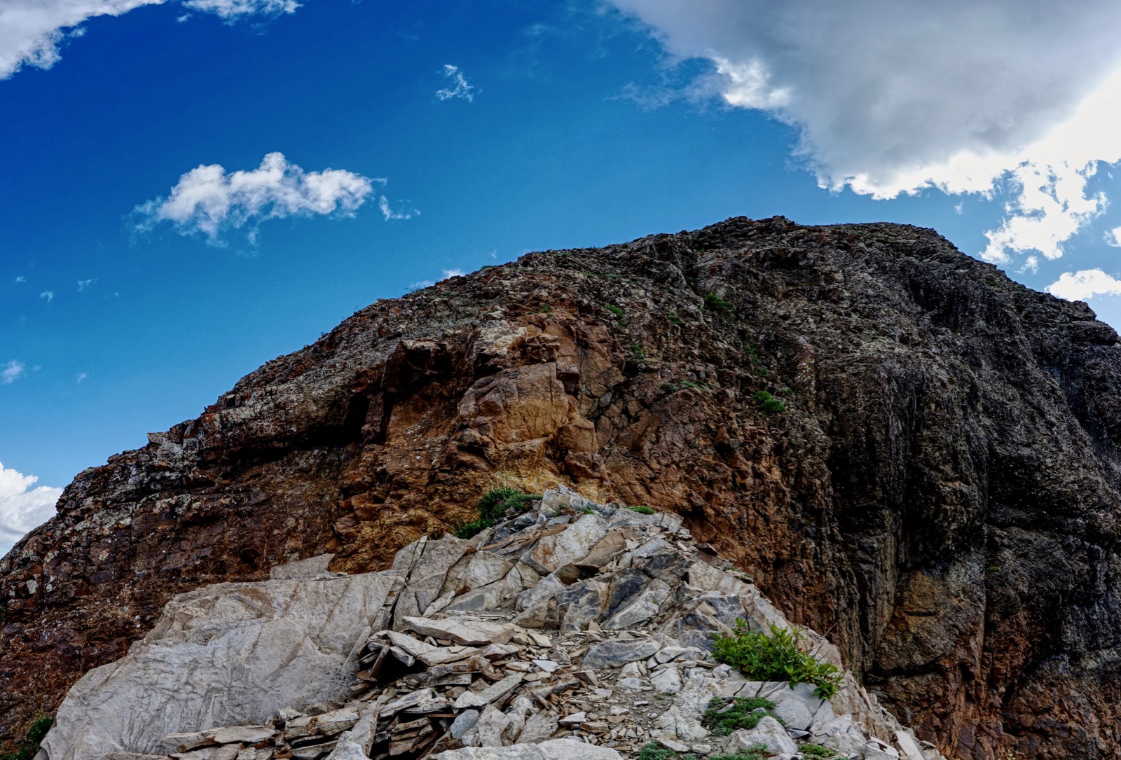
The Rio Grande River begins as a rivulet from Canby Mountain and grows to a murmuring streamway in the high basin. It flows west of Sheep Mountain (shown), rolls through the Weminuche Wilderness, and presses ever onward for 1,900 miles to the Gulf of Mexico at Brownsville, Texas.

Route: There is much fluidity in the route and the hike works equally well in either direction. For the black-line route, from Stoney Pass Road take the CDT/CT southeast and then north through the headwaters basin to the Continental Divide. Stay on the trail to a tarn and then walk off-trail south to the northwest ridge of Sheep Mountain. Return on open slopes back to the trail. For the most efficient climb, take the blue-line route from Stoney Pass Road to the northwest ridge. Peaks 13,152' and 13,165' are discussed at the end of this post.

Rio Grande River Headwaters Basin
The hike begins where the CDT/CT meets the Stoney Pass Road at 12,360 feet. Follow the lovely trail around the south base of Peak 13,152' with its imposing gray pillars. The fortress is informally named "South Canby."  

Swinging north, the treadway descends as it threads through boulders shed from South Canby. Marmots and picas live amongst the stones. The Rio Grande surges softly through the absurdly gorgeous valley. The various and open routes to the false summit of Sheep Mountain are seen below. (Thomas Holt Ward, photo)

On both of our visits we left the trail and climbed to a bench at 12,700 feet under the east slopes of South Canby.
(THW, photo)

We used that higher vantage to locate the very first hint of water coalescing into America's second longest river. The head of the river is on the east slope of Canby Mountain at 12,600 feet.

If you simply stay on the established trail you will reach the junction with the spur dropping into Maggie Gulch at 1.5 miles. The CDT/CT switchbacks up a small but notable divide topped by Point 12,843'. Pause and you will hear water running down Maggie Gulch into the Animas River, a major contributor to the Colorado River system. This little strip of land is the demarcation of Western watersheds.

Sheep Mountain
A tarn is suspended in bright green grass at 2.1 miles, 12,820 feet. It is located at the north end of an extensive platform that emanates from Sheep Mountain. (THW, photo)

Walking south on the mountain mesa is intensely mellow. Both times we visited there was hardly a breath of air. There is very little rock on the tundra platform, the whole mass acting as a lookout into the Weminuche Wilderness in the San Juan National Forest. Image-center is Wham Ridge on Vestal Peak and Arrow Peak. (THW, photo)

On a knoll at 12,840 feet a post in a large pile of rocks marks a historic trail. I found no evidence of the trail on my 1955 topo but it is still visible winding from the saddle down into the West Fork of Pole Creek.

We dodged a lingering snowfield on the north slopes of Sheep Mountain on its west side and made our way to the northwest ridge. It was somewhat steep but the footing was good. (THW, photo)

We met up with the ridge at 13,000 feet and began climbing a rock pile with small to medium-sized rubble. We topped out on the rounded false summit at 13,260 feet. The crest is 0.3 mile east, a ways further to travel but not much further to climb. The ridge is ultra wide to start but pinches 0.1 mile from the top. Footing is reasonable, exposure is mild, and chutes drop off dramatically to the north.

Slow down and take some care crossing the narrow and very orange summit ridge.

Sheep Mountain is the highest point on the chipped rock ridge. It is about eight feet wide, falling off to the east and west. Your mileage will vary but if you followed the trail to the tarn you will crest the mountain at 4.1 miles. We hoped to continue out the ridge to bulbous Greenhalgh Mountain but the weather was threatening. Descending east from Sheep looked time-consuming.

A substantial rock glacier flows north from Sheep. Half Peak, 13,841', claims its rightful place at image-center, ranked number 88 in Colorado. Appropriately, the Rio Grande Pyramid is visible to the south, off-image.

Descent to Trailhead
There are multiple routes back to the trailhead. Descending from the rubble dome you will notice a subtle split in the ridge above a shallow ravine. We wanted to spend more time in the watery basin so we headed north staying rather high to start. (THW, photo)

As we neared the floor of the basin we visually located the CDT/CT. In the image below you can see the trail on either side of the marmot town boulders.

Choose your route carefully and you can stay out of the bogs. We crossed the Rio Grande River with one step at 12,140 feet.

Mid-summer, flowers are superb throughout the hike. Columbine grow within the rocks at the beginning of the trail. Watch beside the path for the purple Silverton wallflower (unique to this region). The tundra cover crop, alpine avens, is on the platform south of the tarn. In the high alpine are sky pilot and purple fringe.  Elephant head and masses of queen's crown and king's crown, shown, live in the moist basin. Having walked along the Rio Grande on the US-Mexico border these flowering plants are in sharp contrast with the ancient creosote bush and lechuguilla of the Chihuahuan Desert. (THW, photo)

Canby Mountain, 13,478', is seen from the trailhead. While I have climbed it from the Buffalo Boy Mine in Rocky Gulch, I know of others who initiated the ascent from Stony Pass. (THW, photo)

Shortest Route to Sheep Mountain
Before the Colorado Trail reroute it met the Stony Pass Road at 12,120 feet. Park near there and take the blue-line route east to the northwest ridge. It is approximately three miles roundtrip to the peak with 1,200 feet of elevation gain. 

Peak 13,152' (South Canby) Attempt 
South Canby is not a stroll, it is a climb with exposure and poor rock. This peak shot was taken from across the basin. The north ridge of the mountain is a fractured wall of towers, teeth, and blades. The standard route is on the southeast ridge.


Our intention was to climb South Canby first. Our route is depicted with a red line on the map above. We left the trail at 0.2 mile, 12,400 feet. We made for the fortress wall seen below. The talus was small enough to roll but the slope wasn't scary-steep. At the base of the wall we cut east. (THW, photo)

It was a power grunt (below) to gain the east ridge with a small standing zone at 0.5 mile, 12,920 feet.

Next, we moved back into the mountain going west on a ledge ramp with loose rock.

The route bends north and here we found cairns marking the way for those who can stomach exposed, steep inclines on San Juan explosive volcanic rubble. It was mentally difficult to turn around less than 200 feet from the top but it was a good decision for us. We reminded ourselves that we are not out there to conquer peaks but to observe Nature and discover fun climbs.

Peak 13,165' Via Stony Pass 
This is a climb I would repeat in a heartbeat. Peak 13,165' (shown below, left of Stony Pass) is the high point on the Green Mountain ridge. As depicted with the purple line on the map above, park on Stony Pass and walk southwest up grassy slopes. Find a social trail up the northeast ridge. Rock is unstable near the top, a mere perch. There is no access to Green Mountain from here. This hike is less than one mile roundtrip with about 580 feet of vertical. Allow one hour or less to complete. 

Saturday, July 27, 2019

Hermosa Peak, 12,579', Via Bolam Pass Road

Essence: Don't overlook this stand-alone twelver with its full-on alpine scene and a vantage point equivalent to a much higher mountain. Views astound throughout the hike. Stroll through long stretches of water-drenched, flowerful meadows at tree limit. The standard and shortest route initiates from FSR 149, a spur off the west side of Bolam Pass Road. This somewhat longer and more spectacular hike begins on the Colorado Trail one mile east of the pass. The crux is a short Class 3 wall leading onto an exposed slope at the base of the summit ridge.
Travel: Bolam Pass Road is capable of killing a car. FSR 578 is a 26 mile track that requires 4WD low, high clearance, sturdy tires, and plenty of time. It goes from Purgatory at Durango Mountain Resort on US 550 to CO 145.  
From US 550: Measure distance from the Purg turnoff. Drive up the road into the ski area and turn right near the upper parking lots at the brown Hermosa Park Road sign and then go straight on FSR 578. (2023 Note: The brown sign is gone but there is a small brown building at the start of the dirt road, 0.4 mile.) Turn right at 3.2 miles toward the Hermosa Creek Trail. At 8.7 miles, the spur to the popular mountain bike trail branches left and Bolam Pass is straight ahead, nine miles away. Ford Hermosa Creek at a shallow, distributed, and flat crossing at 10.2 miles. Avoid in high water. The road degenerates after the Hotel Draw turnoff and steepens. It has big sharp rocks, deep ruts, large pot holes, and small ledges. Pass the mining ghost town Graysill with its chinked log cabin just shy of 17 miles. The Colorado Trail crosses the road at 17.3 miles beside a lake. Park on the left. It took us 1:15 from Purgatory in a Jeep Rubicon. Your mileage may vary.
From CO 145: The turnoff for FSR 578 is located between Rico and Lizard Head Pass. The sign on the highway reads Barlow Creek Road 578 (and yet it goes to Bolam Pass) and Cayton Campground. Cross the Dolores River and turn right onto 578. It is a good dirt road for the first 2.6 miles where FSR 496 branches right. Grind up the road. While the track is steep and rocky, it doesn't have the big clearance challenges found on the east side and it is shorter. At 6.4 miles, FSR 149 branches right. This road leads to the standard route up Hermosa Peak. Bolam Pass is on a wide, spectacular platform at 7.4 miles. Continue over the pass and pull off to the right beside a lake at 8.5 miles.
Distance and Elevation Gain: 6.8 miles; 1,900 feet of climbing
Total Time: 3:30 to 4:30
Difficulty: Trail, off-trail; navigation moderate; A ten-foot Class 3 wall and steep slope with moderate exposure
Maps: Hermosa Peak, Colorado 7.5' USGS Quad; or Trails Illustrated No. 141, Telluride, Silverton, Ouray, Lake City
Latest Date Hiked: July 27, 2019
Poem:
Hello, sun in my face.
Hello, you who make the morning
And spread it over the fields
And into the faces of the tulips
And the nodding morning glories…
Good morning, good morning, good morning.
Watch, now, how I start the day
In happiness, in kindness.
Mary Oliver, 1935-2019
 
The rough and splintered east ridge of Hermosa Peak rises above lush meadows and a thick conifer forest. The Colorado Trail offers an otherwise-missed perspective on the south slopes. (Thomas Holt Ward, photo)

Route: The Colorado Trail (CT) crosses Bolam Pass Road at elevation 11,100 feet. Walk southwest on the CT and cross over the east ridge runout. Stay on the trail as it curves around to the west side of the mountain. Ascend east off-trail to a saddle at 12,020 feet. Climb the southwest ridge, the only reasonable access route. 

Bolam Pass Road skirts around the east side of a reflective lake. We were delighted to see a cluster of salamanders swimming in the lake.

The Colorado Trail passes through the parking lot at 11,100 feet and heads southwest. Thru-hikers were camped in the trees when we launched into the woods.

The pathway winds briefly through a healthy fir forest. Trees part and the world expands on an open hillside, the La Platas off in the distant south. The Colorado Trail is a mini-shelf with a perfectly flat platform suspended 1,000 feet above Hermosa Creek. It is understandable why thru-hikers cross the entire state on this thin thread.

See Hermosa Peak for the first time at half a mile.

Walk through a chunky boulder yard. (THW, photo) 

Reach the east ridge outflow at one mile, 11,540 feet. We left the trail to see about climbing the peak via the east ridge. It looked viable on the map but a crunchy beginning on unstable rock led up to a vertical-walled notch.

One of the best features along this route is the meadowland segment that follows. The trail here is right on the boundary between the subalpine and alpine. Robust trees frame thick swaths of tundra moistened by watery terraces and meandering rivulets. Marsh marigolds and glistening buttercups arise from snow fields and then yield to row upon row of corn husk lilies. Above it all stands conspicuous Lizard Head. (THW, photo)

The CT works the talus-tundra interface along the north flank of the mountain. (THW, photo)

There is a signed junction at 1.7 miles where the standard route joins the Colorado Trail. The parking lot at the end of FSR 149 is quite close.

The CT turns southwest on an old roadbed and gives up a small amount of elevation as it curves around to the west side of the mountain. The next objective is to determine the best place to launch off-trail for the saddle and summit ridge. We overshot this location on our way up and nailed it on the return. At 2.6 miles, almost 11,480 feet, a streamlet crosses the track. This is just before the terminal embankment of a rock glacier. The saddle is an easy climb east from here on green ramps. Below, Point 12,180' is southwest (right) of the saddle. We built a cairn at this juncture.

Below is a better shot of the route taken in 2023.
 
As an aside, we stayed on the trail another 0.2 mile waiting until we could see the peak. Additionally, we hoped to climb Point 12,180' on our return and wanted to check out the route back to the trail. We traversed this boulder field back to the recommended route.

This image looks back on the best ascent route from the CT. (THW, photo)

There are some trail fragments but they are teasers. It is a shallow climb to the saddle at 3.0 miles, 12,020 feet.

In 2007, I climbed Hermosa Peak by way of Point 12,180', shown. If that interests you see the note at the end of this post. (THW, photo)

A distinct trail plows up through chipped rock to the crux.

The Class 3 wall is a ten-foot climb with solid holds; test for them. There is mild exposure and some hikers will appreciate a spot. The ridge is broken so hikers are forced onto the west slope of the mountain for about 100 feet of elevation gain. It is very steep with a ball bearing surface and moderate exposure. A slip would be grave; self arrest not a guarantee. We were fortunate that the ground was damp. The climb would be sketchy if sun-baked. (THW, photo)

The linear summit ridge narrows a bit near the top but is a comfortable width throughout.

Crest the small summit cone at 3.4 miles. We were pleased at the breadth of the view circle. To the east is the slender backside of Engineer Mountain playing opposites with the tabletop that never ends on Graysill Mountain.

Directly below the mountain is the tundra expanse we walked across moments earlier. The drama up high is Sheep Mountain, San Miguel Peak, Grizzly Peak, and Rolling Mountain.

Northwest is Lone Cone, the westernmost peak in the San Juan Mountains; Dolores Peak; the Wilson fourteeners; and Black Face in the Lizard Head Wilderness. In the foreground is Flattop Mountain, accessible from Bolam Pass Road. (THW, photo)

Southwest are the Rico Mountains: Blackhawk Mountain and Harts Peak. (THW, photo)

Wildflowers were late bloomers in 2019 after a long, wet winter. The tundra was in full bloom during our visit. Here is a list of the 45 blossoming plants I saw on this little trek: marsh marigold, globe flower, alpine avens, mountain parsley, heart leaf arnica, Indian and rosy paintbrush, death camas, parrot beak lousewort, draba, Geyer's onion, clover, wallflower, bluebell, Western and edible valarian, salsify, king's and queen's crown, Jacob's ladder, purple violet, pussy toes, sage and snow buttercups, candytuft, brookcress, Parry's primrose, phlox, columbine, moss campion, potentilla, minuartia, purple fringe, smelowskia, snowball saxifrage, northern rock jasmine, geranium, drummond rockcress, native honeysuckle, strawberry, Whipple's penstemon, delphinium, and ball-head waterleaf. Happily tucked in the rocks on the west slope of the mountain was the outlandish Colorado ragwort, ligularia soldanella, with its distinctive thick purple leaves and over-sized flowerhead. (THW, photo)

Jeeps crept over Bolam Pass, 11,433 feet, while children looked out from the rim of the viewing platform. 

2007 Route Over Point 12,180'
We hoped to climb Point 12,180' from the saddle and drop west back to the CT but the weather was too ominous. In 2007, we parked off Bolam Pass Road (east side) across from Grassy Creek at 9,400 feet. We pitched northwest to Spanish King No. 1 Mine. Next, we climbed the south ridge of Point 12,180'. My notes indicate it was "steep but easy." The northeast ridge of Point 12,180' was loose with lots of sliding rocks and quite narrow in places. I advised against this route for people with exposure issues. After climbing Hermosa Peak we did a "quick slide from the saddle" east into an unnamed west fork of Hermosa Creek, intersecting FSR 578 1.5 miles above the vehicle.