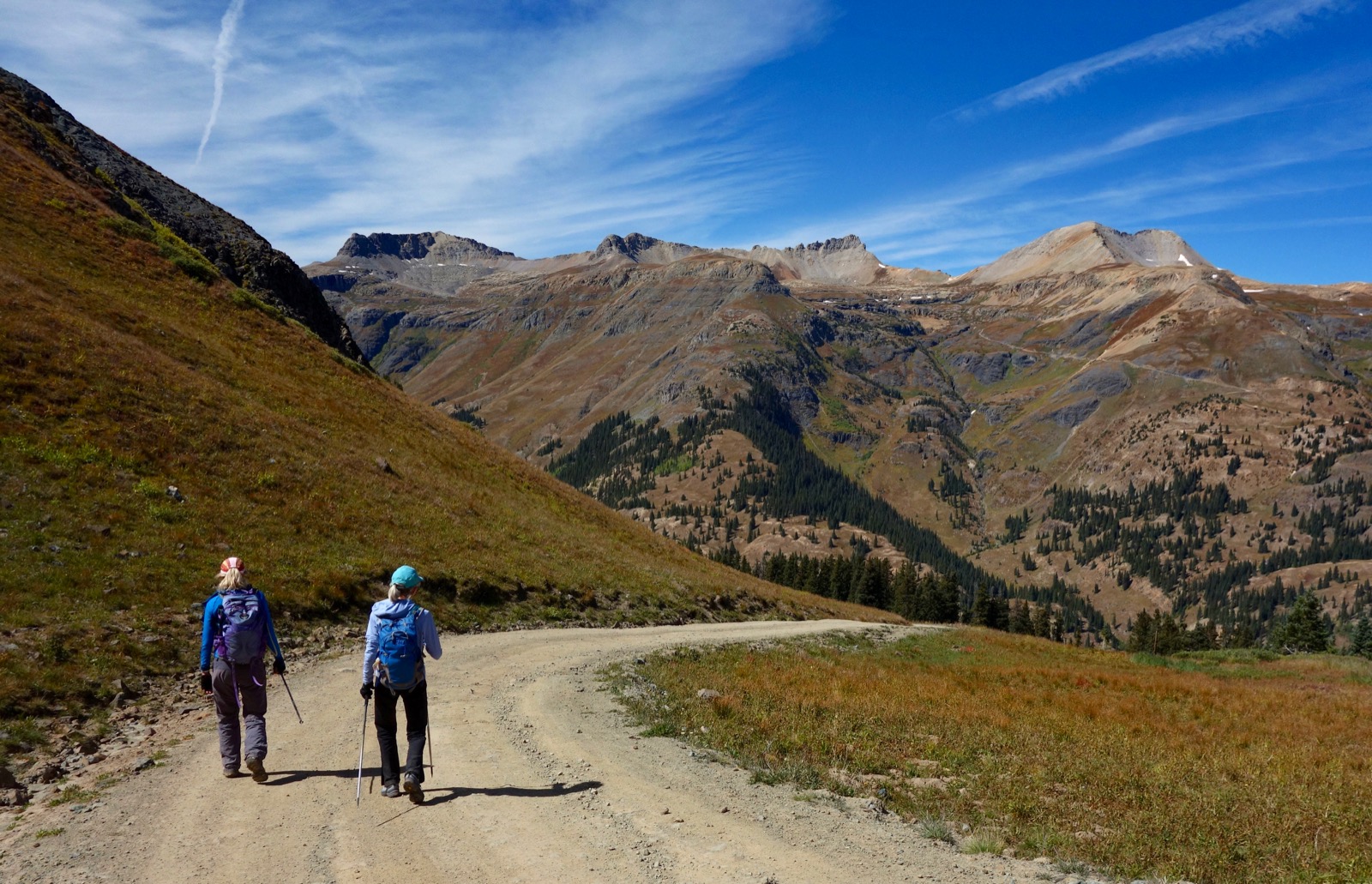
Travel: The turnoff from US 550 is just south of mile marker 80, less than a quarter mile south of Red Mountain Pass. Turn east on unsigned FSR 825 and start measuring from here. You will need 4WD and decent clearance on this steep but good dirt road. The track heads generally southeast. At 0.7 mile, turn right on San Juan CR 14. There is a sign here for St. Paul Lodge & Hut. The road splits at 1.0 mile, go right. Cross Big Horn Gulch at 1.3 miles. Park in the pullout on the left at 1.7 miles. The road continues and reaches its high point at 12,120 feet. Then it descends through Browns Gulch back to US 550 at 5.8 miles. The road is graded dirt (avoid when wet), steep, narrow, with short shelf sections. There is a large pullout at the south end of CR 14 and US 550 at mile marker 75.9.
Distance and Elevation Gain: McMillan Peak loop is 4.2 miles with 1,500 feet of climbing. The out-and-back to the peak is 3.4 miles with 1,200 feet of vertical. The McMillan-Ohio loop is 5.4 miles with 1,750 feet of gain.
Total Time: 3:00 to 4:30 depending on route
Difficulty: Off-trail; navigation moderate; no exposure
Maps: Ironton; Silverton, Colorado 7.5' USGS Quads
Latest Date Hiked: August 6, 2020
Quote: Just living is not enough…one must have sunshine, freedom, and a little flower. Hans Christian Andersen
This image was shot from the broad, south rim of U S Basin. McMillan Peak is easily identified from all over the region by the microwave reflector standing on the summit.

Route: FSR 825/CR 14 is indicated with a red line. There are multiple ways to climb McMillan and Ohio--build your own hike. This description begins from CR 14 in U S Basin. For the blue-line stem and loop, ascend southeast in U S Basin to the ridge and then northeast to the summit of McMillan. Return as you came or extend your exploration by descending along the south rim of the basin over Point 12,596'. For the longer black-line loop, park at the same location and walk south up CR 14 to its highest point. Hike east to the north ridge of Ohio. Climb the peak on a spur and then hike north to McMillan. Descend on open tundra northwest and then west into U S Basin and back to the start.

Blue-Line Stem and Loop to McMillan Peak
From the parking pullout, elevation 11,760 feet, head up into U S Basin. The hike begins at tree limit where healthy spruce stands concede to the alpine. The topo indicates an old trail running up to a mine site at 12,200 feet. Walk up the road a few paces to intersect it. It presents as a stream channel. We just launched from the pullout and intuitively found ourselves on the trail remnant but there is plenty of freedom of movement on the gentle slopes. Favor the south side of the basin to stay clear of willow patches. Cross the stream feeding Big Horn Gulch at half a mile, 11,880 feet.

We gained the ridge in one mile at 12,400 feet, the lowest point in the image below. The photos in this post are taken from different hikes and seasons. In August, 2020, U S Basin was filled with a large herd of domestic sheep.
(Thomas Holt Ward, photo)

Fortunately, sheep do not favor eating queen's crown... (THW, photo)

Or cottongrass. (THW, photo)

A well-trodden social trail flanks Point 12,652' on the west but you may stay right on the ridgeline if you prefer.

McMillan Peak has two rounded prominences on its crest. The climbing is a little steep for the last 200 feet to the secondary summit. Pause here to process the astounding array of thirteeners to the west. In this image alone the span begins with Rolling Mountain on the left, Grizzly Peak, then the peaks ringing the Ice Lake Basin: Fuller Peak, Vermilion Peak, Golden Horn, Pilot Knob, and US Grant; South Lookout Peak, and the peaks surrounding Mill Creek Basin (Columbine Lake): Peak 13,300', and Lookout Peak. Finally, Peak 13,434' is hiding Bridal Peak (formerly T11). Off image to the right are the roads winding up to Porphyry Basin and Black Bear Pass.

The slightly higher summit is a few more paces east. Reach the crest at 1.7 miles after just 1,140 feet of elevation gain. A friend in telecommunications said the passive microwave repeater was necessary for reflecting signals for long distance phone calls back in the land line days. He speculated that the screen remains in place as a backup system.
(THW, photo)

To the north, the Reds put on their brilliant display.

The eastward drop to Cement Creek is abrupt. This image includes Gladstone and the Gold King Mine (site of the calamitous waste water spill in 2015), the Silverton Mountain Ski Area, and the 4WD track going up to Hurricane Pass. On the horizon at image-center is Handies Peak.

Returning from the peak, a social trail climbs over Point 12,652'. (Need to get low in a hurry? See the end of this post for the northwest ridge descent.)

The view from Point 12,652' is spectacular so go over it coming or going. (THW, photo)

From the saddle at 2.5 miles the fastest way back to the start is to return through U S Basin. Extend your excursion by heading west on the ridge rimming the basin on the south, image-right. (The saddle is another good launch point for climbing Ohio Peak.)

Go right up the face of Point 12,596', a short, moderately steep climb. There's a little slot in the rock band you can squeeze through.

From this highpoint you will see CR 14 topping out before plunging through Browns Gulch back to the highway. The beautifully symmetrical mountain in the mid-ground below is V6 (Peak 12,442').

Scramble down the little rocky spine (or go around) and run out the ridge to CR 14. The track across the valley is the notorious Black Bear Pass Road. Trico Peak is image-left. The three counties intersecting on its apex are San Juan, Ouray, and San Miguel.

Hit the road and turn right. The road to Porphyry Basin is across the highway. Image-center is Three Needles and on the right is T10, Peak 13,477'.
Black-Line Loop to Ohio Peak and Then McMillan Peak
From the parking pullout in U S Basin walk south on CR 14. It dips at first and then climbs to 12,120 feet. You will be glad at the end of your hike that you got this ascent out of the way on the front end. The scenery is absolutely stunning. This image looks down on Chattanooga Curve and the Mill Creek trench. This is the location of the most difficult and unconventional Slidepath Route to Columbine Lake.

At 1.2 miles, leave the road just as it begins to roll downhill. Head east and climb the little knoll at 12,180 feet to get your bearings and check out your options. Ohio Peak rises forcefully to the east on the other side of Browns Gulch. This route hits the north ridge at the miner's shack, shown.

We considered climbing the south ridge of Point 12,596' and heading to the Ohio saddle from there. But then we noticed a social trail sweeping through the basin just below the 12,200 foot contour. Turns out, this trail was boot packed and marked with very occasional cairns. Cross the Browns Gulch defile at 1.6 miles.

Hold your trajectory and soon the faded trail will reappear as it climbs softly to the ridge right at the cabin and quite near the saddle at 1.9 miles, 12,300 feet. Someone was living here; there is a stove pipe lying on the ground.
(Jana Goldstein, photo)

Ohio peak is a 0.8 mile roundtrip spur with less than 400 feet of vertical. The short wall on the north ridge presents the toughest segment of the loop. There are several braided trails with resistant soil west of the cliff that pitch steeply. Return to the ridge at first opportunity. This image was shot looking back from a ways north of the saddle.

Once back on the ridgeline it is a mellow rocky ascent up and over a false summit to the real thing. Crest Ohio Peak at 2.3 miles after just 980 feet of vertical.

Looking down the divide, Anvil Mountain is the soft red dome. In front of it and hidden from view is Peak 12,296'. Sultan Mountain and Grand Turk preside over Silverton west of town (left of Anvil in this image). To the right of Anvil is Bear Mountain.

McMillan Peak
From Ohio, McMillan is the next and higher prominence 1.7 miles north. Retrace your steps to the saddle.

As you approach the miner's shack examine your route. We found a couple of cairns guiding onto the highest of the sheep trails mounting the hill north of the saddle. Head the defile at the top of Minnesota Gulch. The social trail passes west of two small knolls and then intersects the ridge at the top of U S Basin. Climb McMillan on the blue-line route, cresting the peak at 4.0 miles.

You could certainly return through the basin or on the south rim route described earlier. We were enticed by the rolling tundra country north and west of the peak. From the secondary summit a trail wanders off toward Red Mountain No. 3. It was helpful for a ways but at 12,600 feet we cut away from it and the ridge.

We curved west and then southwest back into the basin, keeping our eye on our vehicle. The only obstacles on the relaxing descent were willow patches. We weaved around and then plowed through them just before crossing Big Horn Gulch creek. (THW, photo)

This image looks back our sublime descent route.

No comments:
Post a Comment