Sunday, December 6, 2020

Mount Glenn, 7,519', Dragoon Mountains

Essence: Until 2017, Mount Glenn had a strong reputation for repelling hikers with heavy brush. The landscape opened considerably after the Lizard Fire. Nevertheless, the hike is more difficult than statistics imply. Slopes are steep and grasses hide rocks that roll underfoot. Tour seven knobs on the ridgecrest while climbing to the highpoint of the sky island. The prominence northwest of the Dragoon Benchmark is a few feet higher and holds the peak register. View the ranges of Southeast Arizona and look into Cochise Stronghold throughout the trek. This hike is within the Coronado National Forest but private inholdings are nearby so remain on route. 
Travel: East of Benson, take Exit 318 from Interstate 10 at Dragoon Road and measure distance from the stop sign at the bottom of the eastbound exit. (Your odometer will likely vary.) Drive south on Dragoon Road, passing the town of Dragoon at three miles. At 13.0 miles, turn south on US 191 toward Sunsites. Turn west on Ironwood Road at 19.5 miles. There is a sign for Cochise Stronghold before the intersection. You'll be driving toward Mount Glenn and Rockfellow Dome. Cross a cattle guard at 24.8 miles where pavement ends. Turn right onto FSR 795, a good gravel road, at 26.3 miles. Enter the Coronado National Forest at 26.9 miles. Turn left onto FSR 4378 at 27.7 miles. If you are in a 2WD vehicle, park at this junction. The last 0.7 mile is maintained but rough and 4WD with good clearance is recommended. Park at the round water tank on the right at 28.4 miles. There is another pullout on the left at a stone foundation 0.15 mile further up the road but parking there inhibits your options. The road is technical beyond that. 
Distance and Elevation Gain: 5.3 miles; 2,800 feet of climbing
Total Time: 5:00 to 7:00
Difficulty: Primarily off-trail; navigation moderate; Class 2+; no exposure
Map: Cochise Stronghold, AZ 7.5' USGS Quad
Date Hiked: December 6, 2020
History: The Dragoon Mountains are imbued with history; follow in the footsteps of Cochise. His friend Tom Jeffords paid this tribute. "Cochise can't even read a map, but he and his men know every gulley, every foot of every mountain, every waterhole in Arizona. His horses can go twice as far as yours in a day, and his men can run on foot as far as a horse can run. He can't write his name, but his intelligence service knows when you got to Fort Grant and how many men you got. He stopped the Butterfield Stage from running. He stopped the U.S. Mail from going through. And for the first time in Indian history, he has all the Apaches from all the tribes fighting under one command."
Quote: You must speak straight so that your words may go as sunlight into our hearts. 
Cochise, Chiricahua Chief 1805-1874

The entrancing geology of the Dragoon Mountains is revealed from Ironwood Road. To the south are the weathered granitics for which Cochise Stronghold is renown. The eastward climbing ridge of Mount Glenn (image-right) is composed of limestone and quartzite. 

Route: Two alternative routes from the water tank will be discussed. This description begins on the more common route and finishes on a revised route. Walk southwest on the jeep track to a mine and then climb south to the east ridge. At Point 6,740' pivot onto the northeast ridge. Two hundred feet off the summit, either climb directly up through an outcrop or skirt it on the south. Returning, stay on the east ridge to 5,600 feet and then angle northeast to the water tank. 

The Apache Generating Station in Cochise is visible from the water tank, elevation 5,060 feet. The plant is converting from coal to natural gas while diversifying its energy portfolio. The station generates 20 megawatts of renewable energy at Apache Solar Project. (Thomas Holt Ward, photo)

The first objective is to achieve the east ridge of Glenn. There are two possibilities, both somewhat arduous. Judging from trip reports, the more common route takes the road to the mine and then ascends south to the ridge. I'll describe that route first but if I had it to do over, I'd ascend on our return route. 

The lower slopes of the Dragoon sky island are Desert Grasslands within the Sonoran Desert. Saguaro are absent but alive within the expanse of golden grasses are sotol, agave, prickly pear, beargrass, oak, and mesquite. 

Walk southwest up the road on baby heads and boulders while putting away elevation with ease. Stay straight at the 0.2 mile split. After the first switchback the Lizard Fire burn scar is evident. Lightning ignited the conflagration in June, 2017, burning 15,000 acres. The track ends at a mine at 5,480 feet, 0.75 mile. The adit goes back a fair distance. You'd need a headlamp to venture inside. This is not recommended by this blog! (THW, photo)

From here, the route is off-trail with no guiding cairns. The ridge is 300 vertical feet to the south. Start right at the mine or back up until you find a workable opening. It looks more foreboding than it is. Pick the path of least resistance and plow up the ultra steep slope. It is brushy but not too prickly. Footing is good on a mix of dirt and limestone. Climbing the pitched beast in the morning inspired experimentation on the descent. Principally, we intended to find a route that stayed off the treed north aspect. 

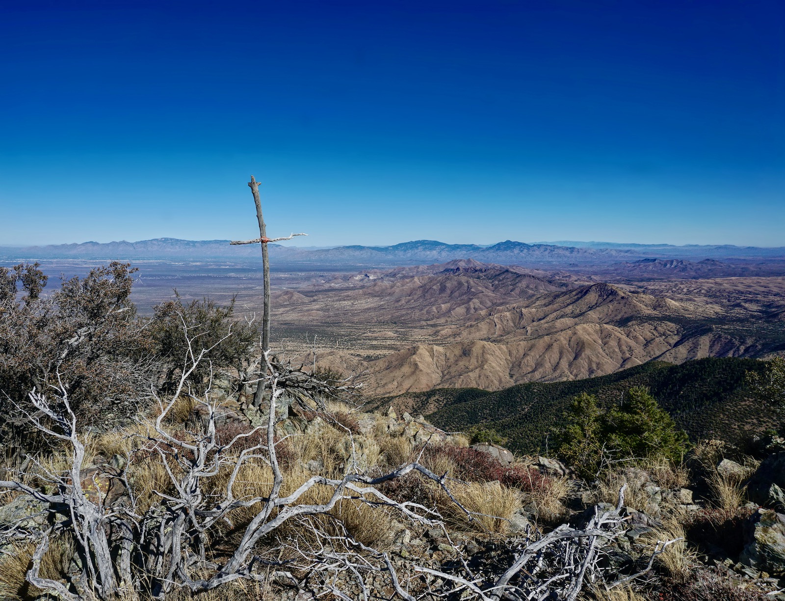
It took almost an hour to put the first mile away. We contacted the heart-soaring east ridge at 5,820 feet. Oh! to be an eagle and effortlessly span the open sky from the Dragoons over the Wilcox Playa to the Dos Cabezas Mountains. (THW, photo)

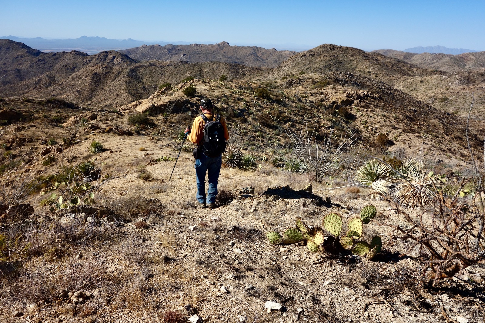
The peak is not yet visible but the way is clear and obstacles are few. Walk on broken quartzsite, limestone, and occasional bedrock. This hike is for the sure footed. Unstable rock is disguised by thick mats of grass. The ridgeline walk requires both patience and concentration. Ascend west to Point 6,241', shown, and then northwest to Point 6,740', image-right. (THW, photo)

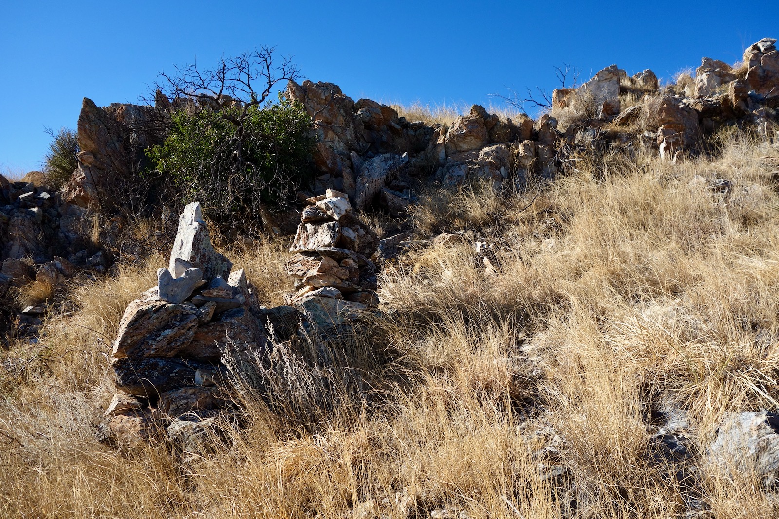
Along the way are a few seemingly old and very large cairns. As guides, they are superfluous and yet they do their job with a certain earnestness. There are hints, fragments, of game and possibly human trails. 

The fire opened the visual field--look over to the igneous formations in the Stronghold. If brush was an issue on the lower ridge, the way is now clear. Burned foliage is recovering amongst unharmed survivors such as symmetrical agave and ocotillo. Shindagger is notably absent.  

Progressing up the ridge, Mount Glenn comes into view, image-left. At Point 6,740', 1.8 miles (image-right), the climbing ridge turns southwest and makes for the summit. A rock barrier stretches horizontally across the ridgetop above the saddle with Point 6,841'. 

My partner climbed to the top of the wall but the downclimb was dicey. So we scooted a few paces south and easily clambered over the barrier. The structure is composed of stacked boulders in light and dark shades highlighted with patches of yellow lichen. (THW, photo)

The incline to Point 6,841' is steep but short. Step up on bedrock boulders and small terraces.  

The damage from the Lizard Fire is concentrated in a burned forest 400 feet off the summit. The understory is reviving but the trees are skeletons. Pre-fire trip reports claim this area was almost impenetrable and visually constricting. The image below also depicts the ridgeline rock outcrop. (THW, photo)

The outcrop is 200 feet below the summit. Either climb directly up the spine through the line of boulders or skirt them on the south. We climbed the outcrop while ascending and flanked it on the descent which worked well. Plants play interference with the scramble but it was playful. Pass swirled and folded stone. (THW, photo)

Transect the linear summit ridge right at the Dragoon Benchmark, 2.8 miles. While the disk is inexplicably blank, the reference marker reads, "Dragoon, 1935." A solar cell is pinned to the ground but the device it powered has gone missing from the stacked peak cairn. (THW, photo)

You'd have to wing your way 27 miles to Reiley Peak in the Winchester Mountains to encounter a taller summit. (Glenn has a rise of 2,899 feet.) So, of course, the views are outstanding. In the Coronado Forest alone (!) spin around to see the Huachuca, Santa Rita, Whetstone, Rincon, Santa Catalina, Galiuro, PinaleƱo, Dos Cabezas, and Chiricahua mountain ranges. Below, Stronghold Canyon West flushes the Dragoons to its master river, the San Pedro. The views into the crazy mash of jumbled rocks in the Stronghold are wonderful but I'd rather just go walking amongst those extraordinary stones. 

The image below was shot from the benchmark looking northwest to the sister prominence 0.1 mile away. It is the consensus that the northwest summit is three to four feet superior. That's where the peak register was located in 2020. Even accounting for people who don't sign registers or failed to locate this one, not many people visit this mountain. The most recent entry was one and a half years prior to ours. 

As noted earlier, we walked a few feet south of the benchmark to a small dip in the ridge and began our descent from there. The downclimb is pitched and loose with rocks at the angle of repose. It's not a panacea but it is faster than the ridgeline scramble. Dive down staying close to the cliffs and at first opportunity, crank back sharply to the northeast ridge. 

It would be all too easy to get sucked into this tempting east-facing swale.

The descent is its own expedition. We'd forgotten how many knobs we climbed. And yet, it had been awhile since I felt that serene. It was as quiet as quiet gets. The air was untroubled; we hiked in solitude. The thin, but warm-enough December sun cast long shadows. 

At 5,800 feet, we blew by our upcoming route from the mine and stayed on the east ridge. It presents much like the former stretch.

At 5,640 feet, the ridge splits very subtly. Veer onto the rounded northeast ridge. You will get a visual of the water tank from here, if not before. The slope is free of inhibiting brush and is satisfying from a ridge purest point of view. We saved 0.4 mile and over half an hour compared with our ascent route. This image of the line of descent was shot from the water tank. (THW, photo)

I am partial to the spheroidal granite in the Cochise Stronghold. This image was taken on an exploratory hike in the Stronghold in January, 2014. (THW, photo)

Sunday, November 29, 2020

McCleary Peak, 8,357'; Peak 8,853' (88 Mac); Peak 9,146' (Mount Ian), Santa Rita Mountains

Essence: Climb three rhyolite summits radiating northward from Mount Wrightson on the Santa Rita Crest. This circuit eliminates the need for a shuttle by linking six trails beginning with the Super Trail and finishing on Old Baldy Trail. The climb begins with McCleary Peak, the most challenging of the three, an unranked summit at the far north end of the range. Progress south, rising for each successive peak. Informally named 88 Mac (the most fun) and Mount Ian (practically a freebie) are legal summits. Be prepared for long miles, hefty elevation gain, forays off-trail, and navigation challenges. The hike is within the Mount Wrightson Wilderness managed by Coronado National Forest. 
Travel: There are three Green Valley exits from I-19. Watch for a brown sign for Madera Canyon Recreation Area and exit on Continental Road, measuring distance from the stop. Turn east under the interstate and cross the Santa Cruz River. In 1.2 miles, turn south on White House Canyon Road which transitions to Madera Canyon Road. Cross three one-lane bridges. The paved road steepens sharply and ends in 12.8 miles at a multi-layered parking lot at the Madera Canyon Picnic Area. Loop around and park near the Super Trail located off the upper lot by the outhouse. Pay the day use fee or display your National Interagency Pass.
Distance and Elevation Gain: 13.2 miles; 4,800 feet of climbing
Total Time: 7:30 to 9:30
Difficulty: Trail, off-trail spurs to peaks; navigation challenging; Class 2+; mild exposure; snow on north-facing slopes shuts this hike down for the season; dress defensively; springs are intermittent so carry all the water you will need.
Map: Mount Wrightson, Arizona 7.5' USGS Quad
Date Hiked: November 29, 2020
Poem:
I feel the inescapable pull of the earth
the deep old Earth pulling me back to her.
But now as the changeable colors of days
wheel with increasing velocity past my sight
these eyes of mine grow steadier,
my heart grows stronger,
and from the deep old Earth I know knowledge of things,
wonderful things I could never have known before.
 Maynard Dixon

A hiker contemplates the series of stone domes emerging from the deep forest and extending southward from McCleary Peak to Mount Wrightson, sentinel of the Santa Ritas.  (Thomas Holt Ward, photo)

Route:
 This description reflects a clockwise loop but the hike may be done in either direction. Begin hiking east on the Super Trail and segue to the "Pipeline Trail." Transition to the Kent Spring Trail and then the Four Springs Trail. Upon gaining the 88 Mac (Peak 8,853')--McCleary saddle, do an out-an-back on the south ridge of McCleary. Continue on the Four Springs Trail to the Crest Trail and head south. Climb the south ridge of 88 Mac. Back on the Crest Trail, hike south and do the short spur to Mount Ian. Proceed to Baldy Saddle and descend on the Old Baldy Trail back to Madera Canyon. 

The Approach
There are multiple approaches to McCleary Peak including the Florida Canyon and Bog Springs trails. This is the most efficient route for those doing the full loop. From the trailhead, elevation 5,420 feet, walk east on the Super Trail alongside an unnamed tributary of Madera Canyon through a forest featuring alligator juniper. The chunky stone on the footpath mimics the surface on the Old Baldy Trail. The lower mountain is composed of a crystalline igneous granitic. At 0.3 mile, cross the creek on a left hook. It was running dry in late autumn but this stream and the next two are capable of carrying large volumes of water so use caution. 

At 0.4 mile, transition left onto the informally named Pipeline Trail. The Super Trail makes a sharp turn to the right at this location. Notice the steel pipe under the log in the image below. The historic pipeline is severed in many places. The secondary, non-maintained trail is a narrow but trodden thread zigzagging steeply up the slope.

Turn right at the T junction, 0.6 mile. The first view of Green Valley and Sahuarita on the desert floor opens as the rock-reinforced path climbs the west wall of the Santa Ritas.  
 
The trail crosses a second, larger tributary of Madera Canyon at 1.0 mile. (Lucky Ledge Mine on the Mount Wrightson quad.) This is a confusing place. A trail remnant continues straight but you must cross the creek bed and make a hard left onto the unsigned Kent Spring Trail coming up the canyon from Bog Springs Campground. Now on an abandoned jeep track, the trail bends around the hill into yet another streamway with stately sycamores. Arrive at Sylvester Spring, 1.2 miles. Of the three springs we encountered, only Sylvester had water and it was earnestly overflowing its cement catchment. (THW, photo)

The road mounts steeply up the drainage to Kent Spring, 6,580 feet, at 1.7 miles. The Bog Springs, Kent Springs, and Four Springs trails all converge at this three-way junction. While the Bog Springs Trail is nicely signed, the Four Springs Trail is not. Turn right onto a single track bearing west for a short distance before switching sharply to the southeast.
 
The trail enters a ponderosa wood with needles blanketing the path. There is a profound sense of spaciousness with an open vista into the western reaches. Enter the Mount Wrightson Wilderness at 1.9 miles. Appropriately, there is a glimpse of the eponymous summit cone at the boundary. There was evidence of recent trail maintenance but since then, a herd of large hoofed animals thundered down the mountain and busted off the edge of the platform. At 7,100 feet, the treadway crosses a river of gigantic boulders. This impressive talus field is composed of rhyolite volcanics in the Mount Wrightson Formation. In contrast, the purple, sandstone conglomerates seen frequently on this hike were deposited within the volcanics in quiet times between eruptions.  

Switchbacks initiate at 7,480 feet. We saw a white-tailed buck while ascending through the forest to gain a westward interior ridge at 7,980, 3.5 miles. In 2005, the Florida Fire burned the eastern slope of the range and ripped through the gap south of 88 Mac, shown. In this pleasant and peaceful setting, incinerated trees tend a ponderosa nursery.  
 
The Four Springs Trail goes straight over the ridge and contours northward. The platform is cleaved into a ridiculously steep slope. Standing rocks jut up from a fir and oak woodland, animals leave tracks in the soft soil. 

Unobstructed in the west are forested Pete Mountain, thrusting Elephant Head, and the granite monolith without rival, Baboquivari Peak.

McCleary Peak, 8,357'
The north spur to McCleary leaves from its saddle with 88 Mac at 4.2 miles, 8,140 feet. I know plenty of people who only climb legal summits. With a prominence of 217 feet, this one doesn't make the 300-foot cut. Do not deny yourself this delightful experience. It is only a quarter mile to the far north crest of the Santa Ritas. Locate a social trail in the grass on the other side of the log, shown. The scant path barges up through shrubs and outcrops. In 2020, there were no cairns but the trail helps immeasurably. In its wild state this climb would be difficult.

We did a short, low Class 3 scramble right on the ridgetop but the trail skirts this red-purple rhyolite obstacle on the east. You needn't exceed Class 2+ scrambles. 

In this classic shot of bulbous McCleary Peak, the spine narrows as shrubs enclose and protect. The crag-studded ridge is a little tricky and demands some patience but the final dash to the summit is on pure rock. (THW, photo)

Arrive on the small crest at 4.55 miles after 3,000 feet of climbing. The peak register is enclosed in the tall summit cairn. This climb is popular with hiking clubs: Huachuca, Green Valley, and Southern Arizona. It's hard to know where to feast your attention given the peak's unique perspective on the countryside. To the north, the landscape dives abruptly for nearly 5,000 feet to Florida Canyon Wash at the base of the sky island, and then punches up to the Santa Catalina and Rincon mountains. (THW, photo)

To the south, barren domes of stone grow ever taller on the northern crest of Mount Wrightson. Below, 88 Mac resides beyond the McCleary access ridge.

Peak 8,853', 88 Mac 
The standard route up Peak 8,853', informally and widely known as 88 Mac, is via the south ridge. That might seem like the long way around but it sets the climber up for Mount Ian and creates a stellar circuit.  (There are no trip reports of successful climbs on the north ridge.) From the saddle, the Four Springs Trail gives up 180 feet on a winding descent to the east. The Florida Fire created an opening for opportunistic graythorn which threatens to take over wherever it takes hold. Smart engineering winds the trail around cliffs and through outcrops. The low point is Armour Spring, 7960 feet. It was dry when we passed the pretty stone crevice with its bare hint of water in a burned out forest. 

The Four Springs Trail ends at the Crest Trail at 5.5 miles. This is 200 feet above Florida Saddle on the northeast ridge of 88 Mac. Turn south on this boot-worn passageway and ascend gradually and consistently. At one dramatic place the trail tracks along a cliff face that insists on being touched. Arrive on the north crest ridgeline once again at 8,540 feet, 6.2 miles. From the grassy flat expanse the second peak is 0.8 mile roundtrip with a rise of 313 feet. Walking north, sporadic cairns guide as you enter the rock. 

The summit climb is a pure and simple pleasure. The multi-colored rock is fascinating; the palette features a mix of brown, orange, yellow, even purple. 

Walk out the broad rocky crest to gaze down on McCleary and onward into the land of the Sonoran. The peak register dates back almost thirty years. (THW, photo)

Mount Hopkins, 8,586', is three miles west as the crow flies. The Fred Lawrence Whipple Observatory, in various locations on the mountain, is owned and operated by the Smithsonian Astrophysical Observatory. The MMT Observatory mirror was cast and polished by the University of Arizona in Tucson. (THW, photo)

Peak 9,146', Mount Ian 
Continuing south on the Crest Trail, it stays east of the ridgeline to Baldy Saddle. Along the way it traverses yet another steep hillside, threads through a notch in outcrops, and emerges from dark woods to wade through shimmering grass. Along this stretch you will ascend 650 feet to the tallest peak of the day. The trail does most of the work so Mount Ian is practically effortless. As the ridge draws close enter a youthful, post-fire aspen forest. Leave the trail at about 8.0 miles, 9,080 feet. From here the peak is only 0.1 mile afar. We did not see a social trail so we simply made the most of grassy openings. In a few moments, we were on the ridge.

We gained the spine slightly south of the small summit, image-center, and scrambled over a couple of knobs. The narrowest section can be skirted on the east. 

Standing on this peak was incredibly satisfying. I'd been looking at Mount Ian for decades from Wrightson, wondering and wishing. To visit three mountains on the ridgeline crest was beyond my dreams. This hike enhanced my understanding of the Santa Rita landscape neighboring the highpoint loved and frequented by so many. We were tempted to take the south ridge to Baldy Saddle but the day was short so we let the trail carry us there. Walk toward Wrightson through a mythical landscape. The rocks have powerful shapes, colors, and presence.

Old Baldy Trail to Madera Canyon
Reach Baldy Saddle at 8.7 miles, 8,780 feet, and begin the familiar westward plummet to Madera Canyon on Old Baldy Trail.

In the unlikely event this is your first hike in the Santa Rita Mountains, please link to Mount Wrightson for a detailed description of this final 4.5 mile segment. As you descend, a mile off the saddle look back at the north crest and you will see the west faces of all three peaks.

At Josephine Saddle, 10,7 miles, 7,100 feet, the footpath makes a turn to the northwest. This hike remains on the Old Baldy to Madera Canyon for a total of 13.2 miles. If you have the time and stamina, you could extend your hike by returning on the Super Trail, adding 1.2 miles.

Friday, November 27, 2020

Tortollitas Benchmark, 4,651', and Jeffords Peak, 4,696', Tortolita Mountains

Essence: The relatively low-slung Tortolita Mountains are located northwest of Tucson in the wedge between I-10 and AZ-77. The two tallest peaks in the range are located north and east of the popular trail system in Tortolita Mountain Park. This stem and loop in the "little turtle dove" mountains links Tortollitas Benchmark (note the variant spelling) via a lengthy ridgeline traverse with Peak 4,696', unofficially but commonly referred to as Jeffords Peak. The ridge is suspended above Oro Valley with superb views of the Santa Catalina Mountains. We did this hike of solitude during the COVID-19 pandemic and did not see a person or even a footprint. Be advised that the Tortolita Fire in June, 2020, scorched the earth and incinerated plants on broad swaths of this route. The hike is primarily on Arizona State Trust Land with a slice of Bureau of Land Management property surrounding Peak 4,651'. 
Travel: This route begins from Edwin Road in Oro Valley. For those coming from Tucson, drive north on AZ-77 (Oracle Road) to the signal at Eagle Crest Ranch Blvd. This is 12.8 miles north of the Ina Road and Oracle Road intersection. Edwin Road is slightly offset, just south of the signal. Hang a U-turn and make an immediate jog onto Edwin Road heading west. Enter Rail X Ranch, a grazing lease on Arizona State Trust Land. 4WD with high clearance is helpful on this primitive dirt, sandy, bumpy and rocky road as it barges through the Sonoran. Go through a white wooden gate and cross a cattle guard 5.2 miles from AZ-77. Make an immediate left to a large parking lot at Crow Windmill, 5.4 miles. 
Distance and Elevation Gain: 9.1 miles; 2,900 feet of climbing
Total Time: 6:00 to 7:30
Difficulty: Primarily off-trail; navigation challenging; Class 2+; no exposure; steep slopes; carry all the water you will need and avoid on hot summer days; dress defensively. 
Maps: Ruelas Canyon; Tortolita Mountains, AZ 7.5' USGS Quads
Permit: Post an Arizona State Trust Land permit in your vehicle.
Date Hiked: November 27, 2020
Quote: By forces seemingly antagonistic and destructive, Nature accomplishes her beneficent designs - now a flood of fire, now a flood of ice, now a flood of water; and again in the fullness of time an outburst of organic life..." John Muir

Mount Lemmon and Cathedral Rock on Pusch Ridge are always in sight from the ridgeline traverse between Tortollitas Benchmark, shown, and Jeffords Peak. (Thomas Holt Ward, photo)

Route: There are multiple routes up both mountains. We devised this route on the fly and I can only confirm that it worked well for us. From Crow Windmill we went south to the east ridge of Tortollitas Benchmark. From the peak, we followed the ridge as it swung west and then north to Jeffords Peak. We retraced our steps to the Wild Burro+Ridgeline mountain bike track and took it east to Crow Wash and the windmill. Note: the Tortolita Mountain quad has 40-foot intervals and the Ruelas Canyon map has 20-foot intervals.

You will get a good layout of this hike while driving west on Edwin Road. Below, Tortollitas Benchmark is on the left and Jeffords Peak, the highest point in the range, is the softly rounded dome on the right.

Crow Windmill, elevation 3,620 feet, was an active place. The windmill turned earnestly and made an eerie singing sound. The graffiti splattered tank was brim full and cattle grazed nearby. 

Tortollitas Benchmark, Peak 4,651'
Our intention was simply to climb the benchmark having seen this intriguing peak from Oracle Road over the years. We got a good visual of the mountain from the parking area and planned our approach from there. The north face looked too steep so we discarded that idea. We decided on the east ridge which turned out to be steep enough in its own right. It was a good choice from a ridge purist standpoint. The northwest ridge may have a shallower incline but we can't confirm the viability of that route. We headed south and crossed Crow Wash, an OHV thoroughfare. On this day, all was silent and still. We ascended a minor ridge, image-left.

Weave around and plow through a typical Sonoran mix of mesquite, soap tree yucca, palo verde; barrel, hedgehog, and assorted cholla cactus; ocotillo, and saguaro. The Hohokam occupied this area from approximately 500 to 1200 CE. We happened by a grinding stone on a gray boulder at the base of the ridge. 

Rise up through igneous granite and diorite boulders embedded with quartz chunks. The walking surface throughout the hike is crushed granite. From the first knob, only a few hundred feet off the Oro Valley floor, the view already captivates. Cattle and burro trails assist while crossing shallow ravines. We went up a stone passageway in the swale, image-left. 

Begin the east ridge climb at 1.4 miles, 3,900 feet. Footing is marginal as the mountain pitches up in earnest with loose soil and stones, and seated bedrock. We made for the largest perched boulder on the skyline.

The fire burned with a vengeance on the upper mountain. Step through ash and charcoal in the pocket to the left of the target boulder. 

Top out on the mellow summit ridge and do a light Class 2+ scramble to the crest at 1.8 miles after 1,100 feet of climbing. 

We searched for the benchmark placed by the USGS in 1903! The little disk was still on the mountain in 1967 when surveyors checked. Lamentably, it has since gone missing. Nothing stands in your way of a fabulous view of mountain ranges splaying out like a pin wheel. Jeffords, afar to the northwest is only 45 feet superior. Our goal to visit the benchmark met, Jeffords wasn't even on our radar. But we were enticed by the convoluted ridge between the two mountains and decided to follow it just for fun. With each successive roller topped, linking the peaks seemed ever more plausible. 

The first prominence to the west is subsidiary Point 4,630'. Downclimb through a Class 2+ cliff band. 

This image looks back up at the fire-scared boulder-enhanced slope. 

There are two knobs between Tortollitas Benchmark and Point 4,630'. Flank the first on the north and climb up and over the next. From the saddle at 4,410 feet, the climb is moderately steep with good footing. Mount the roller at 2.2 miles and then crank briefly south, following the ridge. This image was shot on the southbound segment. On the horizon is Peak 4,416' in Tortolita Mountain Park. It is a big pile of spheres and a joy to climb.

The Westridge, Edwin, Dove, and Tortolita fires burned in the range in the summer of 2020. The largest, the Tortolita Fire, was ignited by a lightning strike in June and incinerated 3,140 acres. The fire was spotty in places, and elsewhere did serious damage. Little rain has fallen since and recovery is minimal thus far. (THW, photo)

Some of the undulations on the ridge are pretty radical as it swings north-northwest. From Point 4,630', give up over 500 feet while bouncing over four knolls and then climb Point 4,492', shown. Along the way thread through spheroidal boulders and pass by gigantic piles of wild burro scat. We saw fresh hoof prints and whiffed their scent but the animals remained out of sight.

There is a dramatic white outcrop and cairn on Point 4,492' at 3.4 miles. From there we could see the mountain bike trail going over the ridge linking Wild Burro Canyon and Crow Wash. With an easy exit in our future, we decided to go for Jeffords Peak. The day was short so we plotted the most direct route, over the saddle (image-center) west of Point 4,526', image right.

Stacked white blocks on the north slope of Point 4,492' may be a Hohokam defensive wall. Descend to the Ridgeline + Wild Burro mountain bike loop trail at 4.0 miles, 4,140 feet. 

Jeffords Peak, 4,696' 
The highpoint of the Tortolita Mountains is 1.5 miles afar. We figured out the route as we hiked and it turned out to be the most direct, taking 50 minutes each way. Make for the east-west saddle, staying west of the initial ravine. Watch for a crested saguaro on the hillside to the west. From the saddle, drop into a west trending swale and then up onto a low ridge, image-center. 

The landscape is chaotic with random knolls in unexpected places. Simply stay on the north bearing ridge. Mount Lemmon dominates over this humble range and its retired chalk mine. (THW, photo) 

The complicated approach is over at 4,420 feet. The bastion exudes a nobility with white crystalline blocks girdling the mountain and floating down the rounded southeast ridge. 

Crest Jeffords Peak at 5.5 miles. Judging from the summit register, this mountain sees slightly more traffic than the benchmark with periodic visits from the Saddlebrook Hiking Club. A brief history of Tom Jeffords is found in a HikeArizona post. "Tom Jeffords was a U.S. Army Scout, Indian agent, prospector, and superintendent of overland mail in the Arizona Territory. Tom was best known for his friendship with Cochise and ending the Indian wars in Arizona. Because of this, he was one of the few settlers allowed to travel freely through Indian territory. After several business ventures, he settled in the Tortolita Mountains and died at Owl Head Butte in 1914."

With a rise of 1,156 feet, Jeffords is a stellar vantage point. This image looks back to Tortollitas Benchmark and Pusch Ridge. 

Northwest is the outlier Picacho Peak and Newman Peak, the tallest prominence in the Picacho Mountains. (THW, photo)

Retrace your path back to the mountain bike trail. From there, it is a fast two mile downhill glide back to Crow Windmill. This image renders a good look at the appealing northwest ridge of Tortollitas Benchmark. (THW, photo)

Be alert for the remarkable crested saguaro on the hillside north of the trail just before Crow Wash. Stay on the old fire road as a single track wanders to-and-fro. Actually, there are multiple threads of roads spinning off the wash so it can be a little confusing. Bear east and watch for the windmill. Eventually, you must leave the wash and walk north to your vehicle. (THW, photo)