Travel: Measure from US 285 and CO 17. Turn south on CO 17 and immediately go straight on Saguache County Road GG. There is a stop sign where northbound CO 17 merges with US 285. GG transitions to smooth gravel at 0.4 mile. The road winds around private land and crosses four cattle guards. Pass CR 61 at 3.2 miles. As the road climbs gradually into the foothills watch for pronghorn, individuals and herds. At 6.7 miles, go right on CR 65. Turn left at 7.3 miles and park at the Hot Springs Trailhead. Both the Hot Springs Canyon and Garner Creek trails leave from here. No facilities, no water.
Camping: We spent two nights camping at the trailhead waiting for the weather to clear. I recommend you camp elsewhere and avoid the dog poop, biting ants, and people coming and going to poach the hot springs at all hours. I have since learned there is better camping at the Major Trailhead one mile south on CR 65.
Distance and Elevation Gain: 12.6 miles; 5,450 feet of climbing
Total Time: 9:00 to 11:00
Difficulty: Trail, off-trail; navigation moderate; Class 2+; mild exposure
Maps: Valley View Hot Springs; Electric Peak, Colorado 7.5' USGS Quads, or Sangre de Cristo Wilderness and Great Sand Dunes National Park by Sky Terrain Trail Maps.
Date Hiked: June 20, 2020
References: See SummitPost for an excellent introduction to the range by RyanS. He writes that the Sangres stretch 225 miles from Salida, Colorado to Santa Fe, New Mexico. They are one of the longest fault-block mountain ranges in the world. For the geologic history, see, Lindsey, D.A., 2010, The geologic story of Colorado's Sangre de Cristo Range: U.S. Geological Survey Circular 1349.
Quote: I have walked out of the body and into the mountain. I am a manifestation of its total life, as is the starry saxifrage or the white-winged ptarmigan. Nan Shepherd, The Living Mountain
This was our first hike in the Sangre de Cristo Mountains. I have deep respect for the age and stature of this lengthy, high range. (Thomas Holt Ward, photo)

Route: Begin on the Hot Springs Canyon Trail bearing northeast. When the trail vanishes stay in Hot Springs Canyon to 11,440 feet where the basin splits. Pitch up north-northeast to the saddle at 12,300 feet. Climb the west ridge of Cottonwood Peak. Descend on the southeast ridge and climb Peak 13,123'. From Garner Pass, take the Garner Creek Trail southwest to the trailhead.
Look in the trail register and you will find people who are whittling away at all the mountains in the southeast flowing range. Someone signed in recently who hiked from Cottonwood to Electric in one day. He was clearly moving a whole lot faster than me. (THW, photo)

From the trailhead, elevation 8,560 feet, start out on Hot Springs Canyon Trail No. 753. The second sign alerts that all hot springs in the area are on private land. (THW, photo)

The trek passes through multiple biozones. Common plants in the piñon-juniper woodland are prickly pear, narrow leaf yucca, snakeweed, rabbitbrush, sage, and Indian rice grass. At 0.3 mile, the wildcat trail to Valley View Hot Springs branches left. Stay on the main track. The oldest rocks in the Sangres are 1.8 billion-year-old Precambrian gneiss. The northern component is composed of 250 million-year-old Permian-Pennsylvanian rock pushed up about 26 million years ago as one large mass. The hot springs are located at the Rio Grande Rift running along the western base of the range. The footpath climbs gently through the short-lived foothills, the big mountains hidden. (THW, photo)

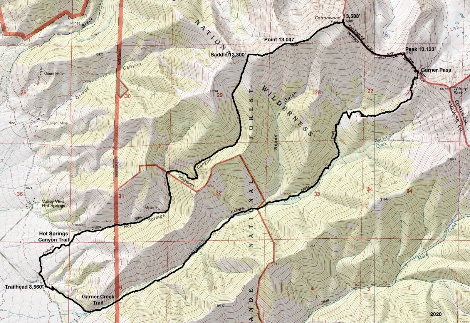
The trail intersects the dry creek bed in Hot Springs Canyon at 0.9 mile. The path stays in or very near the waterway for the next three miles. At 9,200 feet, enter a subalpine conifer and aspen forest. Most of the evergreens have been destroyed by beetles and some of the aspens look distressed. Climb under or over the deadfall. Aspen typically live about 150 years. Ninety years ago, Sep. 23, 1930 was etched into this tree.

We saw a variety of scat and animal tracks on the trail. The mountains are home to cougars, elk, and bear. There were active bears in both canyons shoving logs aside looking for grubs. Big boulders along the trail were dislodged or turned over. There was so much scat it was spooky but we didn't see any animals. The woods seemed extra deep and dark in bear territory.

We dubbed this the Shooting Star Trail because the blossoms lining the stream were profuse. When I lived in the Elk Mountains I saw shooting stars frequently. They are uncommon in the San Juans so it was enthralling to walk among them once again. (THW, photo)

At 2.3 miles, 10,100 feet, arrive in an open clearing. Stop and enjoy this sunny glade because the trail remains shaded for another 1,000 feet. We were hiking on the Summer Solstice and even then the canyon was stingy with its sunlight.
Note that a north tributary joins Hot Springs Canyon at this location. The main watercourse bends to the east and the trail stays with it, making a sharp turn to the right. Below, the forest on the north-facing slope has succumbed to beetle devastation. Thriving on the opposite slope are white pines. A friend believes they are bristlecones, a different species from the ones growing in the Great Basin. Look for the same trees along the Garner Creek Trail near timberline.
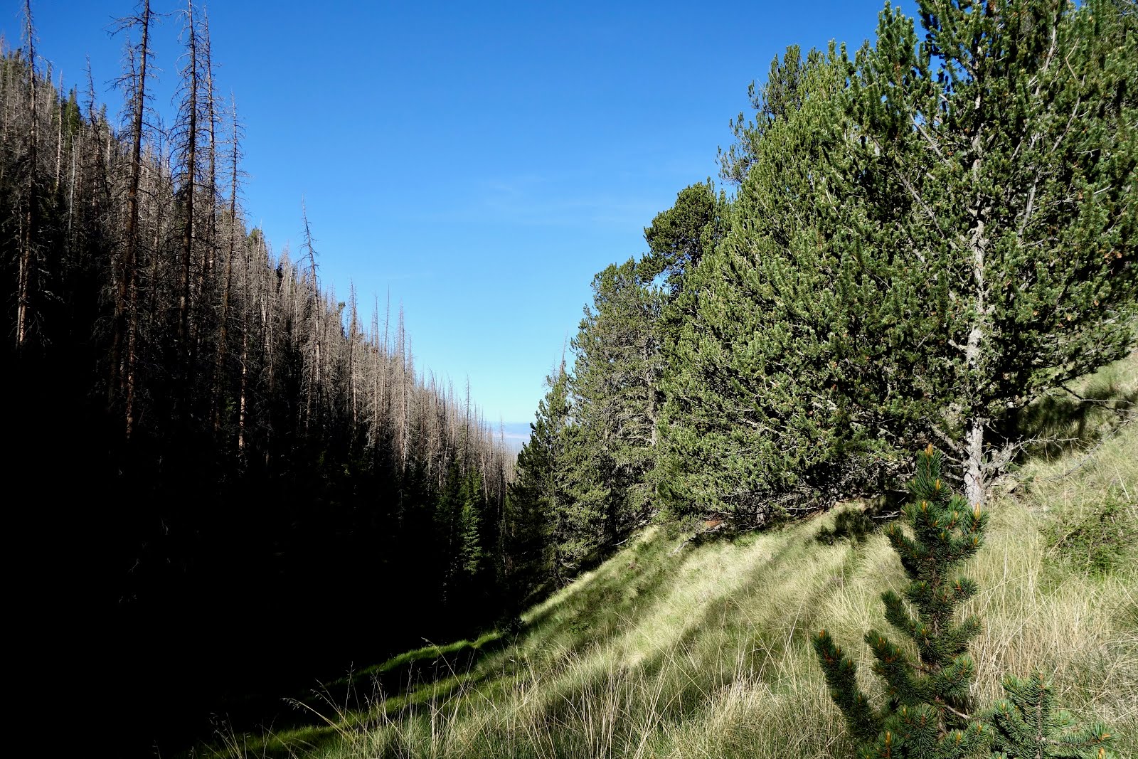
The trail thins in the grass as you ascend and by 11,400 feet, it has disappeared. It no longer makes it to the 12,300 foot saddle as maps imply. Just remain close to the stream bed. At 4.0 miles, 11,440 feet, the basin splits, shown. The old trail went to the right (north-northeast). This is the most efficient course to the west ridge.

The route is direct but not killer steep as you break out above timberline. (THW, photo)
Saddle 12,300' to Cottonwood Peak
Upon reaching the saddle at 4.4 miles, the peak is 1.2 miles off and out of sight behind a false summit. The surface is a friendly combination of tundra and rock.

In mid-June, infinitesimal forget-me-nots were scattered about. They have a heavenly scent. (THW, photo)

From a rise at 12,780 feet you can see Peak 13,123' (image-left), Thirsty, Lakes, and Electric peaks.

Crest Point 13,047' at 4.9 miles. The Sangres stretch on to the northwest dropping to Hayden Pass at 10,676 feet and rising back up to the northernmost highpoint at Bushnell Peak, 13,105'. Further west, the Continental Divide climbs over the La Garita Mountains, Sawatch Range, Collegiate Peaks, and Mount Elbert, number one in the state at 14,440'. (THW, photo)

Now Cottonwood Peak is within sight. This next segment of the loop was our favorite.

Climb on big chunks of fairly stable intrusive igneous rocks with glistening mica flakes. The block fields extend for almost two miles to Garner Pass.

Alpine (fairy) primrose was blooming in occasional patches of soil. (THW, photo)

The view corridor opens to reveal a range growing ever taller as it heads southeast. Ten of Colorado's fourteeners are in the Sangre de Cristo Mountains. (THW, photo)

There is an abrupt cliff on the north and a ramp on the southern slopes. Walk along the beautiful precipice a few feet from the edge. It feels like a mountain should but with minimal exposure. (THW, photo)

The peak tops out with a flourish on a couple of summit knobs. There is a strong sensation of soaring above the valley floor. The highest mountain visible west of the San Luis Valley is Antora Peak, 13,269'. (THW, photo)

Crest Cottonwood Peak at 5.6 miles after 5,050 feet of vertical. There are small chunks of white quartz on the summit but no peak register. Looking east, we could see Silver and Rainbow lakes in Cloverdale Basin. The eastern approach to Cottonwood begins in the lower basin at 11,260 feet. Wulsten Baldy looks like a walk. Eagle Peak, image-right, is a spur hike out the northeast ridge of Thirsty Peak.

Southeast Ridge to Peak 13,123'
The summit ridge is the boundary between the Rig Grande and San Isabel National Forests. It is 0.9 mile southeast to Peak 13,123' and took us 45 minutes. The tundra is soon overcome by talus. The wind was ferocious, throwing us off balance. We passed through a pika village.

The blocks got bigger as we closed in on the saddle at 6.1 miles, 12,820 feet. Peak 13,123' just makes the 300-foot cut to be a ranked summit. The rock pile gets quite steep the last 80 feet or so. Rocks are at the angle of repose so spread out.

Arrive on the second peak at 6.5 miles. The summit cairn is a basket of rocks fashioned from metal fence posts. There was a peak register in 2020. There is a clear view into the Cloverdale cirque. The topo shows the Garner Creek Trail going over the pass into the basin but we saw no trace of it.

On paper, Thirsty Peak looked like a reasonable third mountain. But we got a good look at it on the descent to Garner Pass and just didn't have it in us. As you come down to the pass locate the Garner Creek Trail on the west-facing slope because it's pretty subtle. (THW, photo)

Garner Pass and Garner Creek Trail No. 752
A venturi was blowing with all its might in the pass at 6.8 miles, 12,700 feet. This image gives an overview of the trail's location. It zigzags down close to the center of the bowl then heads southwest to an interior ridge before dropping north into Garner Creek. The dirt path is thin and braided. Some braids are steeper than others. (THW, photo)

The route makes its way over to the grassy southwest ridge, image-center. People have taken multiple paths to get on the broad ridge top.

Once on the ridge, sticks stuck in rock piles at irregular intervals mark the route. There is no sign of a trail; just stay on the ridge crest. Tree limit is at roughly 11,700 feet. At 11,300 feet, a large distinctive cairn with a round rock marks the place to roll off the ridge to the north. The trail becomes distinct immediately. It switches down through a talus slope to a north fork of Garner Creek. This image looks back at Garner Pass from the talus slope and trail.

The south-facing slopes above Garner Creek are solid with healthy aspen that go on for miles. The trail is faint in places with plants growing in the treadway. It stays close to the creek for the next four miles. The stream was flush so we were glad for aspen log bridges at the many crossings. Woods' rose filled the corridor with perfume. Overturned boulders reminded us we were back in bear country. Beavers have created a series of dams and wetlands. (THW, photo)

Hikers are asked to stay on the trail upon entering private land at 11.9 miles. The two-track rounds the southwest end of the ridge between the canyons. Open and close the gate as you reenter public land at 12.4 miles. Then it's a mellow single track to the trailhead.
We were familiar with 50 species of blooming plants. There were more! Here's our list in order of appearance: pricklypear, lupine, woods' rose, potentilla, cinquefoil, tufted evening primrose, harebell, western wallflower, chokecherry, columbine, osha, brookcress, mountain parsley, fern leaf lousewort, shooting star, American bistort, Rocky Mountain penstemon, Indian paintbrush, elderberry, cowbane, Jacob's ladder, current, bluebell, western valerian, purple fringe, sky pilot, snowball saxifrage, old man of the mountain, alpine avens, minuartia, phlox, sulfur paintbrush, forget-me-not, sibbaldia, moss campion, fairy primrose, alpine clover, candytuft, alpine parsley, Colorado ragwort, king's crown, native honeysuckle, pussy toes, Solomon's seal, scarlet gilia, whiplash daisy, arnica, bedstraw, puccoon, golden banner, and the uncommon sugarbowl, shown. (THW, photo)


