Sunday, November 4, 2012

Grand Canyon: Marion/Seiber Route, Kolb Arch

The Colorado River is the West's Great Receiver. Rivulets that percolate from mountains and canyon widening torrents, they all contribute to The River. The Grand Canyon is intricate and immense. It justifiably consumes the lives of its most devoted explorers, the "Grand Canyon obsessed." I spent a week with five experienced canyoneers, passionate people who anticipate and embrace the arduous. Established trails have long past seen their due and now obscure routes and remote destinations remain. Our intention for this week in upper Nankoweap was to descend the rarely traveled Marion/Seiber Route and to visit Kolb Arch.

Conversation pivoted around our feet. Recollections of past hikes, strategies for adventures in our dreams. We rehashed debacles and glanced over successes. Like chemistry and music, hiking tales are a universal language we all comprehend. And while my heart is anchored in the more diminutive canyons of Utah, I too understand the need to explore a particular region thoroughly, and the feeling of betrayal if one strays too far from the landscape of desire.

We spent our first night beneath old growth ponderosas near Saddle Mountain to position ourselves for our three mile, 3,200 foot drop via the Marion/Seiber Route to the Mystic Falls tributary of Nankoweap Creek. In 1996, Doug Nering documented the nuanced navigation for this "Freefall Route". We were supremely fortunate to have Doug guide us instead of consulting him on slips of paper. It took almost eight hours to wend our way down brush choked Supai cliffs; ferret out the multi-stage Redwall descent replete with a frightening, roll-off friction traverse; and revel in Muav ledges and blocky scrambles. Our journey was both tedious and exhilarating. We made up for our first doggedly slow mile by veritably gliding down the dry, rocky streambed runout into camp.

The Nankoweap, or Tilted Mesa Trail, is the standard treadway into the multi-armed Nankoweap drainage. An unmaintained trail, it has a lively and notorious history. And yet, our route down the cleft between Marion and Seiber Points is the passage created by nature and time. It was an honor to pass this authentic way. 

Thrashing down a brushy break in one of several Supai cliff bands. (Doug Nering, photo)

Redwall cliffs have few weaknesses. On the Marion/Seiber Route there is one, and only one, way to walk through the elaborate limestone maze. (Doug Nering, photo)

It is counterintuitive but we climbed over this thin Redwall fin via a two-foot-wide pass, photo center, and slid down a steep, rubble filled gully. (LA, photo)

The next day, we explored the Mystic Falls arm of Nankoweap Creek, visiting archeological sites and the waterfall. This shy, well named cataract only shows a portion of itself from any vantage point. Tricklefalls continuously coat a thick cascade of verdant moss.

The granaries of Mystic Falls are protected by a shallow alcove, preserving ancient corn cobs. (Doug Nering, photo)

Kolb Arch was the centerpiece of our backpack. While we'd been warned that getting to the arch was a sufferfest, we did not find it so. Rather, we had a playful, even joyful day, sharing the lead, strategizing our way around a major pouroff in the Tapeats, scrambling up boulder obstacles in the drainageway, and perfecting the route on our return. Our first view of the herky and squared off arch was from a mile away. Can you find it? (Doug Nering, photo)

The limestone arch is tucked beneath a massive Redwall amphitheater. Autumnal maples on the canyon floor mimic apricot-colored support walls. Beneath the span is a vertical arc of grey and scarlet stone. (Doug Nering, photo)

My personal sufferfest was carrying a big pack through the ridiculously choked Nankoweap Creek. Razors slashed my skin, barbs yanked out tuffs of hair while I hopped upon slippery boulders. We strayed when we could to blackbrush and sage benches above the creek where walking was easier. We were rewarded by scattered archaeological sites. Unprotected by alcoves, some crude walls remain but the structures were not as persistent as lithics and pottery sherds. The remains of everyday ware were scattered on the ground as if pots were deliberately destroyed only yesterday.

The surface of time. Remnants of an orange corrugated pot are laying just as they were left, possibly a thousand years ago.

The Canyon strips time of modesty and flaunts its handsome and bawdy nakedness. The Butte Fault scrambled and jumbled orderly formations and so we began our climb out of the canyon on a rubbly, marbly, scrabbly, path to our dry camp on Tilted Mesa where we slept on the fault's crest. The skybowl unobstructed, we marked Sidereal time by the steady progression of the Pleiades, Jupiter, Orion, and in the deepest dark, Venus.

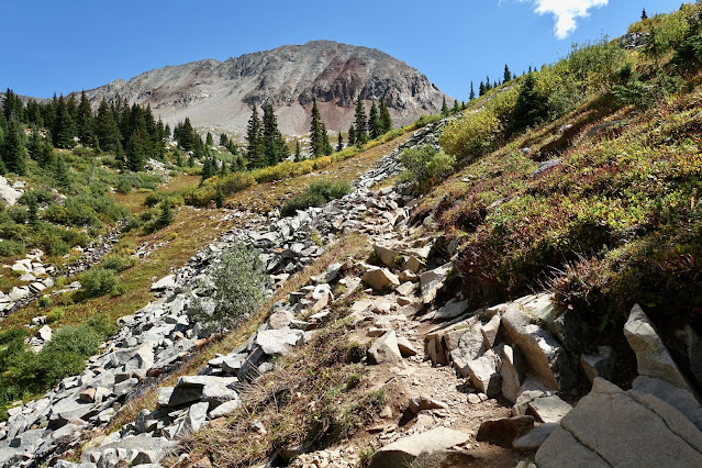
Formations reveal time. A now familiar landscape as seen from the Muav Overlook on the Tilted Mesa Trail. (LA, photo)

Everlasting beauty from our midway camp, late evening.

The Nankoweap Trail was originally an old Native American route to the river. John Wesley Powell employed a trail crew in the 1880's to improve it. It was used in 1922 for the Great Kaibab Deer Drive, an attempt to herd 10,000 deer from the Kaibab Plateau to the South Rim.  I adore this pathway, so quintessentially Grand Canyon. A thin, red thread in the Supai, the trail platform yields a place for a single foot, no more.  Exposure varies between 10 and 150 feet. We walked mindfully through historical time.

On my journeys, I sense that Earth pines for communion with appreciative humans. Off the standard route, Apache Plumes show off generations of blooms without the enjoyment of human accolade, stones suspended in time and space yearn for touch. And so we hesitate, admire their comeliness, absorb their presence, and, thus, bring The Canyon home.

Friday, October 12, 2012

Capitol Reef National Park, Hole In The Rock Road


It is a fat half day drive to Capitol Reef from Durango via Fry Canyon, the graceful bridge over the Colorado River at Hite, and dilapidated Hanksville. Fern's Place where I commonly stayed in the early 90's is in tatters with a cluttered assortment of dinosaur sculptures sloppily assembled with rusted parts scavenged from farm implements. Arriving mid-day, we had our pick of sites in the quiet and intimate Capitol Reef campground. For $10 a night each site has a table, fire ring, a modern bathroom, and water that gushes with astonishing force from a central pump.

The afternoon of our arrival, my companion and I drove out the Scenic Drive and did a 6.5 mile hike to the Golden Throne Overlook before launching cross country to an appealing rock outcrop where we stumbled by great fortune on the birthplace of spherical stone eggs.

Golden Throne and the edge of Henry Mountains from 'Spheroid Egg Nest'.

Stone eggs were being produced from mother rocks, a thrilling oddity.

Each night we'd return to camp and by the time dinner was prepared it was dark. I recently procured a camp lantern that is a marked improvement over my headlamp. After writing the day's field notes, we'd solidify the next day's intention. While I had an itinerary in place before leaving Durango, it was subject to modification and there were trailheads to find and maps to sort through (THW, photo).

Day Two. We did a 11.6 mile loop which demanded a three mile trudge down the main highway from the mouth of Cohab Canyon to the Grand Wash trailhead. I hadn't hitchhiked since high school and was disappointed every time a motorcycle, RV, or an over-stuffed pickup refused us a ride. We walked through the stately, cavernous narrows of Grand Wash pocketed with pebble bearing solution chambers. On the Frying Pan Trail, we climbed to the spur leading to Cassidy Arch, a perfect catenary, contiguous with sheets of sandstone, allowing us passage. Lost in splendor ourselves, we met the vigorous Vittoria, a man in his mid 70's who had unknowingly overshot the campground turnoff by a rugged 1.5 miles. After telling him the disheartening news (his wife was waiting for him even then), we accompanied him back to the proper turn while he regaled us with stories of childhood in the pre-WWII Italian countryside. In retrospect, we were glad we had not gotten a lift but were there to turn him around in that necessary moment.

Traversing Cassidy Arch.

Day Three. After packing up, we drove down the Notom-Bullfrog Road, turned west on the Burr Trail, rose up through hidden switchbacks, and parked at the Strike Valley Overlook TH. Yes, we did the classic 9.5 mile hike on top of Waterpocket Fold (for which Capitol Reef is named), returning down Upper Muley Twist Canyon. This day we were searching for emptiness, the space between living rock--arches. The Fold is creamy white heartrock, Navajo Formation. To the east is a great valley of linearities; to the west, the older Wingate Formation, the color of flat, thick brick paint with a hint of salmon. Softer stone, arch creator. By eschewing the cairns and staying right on the rim's rib, at times three feet wide, we ferreted out ten arches.

Meaning is in the emptiness at Saddle Arch (THW, photo).

Day four. For decades I've wanted to drive over the Burr Trail to Boulder, UT, but was intimidated by the road's reputation. Imagine my shock to find it a paved strip! There are weeks of exploring awaiting off the Burr. We choose Egg Canyon because of its remote reserve of petrified wood. We searched for stone trees. We found three massive logs suspended over a narrow drainage. Walking over them, the texture underfoot felt like bark. But no! Solid rock, the color of ocher, and jasper, quartz, burnt sand, and midnight mud in which ancient trees are trapped. Route finding for 9.5 miles was difficult and would become increasingly so now that we were out of the national park, leaving all hint of trails behind. Solitude was complete.

Contemplating the frozen intelligence of a stone tree in the Chinle Formation (THW, photo).

Stone logs have splintered neatly into rounds, ready for splitting.

Day five. Imagine twelve miles of sucking in your breath, getting as skinny as you may, and squeezing your way through four slot canyons: Peek-A-Boo, Spooky, Brimstone, and the Dry Fork Narrows of Coyote Gulch. Many of you have been to these canyons, as have I. But how can one drive down Hole In The Rock Road and pass by these bastions of gaiety? Popular, we negotiated our way around people, backing up to a wider passage.

Natural bridges at the entrance of Peek-A-Boo.

Column of radiance in Spooky (THW, photo).

The Brimstone squeeze just before this slim canyon turns knee deep wet in starless black.

Day six. Excerpt from my hiking partner's notes: This was our most spectacular and challenging hike with an incomparably varied range of experience. Our 11 mile loop began in Sooner Wash which shortly presented a 30 foot pouroff. The suggested bypass was too difficult and frightening so we went downstream on the rim for several hundred yards to where the canyon wall was somewhat broken. Some dicey traverses and a final short slide down a slanted wall gave entrance at last. After joining Fortymile Gulch the way is blocked by a 20 foot waterfall. Going around to the right, at the bottom, further progress required wading. The next 2.5 miles featured both great difficulties and great delights. Wading through the creek was often through thick mud, sometimes knee deep. Very narrow passages were chest deep in water. All along the way were seep springs in the canyon wall with beautiful hanging plants. Debra was forced to carry her pack over her head on two occasions. The lower section of Fortymile was dark, wet, beautiful, and even spooky, worth the trouble. The high-walled narrow junction with Willow Gulch left a deep impression. In Willow Gulch, the terrain began similarly but with no mud. The route was over sculpted sandstone and sand bottomed pools. After a mile, the huge muscular Broken Bow Arch appeared. This arch is a very thick but perfectly proportioned flying buttress type, standing at least 150 feet high on a stone platform occupying a bend in the creek. Further upstream, flows decreased quickly and vanished. The trek continued through a long series of shallow but charming narrows. After crossing a blackbrush plain, we were back on Hole In The Rock Road, less than a half mile from our camp at Sooner Rocks.

Sucky, gunky, mucky constriction of Fortymile.

Skyhole, Broken Bow Arch in Willow Gulch.

Inviting fluted tributary of Willow Gulch.

Day seven. Our intention was not to hike 15 miles but to go down Fiftymile Creek until we came upon Lake Powell where we hoped for an idyllic swim. The lake has receded considerably since my 7.5 topo was last photo inspected so onward we walked only to find still lake water lapping at a muddy flat. In our corkscrew egress canyon filled with delightful climbing challenges, we leaped over a 15 inch youthful rattlesnake who was doing his best to warn us with his flicking red tongue and high pitched black rattle.

Below Fiftymile Junction beneath 'Sky Bridge Arch' we happened upon a petroglyph panel at least 50 feet long and 20 feet high. The 'Bighorn Procession Panel' was hard to photograph in gleaming sun but tiny sheep were inside the bodies of ewes and life sized horned anthropomorphs had bellies full of snakes. Below is a small portion of the panel (THW, photo).

Recently inundated, we passed through narrows with an overlapping ceiling creating an interplay of bounce light and sun shafts.

Scalloped hallway of Fiftymile Creek.

Stone sculpture beckons in our shallow exit canyon.

Day eight. With a span of 225 feet, Stevens Arch is among the ten largest in the world (six are in Utah). Not only is the window a Herculean structure on a whole other scale, so is the enormity of the Escalante River Canyon. Having been there twice before, I have finally perfected this oft baffling 8.5 mile round trip route to the arch that includes a barefoot traipse down Coyote Gulch and fording of the Escalante.

Shuffling sideways in Crack-In-the-Wall. On our return, we opted to climb the rib instead. Exciting!

Stevens Arch with the ledge route to its base.

Wrapped in a ribbon of rock (THW, photo).

Escalante River from Stevens Arch (THW, photo).

My truck, gear, body, and now my house is the color of red earth. I hesitate to wash up.

If you go: Escalante Outfitters rents tiny log cottages with a communal bath for $50/night. It is 365 miles and 7.5 hours from Durango, Colorado to Escalante, Utah.
 

Sunday, September 16, 2012

San Miguel Peak, 13,752'

Essence: Beauty accompanies every step toward this commanding Sky Stone. Free climb for 2,000 feet on sheets and slabs of granite more typical of the Sierra Nevada than the San Juan Mountains. This hike is best suited for experienced scramblers. LiDAR has increased the elevation of San Miguel Peak to 13,756 feet with a rise of 1,314 feet, and a Colorado prominence rank of 209.
Travel: San Miguel may be climbed from the Bandora Mine west of Silverton, or the Lake Hope Trailhead north of Lizard Head Pass. Both options are described.
Travel to the Bandora Mine Trailhead: From Silverton, drive north on US 550 for 2.0 miles. At the sign for the South Mineral Campground, bear left onto a good dirt road. In 4.2 miles, pass the campground and continue for another 2.5 miles on a slow, rocky, 4WD, high clearance road to the Bandora Mine. Park on the right. Avoid continuing down to South Mineral Creek. 
Travel to the Lake Hope Trailhead: First off, the Forest Service and many other references call this the Hope Lake Trail. However, the lake is correctly named Lake Hope on the topo. The turnoff from CO 145 to the trailhead is on the north side of Lizard Head Pass at about mile marker 61.3. Turn east onto CR 63A (to Trout Lake). After 1.5 miles, turn left on Hope Lake Road, FSR 627. The trailhead is 2.5 miles up the rocky road. 4WD is recommended but 2WD vehicles with good clearance and sturdy tires should make the trailhead. 
Distance and Elevation Gain from Bandora Mine: 10.2 miles, 4,650 feet
Distance and Elevation Gain from Lake Hope Trailhead: 8.0 miles, 3,250 feet
Total Time: 7:00 to 8:00 from Bandora; 6:00 to 7:00 from Lake Hope Trailhead
Difficulty: Trail, off-trail; navigation considerable; Class 3 with minimal exposure to the summit, Class 4 with considerable exposure to the optional subsidiary peaks
Map: Ophir, Colorado 7.5 USGS Quad
Latest Date Hiked: September 8, 2024
Quote: In the mythic tradition the Mountain is the bond between Earth and Sky. Its solitary summit reaches the sphere of eternity, and its base spreads out in manifold foothills into the world of mortals. It is the way by which man can raise himself to the divine and by which the divine can reveal itself to man. Rene Daumal

A sunbeam spotlights San Miguel Peak as seen from the east ridge of Rolling Mountain.

Route: The Lake Hope Trail bears essentially south. At 11,640 feet, leave the lake trail and cut west on a social trail to the dam at the north end of the lake. From Bandora Mine, hike west to Hope Pass and descend to Lake Hope. At trail's end, climb over Point 12,047' and pitch down to the dam. Both routes join at the dam. Climb southwest staying south of San Miguel's northeast ridge. The most efficient route turns south at 12,760 feet and makes for a tarn at 12,900 feet. Pitch west to the southeast ridge of San Miguel, hitting it at about 13,500 feet. Climb northwest to the summit. 

Route from Bandora Mine to Lake Hope Dam: It is 3.5 miles with 1,960 feet of gain from the trailhead, elevation 10,740 feet, to the dam. San Miguel Peak generates a lot of enthusiasm. In 2012, my partner and I led a group of friends in a Durango-based hiking club from Bandora Mine. In 2024, we started from the Lake Hope Trailhead. Below, the mine is just off the road to the right. Rolling Mountain's north face cliffs are south. Hope Pass is a pleasant 2.4 miles away on a broken-rock trail with 1,770 feet of elevation gain. Head up the hill on an abandoned mining road. Soon the unmaintained treadway narrows. Climb over logs, cross small streams, switchback twice, and break out of the trees at 11,600 feet. (Thomas Holt Ward, photo)

On two previous attempts I was turned back by deep snow in the upper basin. I tried too soon one year and too late another. This image was taken from Hope Pass, 12,445 feet, a good place to secure in your mind the true summit. On the right is a double-humped pair. San Miguel is the rounded summit on the left of the twosome. The flat-topped false summit on the right must be bypassed well below on the south. Many people have gotten in way over their heads climbing this scoundrel, especially in the treacherous notch below the actual peak. While it is possible to reach the crest that way, it is ill-advised for most hikers.

From the pass, give up 580 feet in 0.7 mile on an excellent, heavily trodden path to Lake Hope, 11,860 feet. In this image, the beguiling false summit is at the center. At the sign for Trout Lake, go left on a secondary trail. Just east of the lake is a 190 foot knoll. If you try to get around it at lake level, you'll get cliffed out. Climb over Point 12,047' and descend to the dam at 3.5 miles.
 
Route from Hope Lake Trailhead to Lake Hope Dam
From the trailhead at 10,720 feet, it is 2.4 miles with 1,220 feet of gain to the Lake Hope dam. This popular trail is renowned for wildflowers. Initially, the trail bears east and crosses the streamway in Poverty Gulch at 0.25 mile. The creek gathers water from the west slopes of Pilot Knob, Golden Horn, and Vermilion Peak and may be unsafe to ford in high water. Some of the hikers seen below have over-shot the crossing.

The trail turns south and holds the 10,800-foot contour while passing rivers of talus and old growth spruce with swooping trunks. Views of the San Miguel Mountains are captivating. Below, the intimidating northeast ridge of San Miguel Peak and Point 13,088' are glowing in morning light.
 
Lake Fork, the outlet stream from Lake Hope, and another pretty creek join beside the trail at 1.2 miles. A series of switchbacks ascend in earnest to timberline. Pictured is Peak 13,302', climbed from Hope Pass or via a knife-edged ridge from Beattie Peak. 

At 2.0 miles, 11,640 feet, leave the lake trail and cut west on a social trail for 0.3 mile to the Lake Hope dam. The trail is subtle and fragmentary but we were able to patch it together. Below, the markers are the lone spruce, the fin-shaped cairn, and the trail, image-lower-right. Stay below and north of Point 12,047', image-left.
 
Off-Trail Route to Summit 
Both approaches discussed above meet at Lake Hope's outlet. It is not possible to see San Miguel's summit from the lake. Between my partner and me, we have been on half a dozen different routes from the lake to the summit. There's plenty of freedom of movement but also some hazards best avoided. What follows is our favorite and most efficient route. It is 1.6 miles from the dam to the peak with 1,900 feet of vertical. First, cross the dam and climb the obvious grass ramp.

These hikers are just above the ramp, ascending southwest. They are staying south of the northeast ridge of San Miguel. Yes, my partner did a successful climb to the peak on the northeast ridge but negotiating the notch is tedious and not at all fun.

Hold the southwest bearing to about 12,760 feet, thereby avoiding cliffs encircling the lake on the southwest.  
 
It is steep but easy. Enjoy friction climbing on slabs and sheets of granite, seeking out tundra runners. 

Look back on the quickly receding lake and the backside of peaks that frame Ice Lake Basin. From the left: Pilot Knob, Vermilion Peak, Fuller Peak, Beattie Peak, and Peak 13,302'. Hope Pass is image-right. (Judy Mack, photo)

At roughly 12,800 feet, turn south climbing slightly over 0.3 mile to a tarn at 12,900 feet. Look into San Miguel's percolated waters. (C. Blackshear, photo)

The southeast ridge of San Miguel is now in full view. The image below was taken from a higher location but it shows the rounded summit on the left, the notch on the northeast ridge, and the false summit seen from the lake, image-right. Looking at the southeast ridge from the tarn, there is an obvious notch just above the saddle (off-image on the left). Halfway between the notch and the summit is your best target for hitting the ridge. Pitch up due west from the tarn to 13,500 feet and then contour over to the ridge.
 
Use caution while traveling to the ridge. The slabs and boulders are gigantic and some of them are teetering on the brink of taking out hikers. Stone resting on the spine is more stable. However, there are a few obstacles to intuit and finagle your way around. The summit is directly above this cluster of people; a subsidiary peak is to the left.

The distinctive stone cube on the ridgeline signifies the summit nears.
 
The summit is surprisingly small for such a colossal structure. (THW, photo)

San Miguel can be seen from all over the San Juans so it follows that the view from this vantage point is mind-numbing. Framing the expanse, not even two miles south is colorful Grizzly Peak, 13,738'.

At the center of this familiar cluster in the east is Golden Horn framed by U S Grant to its left, and Vermilion Peak, 13,909' (LiDAR), on the right.

There are two subsidiary peaks adjacent to San Miguel tempting lovers of Class 4 rock. If the day has been too exposure-free, here is your fix. But don't go over because you are not sure which peak is highest. Trust me, the one you are standing on is the legitimate high point. Climb the easier peak on the right to get warmed up, walking gingerly on the knife.

On the way back, climb down into the notch and scale the Class 4 tower due west of San Miguel. Face to the rock, my pigtails kept obscuring my field of vision! Downclimb facing the rock. (C. Blackshear, photo)

Retrace your steps back to periwinkle blue Lake Hope. Those returning to Bandora must reclimb Point 12,047' (190 feet) and recover the 580 feet to Hope Pass. For those returning to the Lake Hope Trailhead, there's roughly 100 feet of gentle ascent in the woods. (THW, photo)

In September, 2012, a massive moose grazed slopes west of the lake. (Betsey Butler, photo)

For those returning to Lake Hope Trailhead, the north flanks of San Miguel bear the eternal gift of the ephemeral flower.  Below, Lizard Head communes with rosy paintbrush.