Essence: The hike to Progeny Peak shows off the best of Zion with a staggering amount of variation in terrain features within just one mile, including an unusual arch. The peak's relatively short stature gives it a supreme vantage point over surrounding higher summits. The hike has many strong attributes: the approach and peak are entirely composed of Navajo Sandstone, the short hike works well on a travel day or when afternoon storms threaten, it is attainable for most hikers comfortable off-trail, it is simply beautiful from start to finish and solitude and peaceful silence are assured. The hike is such fun it merits the greatest compliment of all--worthy of repeating. The mountain is located north of Utah State Route 9, just east of the Zion-Mount Carmel tunnel. The hike is within Zion National Park.
Travel: Park in a pullout on the north side of the highway 0.3 mile east of the Zion-Mount Carmel Tunnel, just past Pine Creek. For those traveling west, the pullout will be on the right 0.9 mile west of the much shorter tunnel you encounter after the entrance station. There is room for 4-6 vehicles in the pullout. No facilities.
Zion National Park: Visit the website for information on fees and campground reservations.
Distance and Elevation Gain: 2.0 miles; 1,150 feet
Total Time: 1:45 to 3:00. For reference, it took us 1:05 up and :50 down.
Difficulty: Off-trail; navigation moderate; Class 2+ with mild exposure; wear boots with good grip; hike on a cool day and carry all the water you will need.
Total Time: 1:45 to 3:00. For reference, it took us 1:05 up and :50 down.
Difficulty: Off-trail; navigation moderate; Class 2+ with mild exposure; wear boots with good grip; hike on a cool day and carry all the water you will need.
Reference: AllTrails has an annotated GPX file you may download.
Map: Springdale East, UT 7.5' USGS Quad
Date Hiked: May 19, 2023
Poem:
What I ask from you, Nature,Map: Springdale East, UT 7.5' USGS Quad
Date Hiked: May 19, 2023
Poem:
is a deeply interfused confidence and peace,
a reprieve from fear and from hope
a sand grain of joy, an ocean of oblivion…
Antonio Machado
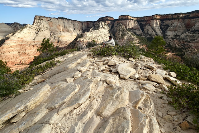
A hiker ambles up sheets of sandstone while rounding the summit dome of Progeny Peak.
Route: The route bears north-northeast up a minor drainage that is just east of the confluence of Pine and Clear creeks. Upon gaining the northwest ridge ascend southeast to the summit. The Springdale East topo has 80-foot contour intervals so the terrain is steeper than it appears on the quad.
Route: The route bears north-northeast up a minor drainage that is just east of the confluence of Pine and Clear creeks. Upon gaining the northwest ridge ascend southeast to the summit. The Springdale East topo has 80-foot contour intervals so the terrain is steeper than it appears on the quad.
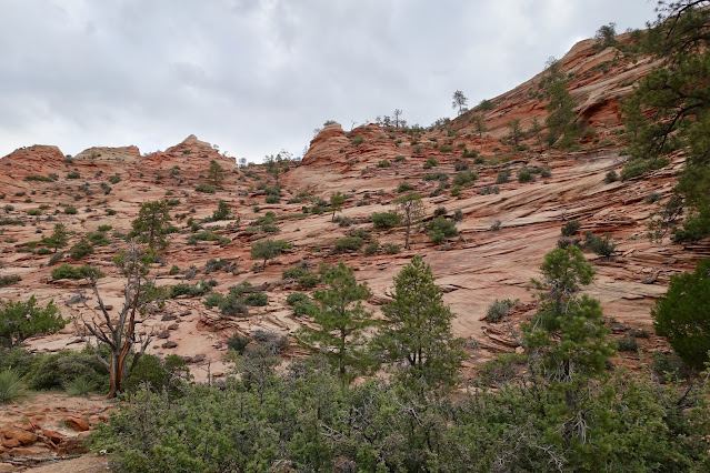
Get your bearings from the parking pullout, elevation 5,160 feet. The peak is visible nearby in the north. The route passes right by the arch and makes for the northwest ridge at skyline, image-left.
The access drainage is seen from the roadway.
Locate a use trail at the east end of the pullout that drops into the wash. This image looks back at the pullout from the footpath. We concluded our hike before the rains came at 10 am. Clouds shrouded peaks to the west: Mind's Eye, Shelf Point, and The East Temple.
The waterway splits almost immediately. Take the branch upcanyon-right. Your confirmation is the unusual speckled white and tan slab, shown. The entire hike is on swaths of sandstone, so very pretty. A word about navigation in subtle terrain. It's more challenging to stay the course while going upcanyon because you have to decide which branch to take when the waterway splits. It's easier on the way back--just follow the evidence of water downhill. As seen on the map above, on our return we blithefully followed the wash to the immediate west and very soon intersected our original route.
Climb a steeper lip at 0.2 mile. This presents a minor friction test for your boots.
Follow the waterway up the shallow pink drainage holding a north-northeast bearing. Showers were occurring daily and the sand was moist.
The arch is clearly visible at 0.3 mile. It's not a skyline window but rather a thin ribbon of stone fastened to the sloping sandstone surface. Aim for it.
Three crusted black boulders that eroded from a different formation rest on variegated bedding planes.
At 5,540 feet the slope steepens. On our way up we veered to the west looking for shallower terrain. On our return we took a more direct line. Just work your way up the friction pitch at an angle that's manageable for you. Below, the arch is image-right partially hidden by a ponderosa pine.
Arrive at the arc natural arch at 0.5 mile, 5,680 feet. The initial perspective is unusual. The steeply sloping lintel is wider than it is thick. The arch is not indicated or named on the topo. AllTrails assigns the informal name "Two Pines Arch" but there is only one significant ponderosa remaining, its roots spreading down and around the base of the arch. Please resist the urge to climb on the fragile span.
Could anything match the beauty of an old growth ponderosa and a delicate thread of iron-red Navajo Sandstone? (Thomas Holt Ward, photo)
Proceeding, a visible crack extends north from the arch. To its left is a buttress. The easiest strategy is to climb left of the small buttress. We put our poles away (and never wished for them again) for the Class 2+ pitch. It was steep enough that I found myself climbing with my fingers bracing off the slope. Absent exposure, it was a delightful little interlude. (THW, photo)
This image looks from the buttress into the upper crack. I've included it because the whole scene is quintessential American West. (THW, photo)
Keep heading north and soon you'll top out on the buttress and arrive on a westward flat at 0.6 mile, 5,880 feet. Move to the east of the cleanly sliced fin, shown. Be sure to locate this obvious landscape marker.
From here, the summit is visible to the east. The easiest approach is via the northwest ridge. The route wiggles around a bit to gain the ridge. Turn east toward the mountain. While you may get some help from cairns, the way is intuitive--follow the lay of the land. Walk east until you head a shallow drainage and turn north.
Transition onto a bench. Stay on the terrace until the bedding planes on your right lay back enough so you can work your way up to the east. The bench was so irresistible we didn't want to leave it behind.
Heft up onto a low-angle sloping slab with the peak right in front of you. Yes, perhaps you could climb it straight on but why would you do that when the easier and more beautiful approach is on the ridge?
We passed by a penstemon blooming despite having taken root in a ever-so-thin crack in the slab. (THW, photo)
Arrive on the northwest ridge at 0.8 mile, 6,040 feet, 0.15 mile from the summit. (THW, photo)
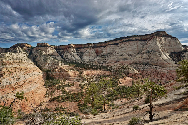
It was simply astounding that we hadn't even walked a mile and the vista was already overwhelming. Deertrap Mountain is the blade-like peninsula in the northwest.
The Scarlet Begonia is the confounding informal name for Peak 6,995' to the northeast. (THW, photo)
The final climb up the ridge begins with roughly 80 vertical feet of rubble on bedrock at a pretty steep incline.
Groups should spread out horizontally. Be on the alert for sliding slabs. Practice good slickrock techniques--avoid stepping on thin bedding planes and breaking off edges of stone, take baby steps to keep your weight over the earth and imagine smearing the soles of your feet into the stone. Make it elegant, not crude. This rock was laid down 180 million years ago and doesn't want to be dislodged by sloppy foot placement. (THW, photo)
The slope moderates and it's just pure pleasure finishing off the climb. (THW, photo)
Arrive on the roomy, relatively flat-topped summit in just under a mile. We were not able to locate a peak register in 2023. You wouldn't necessarily think so, but sometimes well positioned lower prominences have a visual advantage. Surrounded by a ring of taller peaks it felt like we were in the center of everything. Progeny is a ranked summit with 475 feet of prominence.
We were a world away but we could look way down on the highway, parking pullout, and tunnel entrance. On the horizon left to right are: Roof, Hepworth, Gifford, and Destination peaks, G2, G3, and conical Bridge Mountain.
Look southwest and you will see more of the snaking highway below Nippletop, The Fin, The (geometric) Triplets, Second Triplet, First Triplet, and Lost Peak.
Retrace your steps. The trickiest part of the hike is the downclimb off the lower summit dome. Once you are past the slope below the arch, just follow the stream course back to the start.


1 comment:
Ah this is a sweet little intro to the vast slickrock country of East Zion. To put the difficulty into perspective, my son went up when he was 7. But this is still off trail and requires careful navigation. Locals call that "Two Pines Arch" but one of the pines died some time in the last decade.
Post a Comment