Thursday, October 10, 2013

Arizona Strip: Coyote Buttes, Page Hoodoos, and More

The day the United States Government Shutdown, my companion and I were driving to Zion National Park to meet three other couples. Disappointingly, but understandably, they chose to stay home.  We did a quick plan adjustment and headed for open country.

Heading south from Hwy 89 on House Rock Valley Road, the Wire Pass parking lot was surprisingly stuffed with vehicles. We took up residence in the mostly deserted, technically closed, Stateline Campground where we slept on the ground, the sky shot with stars, crystalline down to earthline where they were swallowed by planetary darkness.

It is irritatingly improbable to score a permit for North Coyote Buttes, site of The Wave. The ranger at the trailhead on day two of the Shutdown gave us the nod by saying he wasn't enforcing. So away we giddily walked.

The scofflaws make their entrance (THW photo).

The Wave pool reflecting mid-morning cross-bedding and fluid pigment.

Dry stone ripples move all things forward.

Ten foot circle of chaos held firm by Stripe World Order. Voices inside rocks are not silent; they mirror a similar place inside of me.

Twenty foot section of bedrock that doesn't know what to make of itself; still, this is relationship perfected.

As it happens, it is a good thing we were exactly there on that day for upon our return, we caught up with a Chinese couple in their mid-80's from New York City. They were very much lost and weak from exhaustion having been hiking for seven hours. We escorted them home.

Our second day met with initial disappointment as the road to the Middle Route into Buckskin and Cobra Arch was washed out. So we attempted to find Starlight Arch. My friend later wrote, From our parking area a break in the Vermillion Cliffs was visible to the north about two miles away, so we headed for that. We followed a side drainage of the creek to a steep, narrow gully coming down from the cliff proper through the Chinle Formation. Numerous small obstacles were all passable to the cliff base where a clear view of the break was available. Not possible!

The gentle initial pitch of gaily variegated Chinle Formation.

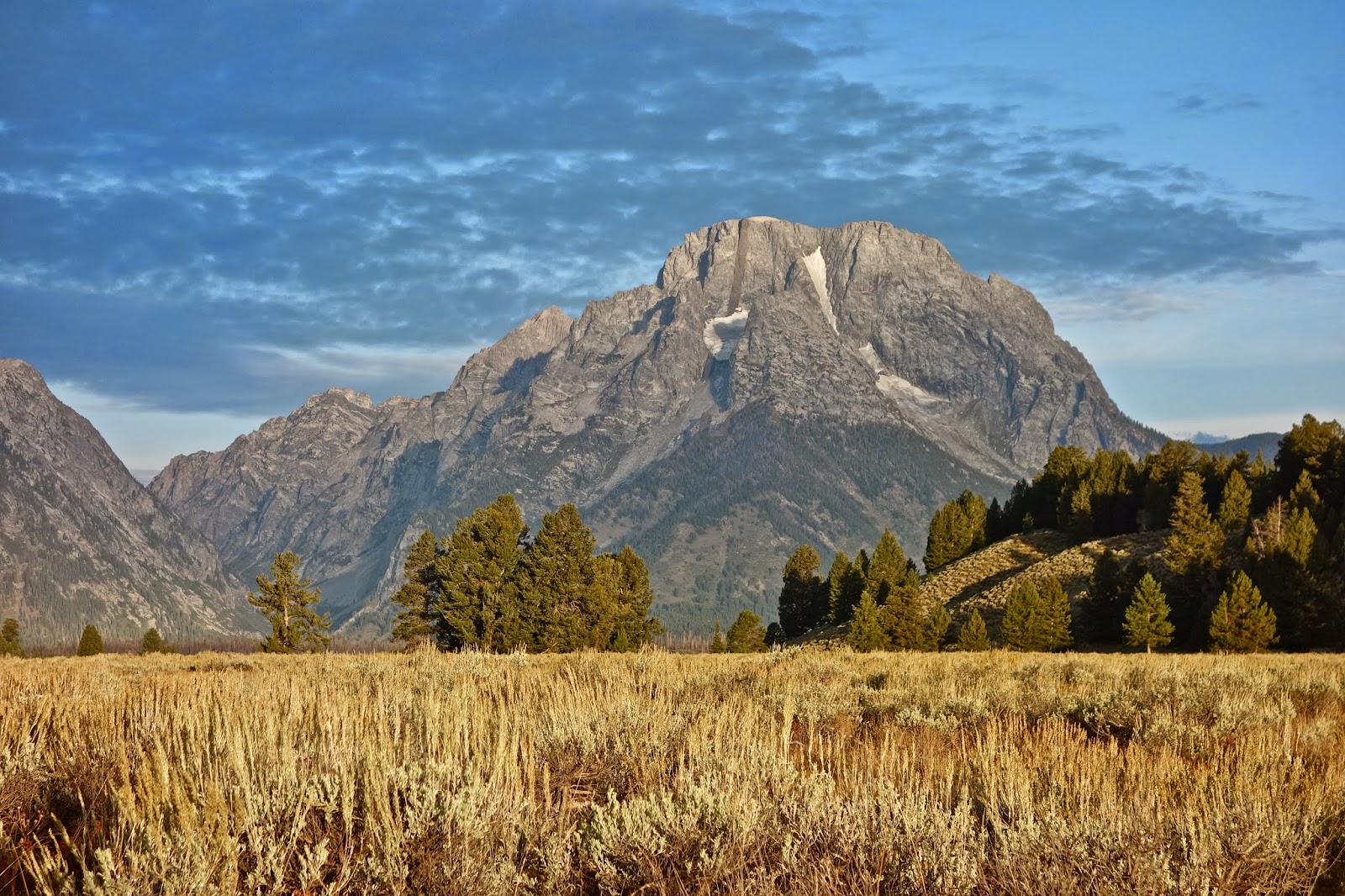
A dry river flows at the base of Vermillion Cliffs. Mollie's Nipple is in the distance.

To the right, however, the cliff was somewhat broken and offered possibilities. Pursuing these, a narrow scrambling route was eventually discovered, including a delightful 'crack in the wall,' and an exposed final leg-up to a narrow micro-ridge and onto safe ground. Exploring south from this point, we found large, beautiful wind-eroded formations of white Navajo Sandstone, but no arch! After lunch at our southernmost excursion along the cliff top, we decided to retreat as we had come, in spite of clear route-finding challenges...In the end, although the hike turned out to be one from the non-existent to the undiscoverable, we happily christened ourselves 'Vermillionaires' for our unique penetration of the cliffs.

Impassible pouroff in the break, our scramble and squeeze route center. Opportunity created by obstacle, uncharted route finding holds the possibility and promise of everything we cannot yet see.

Page, AZ was simply over-flowing with international tourists ousted from our National Parks. I found myself apologizing multiple times to disappointed French, German, and Chinese travelers. Town was literally jammed with tour buses. We half expected to see a bus parked at Waterholes Canyon a few miles south of Page. The upper portion of this slot is nearly as spectacular as renowned Antelope, without the fees and hoards. We spent an additional two hours dangling off precipices in our attempt to penetrate the deeper, lower canyon but it is hopeless without ropes.

The interior of everything that matters glows.

Fluted, sinuous narrows beckon in upper Waterholes.

The road was so trenched and treacherous to the Page Hoodoos, we walked in solitude. Stone columns happily hoist their partners as a human provides scale.

I am drawn to the tallest tower of castle ramparts above the hoodoos. Lake Powell and Navajo Mountain are in the distance (THW).

We bored our way out through deep sand to Paw Hole in South Coyote Buttes; walked past this complicated, cross-bedded stone edifice; admired the filigree inside the alcove, and in time, found "Finland".

If I could discern this stone's story of origin, I should ask how it came to live in the three dimensions pictured. Alas, it'd require a PhD in geology to understand how rock dares to structure itself as it does in Finland.

Do not enter on a klutzy day. Careful placement of feet is required at all times, even when you are laughing along with these guys, more bizarre than creatures in my dreams (THW).

Sheets of sandstone were a half inch thick. Interior bonds are strong but on the outside the rock is as fragile and delicate as a wafer.

The jig was up on the sixth day of the Shutdown. Hoping to walk in the non-permitted upper section of Buckskin Gulch, a ranger ordered us off our very own public land. We drove home, but not before making a hearty run at it, even capitalizing on this utterly ridiculous, perilous, and heartbreaking Shutdown situation.

Wednesday, September 25, 2013

Rocky Mountain and Grand Teton National Parks


It is 378 miles from Durango, Colorado to Rocky Mountain National Park. Untroubled by traffic and wind, captivated by some of the best scenic beauty in Colorado, the miles flew by effortlessly.

The San Luis Valley is at its finest this time of year. Farmers were mowing and bailing. There were single rectangular hay bales strewn all about, defined by shadow and sunshine, and gigantic stacks of bales that looked like bricks of gold. Indeed they are. The harvest was surprisingly abundant. Open trucks were brimful with potatoes. The Sangre de Cristo Mountains were silent and serene in the east but the San Juans had clouds jumping up and down on their tops to the west.

On Highway 9 North towards Kremmling, my truck rolled along the Blue River which bifurcates a green valley. Black cows ranged beside a red barn with 15 deer, elk, and moose racks mounted about the entrance. Their antlers looked strikingly pointingly similar to the grey sawtooth peaks in the west.

Almost to Granby, I entered a 35 mph gorge road paralleling a mere trickle stream. The Colorado River! Does this great carrier of western waters begin in the park I wondered? I felt a sense of exaltation when a friendly ranger welcomed me to Rocky Mountain National Park mid-afternoon.

Four cow elk grazed in my site at the Timber Creek Campground the following morning while a bull elk bugled a few feet off in the trees. Two resident campground moose tore at willows on the banks of the headwaters of the Colorado River. It had rained lightly until 11:30 pm, clearing to reveal the realm of stars.

I debated the wisdom of riding my bike since at 8:15 when I took off from camp the sky was 99% covered in cloud. I'm so glad I took the chance but the clouds played their part in keeping me from going up and over all the way to the east side, a 64 mile ride round trip. Trail Ridge Road is my new favorite, a perfect biking roadway. Traffic was light, and while the road went well above timberline, it was a full two lanes wide and buttery smooth. Seriously, there are no imperfections on this Colorado show-case byway. Switchback edges were lined with rock walls. Retaining walls on the uphill slopeside were carefully sculpted. It was a little exciting in places (precipitous) but I just took the room I needed.

The climb began gradually then pitched up in the switchbacks where you can look down on three levels of asphalt at once. It was 6-7 mph steep in places. I gained 3300 feet in the first 14 miles to the road's high point (12,183'). Then I flew down to Iceberg Pass and back up to Rock Cut. The ride accumulated 4100' of climbing, 34 miles.

Trail Ridge Road is not plowed in the winter and for good reason. Winter is long. In fact, for every 100 feet in elevation gain, spring comes a day later and autumn, a day earlier. So if Estes Park, the eastern gate to the park is at 7,522 feet, winter lasts 112 days longer a few miles up the road. Further, the highest surface wind gust ever recorded was 221 mph on Mount Washington. Longs Peak was second at 201 mph. Winds of 115 mph have been recorded on Trail Ridge.

The Alpine Visitor Center at 11,796' is past the next switchback and a few hundred feet above treeline, typically about 11,500' in Colorado.

Longs Peak, 14,259' and elk herd of approximately 75 just off Trail Ridge Road.

Royal elk grazing within yards of the road.

Curiously, the Great Divide is part way up the west side of Trail Ridge. As a Westerner, the Divide is the defining edge of my universe.

On my second day, I climbed to Mount Ida which resides right on the Continental Divide. While my map does not indicate a trail, it is actually very well defined until the rock fellfield where the way becomes self explanatory.

Ida is the highest peak, 12,889', off in the distance. The rolling tundra was so easy and pleasant. I spotted eight pikas, two marmots, and four royal elk.

The drive from the Rocky Mountains to the Grand Tetons transpires on empty roads crossing empty country, Wyoming. A single windmill or horse on the crest of a hill is an event. I slowed for a pronghorn and found another seven grazing town grass in beat up Jeffery City. I was passed occasionally by cowboy hats driving dually guzzler trucks and Lincolns.

Snow fences line roads for miles, protection against blowing snow shortly to come. Weathered wood undulating with the land looks artistic and appealing.

The first view of the Tetons left me gasping out loud. The range looks like a fantasy, jutting and weird and ridiculously high and startling.

Moran Peak in the morning before 100% cloud cover.

The climbing ranger recommended Static Peak as a good solo hike. But really, a super long hike on a day that had a 90% chance of rain by early afternoon? No problem, he said. The narrow road to the trailhead was gridlocked because of an exhibitionist bear eating roadside berries. Many people, even more people, with long-lensed cameras were shooting. It made me smile to see their reaction to this hungry bear but consequently I didn't get hiking until 8:39. I didn't see another person until mile 7.7 and then it was three teenage girls from Jackson climbing their first Teton peak. They needed to be redirected to the proper route.  Clouds shrouded neighboring peaks but the girls and I exchanged cameras and with patience, got a few pictures. The weather was a little disconcerting but it never did rain for which I was exceedingly ecstatic. The Teton Range is made of ancient rock, schist and gneiss 2.68 billion years old, but the range itself is quite young, uplifted relatively recently and glacially carved. I lucked out on this inaugural hike and will be back for much more: 16.2 miles, 4,800' gain, 7:20 total time, on a perfect trail to within 500' of the peak, then an easy ridge climb.

From Static Peak, 11,303', Timberline Lake and the Grand Teton cluster in the background.

If I'd known then as I do now that there are grizzlies in this park I wouldn't have left the parking lot.

Gros Ventre is the perfect campground. There were plenty of empty spaces to choose from and friendly, quiet people. It's the sort of campground where couples ride around on townies, smile and wave.

It rained every afternoon and throughout the nights of this trip, a little unexpected for September. There was a steady downpour on my final night; it rained so hard it leaked inside my topper.  In the morning I pedaled the five miles to the bike path hoping to get a photo of Static Peak since it was shrouded after my hike. But the valley was stubbornly cloaked in fog. I came upon a wild bison herd. Needing to pass through, a local woman rolled the window down of her van and said, "Either get in my van or hang on to the mirror." I rode by her side and came within five feet of bulls as we plowed through the pack. On the way back, I waited for a break and shot photos. It was worth the chilly ride to see these magnificent beasts of the American West so close. Of note, the idyllic bike path goes from Jenny Lake campground (most always full) to the town of Jackson. I rode by the Jackson Airport, the only commercial airstrip in a national park, or so I was told by a prideful local.

Reluctantly, I moved on for northern Idaho was my next appointed destination. I had not even dabbled in the wonders of this park. Charming towns politely scattered along the asphalt path threatened to further distract me from my goal. I am utterly smitten with the America West.

In Montana the rivers run north carrying anglers in floating vessels. Water flows up broad, long valleys with hills on either side which I expect the locals call mountains. In their modest manner they hold appeal. Very occasionally summits rise above timberline.

Rural Idaho is a country with clean shapes. Golden hay meadows, grey cylindrical grain elevators, and red potato trucks. All potato trucks are red, it seems, the shinny new ones and the old rickety ones. Altogether, I traveled through seven western states, 3,747 miles. It was harvest time and the road trip's defining thread was surprisingly not in the spectacular but rather the humble hay bales dotting the landscape along the entire loop as beads on a necklace.

Friday, August 30, 2013

Sierra Nevada: Lamarck Col to Bishop Pass

The High Sierra trip this year included my hiking companion as well as my son, 23, a seasoned climber and backpacker. We began at the Piute Pass trailhead but veered off immediately toward Lamarck Col. From the Col, we dropped into Darwin Canyon and eventually met up with the John Muir Trail. On this highly engineered, manicured marvel, we passed through Evolution Basin, went up and over Muir Pass, down into Le Conte Canyon, and finally out Bishop Pass by way of Dusy Basin. We began our trip on August 18, walking into the face of a multi-day storm.

California's Sierra Nevada is a young, edgy and restless range with three commanding components: rock, sky, and water.

Darwin Canyon and a portion of the "Range of Scientists" from Lamarck Col. (THW, photo)

We scrambled easily enough up to the Col beside one of many dwindling glaciers on dependable, blocky talus.

Swimming into blue blue reflection at the highest lake in Darwin Canyon, its water sweet and pure. (THW, photo)

I favor rock. Having been raised literally on Sierra granite, it is home. At every point on the north/south running craggy dragon's spine, covering an enormous portion of California, senses are overwhelmed by the presence and power of rock that dominates this land: smooth sheets and domes, palisades and pinnacles, thick exfoliated slabs, glacial erratics, quartz edged chunks, crushed granitic granules, and America's tallest mountain. Granite is so obdurate, so enduring, it emerged victorious, gleaming prettily, from the punishment of the glacier's grinding force. Ice scoured and polished, with a certain slant of the sun, whole mountainsides shine so brightly it makes my eyes hurt.

Glacial polish glistens in light rain at Sapphire Lake in Evolution Basin while Sun finds an opening to light Mt. Huxley, evening.

Granite, so dependable, is the climber's delight. Standing on a lofty slab of trustworthy stone, framed by Mt. Huxley, morning. (THW, photo)

It rained 40 hours over our first four days. We were awash in downpours, cramming three people into a two person tent for extended hours of stories and mind games. On our much anticipated climbing day, it rained all night and we woke to splatters on tent walls.

We capitalized on ten minute rain-free segments to prepare meals before dashing back into tents at Sapphire Lake.

Abandoning our climbing agenda, we raced rain over Muir Pass and dropped into Le Conte Canyon in a ridiculous bone chilling, finger numbing deluge. The Muir Hut resides on the shallow saddle. Black Giant 13,330', surrenders to the storm.

Descending into Le Conte Canyon, even in the rain, granite gleams.

The Sierra is most often kind to its pilgrims and our fifth day was drenched, this time in sun, born on a cold, gusty wind. We friction climbed up a sheet of stone beside Dusy Creek. This outrageous fun is only possible on dry rock.

The sky up there is very pure and fine, bracing and delicious. And why shouldn't it be? It is the same the angels breathe.  Mark Twain

The Citadel, a razor edged fortress, is delineated by a sharpness of light, the air so clean it draws with a needle made of quartz.

We adjusted plans, this time to accommodate sun, and enjoyed the highlight of our trip. We climbed angular slabs and terraces to Knapsack Pass above Dusy Basin.

Columbine Peak, North Palisade, and Polemonium Peak from Knapsack Pass.

Mt. Agassiz amongst the Palisades, basking in alpenglow above camp in Dusy Basin.

We'll return to climb in the Range of Scientists, the Palisades, explore Goddard canyon and mountain, and climb the Black Giant off Muir Pass. And that is a tiny cranny. After six decades, I'm only beginning to know my home mountains which inspire a mystical devotion, so vast, raw, and indomitable are they. Appropriately, an ancient name for the Sierra range is Inyo, Dwelling Place of a Great Spirit.

These days must enrich all my life. They do not exist as mere pictures, but they saturate themselves into every part of the body and live always.  John Muir

Friday, July 12, 2013

Redcloud Peak, 14,034'; Sunshine Peak, 14,001'; Sundog, 13,432'

Essence: On an excellent trail climb a pair of fourteeners connected by a high, smooth ridge. Completing the curvilinear divide is Peak 13,432', unofficially named Sundog. The most delightful of the three mountains, Sundog is often neglected due to an accident of altitude. Falling shy of 14,000 feet this ignored treasure has fallen prey to the fourteener shadow effect. Experienced hikers can turn the standard out-and-back into a circuit by adding Sundog, ranked No. 300 among Colorado's peaks.
Travel From Durango Via Cinnamon Pass: In a 4WD, high-clearance vehicle drive 47 miles to Silverton. Turn northeast and proceed up Greene Street, the main drag. Zero-out your trip meter as you make a soft right onto San Juan CR 2. The dirt road is good at first but degenerates to a slow, rocky surface. In 11.5 miles, 0.5 mile before reaching the abandoned mining town of Animas Forks, go right toward Cinnamon Pass on the Alpine Loop. At 11.8 miles, stay right. Drive over bedrock outcrops with uneven ledges. At 12.1 miles the roads to Engineer Pass and Cinnamon Pass diverge. Make a sharp switchback to the right. The track is steep, narrow, and rocky. Reach the pass, elevation 12,640 feet, at 14.3 miles. Negotiate four tight and ledgy switchbacks. At 16.1 miles continue straight at the spur road to American Basin. Reach the Silver Creek Trailhead at 20.4 miles. Join the crowds tailgate camping in the parking lot or find private and lovely camps just up the road toward the pass. There is an outhouse at the trailhead but no water. Allow 2:15 to 2:45 from Durango.
Travel Via Lake City: Drive about two miles south on Colorado 149 and turn right on County Road 30, the Alpine Loop, toward Lake San Cristobal and Cinnamon Pass. Zero-out your trip meter. After 12.5 miles the track becomes rough and between 13 and 14.5 miles it is a shelf road that hugs the south flank of Sunshine Peak. The Silver Creek Trailhead is just shy of 16 miles with a large parking lot on the right. When it is dry 2WD vehicles with good clearance should be adequate. Allow an hour from Lake City.
Distance and Elevation Gain: 10.8 miles, 4,860 feet of vertical for the three-summit circuit. Redcloud and Sunshine without Sundog is 12.2 miles with 4,800 feet of climbing.
Time: 7:00 to 8:00
Difficulty: Redcloud and Sunshine are on an excellent trail with easy navigation. The Sundog circuit is off-trail; Class 2+; navigation moderate; mild exposure.
Map: Redcloud Peak, Colorado 7.5 USGS Quad
Latest Date Hiked: July 12, 2013
Quote: Everything is number. Pythagoras, ca. 569 B.C.E

From the summit of Redcloud Peak the trail can be seen following the ridge to Sunshine Peak. Sundog is the mountain with the flat backbone. (THW, photo)

Route: Detailed route descriptions of Colorado's 54 peaks above 14,000 feet may be found in the definitive, Colorado's Fourteeners: From Hikes to Climbs, by Gerry Roach. He depicts every possible route up the three peaks. Alternatively, consult 14ers.com. The route described here is a clockwise loop that incorporates the two fourteeners on the way to Sundog. The trail goes over Redcloud and terminates on Sunshine. Sundog is off-trail to the west.

From the Silver Creek Trailhead, elevation 10,400 feet, gently ascend northeast through a mature aspen and conifer forest on a soft trodden trail busy with people. In 1.7 miles at 11,320 feet the South Fork of Silver Creek comes in on the right. This is where our three-peak tour meets back up with the main track at the end of the circuit. Emerge from the woods into a sea of senecio. Silver Creek remains on hiker's right while the track bends around the billowing skirts of Redcloud.

The path turns east and crosses a rivulet moistening brookcress and bluebells. Looking back, Handies Peak, 14,048', monopolizes the earthline.

The trail hooks southeast through tundra to Pass 13,020', shown. It will take about two hours to cover the first 3.5 miles while gaining 2,620 feet. Redcloud is less than an hour away with roughly a thousand feet of climbing remaining in the next mile.

The trail switches steeply up the north slopes of Redcloud. People on the summit of Handies are visible with the naked eye.

The grade decreases when the trail turns south to take a direct ridgecrest shot at the carmine cloud house.
(THW, photo)

From the weathered cone a panoramic wedge encompasses Coxcomb Peak; Wetterhorn Peak, 14,015'; Matterhorn Peak; and Uncompahgre Peak, 14,309'.

Sunshine Peak resides 1.5 miles south. The trail mimics the tight turns of a skilled slalom skier while losing 500 feet to the saddle. Topping out at 14,001 feet, Sunshine just makes the cut; it is the lowest of Colorado's fourteeners. This image, taken from Sunshine, looks back at Redcloud and the trail between the pair. (THW, photo)

Climbing two fourteeners in one day is a celebratory accomplishment. The overwhelmingly popular choice is to turn around at Sunshine, returning as you came, climbing Redcloud once again as this hiker is doing. 

To reach Sundog from Sunshine, retrace your steps 250 vertical feet to a cairn marking the junction with an old rocky trail that switches down the west slopes of Sunshine into the upper reaches of the South Fork Basin. Do not return to the Sunshine-Redcloud saddle; the trail west from there is closed.

Pitch down to 13,300 feet, leave the trail and continue westward to the broad ridge between Sunshine and Sundog. (If the weather totally degenerates, simply continue to follow the South Fork track all the way back to the confluence with Silver Creek and rejoin the standard trail. This bailout course is ten miles total with 4,400 feet of climbing.)

Walk down the divide to Saddle 13,100'. It takes about 25 minutes to reach the crest from here. This hiker is on the ridge looking down into the South Fork drainage. (THW, photo)

The initial climb up Sundog's backbone is steep with three sections of scrambling. Go straight up the secure grey rock, avoiding the blood-red stone. (THW, photo)

Soon the ridge levels out but gets a bit narrow. This image looks back at Sunshine. (THW, photo)

Sundog has several false crests and while the summit block looks sinister, it presents little trouble. This image looks 1,600 feet down into the South Fork drainage. (THW, photo)

To complete the loop, follow an intermittent social trail down the north ridge, shown. Portions are loose and rocky.
(THW, photo)

Skirt a blocky wall on the left/west. (THW, photo looking back)

Enter the forest. At about 11,600 feet, leave the ridge turning right/east to descend roughly 100 feet to the creek. Things are a little tangled up and messy in the drainage but cross it and find the trail that leads to the confluence of the South Fork and Silver Creek. Cross Silver Creek and go up a short incline to connect with the main trail. Turn left for a fast walk back to the trailhead.