Friday, March 25, 2016

Saddleback Ridge to Point 5,001' Via Phoneline Trail; Blackett's Ridge to Point 4,409'

Essence: This trek rewards Santa Catalina Mountain aficionados. Traverse the Blackett's-Saddleback Ridge straddling Sabino and Bear Canyons. Utilize two popular trails in Sabino Canyon Recreation Area before launching off-trail into complete solitude. The route climbs rather than descends the two trickiest segments offering a reasonable route to the crest of Saddleback Ridge, Point 5,001'. Climb a protected gully to Blackett's Ridge and Point 4,409'. Both summits are legal, rising more than 300 vertical feet above the low point between them and the next prominence.
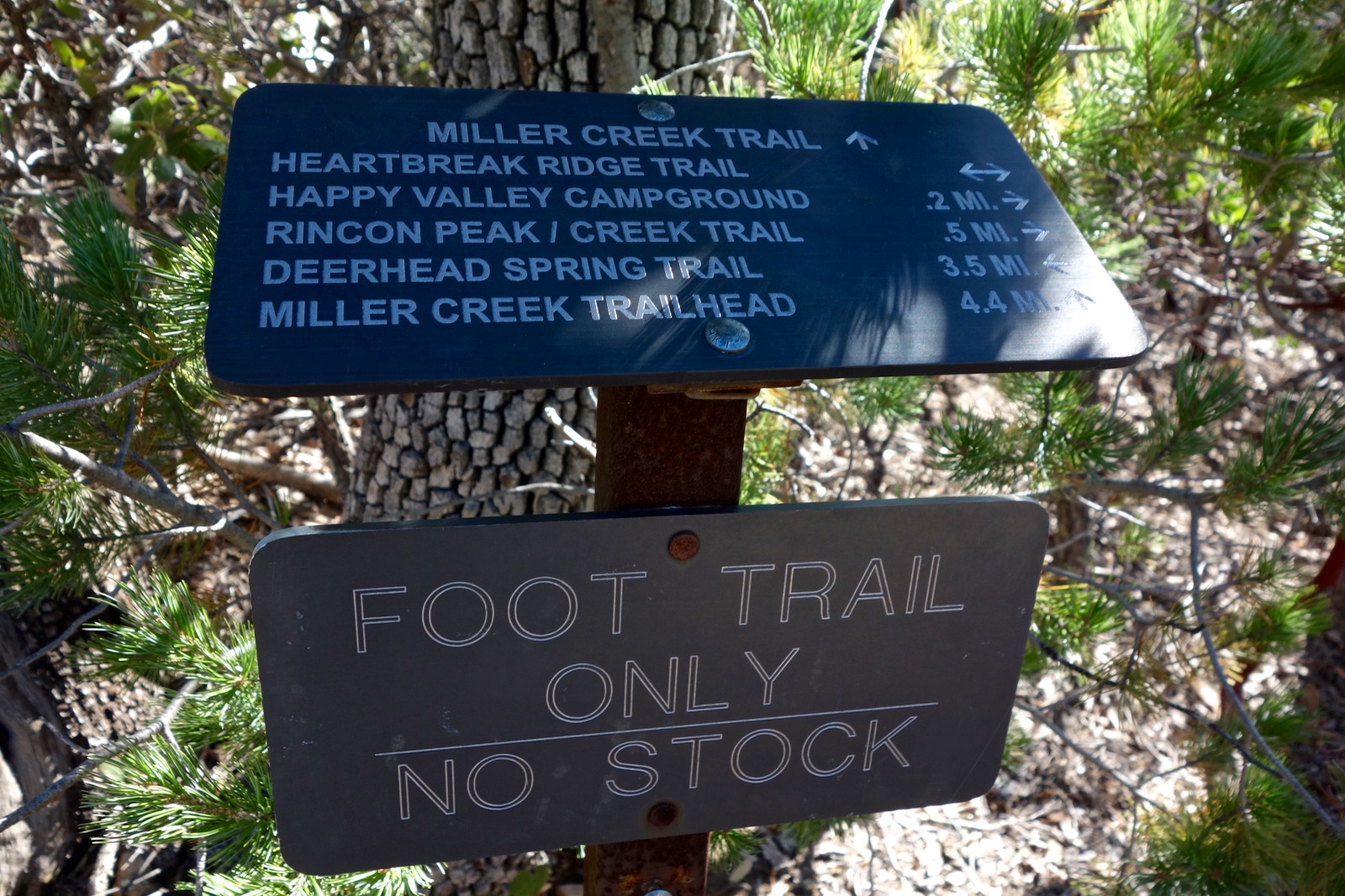
Travel: The Sabino Canyon Recreation Area is located at the northeast corner of Sunrise Drive and Sabino Canyon Road in Tucson. Park in the paved lot, displaying your Coronado Recreational Pass or National Parks Pass. Absent one of these, pay $5.00 for a day pass at the entrance booth or at the self-pay station. Water and bathrooms at the trailhead.
Distance and Elevation Gain: 9.0 miles; 2,850 feet of climbing
Time: 5:30 - 7:00
Difficulty: Trail, off-trail; navigation challenging; Class 2+ with mild exposure; steep slopes; carry all the water you will need; no dogs
Maps: Sabino Canyon, AZ 7.5 Quad; or, Pusch Ridge Wilderness, Coronado National Forest, USDA Forest Service, 1:24,000
Date Hiked: March 25, 2016
Quote: O! how I dreamt of things impossible. William Blake 1757-1827

This entry is for everyone who has stood on the prominence of Blackett's Ridge and looked with longing at beautiful Point 5,001', the highpoint of Saddleback Ridge.

Route: From Sabino Canyon Trailhead 2,725', access the Phoneline Trail and walk northeast. When Saddleback Saddle 4,060' is visible from the trail, leave the Phoneline and gain Saddleback Ridge. Climb northeast to Point 5,001'. Return to the saddle and access Blackett's Ridge via a gully, topping out a few feet from Point 4,409'. Finish the hike on the familiar Blackett's Ridge Trail.

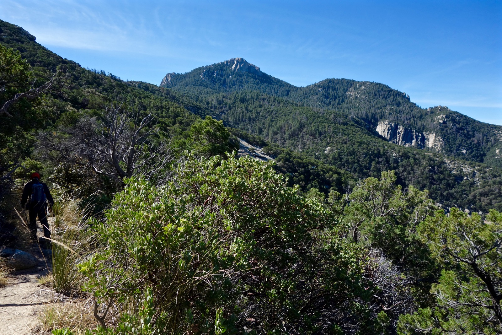
To access the Phoneline Trail, leave from the northeast corner of the Sabino Canyon parking lot and walk east on a broad and flat pedestrian-only track. At 0.5 mile, turn right on the paved shuttle road, following a sign for the 7 Falls Trail. At 0.7 mile, turn right at the fork, staying on the paved road toward Bear Canyon. This is the final opportunity for bathrooms and water. In the photo below, Point 4,409' is image-center and Point 5,001' is just to its right.

Cross Sabino Creek at 0.8 mile and almost immediately Phoneline Trail #27 takes off. Stay left at the split with the Bear Canyon/7 Falls Trail.

The Phoneline, the most popular trail in the park, carries on for 4.5 miles to the end of Sabino Canyon Road with occasional spurs down to the blacktop. The well-built treadway is hard packed sand, cobbles, and bedrock.

Blackett's Ridge Trail #48, our return path, goes right at 1.4 miles. Stay left.

The trail pretty much follows the contour; occasional climbs up crafted rock steps are effortless through this exquisite corridor.  A glimpse of Thimble Peak and Point 5,001' opens at 2.1 miles. Pass beneath one of Blackett's most dramatic sidewalls. Watch for the obvious Saddleback Saddle 4,060', shown.

Leave the Phoneline Trail at 3.0 miles, 3,440 feet. It is a 600 foot climb south to the saddle. Find a minor break right/west of the primary barrier wall.

Once above the obstruction, in the past my climbing partner worked his way left into the gully. However, that sidehill traverse felt too exposed to me and we found an easier and safer approach. We ascended the grassy slope southwest of the gully. The pitch eases after the first 100 feet. Plants have easy workarounds. There are foot-sized platforms of resurrection moss and well-seated rock. This is an excellent route; it even affords a closeup look at Blackett's east face minarets. (THW, photo)

In contrast, the gully route is troubled with vegetation (velcro plants!) and steeps.
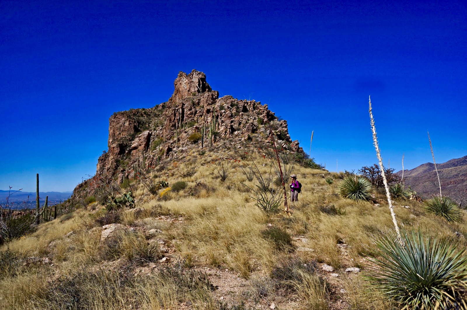
It takes about 20 minutes for the climb to Saddleback Saddle 4,060', 3.3 miles from the trailhead. The southwest ridge of Point 5,001' affords spectacular lookoffs from a unique vantage point, a lateral ridge in the Pusch Ridge Wilderness. From the saddle, climb northeast on the spine aiming for the base of the cliff, shown. It is steep but there is good rock to work with. Upon reaching the gendarme, contour right/east to a small saddle at 4,320 feet. (THW, photo)

The saddle leads directly onto a northeast trending bench. There is no right or wrong way from here, but there is a best way that we discovered after lots of wondering around in this area. Do a rising traverse aiming for the grassy slope just right of the escarpment, image-left. (THW, photo)

Here is a closeup with the route image-center. You may find fragments of a game/social trail on this grassy slope.

At the next level, the ridge presents a 20 foot scarp. Just for kicks, we did a Class 3 crack climb. On our return, we skirted the obstacle just to the southeast.

Minor challenges completed, at 4,760 feet a dreamy view the mountain is revealed. The remaining walk is on a segment of grand and elegant classic ridge. (THW, photo)

The spine tapers to 15 feet at its narrowest, falling sharply 800 feet before dropping more gradually to the canyon floor on two sides. There is mild exposure here. This image looks back at the narrowest link.

The Saddleback Diving Board is a temptation to all brave souls.

Top out on Point 5,001' at 4.2 miles. The field of vision from this interior highpoint includes familiar favorites. Besides most of the Pusch Ridge peaks, see the Rincon Mountains, Santa Rita Mountains, Baboquivari Peak, and Tucson Mountains. Thimble Peak, just 300 feet higher, is on a continuation of this ridge but is unattainable from here. Observe trail systems in canyons almost 2,000 feet below. The peak register was placed in 2,000 and consists of a few slips of paper. Three months had lapsed since the last visitor. (THW, photo)

On the return it is easier to spot and utilize game trails. Once back at the small saddle beyond the bench be sure to hold the contour for about 100 feet to avoid a dangerous drop. The descent back to Saddle 4,060' is most forgiving right on the ridgecrest. Regain the saddle at 5.2 miles for an mesmerizing view of the east bulwark of Point 4,409'. Access is up the gully on the left/south side of the mountain. (THW, photo)

Do a steep side hill traverse passing under a dominate rock outcrop. You may enter the gully at this level but it is choked with brush. It is better to keep climbing a short distance and enter the defile at about 4,100 feet.

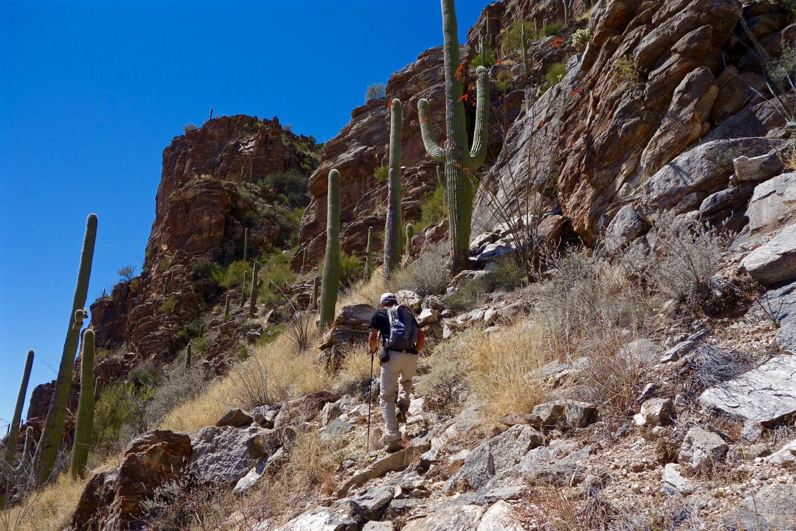
Scale the declivity on stable rock. It is a comfortable route with a feeling of protection. (Note: In 2017, the gully was more troubled with brush than in 2016.) Emerge onto the ultra familiar Blackett's Ridge Trail just feet from Point 4,409'.

Reach the top of Blackett's Ridge at 5.55 miles. Yes, this is home turf but it feels somehow like a mighty achievement considering where we came from.

The Blackett's Ridge Trail drops 1,700 feet on a heavily trodden, steep treadway with a view of Tucson all the while. Descend slabs of perfectly angled bedrock, stone steps, and a series of switchbacks.

Close the loop at 7.7 miles where the trail meets the Phoneline. If you have not done so, take a brief side trip, turning right on the Bajada Nature Loop at 8.6 miles to visit Sabino Canyon's prize crested saguaro. At the loop go left, cross a wooden bridge, and soon arrive at twin saguaros. Proudly stands a most elaborate cristate with multiple arms growing from the anomaly. 

It is March so we identified a great number of flowering plants, including blue palo verde draped in yellow blossoms, a golden Mariposa lily, purple twining snapdragons, and magenta trailing windmills. The chili-red torches of the ocotillo were in full explosion giving enthusiastic expression to a flawless and deeply satisfying day.

Tuesday, March 22, 2016

Rincon Peak, 8,482', Saguaro National Park, Rincon Mountain District

Essence: Long hike on an excellent, well-signed trail to a spacious stone summit with precipitous drops on three sides. Full-circle vista. Spheroidal granite boulders are an extraordinary feature. Much of the hike is under the cover of trees. Rincon is a commitment--the many miles coupled with a long drive from anywhere suggests camping out the night before. Between the remoteness and difficulty, enjoy a high probability of total solitude. Seen from distant vantage points, the peak has regal symmetry and stateliness. 
Travel: From I-10, take Exit #297, Mescal Road. Zero-out your trip meter and drive north on Mescal Road, a paved two lane. Pavement ends 3.2 miles from the interstate. Transition to FSR 35 at 4.3 miles. It is a graded, wide, flat roadbed prone to washboard. Wind up Ash Creek which drains the Little Rincon Mountains on the east and the Rincon Mountains to the west. Pass Ash Creek Ranch at 7.2 miles. If the washes aren't running, a 2WD with decent clearance should reach the trailhead. However, in March, 2016, we forded Ash Creek four times. The first and deepest crossing at 8.1 miles required 4WD with high clearance.  Enter Happy Valley at 15.5 miles. At 15.8 miles there is a sign for the Miller Creek Trail pointing left. Go left at the first fork and park at the trailhead, 16.0 miles and 45 minutes from I-10.
Camping: There is shaded, dispersed primitive camping along FSR 35. We found a peaceful camp with an excellent view of Rincon Peak near the trailhead amongst oak and sycamore trees. Early sun. Bring water. Bonus: a herd of horses came through camp in the deep night, beautiful in full moonlight. There is a fabulous backpacker's camp halfway up the mountain with undependable water. 
Distance and Elevation Gain: 15.7 miles; 4,600 feet of climbing; carry more water than you think you will need.
Time: 8:00 - 10:00
Difficulty: Trail; navigation easy when free of snow; Class 2 with no exposure; no dogs
Maps: Happy Valley; Mica Mountain; Rincon Peak, AZ 7.5 Quads, or Trails Illustrated No. 237, Saguaro National Park
Date Hiked: March 22, 2016
Quote: 
I love the joy of mountains
Wandering free with no concerns
Sometimes I climb a rock pavilion
To look down a thousand foot precipice
Overhead are swirling clouds
A cold moon chilly cold
My body feels like a flying crane. Han-shan (9th century)

Rincon Peak in clear morning light from the trailhead primitive camp.

Route: It's trail all the way. From Miller Creek Trailhead 4,200', walk west through Miller Canyon and enter Saguaro National Park. At the Happy Valley Saddle, go southwest on the Heartbreak Ridge Trail. Climb south on the Rincon Peak (spur) Trail to the summit. This is an out-and-back hike.

Two trails leave from the trailhead area; there is no mistaking the one you need. Open (and close) a barbed wire gate. The Miller Creek Trail sign is on the other side.

Shortly, cross Miller Creek, the first of several fords. Water level was inconsequential when we visited but could be problematic during run-off. The riparian warm-up is on a flat, smooth dirt trail through tall Arizona oak and sycamore; typical Sonoran vegetation is noticeably absent.  There are no saguaros on the east side of the Rincons. Rather, soft golden hills are north of the creek and south are tree-covered slopes. The track takes aim at a prominent outcrop (image-center) east of Happy Valley Lookout on Heartbreak Ridge.

Pass by coarse grained intrusive granite boulders with chunks of discarded quartz scattered all around. The crushed granite path finally begins pitching up after a mile. Mileages on the signs are generous. At 1.34 miles, enter Saguaro National Park through a kinked fence and sign the register. Bikes and dogs must turn back here. The treadway, now in the oak woodland vegetation zone, plows through manzanita and madrone. It kicks up in earnest on spheroid steps; big old weathered boulders are everywhere. If you favor metamorphic granitic gneiss this climb is for you.

Turn south to skirt the rock outcrop at 2.3 miles on the first major switchback shown on the map. Keep a watchful eye as the track twists and turns all over, weaving around and up and over boulders, a great pleasure. The image below looks back to the sun powering up over the Little Rincon Mountains. (THW, photo)

At 3.3 miles, enter the Miller Creek ravine. The trail stays south of the stream, passing by a jumble of huge boulder balls.

At 3.8 miles, 6,100 feet, there is an excellent resting place on a granite slab overlook. Pictured is Happy Valley Lookout. (THW, photo)

The peak is revealed as you top Happy Valley Saddle at 4 miles, 6,160 feet.

Within a few paces, go left/south at the junction with the Heartbreak Ridge Trail.

The short spur into Happy Valley Campground is at 4.2 miles. This classic backpacker's camp shelters in a mature ponderosa grove. There is a vault toilet and spacious sites with bear boxes, fire rings, and log round furniture. We found some grungy water pooled below the campground. Don't count on treatable water. (THW, photo)

At 4.5 miles, the Rincon Creek Trail continues straight and we turn left on the Rincon Peak Trail. For most of the distance to the crest, the trail stays well off the ridge on the west side. Standing rock towers drill up from the dense alligator juniper forest. The trees are tall and massive with multiple trunks.

A contour reprieve gives way to the climb. While old, orange metal markers are tacked to trees, they are sporadic. This segment would be a navigational challenge if there was much snow.

Cross several small creeks and finally reach the ridge at 7.1 miles, 7,600 feet. This is not a conventional ridge hike. After just 150 feet of climbing the trail traverses to the east side. A few aspen struggle in a shady climax forest with huge conifers. The forest duff path bolts directly up a very steep slope for a good 400 feet. At 8,300 feet weave around and step over granite boulders; Class 2. The peak register is just shy of the summit.

Cresting the mountain at 7.8 miles feels like boundless exhilaration. Ravens dive bomb in the frigid windblast.

Rincon has the best view anywhere of Mount Lemmon, image-left. From here it is clearly the highpoint of the Santa Catalina Mountains. The granite summit falls precipitously off on three sides. This image looks north to Mica Mountain. This is a small, L-shaped range with three principal peaks. Rincon means “corner” in Spanish. The Mica Mountain dome, the highest eminence at 8,666 feet, sits at the vertex. Tanque Verde Ridge slopes westward, the south running Heartbreak Ridge climaxes at Rincon Peak.

Northeast is Bassett Peak in the Galiuro Mountains and Mount Graham in the Pinalenos. I let go of any notion of an off-trail return on Rincon's north ridge. The range is a highly eroded mass of bedrock and the ridge is riddled with towers.

The zenith is bigger and broader than it appears when seen from afar. This image looks toward Tucson and Tanque Verde Mountain. (THW, photo)

The wind hustles us off the peak before we've had our fill of top time. A community of claret cup cacti on the east side of the summit block are still in winter mode. But periwinkle wild hyacinth is blooming in the lower reaches and manzanita is clothed in profuse sticky pink blossoms. The  grassland foothills of Rincon Peak are flowing folds of velvet in afternoon light. (THW, photo)


Thursday, March 17, 2016

Gibbon Mountain, 5,801', From Bear Canyon or Hirabayashi Trailheads, Pusch Ridge Wilderness

Essence: Unusual approach to Gibbon Mountain on one of Santa Catalina's prominent westward divides. Classic and gorgeous ridgecrest thru-hike overlooking Bear Canyon and paralleling the compelling Blackett's-Saddleback-Thimble Peak ridge. Approach over, the final 800 feet is a steep scamper on stone to the summit. Relatively quick descent to the finish at the Hirabayashi Trailhead. Note: See the end of this post for a new route up Gibbon from Hirabayashi, posted in 2021.
Travel: Shuttle required from Hirabayashi Trailhead to Bear Canyon. In Tucson, drive east on Tanque Verde Road and turn left on the Catalina Highway. Drive past Molino Basin and turn left in 11.7 miles at the sign for Gordon Hirabayashi Recreation Area. Drive through the campground (tables, fire grates, food boxes, pit toilets, trash, no water) and drop a vehicle at the trailhead in 0.3 mile. Zero-out your trip meter. Turn right on the Catalina Highway (aka General Hitchcock Highway) in 0.3 mile. At 8.3 miles, turn right/west onto Snyder Road, the first stop sign. In 11.0 miles, turn right on Bear Canyon Road. Make a 90 degree left turn onto a dirt road at 11.4 miles. The road can be lumpy but driven carefully, most vehicles should reach the Bear Canyon Trailhead in 11.5 miles. New in 2020: If you are taking the blue-line route to Gibbon Ridge, from the 4-way stop at Harrison and Snyder roads, turn right/north on Bowes Road. Past Sabino High School, Bowes turns to gravel. Park in the lot at the end of the road without blocking the driveway on the right. 
Distance and Elevation Gain: 8.1 miles; 3,840 feet of climbing
Time: 6:00 - 7:30
Difficulty: Almost entirely off-trail; navigation challenging; Class 2+ with mild exposure; no dogs; carry all the water you will need
Maps: Sabino Canyon; Agua Caliente Hill, AZ 7.5 Quads, or Pusch Ridge Wilderness, Coronado National Forest, USDA Forest Service, 1:24,000
Date Hiked: March 17, 2016
Quote: For bighorns, topography is memory, enhanced by acute vision. They can anticipate the land's every contour--when to leap, where to climb, when to turn, which footholds will support their muscular bodies. To survive, this is what the band would have too do: make this perfect match of flesh to earth. Ellen Meloy

The southwest ridge of Gibbon Mountain from Saddleback Ridge. (THW, photo)

Route: From Bear Canyon Trailhead at 2,660 feet, enter Sabino Canyon Recreation Area and then locate the base of Gibbon's southwest ridge. Stay on or near the ridgeline to the summit. Descend east to meet the Arizona Trail and take it to the Hirabayashi Trailhead, 4,840 feet. See the end of this post if you wish to take the blue-line route from the Bear Canyon Lookout Trailhead to Gibbon Ridge.

From the trailhead, walk up an old dirt road and hop across Bear Creek at 0.2 mile. During run-off it can be a difficult, even dangerous crossing. The stony road easement is enclosed by fence lines on either side. Catch a glimpse of Gibbon Mountain, image-center, looking very far away.

Pass into the Coronado National Forest and Sabino Canyon Recreation Area at 0.5 mile.

Turn right on the paved road walking toward the mountain. Stay on the road where it meets the Seven Falls Trail. This is the last opportunity for bathrooms and water. While walking up the road, devise a plan for getting onto the ridge; there is no perfect or cairned way. We left the main road at 0.9 mile and turned right onto a secondary dirt road. Cross Bear Creek and bash through brush to the run-out of the cliff formation. At 1.1 miles start up the ridge, a spur that avoids private property on the main. The two join shortly and seamlessly.

Gibbon's ridge is immediately captivating for its ease of travel and perspective. Walk on rimrock; plant annoyance is minimal all the way to the summit. The divide slopes off on the right into a deep unnamed drainage, and cliffs out on the left. The best walking is along the edge overlooking Bear Canyon. The voices of hikers on the Seven Falls Trail are easily heard as is Bear Creek.

Just before Pt. 3,250' on the topo, at 1.4 miles, look directly through a hard-rock, rectangular buttress arch.

The barbed wire fence that was an impediment has been clipped and is lying on the ground so watch for it. Climb directly over a series of small ridgetop spikes. Twin protrusions look unaccommodating but nothing is gained and much pleasure is lost by going around them. These are followed by a series of rollers and saddles. Just hold to the rim.

By 4,300 feet, saguaros are replaced by grassland cast in a purple haze from flowering Santa Catalina prairie clover. The ridge bends east at a promontory at 4,570 feet before resuming its northeasterly trajectory. Take in a unique vista of the iconic Santa Catalina divide originating at the base of Blackett's and terminating in Sabino Basin. Saddleback Ridge to Point 5,001' is compelling and rightly so.

Further along, the precipice affords an extraordinary perspective on Seven Falls, upper Bear Canyon, and Thimble Peak.

The next goal is Pt. 4,892', image-center, where we will plot our summit course through this somewhat convoluted landscape. The companion crest of Gibbon Mountain is left of center.

Along the way we find a gigantic, golden Mariposa lily and an uncommon purple twining snapdragon. (THW, photo)

At 4.4 miles, reach Pt. 4,892', the first opportunity to study the mountain. We decide on an approach that we had not tried--to hold our bearing right up the spine. This proved to be delightful and expeditious.

Lose 150 feet then gradually climb to 5,000 feet. The approach is over. The last 800 feet is troubled with cliffs and gendarmes. However, these may all be bypassed on the right/southeast. The first set of cliffrock looks imposing so contour to the right into an excellent climbing declivity. It is steep but not ridiculous and there are plenty of big leverage rocks.

Return to the ridgeline at 5,200 feet. Go directly up the spine; skirt the next gendarme on the right and then pitch up a very steep slope regaining the backbone at 5,480 feet.

Repeat this pattern and then come to the last rock face, starkly beautiful and lichen covered. Scale it directly for some distance before detouring to the right one last time, pictured.

Top out on Gibbon's false summit (Gibbon #1) at 5.7 miles, 5,780 feet. After the long and lovely approach, the obstacles on the 800 foot high-angled incline added a sense of sparkle and genuine pleasure. It is so satisfying to remain true to the ridge. The image below was shot from the subsidiary summit. It shows the Bear Canyon trench flowing into Tucson and the ascent ridge stepping down.

From this vantage point, it's hard to tell which crown is higher but the middle crest (Gibbon #2), labeled 5,801' on the topo, wins out by 21 feet.

Stroll over to the true summit, reaching it at 6.1 miles. Gibbon Mountain is double-humped; the first/west projection is slightly higher. Weathered granite provides good seating. This is one of the few high forward peaks in the Pusch Ridge Wilderness and the vantage point is far-and-wide. East is the Catalina Highway. Swing around clockwise to see Agua Caliente Hill (looking like a real mountain), the Rincon Mountains, Santa Rita Mountains, Elephant Head, Baboquivari Peak, Tucson Mountains, then Mount Kimball, Window Peak, Cathedral Rock, and Mount Lemmon.

Total climbing to this point is 3,740 feet. If you did not shuttle a vehicle, return as you came, or drop to Shreve Saddle and go back via Sycamore Reservoir and Bear Canyon trails, a long haul. I advise against dropping directly from the mountain into Bear Canyon. My climbing partner did that and barrier walls are dangerous and present navigational challenges.

It's pretty amazing to have a car parked two miles from the summit. Downclimb off the double summit block then ascend a delightful, rocky ridge to the next promontory at 5,620 feet, shown image-center. There is a hint of a social trail near twin standing-up rocks but the route is too bouldery to encourage a path.

The mountain shows little sign of visitors. However, of those who do climb, most start from the Hirabayashi Trailhead. While there is no standard route, there are some wonderful descent alternatives described on the internet. Our route hits the Arizona Trail at first opportunity, Shreve Saddle and the wilderness boundary. From the promontory at 5,620 feet, head southeast on the ridge and then do a steep downclimb east to the saddle, hitting it at 7.1 miles. Turn right/southeast on the Arizona Trail, a two track. The image below looks back to the final knob above Shreve Saddle, just off-image to the right. A shallower descent comes off to the southeast.

Arrive at the Gordon Hirabayashi Trailhead at 8.1 miles, 4,840 feet. Along the Arizona Trail, this is Passage #11, The Santa Catalina Mountains, covering Hirabayashi to Romero Pass in 11.7 miles.

The parking area is on the other side of a corral.

We identified 23 flowering plants, a fraction of the bloomers out there in March. Desert sand verbena is a common plant in the Sonoran. On this trip I discovered that if you put your nose into the plant its fragrance will alter your state of consciousness...for the better!

I wish to credit my companion who pioneered this route up Gibbon Mountain. 

2020 Revision: Bear Canyon Lookout Trailhead
The blue-line route will please everyone except those who want to hike the entire Gibbon Ridge. From the trailhead, elevation 2,820 feet, ascend north on an easement enclosed by fencing. Cross into the Pusch Ridge Wilderness and climb on a maintained trail up a south-facing ridge. The trail ends at Bear Canyon Lookout, 3,380 feet, on Gibbon Ridge after 560 feet of climbing over half a mile.

Gibbon Mountain from Hirabayashi Trailhead
Distance and Elevation Gain: 5.0 miles; 1,500 feet of climbing
Total Time: 3:00 to 4:30
Difficulty: Trail, primarily off-trail; navigation challenging; Class 2+ with mild exposure
Map: Agua Caliente Hill
Latest Date Hiked: March 14, 2022

Route: Gibbon Mountain doesn't get much traffic but judging from the peak register, most hikers begin from the Hirabayashi Trailhead. If there is a standard route, no one has documented it on the web. My partner navigated the following route as a pleasant alternative to crashing up (or down) via Shreve Saddle. While the mountain is essentially due west of the trailhead, the way is a little tricky so I've documented the route with photographs.

The hike starts out heading west on the Arizona Trail, elevation 4,840', and crosses the bridge over Solider Canyon at 0.2 mile. At 0.5 mile, an old trail bears west. This is 10 to 15 paces after the passing three rusted pipes, pictured.
 
You won't find this trail on a map but it shows signs of frequent use. Point 5,420', the next objective, is image-left.

The track segues to a braided social trail at about 0.8 mile. The paths wander up the east slope of Point 5,420'. Avoid the trail branching southeast toward Point 5,158' at 1.0 mile. Either tag the top of Point 5,420' or skirt it on the right, contacting its north ridge at about 1.3 miles.

Walk northwest on a short segment of clear trail composed of bedrock and crushed granite. Cross a short divide with a fork of Sabino Creek on the west and a tributary of Soldier Canyon on the east.

Pass a square-stack hoodoo.

Ascend into a draw with a grove of carbon black trees.

Hold a northwest bearing to the top of the draw and gain a ridge at 5,540 feet. From here, you can see Gibbon #2, and #3. Turn 90 degrees to northeast and head a drainage. (This is where our route overlaps with the thru-hike from Bear Canyon.) Swing around to the west and onto the lengthy Gibbon Mountain summit ridge at 5,620 feet. 
 
A sporadic social trail graces the ridgetop, wandering to and fro between rock stacks. My favorite is the best-friends-forever hoodoo duo.

Gibbon Mountain has three prominences, all quite different. Visit them all! The eastern summit is the gnarliest. Clamber up the rock pile to perch on Gibbon #3 at 2.0 miles, 5,780 feet. The register is buried in the cairn stack. The high vista captures Cathedral Rock and Mount Lemmon, and well below is Sycamore Canyon and Reservoir.

There is a short section of mild exposure on the 0.1 mile traverse to Gibbon Mountain, aka Gibbon #2, the highpoint at 5,801 feet. Be sure to continue 0.4 mile to Gibbon #1. You'll loose 180 feet and climb another 160 on bedrock and resurrection moss. Not only does the outpost have the best views, it has an entertaining peak register. The 70+ IPA Club wrote, “2 bad boys, 2 good dogs, 10 beers, nice.” Look directly down on Bear Canyon and over to Gibbon's sister ridge where vertical shafts hold up Thimble Peak, and Saddleback and Blacketts ridges.

We altered our route on the return, going over Point 5,158' and looking into the beautiful (and vertical) Soldier Canyon gorge. A social trail goes as far as Point 5,158' and then disappears. It was rewarding but a more difficult choice than simply retracing steps.