Tuesday, October 22, 2019

Lathrop Canyon Trail to White Rim Road: Canyonlands National Park, Island in the Sky

Essence: Island in the Sky is a colossal, elevated mesa with deeply-incised canyons shredding west to the Green River and east to the Colorado River. The White Rim terrace rests at mid-point between the mesa top and the West's signature rivers. The Lathrop Canyon Trail, a dedicated footpath, descends from the erosional remnant to the White Rim Road. A 4X4 track continues downcanyon to the Colorado River. This is a hike of contrasts, transitioning from flat and smooth to steep and rugged. The improbable trail must penetrate three impermeable members of the Glen Canyon Group: Navajo, Kayenta, and Wingate Sandstone formations. It makes a lengthy and convoluted traverse on a narrow shelf to access a rubble field choking the smooth throat of a side canyon. The historic trail incorporates admirably crafted stone stairways and tight switchbacks.
Travel: Measure from Center Street and Main Street in Moab and drive north on U.S. Route 191 for 10.8 miles. Turn left/west on Utah State Route 313 South. At 25.1 miles, 313 South goes left to Dead Horse Point State Park. Stay straight. Pass the Canyonlands National Park entrance station (closed) at 30.8 miles. Show your pass or pay fees at the Visitor Center, 31.9 miles. Continue south on Grand View Point Road, driving across The Neck. Pass the Shafer Trail Viewpoint. Park on the left at 33.8 miles, 1.9 miles from the Visitor Center. No facilities.
Distance and Elevation Gain: 12.2 miles; 2,100 feet of climbing
Total Time: 5:00 to 7:00
Difficulty: Trail; navigation moderate; mild exposure; avoid on hot days (very little shade) and be wary of seasonal afternoon thunderstorms; carry more water than you think you will need.
Fees: Please check this link for current fee information. The Visitor Center is closed seasonally. For a snow report during that time, call Park Headquarters, (435) 719-2313. No pets, no bicycles.
Map: Musselman Arch, Utah 7.5' USGS Quad
Reference: I consulted David Day's website,  www.utahtrails.com, for information on the trail's origin, sheep herders, and mining operations.
Date Hiked: October 22, 2019
Poem:
Remote for detachment,
narrow for chosen company,
winding for leisure,
lonely for contemplation,
the Trail leads not merely north and south
but upward to the body, mind and soul of man.

Harold Allen

Episodic runoff through lower Lathrop Canyon perforated White Rim Sandstone and joined forces with the Colorado River.

Route: Hike on-trail bearing generally southeast. Drop through a weakness in the Navajo Sandstone and then begin a circular double-back to a rubble field located in the north arm of Lathrop Canyon. Descend steeply to intersect the main canyon. The runout to the White Rim Road is gradual. It is an additional 9.4 miles roundtrip to the Colorado River.

The sign at the trailhead, elevation 6,000 feet, claims it is five miles to the White Rim Road. And yet the posted mileage at the White Rim Road is 6.8 for the return. My GPS unit clocked 6.1 miles each way. My calculations confirm that it is 2.5 miles to Canyon Rim and 10.8 miles to the Colorado River.

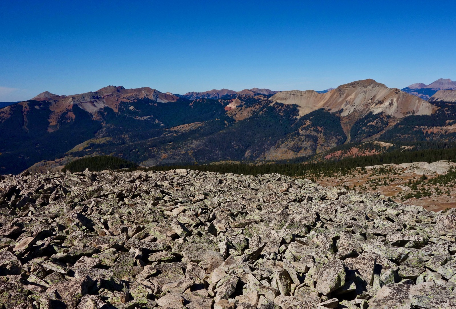
The trail launches out across Gray's Pasture, an open prairie. Peering into never-ending distances is a distinguishing paragon of the American West. Far away and way up high are the La Sal Mountains, the Abajo Mountains, and Cathedral Butte in the Needles District. At ground level a soft, thin footpath, sometimes dirt, sometimes sand, is bordered by ephedra, snakeweed, rabbitbrush, sage, blackbrush, and a variety of grasses. I was glad to see Indian ricegrass but distraught that invasive cheatgrass was overwhelming native plants.

The land swells almost imperceptibly to a shallow rise at 1.1 miles, 6,120 feet. Look north and locate a tin-sided line shack, image-left. While hiking, I was consumed with questions about the trail's origin story. Who would engineer this unlikely treadway and why? According to David Day, Howard Lathrop, a domestic sheep herder, grazed his flock on the White Rim platform during the winter in the 1940s. He constructed the trail to move supplies between the mesa and the river. The trail was used by ranchers until the 1960s when Canyonlands became a national park. Today, the footpath is maintained by the Park Service.

Transition onto Navajo Sandstone and follow cairns across the slabs while wandering through moderately sized globular formations.

Venerable piƱon and Utah juniper live in a sandy basin sheltered by low sandstone domes.

After passing by the trees walk a few feet off-trail to overlook the Lathrop Canyon amphitheater. The trail can be seen 100 feet below on a sloping Kayenta Sandstone shelf.

The trail takes a circuitous route to get underneath the overlook on its way to the north arm of Lathrop Canyon. This image shows the wind scoured Navajo Sandstone wall and the path working its way down the block field.

The trail begins its descent through the Navajo in a series of weaknesses beginning at 2.1 miles, elevation 5,960 feet. It burrows into a slope and curves down into a sandstone-floored bowl.

Then it rounds a thin, stone corner (how fortuitous) with a sensational view of the White Rim terrace and the Colorado River making a lazy meander.

Arrive on Canyon Rim at 2.5 miles. From here, the trail drops down one final break in the Navajo to rest on ledge-forming Kayenta Formation overlying the Wingate Sandstone, shown. The shelf is generous (ten feet at its narrowest) but the drop is significant and hikers with a fear of heights may wish to turn around at Canyon Rim. The route utilizes the bench for the better part of a mile as it travels south and then west back into the Lathrop amphitheater. Long, pleasurable traverses to access passageways are common in canyon country. Grand prize is awarded to the 95-mile-long Tonto Trail in the Grand Canyon.

Across Lathrop Canyon are Airport Tower, the standing spires of Point 5,601', and the column cluster on the south wall. All three are typical of cliff-forming, vertically fractured, gleaming Wingate Sandstone.

The image below looks back on the pathway, a thin thread suspended above an 800 foot wall.

Reach the back wall of the north arm of the canyon at 3.2 miles, 5,700 feet. The ensuing plunge (drop 900 feet in 0.7 mile) reminds me of weaving down the rubble field on the Murphy Hogback Trail, my favorite Island in the Sky hike. To begin, step down a series of boulder strewn Kayenta ledges.

Enter the stone throat and descend the Wingate chute on engineered and reinforced switchbacks. Be patient; the steepness is complicated by loose debris.

The admirable path is actually a series of winding staircases made from scavenged stone. One thousand steps is a conservative estimate. The footing felt more powerful and secure on the upclimb.

The grade lessens significantly at 4,800 feet in the hardscrabble runout zone.

Swing back into the canyon's interior and cross the primary and typically dry watercourse at 4.5 miles, 4,640 feet. This image looks back at the access route.

The canyon continues descending while the track holds the contour on an abandoned road through the slope-forming Chinle and Moenkopi Formations, shown.  David Day writes about the uranium boom that took place in Canyonlands during the 1950s. The prospectors used the Lathrop Canyon Trail as access to several mines very near the road on both sides of the canyon. Stay on-trail. Radioactive material is present in the mines, on tailing piles, and in contaminated springs.

The path narrows to a single track and descends southeast into a tributary wash at 5.5 miles. Stay in the drainageway until it meets the White Rim Road at 6.1 miles, elevation 4,400 feet. The pretty pouroff is our turn-around location but one could wander endlessly on the soft-edged, cracked slabs of White Rim Sandstone.

The Lathrop Canyon Trail once extended downcanyon to the Colorado River. After the White Rim Road was constructed in the early 1950s, the trail was widened into a 4X4 double-track, shown. The signed junction is 0.1 mile south. It is 10.2 miles roundtrip to the river. The climb out adds 500 feet of vertical.

In this image, the Lathrop Trail sign is directly below the Lathrop amphitheater. The lengthy Kayenta ledge traverse is image-right, overlying the beautiful Wingate wall. This is the halfway point of the hike. There are so many astounding features I was glad for the opportunity (and necessity) to retrace my steps.

Monday, October 21, 2019

Portal Overlook, Poison Spider Trail to Little Arch

Essence: Hike to favored sandstone features seen from Moab. Start out on the Portal Overlook Trail, a Moab classic. The rim route affords astounding views of town, the Colorado River, Arches National Park, and the La Sal Mountains. Walk over boundless rolling sheets of Navajo Sandstone on Poison Spider Mesa. Little Arch is a round sky window on a wall constraining the Colorado River. Visit Barney's Overlook and then walk on top of the rim back to the trail. Expect to share the trail with mountain bikers and off-highway vehicles. Traffic is lightest mid-week during the off-season.
Travel: From Moab travel north on US 191. Turn left on Potash Road, Utah 279, 1.5 miles north of the junction with Utah 128. Travel south beside the Colorado River for 3.9 miles. Turn right into the Jaycee Park Recreation Site. There is no fee for parking. Pit toilet, no water. The Jaycee Park Campground (fee) has seven shaded, walk-in tent sites.
Distance and Elevation Gain: 9.3 miles; 1,700 feet of climbing
Total Time: 4:00 to 5:30
Difficulty: Trail, off-trail; navigation moderate; mild exposure between Portal Overlook and Poison Spider Trail; carry all the water you will need and avoid on hot summer days.
Map: Moab, Utah 7.5' USGS Quad
Latest Date Hiked: October 21, 2019
Quote: I can only tell where I feel most at home, which is in the erosional landscape of the red rock desert of southern Utah, where the Colorado River cuts through sandstone and the geologic history of the Earth is exposed. Terry Tempest Williams

A Moab old-timer bikes out Kane Creek and looks up at Little Arch every day. "How big is the opening? Is it this big?" He stretched out long arms. "Oh much bigger than that! Why, it's got to be 20, maybe even 30 feet across," I replied. The Portal Overlook Trail is 700 feet below the arch rising with the tilted bedding planes of Kayenta Formation. This photo was shot from the Moab Rim Trailhead.

Route: Hike northeast on the Portal Overlook Trail, gaining elevation quickly to the Overlook. Stay on the single-track walking northwest to the junction with Poison Spider Trail. Walk southwest and then southeast across Poison Spider Mesa to Little Arch. There are multiple tracks and considerable leeway for creating your own hike once you are on the mesa. Retrace your steps on Poison Spider to the 4X4 track heading northeast to Barney's Overlook. From there, walk off-trail northwest on or near the rim and intersect the Portal Overlook Trail.

Portal Overlook Trail
From the trailhead, elevation 3,960 feet, walk briefly through a riparian woodland of cottonwood, tamarisk, oak, and juniper. Confined between the cliff and river road, the path barges through impressive piles of water-polished cobbles.

The trail register is at 0.5 mile where a shortcut comes up from the road. Throughout the Colorado Plateau ancient footpaths are found on the ledge forming Kayenta Formation. Watch for historic chiseling. On this most recent hike, I saw a lot of mountain bike tracks but had the trail to myself.

The trail makes a sharp switchback at 1.3 miles. I have seen a number people miss the turn and wander out on an appealing looking bench below the trail.

The Overlook is located where the rim pivots northwest at 1.5 miles, elevation 4,860 feet, after 900 feet of climbing. Stand comfortably on a solid slab while taking in the imponderable view. In the image below, the opposite wall of the Colorado River portal is in the shade. The highest peak in the La Sal Mountains is Mount Peale, 12,721', in the south block (image-right).

See skylight streaming through Turret Arch in the Windows Section of Arches National Park.

The trail continues northwest for one mile where it gains the top of the rim and links with the Poison Spider Trail. For the next half mile the platform is good but the cliff exposure is huge with a 1,000 foot drop. At the upper end, the BLM has posted a sign for mountain bikers that reads, "Dismount now, narrow, dangerous trail ahead. Riders have died here." That same sign was posted on my first hike here in 2002 and they mean it. In short, the Overlook should be the turn-around for hikers who are uncomfortable on ledge trails. The image below looks back at the Overlook from the narrow shelf.

The treadway comes very close to the rim crest and then continues north. Note: this is where our off-trail trek on the rim from Barney's Overlook meets back up with the Portal Overlook Trail.

The trail expands to a two-track and at 2.5 miles, 5,060 feet, ends at the junction with Poison Spider Trail, shown, and Gold Bar Rim. The technical Gold Bar 4X4 and mountain bike route continues north to Gemini Bridges.

Poison Spider Trail
Turn left onto the 4X4 track. There are intermittent intervals of deep sand and bedrock.

There is a major junction at 3.1 miles; take the left fork. Five roads intersect at 3.7 miles. Stay on Poison Spider. Now the journey crosses expansive sheets of desert pavement, the hallmark and bliss of Poison Spider Mesa. Follow the white hash marks to stay on route. Peak 5,245', shown, is a prominent feature seen from all over Moab. I searched all over for a non-technical route but it was too steeply pitched to friction climb. Barney's Overlook is located right at the base of the north ridge, image-center. For now, pass the signed junction for Barney's, staying on Poison Spider.

Periodic signs will help keep you on route. Cylindrical weathering pits are characteristic of Navajo Sandstone and the track swings by a moderately sized one. They are carved by aeolian (wind-abraded) activity. Be wary of pothole suck. The pits typically have a rounded lip and then a vertical fall.

Little Arch, 4720'
Descend softly to Little Arch. I had a lot of company at first but soon I was alone with the perfect structure that isn't so little after all.

The arch is 4.8 miles into the hike. Once in a flash flood event, I saw it function as a natural bridge with water gushing through the hole and free-falling onto Potash Road. From one angle you can look through the window to the Moab Rim Trailhead.

I have gone to considerable effort and risk to stand on arches. This is among the easiest with a manageable friction descent to the top of the span. However, it is not trivial. Do not attempt when it is windy or the rock is wet. Wear sticky soled shoes.

Look down on the Portal Overlook Trail, Colorado River, Moab Rim Trail making the most of Kayenta shelving, and the whimsical shapes in "Finlandia," Behind The Rocks (off-image).

In 2002, I did a much bigger loop that long distance enthusiasts may wish to replicate. I took the Portal Overlook Trail to the rim and then kept going north on Gold Bar Rim. I transitioned to Golden Spike, did an out-and-back to the arch on Poison Spider, and then went southwest to the Poison Spider Trailhead on Potash Road. I walked back to Jaycee Park on the road with its mind-bending juxtaposition of rock art and Wall Street climbers.

Barney's Overlook
Still hoping to climb Peak 5,245', I launched off-trail from the arch attempting to stay near the rim but I was foiled by prickly vegetation. So, from the arch, retrace your steps on Poison Spider to the junction with Barney's Overlook Trail at 5.8 miles and turn right. Knowing nothing in advance about Barney's, I noticed was that the track was bearing northeast, right where I wanted to go. The 4X4 climbs a steep slickrock ramp aiming for the sky.

I am dumbfounded that the vehicle track rises up and up and then terminates in thin air at the cliff edge. There is no warning for drivers. Barney's is located right on the rim just north of Peak 5,245' at 6.5 miles. It is clearly visible from Moab now that you know where to look. The Portal Overlook Trail is only 100 feet below but there is no safe way down from here.

Rim to Portal Overlook Trail
When I headed north from Barney's I had no idea whether it would work but, in fact, it is simple to stay on or near the rim for the half mile back to the trail. Looking at the image above, there is a short wall north of Barney's so back up west about 100 feet to a social trail heading north. It disappears when you get on the rock and there are no cairns.

From Point 5,048' the trail system can be seen off in the distance. Reconnect with the Portal Overlook Trail where it first contacts the rim at 7.0 miles, 4,980 feet. This alternate route is not only quick, it is  quiet.

Sunday, October 13, 2019

Grayrock Peak, 12,504'; Peak 12,029', Via Pando Creek and Graysill Mountain

Essence: The Hermosa Creek-Cascade Creek Divide on Graysill Mountain is unfathomably spacious, an unlikely plateau embedded within the San Juan Mountains. The link between Graysill Mountain and Grayrock Peak is a startlingly narrow reef composed of teetering plates. This route accesses Graysill Mountain via Pando Creek. It takes some navigation acumen to avoid trench entrapment while climbing off-trail through the drainage. Peak 12,029' forms the north wall of the Pando bowl. It is a fast, simple climb sporting the best views of the day. The region described may be approached alternatively from the southwest via the Relay Creek Road. The hike is within the San Juan National Forest.
Travel: In a 4WD, high clearance vehicle with sturdy tires, from US 550, mile marker 49, turn west into Purgatory Resort and measure from there. Advance toward the upper parking lot. At 0.3 mile turn right on Hermosa Park Road, FSR 578. There is a small brown sign marking this dirt road. The road makes three big switchbacks. Little spurs head off but the main road is obvious. At 3.2 miles go right, staying on Hermosa Park Road. At 3.6 miles turn right on Relay Creek Road, FSR 579. At 4.8 miles go right on Cascade Divide Road, staying on FSR 579. The rocky, painfully slow road is riddled with tire-sucking divots and gigantic potholes. Pando Creek is the third major drainage crossing the road. The second is Camp Creek at 8.4 miles. The road swings under the east slopes of Grayrock Peak and crosses Pando Creek at 9.9 miles. There is no parking in the curve. Park in a pullout on the right side of the road with room for two cars in advance of Pando at 9.8 miles.
Distance and Elevation Gain: 6.6 miles with 2,450 feet of climbing for Grayrock Peak (includes South Point); Peak 12,029' adds 1.2 miles total and 310 feet of vertical
Total Time: 4:00 to 5:00 for Grayrock; Peak 12,029' adds less than one hour roundtrip
Difficulty: Off-trail; navigation moderately challenging; no exposure
Map: Engineer Mountain, Colorado 7.5' USGS Quad
Latest Date Hiked: October 13, 2019
Quote: We walk aware of what is far and close. Here distance is familiar as a friend. Theodore Roethke

The highpoint of Graysill Mountain is Peak 12,033'. It presents as a small hill on the plateau toward the left in the image below. The Pando Creek drainage is the forested swath bordered on the north by Peak 12,029'. On the skyline is Lizard Head, Grizzly Peak, Vermilion Peak, and Rolling Mountain.

Route: From FSR 579, climb west-northwest while staying well above and north of Pando Creek. Upon reaching the saddle on Graysill Mountain ascend south. Cross the narrow divide to Grayrock Peak. South Point 12,440' is an optional spur. Return to the saddle and climb northeast to Peak 12,029'.

Pando Creek to Graysill Mountain
There is no trail from the road in the vicinity of Pando Creek, elevation 10,400 feet, and there is inevitably a fair amount of confusion about where and how to launch. Following are some options. From the parking pullout, descend northwest on the road. Two streams cross the road in the curve. The first is a tributary of Pando Creek. The imposing rock walls are a warning that this is not the point of access.

This shot of Pando Creek was taken from the pullout. It is at the apex of the curve.

There is a hint of an opening and trail just north of the creek. We started here but, turns out, there was no trail. Instead, the drainage is a steep-walled, tangled mess of deadfall.  Do not linger in the creek bottom. At first opportunity, haul up out of creek, climbing very steeply 100 feet onto the north rim of the Pando trough.

Alternatively, continue past Pando on FSR 579 for 0.05 mile and claw up the second tiny draw onto the bench above the creek. That was our descent route and it worked fine.

I have heard that you may also continue on the road past Pando for another 0.15 mile or so. There is rumored to be a pullout. My Forest Service map shows a logging road starting up the hill from here, a presumably gentler route to the bench. There are a bevy of old roads on the lower slopes so find your way back to the creek rim. I intend to return and scope out this alternative in 2020.

The basic idea is to stay well north of the creek and below the south slopes of Peak 12,029' while holding a west-northwest bearing and climbing consistently. We stumbled around a bit and happened upon intermittent segments of trail with very old blazes. Despite our best effort we could not follow the trail all the way to the saddle. At 0.5 mile, 10,920 feet, we walked under a rock glacier flowing from Peak 12,029'.

Walk across the lower end of a talus yard further along. This image features the north face of Grayrock Peak and the east cliffs of Graysill Mountain.

At 0.8 mile we once again happened upon the blazed trail and were able to hang onto it clear to the saddle. If you miss the trail you can still get a pretty good visual on the saddle location.

At about 1.4 miles, emerge from the forest onto the intoxicating immensity of the Graysill Mountain tableland at the saddle, elevation 11,720 feet. It is an exhilarating visual moment that only gets more thrilling throughout the ensuing hike.

Grayrock Peak
The mountain is not apparent at first. Begin walking south in the vicinity of the rim of the Pando bowl. On our way up the mountain we skirted west of a blockfield. On our return we stayed on the rocky rim as indicated on the map above. The tundra is studded with weathered boulders and trees.

If you aren't already on the edge, head southeast and engage the talus at 12,150 feet. The route climbs Point 12,380' (approximated), crosses the narrowest stretch of the divide, and then ascends Grayrock Peak, image-left.

Point 12,380' is a worthy goal by itself because it overlooks both sides of the divide. This image follows the Pando Creek waterway down to the Cascade Creek canyon and up the west slopes of Engineer Mountain.

Swing around to look west over the Hermosa Creek corridor to Whitecap Mountain, and Blackhawk Mountain and Harts Peak, the cluster image-left. Hermosa Peak is southwest of Bolam Pass, image-right.

At its thinnest, the divide is eight to ten feet wide extending for 0.2 mile. Ridge people will marvel as the land just drops away. Passage requires a bit of patience because many of the stone plates are teetering. This landscape is so oversized it is hard to process a mere thread linking two great mountains. Erosion has been ongoing and I am grateful to be here in this moment when humans may cross the bridge to Grayrock, an island mountain. 

Near the top of the bridge a social trail skirts to the right of a jumble of unstable rocks on the backbone. The ridge melds into the exceedingly broad, tundra covered, nearly flat backslope of Grayrock Peak.

A large bivouac is located near the rounded crest at 3.2 miles. We searched all about for the peak register that was there in 2014, disappointed that it was gone along with its history. Grayrock is the middle ground between the La Plata and San Juan ranges. See the grand sweep of the Colorado Trail connecting the two.

The total mileage noted above includes the 0.4 mile roundtrip spur to the southernmost point on Grayrock Peak, 12,440 feet. This delightful foray adds just 60 feet of climbing. The South Point looks down on the CDOT maintenance shop at the Cascade Curve on US 550 and up into the Twilights in the West Needle Mountains. Off-image but even closer are the ski runs at Purgatory Resort.

Recross the reef and return to the upcoming route in the saddle at 5.4 miles. I have been chased off this mountain twice by electrical storms. If the weather is good, Peak 12,029' is moments away.

Peak 12,029'
This optional spur long eluded me so I was overjoyed to climb the mellow backslope of the cuesta in 2019. The ascent takes only 20 minutes with just over 300 feet of lift in 0.6 mile. Climb in the sweet spot between the talus and the trees.

There is a large mounded summit cairn and peak register on the crest.

Looking north from this location, the Graysill Mountain plateau segues to Sliderock Ridge and on to Grizzly Peak. Some friends attempted to climb Peak 12,460', the ultra narrow wedge at the south end of Sliderock Ridge. They were summarily booted off the mountain by garbage rock and exposure.

We considered bailing from Peak 12,029' southeast into Pando but it looked unappealing on broken talus. It only took an hour to glide down to the saddle and descend pretty much as we came back to the vehicle.