Essence: Pagosa Springs locals praise Blackhead Peak in tones of reverence and joy. They tell of glorious swaths of tundra rising gently and culminating on a broad summit with far-reaching views of the South San Juan Mountains. In the forest, an indispensable social trail weaves through complex terrain and escarpments. The footpath is not engineered or maintained and gets the job done somewhat abruptly--it is steep. The trail functions until you don't need it anymore and then it disappears. The hike is within the San Juan National Forest. The ridgeline between Blackhead Peak and Nipple Mountain is on the western boundary of the South San Juan Wilderness.
Travel: Nipple Mountain and Blackhead Peak are distinct eminences on the ridgeline east of Pagosa Springs. Just east of the San Juan River bridge on US 160, turn south on Hwy 84, signed Chama, New Mexico. In 0.2 mile turn east on CR 302, Mill Creek Road, and measure distance from there. In 0.3 mile pavement ends. The gravel road is wide, graded, and maintained. Cross over a cattle guard at 4.0 miles. At 6.1 miles, turn right onto signed Nipple Mountain Road (FSR 665). Cross a cattle guard and the road narrows a bit. Stay on the main road at 8.3 miles where Echo Canyon Road #029 turns off to the right. At 9.1 miles, FSR 665 and "24" split. Take the left branch, staying on FSR 665. Stay on the main road when FSR 735 branches to the right at 12.3 miles. Good clearance and tires are necessary when the road gets rockier at about 14.4 miles. At 14.6 miles, the track does a switchback to the left followed by another to the right. Parking for the Little Blanco, Quartz Lake Trailhead is on the right at 15.6 miles. For Blackhead Peak, park in a large, unsigned lot on the right at 16.3 miles. The road continues but is blocked just beyond the lot. It took us 50 minutes from the intersection of Hwy 84 and CR 302 in my Subaru. Dispersed camping along this road is used by hunters in autumn.
Distance and Elevation Gain: 6.0 miles; 2,400 feet. Add 0.2 and 160 feet for the spur to the base of Nipple Mountain.
Total Time: 4:00 to 5:30
Difficulty: Primarily trail, off-trail; navigation moderate; one short Class 2+ scramble; no exposure.
Difficulty: Primarily trail, off-trail; navigation moderate; one short Class 2+ scramble; no exposure.
Map: Blackhead Peak, Colorado 7.5' USGS Quad
Date Hiked: September 17, 2022
Poem:
Date Hiked: September 17, 2022
Poem:
Three primary essentials of genius
An eye that can see nature
A heart that can feel nature
And a boldness that dares follow it. Taliesin
An eye that can see nature
A heart that can feel nature
And a boldness that dares follow it. Taliesin
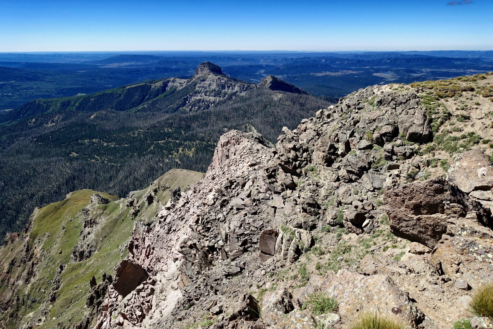
The forces of time and erosion have chiseled Blackhead Peak on three sides leaving a perpendicular escarpment. The north ridge functions as a heaven-sent ramp to the summit as seen from the base of the Nipple Mountain spire. (Thomas Holt Ward, photo)

Route: Walk easterly on the closed road for 1.2 miles. Leave the road and ascend east on a trail to the Nipple Mountain and Blackhead Peak saddle. Hike south on the north ridge to the summit. Return as you came. The spur to the base of the Nipple Mountain spire is optional.

Walk east out of the parking lot, elevation 10,120 feet. The track is signed "No Motor Vehicles" and a dirt mound blocks further moto access. The peaceful, nearly flat road is surrounded by lush meadows, a mixed conifer forest, and aspen stands. This stretch would be especially lovely in autumn. On our hike a drifting wave cloud unfurled across the face of the sky. (THW, photo)

We were delighted to spot two camouflaged horned lizards, "horny toads," on the roadbed basking in afternoon warmth. (THW, photo)

The road is a good orientation platform. Below, from the left is unnumbered Point 12,260', Nipple Mountain, Saddle 11,820', and Blackhead Peak. The amphitheater created by the three peaks embraces the headwaters of the Rito Blanco. At ground level, by mid-September most of the wildflowers had gone to seed. However, showy goldeneye and pearly everlasting were abundant. The conifers have been ravaged by bark beetles. Some large trees remain and most of the trees less than four inches in diameter.

It is helpful to keep count of the four drainages you'll be crossing before turning off the road onto the trail. The first at 0.6 mile was just a trickle running across the road in September. But the track and bridge were completely obliterated by a north fork of the Rito Blanco at 0.9 mile.

The image below shows the location of the fourth creek crossing at 1.15 miles.

Twenty paces further on at 1.2 miles, watch for a cairn or two and a path going softly uphill on the left heading due east at elevation 10,380 feet. In keeping with the ephemeral nature of cairns they may not be present when you hike. The turnoff is subtle and you'll need to keep a steady eye on the trail. But we found it reassuringly clear, more so than we anticipated. The footpath is absolutely necessary to get through complicated country troubled with cliffs. The trail escorts the hiker all the way to the north ridge of Blackhead Peak. It climbs almost 1,500 feet in just over a mile. That's steep but not ridiculous.

The forested portion of the hike is lengthy and the standing dead exacted an emotional toll. We took heart in the healthy spruce bordering clearings further enlivened by carmine-colored fireweed. Blackhead Peak can be seen frequently from the glades.

The trail showcases a castle composed of volcanic breccia. All the peaks in the area are volcanic. Most of the rock was exploded out of calderas somewhere in the vicinity. Because the eruptions were so violent, lots of preexisting rock fractured and that rubble became incorporated in the massive deposits of welded debris--volcanic breccia.
(THW, photo)

Alight on a small interior ridge and then emerge onto a grassy slope at 10,960 feet. The lower cascade of a delicate and long-drop waterfall is visible from this vantage point.

The trail skirts the 300-foot cliffband that precipitates the waterfall. At 11,140 feet, step off the trail to the right for the best view of the falls. (THW, photo)

The grade moderates at 11,260 feet and angles southeast toward the saddle. As you progress through large, open meadows make every effort to stay on the trail. Your only indication of its existence is likely to be trampled grass. Alongside the toe of a rock glacier I tried to imagine the immense stature of the mountain before weathering and erosion whittled away at Blackhead Peak.

The final bench is by contrast peaceful, even comforting, tucked under the near vertical west wall of Blackhead's north ridge.

At 11,720 feet the trail hooks north and makes for the saddle. We saw another group of hikers on the mountain and they led the way on the somewhat elusive trail. (THW, photo)

Gain the ridge 20 feet above the 11,820-foot saddle at 2.4 miles. Right then and there we were so enthralled with the Nipple Mountain spire we agreed to climb to its base on our return. (THW, photo)

The route to Blackhead turns south. Immediately, there are two forceful gendarmes. Ridge purists may be able to negotiate the outcrops but we stayed on the trail and bypassed them on the west. The path is a little slick and thin as it crosses a steep slope.

Upon gaining the divide the trail disappears, lost in the tundra, and the glory begins. The north ridge ascent is pure ecstasy. This image looks back on Point 12,260', the Nipple spire, and the Little Blanco Trail crossing in front of Point 12,375'. (THW, photo)

Simply stroll up the green ramp to the minor cliffband at about 12,000 feet. Considering this ridge is essentially holding the mountain down, it's not terribly wide. Yet there is a top-of-the-world feeling of expansiveness for the hiker.
(THW, photo)

The 20 foot, Class 2+ scramble is the one and only chance to get hands on stone. Holds are good, the rock is stable--it's a blast.

There is more than one route up the wall.


We have not spent much time exploring the South San Juan Mountains so an unknown and enticing world unfolded as we climbed the broad backslope. (THW, photo)

The upper mountain is a study in contrast. The tundra is rounded and mellow. But wander over toward the west edge and you will see thrusting standing towers and forceful blocks of extrusive, igneous volcanics. The powerful union of stone and thin air! (THW, photo)

Sweeps of tundra and a pleasant grade invite free-range exploration.

I regret not taking a spin around the perimeter of the expansive plateau to the east with its threshold of tabletop and precipice. (THW, photo)

Crest the roomy big top at 3.0 miles. The peak register held random scraps and a notebook. With a rise of 800 feet, we took in the beckoning surround. To the northeast is Summit Peak, 13,300', the highpoint in Archuleta County and the tallest peak in the South San Juan Mountains, image-right.

The broken southwest ridge extends to descriptively named Squaretop Mountain and Katie's Peak.
Descending hikers highlight the astounding relief between the unseen Rio Blanco and the Continental Divide.
(THW, photo)

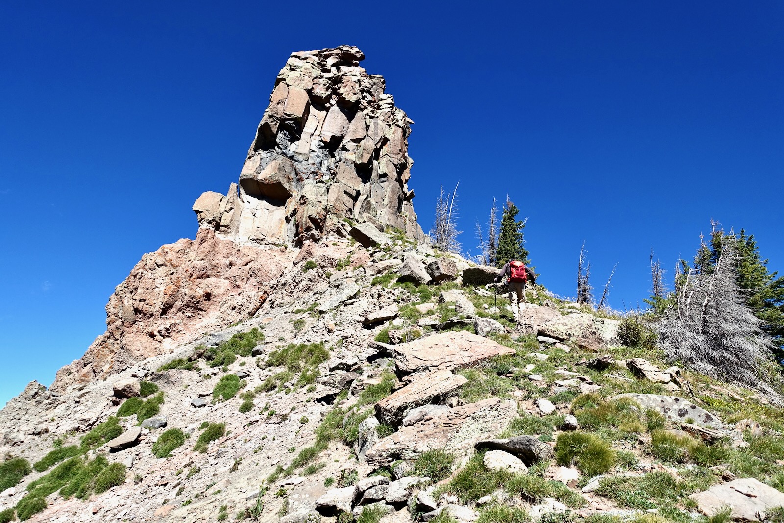
Base of Nipple Mountain Spire
The hike to Blackhead Peak is an out-and-back so simply retrace your steps to the trailhead. For those who love the thrill and power of standing stones, the spur to the base of the unranked spire adds just 0.2 mile roundtrip and 160 feet from Saddle 11,820'.

The south ridge pitch is just a walk-up with no obstacles. The base of the pillar is littered with shattered rock; this is not a safe place to settle in for a picnic.
We explored the east side to see if by some miracle a scramble opened. Previously, some friends did a short-pitch technical climb. They said
it was, "Cool sitting on top and seeing everything around Pagosa." Our mutual reverential exchange with stone had to be satisfied with a pat and a kiss. (THW, photo)

The ridge north of the Nipple is exposed and skittish. We'll return for further exploration from the Quartz Lake Trail.


.jpeg)


