Travel: From US 160/550, turn west at the Sawyer Drive signal and go up the hill. The road ends in 0.4 mile at a green, steel gate. Drop a shuttle vehicle or a bicycle here. Parking is limited. Drive to the bottom of the hill and turn right on the frontage road which transitions to La Posta Road. Go past the scary stop sign at Turner Drive and turn right onto La Plata CR 213. Park in a small pullout below the Solar Slab, 0.7 mile down La Posta Road.
Distance and Elevation Gain: 5.0 miles and 2,200 feet of climbing for the traverse. Round trip for the standard summit climb from the Bodo SWA boundary is 3.0 miles with 1,250 feet of elevation gain.
Time: 3:00 to 5:00
Difficulty: Off-trail; navigation challenging; Class 2+; brushy, wear long pants
Map: Basin Mountain, Colorado 7.5 Quad
Latest Date Hiked: May 13, 2023
Bodo State Wildlife Area: Carbon Mountain is within the 2,923 acre Bodo SWA. The land was purchased by the state from Archie Bodo. It is closed to protect wildlife habitat from December 1 through April 15. Posted, dogs must be on leash.
Quote: Only in nature do we have a being. In mere moments we have arrived. Joseph Wood Krutch
Carbon Mountain is one of Durango's neighborhood prominences but it is rarely visited.

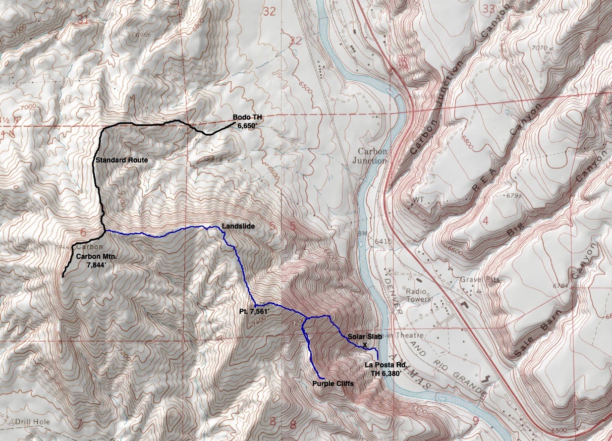
Route: The black-line route is the standard and easiest approach to Carbon Mountain. It begins in Bodo Industrial Park and climbs the north ridge social trail. The steep and brushy blue-line traverse begins from La Posta Road with a friction climb up the Solar Slab. The out-and-back to the Purple Cliffs is optional. Scramble west along sandstone rimrock to Pt. 7,561'. Turn north, staying on the ridge to the site of the 1932 landslide and then go west to the summit.
From the turnout on La Posta Road, elevation 6,380 feet, walk up the road briefly and turn west into a minor drainage to access the Solar Slab.

Comprised of Farmington Sandstone, the Solar Slab is a pale olive color with abundant quartz, feldspar and mica. The Slab is a bedding plane that was tilted up at a high angle upon ramming into the San Juan Mountains. There are plenty of features in the rock to enhance your grip but you will want sticky soles and a modicum of courage for this friction pitch.

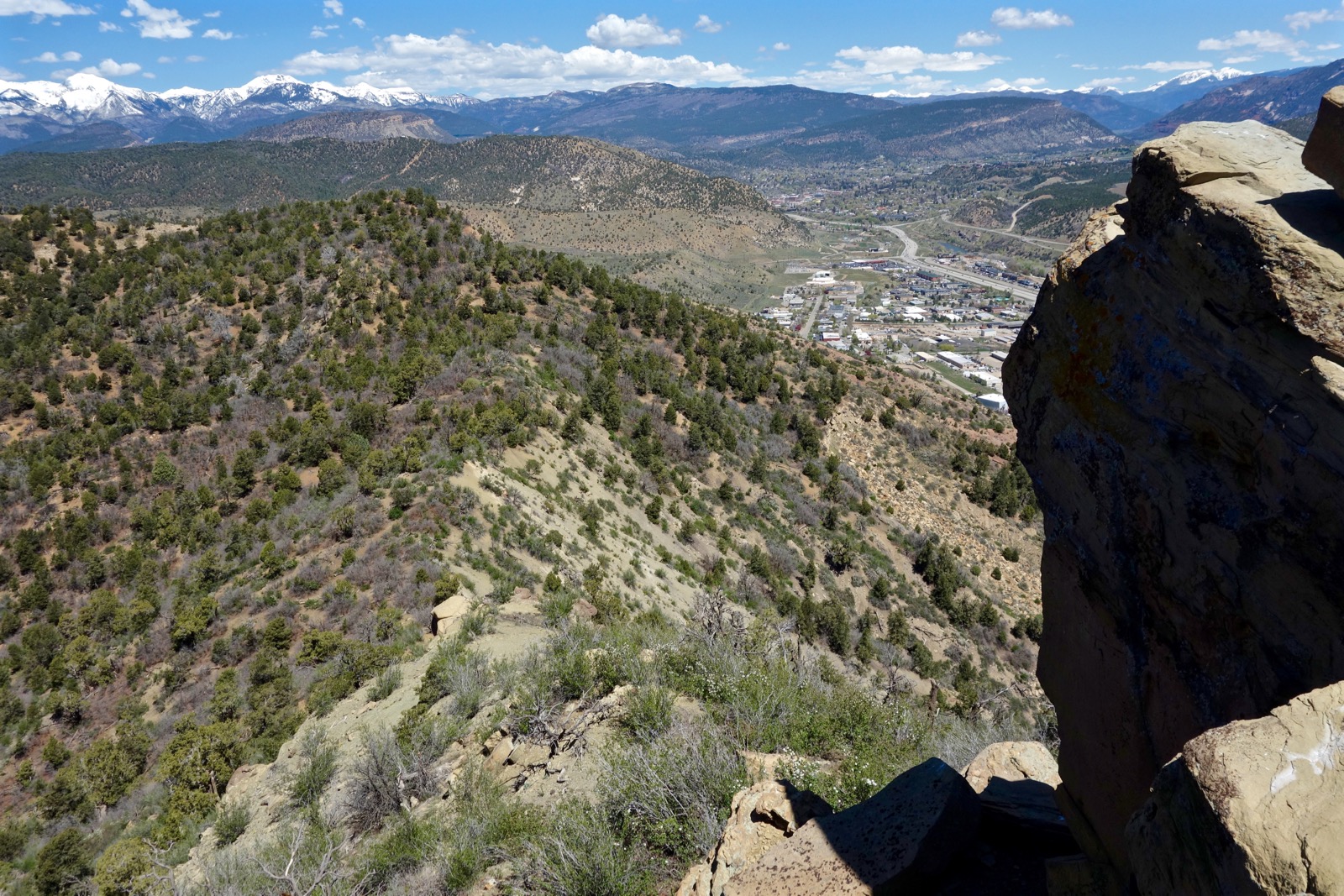
Look 250 feet down the incline to the Animas River and the ball fields at Escalante Middle School. Conversely, now that you know what to look for, the Solar Slab is clearly visible from south Durango locations. (Chris Blackshear, photo)

Clean sandstone transitions onto a equally steep dirt slope. Bearing northeast, pick a good line weaving around boulders, piñon and juniper. Just 0.4 mile from the road intersect the east ridge at about 6,860 feet. The high angled climb does not let up but it is ameliorated with a full spectrum valley-to-mountain vista.

Power west up the ridge passing a cliff band.

The Purple Cliffs rise directly above La Posta Road and stand out because of their eponymous color. You may skip this out-and-back if you wish; it adds 0.8 mile roundtrip and 300 feet of climbing. At about 7230 feet, 0.6 mile, leave the east ridge and descend south to the pleasant ridgeline that leads to the highpoint of the Purple Cliffs. A rocky outcrop projects from the prominence. Go right of an enormous boulder and up a little rocky chute. Take the next scramble on the ridgecrest.

Top the Purple Cliffs at 7,080 feet. John Bregar, geologist, explained that the Purple Cliffs are Late Cretaceous McDermott Formation which is distinguished by its maroon to purple color. Some geologists attribute the color to manganese. Rock fragments, or clasts, ranging from pebbles to boulders are mostly igneous material, perhaps originating in volcanoes associated with the formation of the La Plata Mountain laccolith. The lowest massive portion of the McDermott Formation at the Purple Cliffs appears to be a volcanic debris flow that is now interposed between tilted sedimentary layers.

Scramble down from the crest.

Rejoining the east ridge, climb another steep 250 feet to reach my favorite feature of this hike. Walk on top of sandstone rimrock. The cliffrock façade was once favored by Durango's bouldering community but there is no climber's trail and once evident chalk marks have faded away. However, we have them to thank for naming the Solar Slab in a climber's blog years ago.

There is just one tricky move on the escarpment.

At 1.7 miles, Pt. 7,561', the ridge makes an abrupt turn to the north. There are two, fun little scrambles between the prominence and saddle. The point is protected by a rocky outcrop. Find a way off to the west and curl back under the cliffrock. Stay on the ridgecrest while down-climbing through a second cluster of boulders.
Pass above the Durango Gun Club and then plow through a thick patch of oakbrush (long pants recommended).
At 2.2 miles, 7,500 feet, the ridge makes a 90 degree bend to the west. At this apex, you are standing on top of Moving Mountain! As detailed by geologist Paul Oldaker and articles published in the Durango Herald, one June night in 1932, Durango was shaken awake by a raucous and mysterious explosion. Six months later, a second blast deep underground rocked the town. Carbon Mountain, then three miles out in the country, was on the move and millions of tons of debris encroached on the Animas River. Boulders were hurled across the river, trees snapped. Fearful that the Animas would be dammed by the on-coming slide, Second and Third Avenue bootleggers moved their supply of hooch out of cellars while plans were made to tunnel the river.
The landslide was 100 feet deep, a quarter mile wide, and extended over a mile down the eastward slope. "Colorado's Runaway Mountain" became a tourist attraction. A hotdog stand near the base of the mountain was established for hungry visitors returning from a climb over the slide area. On-lookers stood spellbound as they watched a north Durango sightseer standing on the fractured rim lose his footing as the ground crumbled beneath him. He was carried with the debris flow more than 1,000 feet, managing to keep abreast of racing boulders and surviving unscathed.

Leave the scarp and walk west on a sweet rock rib. Bash through oak scrub on a loose, precipitous slope before turning uphill on the north ridge social trail. As the path tops out and disappears you will come to an old road. Note this location carefully for your return trip. A cairn marks a path to the right leading to the summit. Mountain lion tracks were imprinted in the mud here on my recent hike.

A 1936 Benchmark is located on the summit of Carbon at 7,844 feet, 3.2 miles. The relief from La Posta Road is 1,564 feet but given the undulations we have climbed 2,200 feet. Carbon Mountain is Pictured Cliffs Sandstone, a light-colored rock up to 70 meters thick. It is the same formation as the Pautsky Point ridge but the Animas River takes a big chunk out of this tilted uplift. The peak overlooks Basin Mountain, Lake Nighthorse, the La Plata range, Smelter Mountain, and Durango.

The peculiarly unnatural sight just north of CR 210 on the south skirts of Smelter Mountain is the 120-acre Bodo Canyon Disposal site. Managed by the U.S. Department of Energy, it contains former tailings generated in the 1940's through the 1960's from uranium ore milling for national defense programs. The disposal cell encapsulates and isolates 2.5 million cubic yards of uranium contaminated materials and is surrounded by a rock apron. The decommissioned processing site is now Durango Dog Park.
Walk southwest along the jutting edge where the daring have the most fun.

We generally turn around where the ridge drops off sharply. There's a view of the Lake Nighthorse dam from here.

To return, the north ridge social trail is 0.15 mile east of the summit. Peg this path before heading down. This is the standard route up the mountain, steep and direct.

Stay on the north ridge until it curves around to the east, dropping into the valley just before the gate. If you are tempted by short-cuts no matter how annoying you can dive off the north ridge heading east as soon as the terrain levels out.

This image looks back at the standard route up Carbon on the north ridge.

Pictured Cliffs Sandstone overlies Lewis Shale. This dark grey to black formation is up to 600 meters thick in the Durango area and is also found in Horse Gulch.
Why is the appealing-looking valley so weirdly lumpy? It was once the county landfill, a free and open dumpsite where you could toss anything you wanted. It was operational from the end of World War II until the mid-1970's when Bodo Industrial Park was approved and constructed.

Squeeze through the metal gate that posts the official rules for Bodo State Wildlife Area. The refuge is patrolled by wildlife officers so be in compliance.

Naturalist John Bregar, the guidebook you don't have to carry, identified these flowering plants in May, 2016: double bladder pod, mountain mahogany, bitterbrush, squaw apple, serviceberry, cliff Fendlerbush, skyrocket gilia, Easter daisy, primrose, lupine, rock cress, phlox longifolia, fleabane daisy, Gray's desert parsley, and orange globe mallow.
A serious amateur ornithologist, John identified the following birds: orange oreol, violet-green swallow, turkey vulture, white-throated swift, rock wren, raven, Cooper's hawk, plumbeous vireo, yellow-rumped warbler, bald eagle, peregrine falcon, pinon jay, spotted towhee, house finch, scrub-jay, Bewick's wren, vesper sparrow, western kingbird, black-headed grosbeak, and sagebrush sparrow.
4 comments:
Hi Debra, may I have permission in writing to quote the distance & elevation gain, time, and difficulty bullets (48 words) for a story I'm writing to give to my family at Christmas? I will add a citation to credit your work. This story is part of a larger family history project (44,000 words). I will also send the final project to various libraries (including the Durango Public Library), historical societies, and genealogy societies. I am not getting paid anything for this--it's strictly a labor of love. :) Sincerely Linda Jewell, Linda.Jewell@icloud.com.
Yes Linda, you have my permission. Thank you for asking. Debra
Thank you for this route guide Debra. I see the Purple Cliffs everyday at work and have always envisioned going up there to play. I worked my way up Solar Slab today to the east ridge during my work lunch for a quick punchy out and back. I can't wait to go back and explore more of this route when I make the time. Thanks again!
Scampering around on the landscape you see out your office window. Next thing you know, you're going to be a hopeless topophile! I love it. Kindred spirit. Debra
Post a Comment