Travel: From the Visitor Center and UT-24, drive south on Scenic Drive. Pass by the campground, the Grand Wash turnoff, and go over the Slickrock Divide. In eight miles, Pleasant Creek Road branches to the right and the paved road transitions to graded dirt. Upon entering Capitol Gorge the road is squeezed between constricted towering walls textured with tafoni. As you enter the large parking lot at 10.2 miles, the Golden Throne Trailhead is on the left. During busy times this lot will fill by mid-morning. Pit toilet and picnic tables but no water.
Fruita Campground: This idyllic, shady campground is adjacent to the Fremont River, tucked amongst historic fruit orchards. In 2018, the campground initiated a reservation system. The 71 sites are first-come, first-serve November through February. There are bathrooms, fire grates, picnic tables, and water. Campground information.
Fee Information: Park facilities are open year-round.
Distance and Elevation Gain: 9.7 miles; 2,200 feet of climbing
Total Time: 5:00 to 7:00
Difficulty: Trail, off-trail; navigation moderately challenging; Class 3 with moderate exposure on the west slope of George
Map: Golden Throne, UT 7.5' USGS Quad
Latest Date Hiked: October 19, 2018
Quote: The horizon may shift and change around you, but underneath it is the heart from which we move. Joy Harjo
There is not a lot of space to move about on the summit of George. From the airy perch the climber is rewarded with a full-circle horizon. To the southeast is the Golden Throne, Waterpocket Fold and the Henry Mountains.
(Thomas Holt Ward, photo)

Route: From the Golden Throne Trailhead, hike roughly west-northwest to the end of the trail. Head north along the west side of Golden Throne and then up a sandstone ramp to the west end of a knobby ridge and Point 6,694'. Walk north in a sandy drainage and then cut over to the west slope of George. Climb steeply east on Navajo Sandstone to the north ridge. This is the crux and route tolerance is exceedingly narrow. From here it is "just a walk" to the east slopes of the summit block.

The Golden Throne Trail and the Capitol Gorge Trail leave from different locations in a shared parking lot, elevation 5,420 feet.

The hike begins in the Kayenta Formation, a ledge-forming sandstone. Fortunately for hikers, the tilt of the shelves render a gradual, consistent ascent. The well-engineered path rises high above the road. (THW, photo)

Pass through a cluster of gigantic fallen Navajo Sandstone boulders. One of the defining characteristics of this route is its scalloped nature as it winds in and out of three, sheer-walled slash canyons, little more than water-bearing cracks. If you have time, prob into these dark recesses to the north. Golden Throne comes into view for the first time at 0.9 mile. (THW, photo)

Watch on the bedrock surface for Liesegang banding, coloration on sandstone seen throughout the American West. Living on the ledges are piñon-juniper, roundleaf buffaloberry, and two species of ephedra. Blooming in the spring are Utah penstemon, rockcress, paintbrush, puccoon, cat's eye, and woolly milkvetch, a mat astragalus.
The Golden Throne trail ends at 1.9 miles, elevation 6,140 feet. The overlook rests on a sheet of Navajo Sandstone. We will be in that formation from here on. Look deeply into Capitol Wash and southeast to the Henry Mountains. With its smooth vertical walls cloaked in yellow the Throne is a marvel. To its north are three flat-topped, cliff-bound buttes. The first two are unnamed and unnumbered. George is the most northern, image-left.
The first navigation challenge is to reach the west end of the knobby ridge shown below, image-left. Backtrack 0.05 mile and locate a faint social trail going north. Typically, it is blocked with a line of rocks. Do your very best to stay on the track and avoid stepping on cryptobiotic soil. The path hugs the western base of the Golden Throne.

In just 0.4 mile, 2.35 miles from the start, the track enters the wash above a distinctive pouroff and pool.

Cross over the top of the barrier fall on fluted sandstone. (THW, photo)

Walk up the drainage about 50 feet and then take a few steps up out of the wash onto an appealing slickrock ramp. Sometimes this exit, just past a dead juniper on the left, is marked with a cairn.

Holding a westward bearing it is possible to stay on the stone ramp all the way to the end of the ridge. It is as simple to follow the bedrock as it is to cairn hop. If you find yourself mired in dirt and boulders unravel your mistake and head back onto the threads of rock. (THW, photo)

Reach the west end of the ridge (near Point 6,694'), at 3.0 miles, elevation 6,600 feet. This is yet another exceptional vantage point. (THW, photo)

This image shows the end of the knob-topped ridge and George. There are no cairns, trails, and likely no tracks hereon. It is one mile to the base of the climb. Walk north and in 0.2 mile enter a sandy washbed.

At 3.3 miles the wash splits, shown. Either branch works fine. For the approach we stayed in the main channel (the route to Fern's Nipple). We returned via the tributary that runs along the west base of George.

Leave the drainage at 3.8 miles, 6,680 feet, at a side wash. Avoid cryptobiotic soil by walking in rivulets. Walk northeast toward the white checkerboard on George's western slopes. It is a bit of a cactus minefield. Keep watch and you should be able to weave through the pesky plants.

Locate an old growth leaning ponderosa, pictured, at 4.0 miles. The approach is over.

From the tree walk north into the relatively uncluttered cleft between the outcrop, image-left, and the west wall of George. The cleft tops out at 6,780 feet and then goes subtly downhill. We started our climb up the sandstone at the top of this first rise. If you don't like this initial friction pitch it may be possible to continue in the cleft a short distance and punch up from there. However, you will have to double back onto this very specific route to avoid getting cliffed out.

The next objective is the north ridge. Climb east and enter a beautiful sandstone bowl with a line of tanks, shown. Climb the shallow interior ridge left of the tanks.

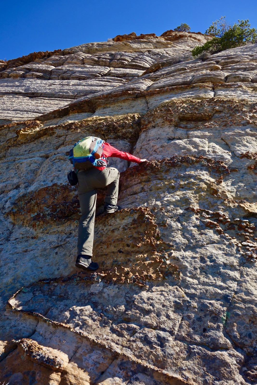
The 150 foot crux is shown below. Spend some time locating the safest route up the slope. I thought it was a little dicey, the exposure unnerving. For me, downclimbing was more comfortable because I had four or five points on the rock. Looking at the image below, we initially climbed to the short piñon on a platform half way up the pitch, image-center.

Iron concretion nodules protruding from the sandstone were dependable hand and foot holds.
At the top of the crux continue climbing--it is safer now. Upon gaining the north ridge at 7,100 feet, a minor outcrop blocks travel. Climb up and over it, west of the top knob. The summit is at skyline image-right.

This image looks back on the north ridge outcrop, image-center. We are already higher than Fern's Nipple, 7,065'.

Unexpectedly and amazingly the north ridge is literally covered with Moqui balls. I have never seen this many in one place. Please leave every one of them here where they belong.

On the east side of the butte platform is an orange block.

This distinctive feature is a good landscape marker for locating George from afar. For example, this shot was taken from the Notom Road. The Golden Throne is image- left and the orange block is on the right.

Mount the east slopes to the summit, reaching it at 4.8 miles. You will find a benchmark placed in 1952 but no peak register.

Movement is restricted to the small, precipitous summit ridge. In this image I am looking over Waterpocket Fold to the Henry Mountains, off-image. So far above familiar features in the park, it feels like I am flying. (THW, photo)

Below is the wash we walked up and off in the distance is Thousand Lake Mountain.

Descend on your proven upcoming route. This image looks down on the north ridge and crux from the summit. It is located in the center of the image toward the left side.

This is a good depiction of the steepness of the crux.

Upon reaching the small cleft, relocate the leaning ponderosa. On our return we walked down the drainage along the base of George's west wall. It is just 0.1 mile longer and quite pretty with ancient juniper and ponderosa.

The streambed makes a lot of tight turns with a couple of incoming side drainages. The most significant requires a 90 degree turn to the right 0.3 mile before the main wash. Retrace your steps back to the Golden Throne Trail. After a few hours of welcome solitude you will be overlooking the busy parking lot. 

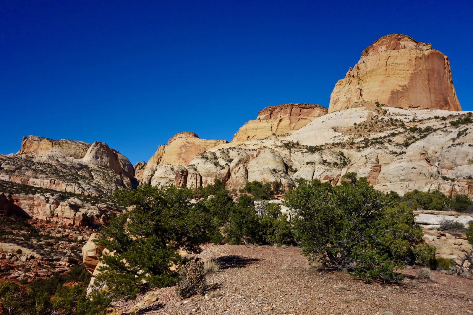
All four Navajo Sandstone structures in this lineup are encircled by cliffs. George is the highest and the only non-technical scalable prominence. It was a glorious climb and we felt grateful for the gift of access. (THW, panorama)

No comments:
Post a Comment