Saturday, August 30, 2014

Twin Sisters: East, 13,432', and West, 13,374', Via Lime Creek

Essence: The pairing of conical masterpieces makes these peaks stand out when seen from afar. This loop route utilizes two fault breaks that allow passage through the otherwise impenetrable Cutler Formation. Two miles of idyllic tundra walking soften the experience. Overall, the hike is rugged and demanding.
Travel: From the US 550/160 intersection in Durango, drive north on US 550 towards Silverton. At 35 miles, top Coal Bank Pass and continue down the other side. As the road begins climbing Molas Pass, it makes a horseshoe bend to the right. Park just before the apex of this curve at a large turn-out on the right/east side of the road at mile marker 60.2. The hike begins 0.1 mile up the road, across the highway. Allow 45 minutes from Durango.
Distance and Elevation Gain: 11.5 miles, 4,400 feet of climbing
Time: 8:00 to 9:00
Difficulty: Trail, primarily off-trail; navigation considerable; mild exposure
Maps: Engineer Mountain; Ophir, Colorado 7.5 Quads
Dates Hiked: September 1, 2007, August 7, 2011, August 30, 2014
Quote: Grown together; friends forever. (source unknown)

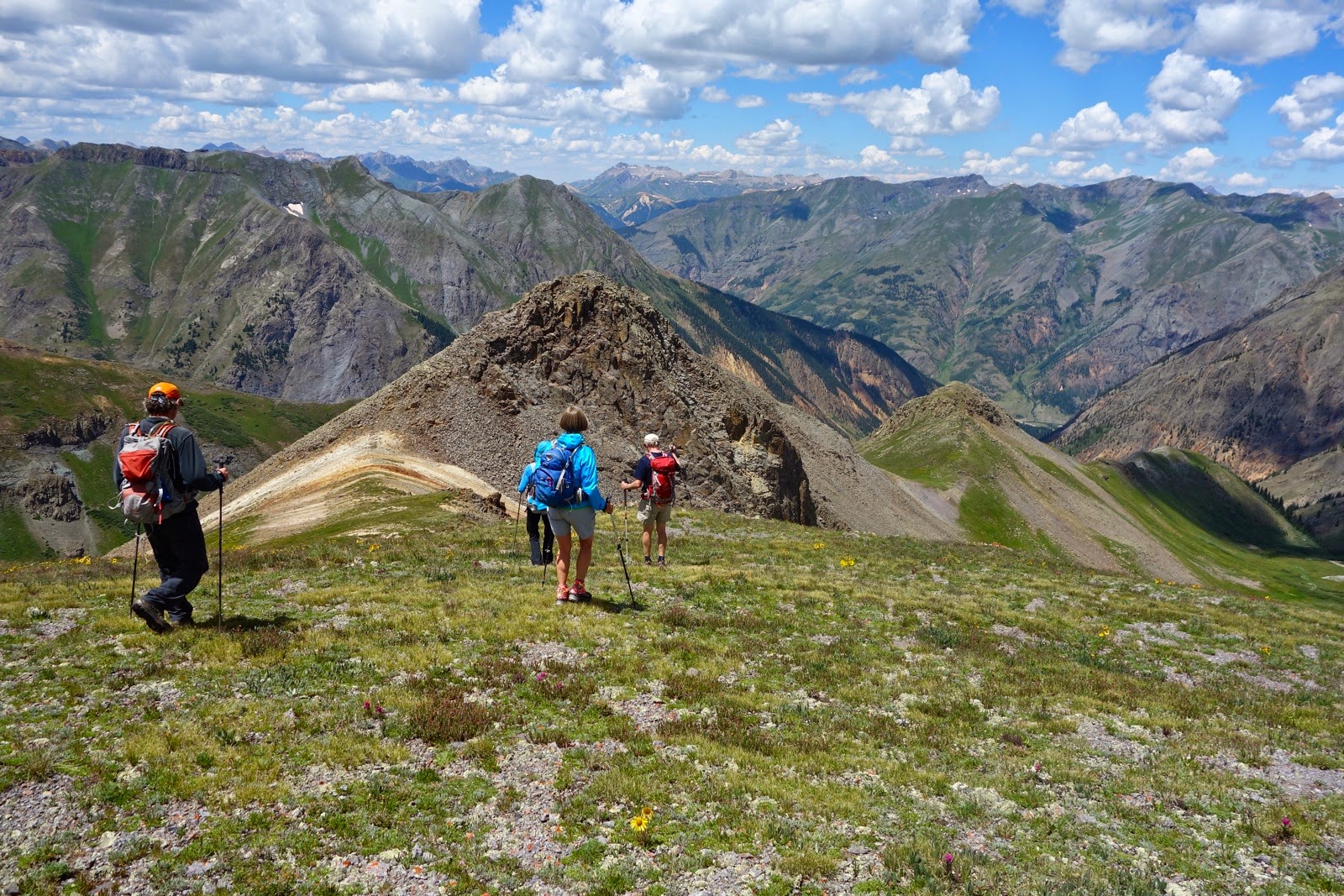
Point 13,205' and Twin Sisters from Jura Knob, two miles to the south.

Route: While it is possible to climb Twin Sisters from the South Fork of Mineral Creek or the Colorado Trail Trailhead at Little Molas Lake, this counterclockwise stem-and-loop originates at the Lime Creek TH, 9,800'.

From the TH, take the main trail that goes down towards the creek, ignoring the faint path on the right. The undulating track points north, staying east of the creek, sometimes quite close, but mostly well above the water. Grassy clearings are interspersed with old growth conifer. In 0.5 mile, cross North Lime Creek with its cascade series. In June, 2005, this tributary was a trip ender, running too deep and swift to cross.

Make good time on this straightforward pathway. In 1.6 miles, the trail splits at the second tributary. Stay left, crossing the stream on the main trail. At 1.8 miles, reach a clearing marked by a large boulder, shown. Leave the trail here at 10,300'. (THW, photo)

The next objective is to intersect the Colorado Trail (CT). The most favorable route stays just left of the rounded ridge. While there are two steep sections with rock outcrops, the slope is most forgiving on this aspect. Trees are politely spaced. At 2.4 miles, 11,400 feet, reach the CT. (THW, photo)

Walk east/right on the CT for 0.6 mile to Lime Creek. Mid-summer, the osha is literally shoulder high. Plan to rest on top of the Telluride Conglomerate boulder seen below and contemplate this fellow that peeled off the cliffs above. The Cutler Formation records the unroofing of the Rockies. It is named for outcrops near the mouth of Cutler Creek, north of Ouray. Laid during the Permian age, 252 to 298 million years ago, the red color comes from iron-oxide compounds deposited with the sand and mud. This loop route is rendered possible by two faults in the Telluride Conglomerate and Cutler Formation. The next objective is to pierce the break at the apex of the Lime Creek drainage.

Leave your perch, cross Lime Creek, staying eastward on the CT another 0.2 mile or so. Where the CT curves SE, search around for a faint secondary trail and turn left/north. If you can't locate it, no worries. Just stay well east of the creek, heading straight for the cleft. As you approach the rift, the trail becomes more distinct. (THW, photo)

Here's a snap looking back into the Lime Creek valley. The Twilights are just right of center. (THW, photo)

At 3.7 miles, 12,100 feet, top the Telluride Conglomerate and see East Sister for the first time, center left below. The peaceful walk to Saddle 12,300', north of Peak 12,601', is sure to infuse you with tundra euphoria. Once, I went SW and topped the knoll at 12,200' before swinging around NW to reach this saddle. However, there is a well cairn'd route that goes to the saddle, shown on the track above. Watch for golden eagles and snowshoe rabbits. Reach the saddle at 4.6 miles. (THW, photo)

Right at the saddle there is a small cliff with an amber colored vein. Quartz crystals coat some of the surfaces. Likely, hot water with dissolved silica and iron caused the deposit along a fracture in the rock. (THW, photo)

At Saddle 12,300', make a climbing strategy for East Sister. Turn SW and descend to a soft swale at 12,200'. In wet years, there will be a pond in the depression. Climb the broad east ridge, using the grass as long as you can. There are bits of social trail. The grade steepens, becoming most angular 150 feet below the NE ridge. Here some will feel a disconcerting sense of potential tumbling exposure. Enter more solid rock just below the ridge and the footing improves. (THW, photo)

Gain the ridge and enjoy the gentle, sweet climb to the summit at 5.8 miles. This image looks back on the NE ridge from the crest. (THW, photo)

Vermilion Peak, 13,894', center, dominates the Ice Lake cluster. (THW, photo)

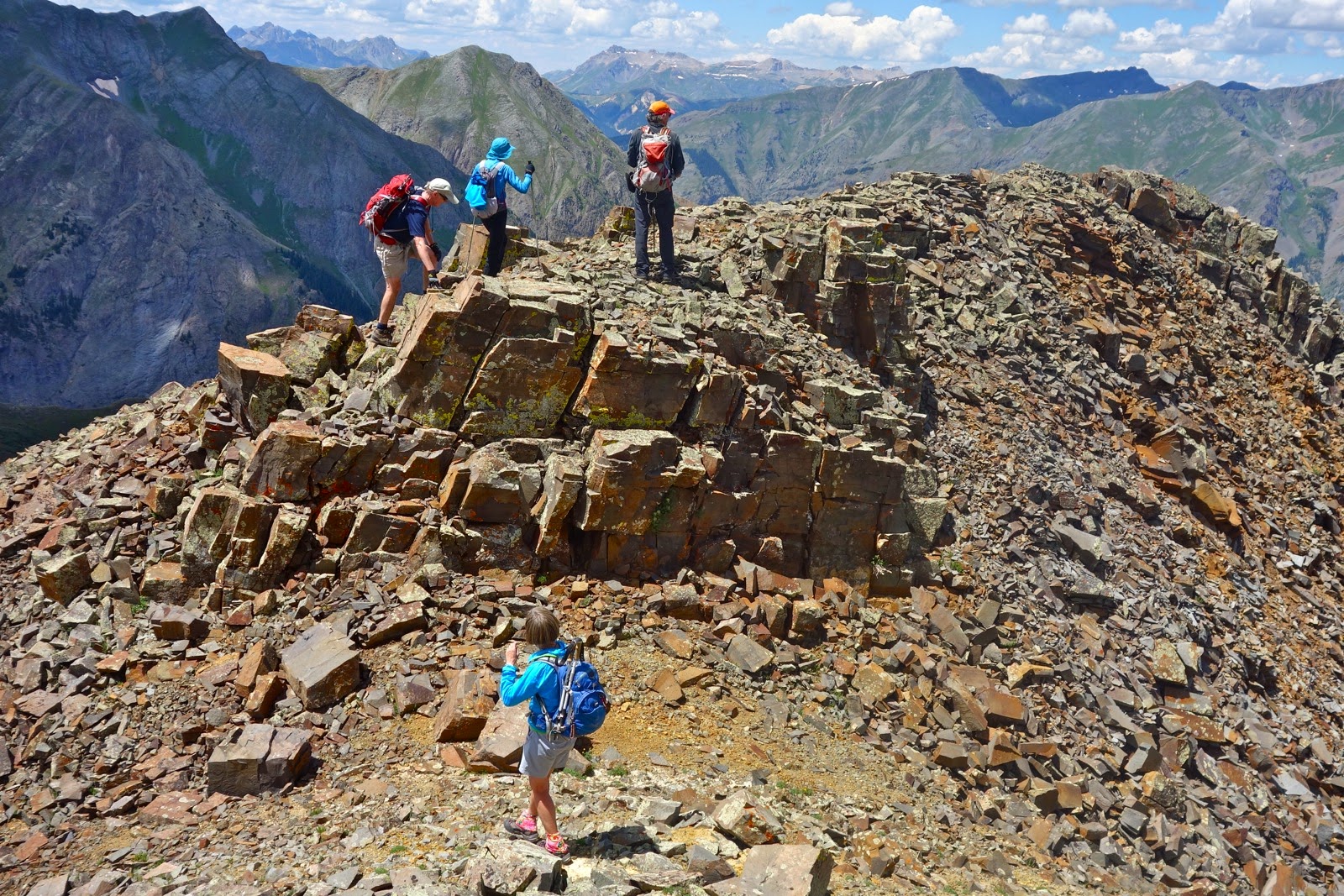
It is 0.6 mile between the twins. As you descend SW from East Sister, come to a 15 foot cliff. Pay attention as you traverse it on the east side. Return to the ridge at first opportunity. Arrive at Saddle 13,000' in 6.1 miles. It will feel quite welcome to have no complications climbing 374 feet to West Sister. (THW, photo)

From the crest (at 6.4 miles), to the south is Pt 13,205', with masculine Engineer Mountain hovering close by. Of course East Sister, best friend forever, is inseparable. (THW, photo)

Psych yourself up for the trip home which has its share of demands. Return to Saddle 13,000'. Drop east, picking your way down a rock glacier. At the abrupt edge of the glacier's toe, jog way left, or stay in the lowest ravine on the right, shown below. (THW, photo)

Descend 800 feet from the saddle to the top of the dramatic Cutler Formation. If there is a crux in this climb, this is it. There are two ways to penetrate this wall: climb down the gully (center in the image below), or slide down a scree slope (far left). Most people will choose the scree, scooting down next to the wall. There is a distinct path leading to the plunge, seen below. If you are doing an out-and-back along this route, it works nicely to climb up the gully and slide down the scree. The gully is steep and wet. You will be in the streambed so avoid it during high runoff. (THW, photo)

Here's a look at the options from below. The gully is in the center and the scree slide, on the right.

The final 400 feet of descent to the CT is tedious but beauty compensates. Blue bells and corn husk lilies are thigh high, there are rivulets to hop across, and gargantuan Cutler boulders randomly strewn about to dodge. Reach the CT at mile 7.7. These boulders reside beside the trail. (THW, photo)

The next challenge is to get yourself back to the Lime Creek trail. Once, I simply crossed the CT, held my SE bearing, and dropped 900 very rugged feet to the trail. Brush and deadfall were interspersed with swamps. As seen on the map above, another time I walked east on the CT 0.6 mile to an opening in the forest on the point of a ridge. This was a better choice. Go due south. It is easy at first; then the ridge steepens for 600 feet but there is little woody entanglement. Reach the trail at 8.9 miles, 10,600'. It is a fast walk back to the TH at mile 11.5. There is plenty to admire along the way such as this salsify seedhead. Just before reaching the highway, notice multiple beaver dams in the creek below.
(THW, photo)

Alternate Route: Once I climbed Twin Sisters by starting at Little Molas Lake (elevation 10,900 feet) and heading west on the Colorado Trail. The mileage is longer but the elevation gain is less, and the navigation is considerably simpler. Take the CT for 5.0 miles until you are about 0.2 mile east of Lime Creek. A faint path peels off the CT and heads up through the cleft. Continue as described up East Sister and over to West. Return as you came, or follow the above route from Saddle 13,000' back to the CT. Return to your vehicle at Little Molas Lake or at the Lime Creek TH if you spotted one there. 

Friday, August 8, 2014

White Dome, 13,627', and Peak One, 13,589', Via Beartown

Essence: A playful day of splendor in the quartzite rewards those who endure the long, rugged drive to the TH. A short stretch of trail followed by miles of rock hopping and scrambling.
Travel: From Durango, in a 4WD (low, helpful) with high clearance, drive north on US 550 for 47 miles to Silverton. Turn northeast and proceed to the far end of Greene Street, the main drag. Zero-out your trip meter as you make a soft right onto San Juan CR 2. The pavement ends at 2.0 miles. Turn right onto San Juan CR 3/FS 520 at Cunningham Gulch, 4.1 miles. At 5.8 miles, turn left at the little handmade sign for Stony Pass. Aptly named, this is a steep, narrow, stoney road. In places, there are 1,000 foot drops with only wildflowers standing in as guard rails. Turn right at the 7.3 mile spur, and right again at 7.5 miles. Stay on the main road to Stony Pass, 12,650', at 10.1 miles.  The Continental Divide Trail (CDT) crosses the road at 10.6 miles. There are two tight, steep switchbacks as the road descends into the glacially carved valley that carries the headwaters of the Rio Grande. Enter a mixed aspen/conifer forest and cross Pole Creek at 16.1 miles. This notorious crossing is 80 feet wide and about a foot deep. Do not attempt in early summer or after a big rain. At 16.4 miles, turn right on San Juan CR 3A/FS 506. Cross the Rio at 16.8 miles. This is a 100 foot crossing below the confluence with Pole Creek. The roadbed is dirt with annoyingly deep potholes as it rolls up the broad valley containing Bear Creek. At 19.8 the road degrades; it is steep with big rocks. All but serious 4WD vehicles should park at the primitive campsites at mile 21.1 (Add 2 miles RT to the total below.). At 21.3, cross Bear Creek, staying on FS 506. At walking speed, punch up an incline covered in bowling ball boulders and wallow through deep, muddy patches. Park at 22.1 miles where the CDT crosses the road. A Weminuche Wilderness map and register box marks the spot. Allow 3:00 to 3:30 from Durango.
Distance and Elevation Gain: 7.5 miles, 3,100 feet of climbing
Time: 6:30 to 7:30
Difficulty: Primarily off-trail; navigation considerable; moderate exposure between White Dome and Peak One; Class 2+ to White Dome, Class 3 between the two mountains
Maps: Storm King Peak, Colorado 7.5 Quad; Weminuche Wilderness, Trails Illustrated #140
Date Hiked: August 8, 2014
Quote: All the way to Heaven is Heaven. Saint Catherine of Siena, b. 1347

Seen from Peak One, a few seconds of sun is all it takes for quartz crystals to glisten and emblazon White Dome.

Route: White Dome is a worthy side-trip for backpackers on the Colorado Trail (CT) or CDT. Those camping at El Dorado Lake must link up with this route. The peak may be accessed via the SE or SW ridges. The route discussed, the black line, begins where the CDT crosses FS 506, 0.5 mile east of Kite Lake. The blue line shows the route over Hunchback Mountain, an option on the return.

From the TH, 11,800', walk up the gnarly 4WD track almost 0.5 mile to Kite Lake. Just before reaching the lake, 12,100', look for cairns off the right side of the road (N37 42.736 W107 31.414). They mark an unnamed, unsigned path, the "Kite Lake Trail". The well-worn trail is disguised by willows but soon cuts through them and becomes easy to cypher. Reflecting stone, the lake is an unsaturated color but as the trail climbs, it takes on the color of the sky. The lake is the shape of a kite, complete with tail ribbons.

The treadway ascends a hillside where pretty flowers are living amongst quartzite blocks. At 1.0 mile, the trail levels out briefly, affording a view of Hunchback Mountain, 13,136', to the south. This peak would be a great way to finish off the day, as noted at the end of this description.

The trail reaches the Continental Divide at a minor saddle, 12,840', 1.4 miles. White Dome dominates the local landscape, its uniform bedding planes rippling along the mountain's flanks for miles. El Dorado Lake is just 300 feet below the viewpoint. The Elk Creek trench, carrier of the CT, is on the right. The Kite Lake Trail ends here at a T intersection with another unnamed, secondary trail. To reach the CT, one would turn right. Those climbing White Dome, turn left/south. (THW, pan)


Walk 0.5 mile on the trail and then leave it, turning west to gain Pt 12,848'. Drop a few feet to a saddle between this rolling mound and Pt 13,378', seen below, center. White Dome's east ridge presents daunting obstacles. Therefore, the standard route contours south at roughly 12,800' for 0.5 mile to the SE ridge. Walk to the base of the mountain and climb a 20 foot wall of blocks. Welcome to the Quartzite Playground.

Geological Note: Quartzite is a metamorphic rock which was originally quartz sandstone. Sandstone is converted into quartzite through heating and pressure. The quartz grains recrystallize to form an interlocking mosaic of glassy-looking quartz crystals. Pure quartzite is usually white; various shades of pink and red are due to iron oxide.

The quartzite slab contour is pure pleasure. The bedding planes will tend to pull you downhill off the contour. Make a correction now and then.

Cross a stone gully at 2.1 miles and then hop across a quartzite boulder yard. Shimmering Vallecito Lake is well below; The Guardian and Mount Silex hold down the east end of the Grenadier Range. In the near distance, aim for the white toe of White Dome's SE ridge at the vertical midpoint of this image.

Reach the climbing ridge at 2.4 miles, 12,800' (N37 42.151 W107 32.433). Turn northwest and ascend tundra ramps infused with wildflowers. (THW, photo)

A few reassurance cairns mark the way. Regardless, hold this NW direction to the top. In the image below, there is a small cairn at skyline that marks the end of the green ramp. From there, it is Class 2+ climbing on pure white boulders decorated with lichen. Talus size decreases as the roll-off summit approaches.

The summit ridge is surprisingly narrow considering how long it is. The actual high point is a little ambiguous. Reach it at 2.8 miles. For those not traveling on to Peak One, return essentially as you came. (THW, photo)

Peak One is 1.0 mile away, shown center, accessed by White Dome's SW ridge.

Drop 650 feet in 0.4 mile. It is a Class 3 scramble on a very thin rib with moderate exposure. The rock is good, the downclimbing fun, but it is a pick-your-way proposition that cannot be hurried.

This image looks back at the ridge. There may be a way to skirt the whole business on the northwest but I greatly prefer to stay on, or quite near, the top of the spine.

Reach a 3-way ridge split at 13,250 feet. To the NW is Pt 13,453', shown below with Pt 13,414' behind (right). Peak One is off to the left/SSW. Cross over to the horizontal saddle.

Climb the false summit, Pt 13,401'. Rock is not well anchored and it feels like a slip and slide. The slide is a long one so take care. Go directly over the top.

Descend to Saddle 13,240' on better rock. Note, this is the homeward bound saddle. While a quartzite wall looks intimidating, the rest of the summit climb is Class 2+. Stay on, or quite near the ridge.


Peak One has some nice features but it is not terribly distinctive. However, its position affords one of the most rugged views in the San Juans. The next two images convey the middle sweep, the Grenadier Range: The Guardian, Mount Silex, and Storm King Peak.

West of them are five peaks that exhibit geometrical perfection: The Trinities,Vestal Peak's Wham Ridge, and Arrow Peak. Peak Three is on foreground right. The 14ers, Windom Peak, Sunlight Peak, and Mount Eolus are visible through a sky wedge left of the photo.

To return, retrace your steps to Saddle 13,240' (N37 41.990 W107 33.182). Drop east and then northeast, happily threading your way via interlaced green patches, aiming for the run-out slab at the base of White Dome, shown below. Tundra and stone are mixed at just the right ratio, making this segment enchanting. Upon reaching White Dome's flank, pick a contour elevation that pleases you. In fact, you could quite easily return to your inbound track. As seen on the map above, we made our way over to the NE feeder stream for Vallecito Lake. From there, we regained the ridge NW of Hunchback at 12,800'. Turn left, pass Pt 12,848' on its east, and finish on the inbound route. (THW, photo)

Hunchback Mountain, 13,136', option: If you have the weather for another peak, it is only 336 feet to the top of Hunchback. From the summit, descend east on a ramp to Hunchback Pass, 12,493'. Turn left on the CDT and walk 1.0 mile back to the TH, an ideal loop.

Parting shot: Vallecito Lake, Grenadiers, Peak One from White Dome's summit. (THW, pan)


Wednesday, August 6, 2014

Galena Mountain, 13,278', and Canby Mountain, 13,478'

Essence: A tundra-infused euphoric stroll. Extended walking on two prominent, rolling ridges. Visit picturesque Buffalo Boy Mine and the abandoned Aerial Tramway.
Travel: From Durango, in a 4WD vehicle (low, helpful) with high clearance, drive north on US 550 for 47 miles to Silverton. Turn northeast and proceed to the far end of Greene Street, the main drag. Zero-out your trip meter as you make a soft right onto San Juan CR 2. The pavement ends at 2.0 miles. Turn right onto San Juan CR 4 at Cunningham Gulch, 4.1 miles. At 5.8 miles, turn left at the little handmade sign for Stony Pass (In 2019, an official sign). From here, mileages are approximate. Aptly named, this is a steep, narrow, stony road. In places, there are 1,000 foot drops with only wildflowers standing in as guard rails. In about half a mile, take an unsigned left fork, leaving the Stoney Pass road. Do the switchbacks exceedingly carefully. The apex of one hairpin to the right hangs over an abyss. Two corners will require one to three back-ups, depending on your vehicle. In about a mile, enter Rocky Gulch. The road divides. The left fork goes to the Old 100 Boarding House trailhead. Take the right fork toward Buffalo Boy Mine. In about 0.2 mile, park in a pull-out on the right where the stream coming from the upper basin goes under the road. The road is passable all the way to Buffalo Boy if you'd rather keep driving and modify the hike. Allow 1:30 to 1:40 from Durango.
Distance and Elevation Gain: 7.5 miles, 2,900 feet of climbing
Time: 5:00 to 6:00
Difficulty: 4WD road, trail remnants, off-trail; navigation moderate; Class 2+ scrambling; no exposure; about as easy as it gets in these mountains.
Map: Howardsville, Colorado 7.5 Quad; Trails Illustrated #141, Telluride/Silverton/Ouray/Lake City (expect some road inaccuracies)
Latest Date Hiked: August 6, 2014
Quote: Sometimes I go about in pity for myself, and all the while, a great wind carries me across the sky. 
Ojibwe Indians
Route: Beginning at 11,700 feet, walk generally southeast up the dirt road to the Buffalo Boy Mine. Angle up to the ridge and go north-northwest to Galena Mountain. Returning, stay on the ridgetop to Point 13,214'. Go out-and-back to Canby Mountain. Back on Pt 13,214', go northwest on the ridge dividing Stony Gulch from Rocky Gulch. Peel off the ridge to meet the road and walk a short distance back to the start.

Buffalo Boy Mine: Heading generally southeast, walk up the road 0.9 mile to the Buffalo Boy Mine in the upper basin at 12,600 feet. Prospectors were after both silver and gold. You will find railroad tracks, and cables still strung between aerial tramway support structures. Behind all this is the return ridge from Canby.

 The hopper holds a potential haul, big wheels spin, and a metal track retains its curved shape.

Watching for nails and missing boards, tour inside the tram house.

Galena Mountain: If you wish, you may take the 4WD track up to meet the ridge. It is most efficient to ignore this temptation and ascend on a rising traverse northeast to Galena's south ridge. Reach it at about 13,000 feet.  The rolling ridge divides Cunningham Gulch on the west side, from Maggie Gulch on the east. Walking north, hit the highpoints either going or coming. In the center of the image below Galena is the right crest of what looks to be a double summit.

Crest Galena Mountain 2.7 miles from the trailhead. In this image looking south, Sheep Mountain is just left of center and Canby is right of center. If you prefer a much more direct approach to Galena, park at the trailhead for the Old 100 Boarding House. In 2007, I took the trail about 0.1 mile north of Sterling Gulch and then ascended steep grassy slopes northeast to 12,400 feet. Then I climbed north, gaining the ridge west of the peak.

Canby Mountain: Retracing your steps, You can see Crystal Lake in a cirque suspended above Maggie Gulch. Continue ridgetop to Pt 13,214', image right. With the exception of rocky highpoints, the gentle ridge walk is exclusively tundra.

From Pt 13,214', climb southeast to Canby Mountain, cresting at 5.3 miles. The ridge crumbles to an impassible stream of crags with a vertical face. The Continental Divide Trail crosses the ridge just beyond this obstacle. The image below shows the trail south of Stoney Pass. The Grenadier Range, an equation my mind can't solve, is southwest. Whereas Half Peak, with its plausible solution, is in the east. 

In 2008, I climbed Canby from Stoney Gulch, beginning 0.3 mile north of the pass at 12,400 feet. We barged our way up the steep, loose slope, gaining the ridge 0.2 mile northwest of Canby. If you prefer a brute force, inelegant route up mountains, this one is for you.

Ridge Between Stoney and Rocky Gulches: Return to Point 13,214' and turn left/west. Descend northwest on the ridge for about a mile. The first knob, pictured, is a fun Class 2+ scramble. Note: If you'd rather climb two 13'ers without putting a hand down, this ridge may be skipped. Merely go back as you came until you cypher a pleasing route back to Buffalo Boy. With an luck, you left your vehicle there!

Buffalo Boy Mine is a 4 wheeling destination so you may see vehicles.

The ridge has just enough rock play to make it fun. Its premier location presents fantastic views all the way along.

Cross paths with the abandoned aerial tram in a mile. Here we dove down to Rocky Gulch. However, you could just as nicely play out the ridge a bit more and finish beside the creek very near your vehicle.

Our spontaneously chosen route fortuitously took us through the best wildflower fields of the day, rivaling the finest of the summer. Indian paintbrush were as colorful and plentiful as they get. This little arrangement features queen and king's crown, elephant heads, alpine avens, and paintbrush.

Be bird watchful. I have seen a juvenile golden eagle with chevrons on its wings, a mature golden, a bald eagle, and ptarmigan tracks with wing prints on snow.