Travel: From Durango, in a 4WD vehicle (low, helpful) with high clearance, drive north on US 550 for 47 miles to Silverton. Turn northeast and proceed to the far end of Greene Street, the main drag. Zero-out your trip meter as you make a soft right onto San Juan CR 2. The pavement ends at 2.0 miles. Turn right onto San Juan CR 4 at Cunningham Gulch, 4.1 miles. At 5.8 miles, turn left at the little handmade sign for Stony Pass (In 2019, an official sign). From here, mileages are approximate. Aptly named, this is a steep, narrow, stony road. In places, there are 1,000 foot drops with only wildflowers standing in as guard rails. In about half a mile, take an unsigned left fork, leaving the Stoney Pass road. Do the switchbacks exceedingly carefully. The apex of one hairpin to the right hangs over an abyss. Two corners will require one to three back-ups, depending on your vehicle. In about a mile, enter Rocky Gulch. The road divides. The left fork goes to the Old 100 Boarding House trailhead. Take the right fork toward Buffalo Boy Mine. In about 0.2 mile, park in a pull-out on the right where the stream coming from the upper basin goes under the road. The road is passable all the way to Buffalo Boy if you'd rather keep driving and modify the hike. Allow 1:30 to 1:40 from Durango.
Distance and Elevation Gain: 7.5 miles, 2,900 feet of climbing
Time: 5:00 to 6:00
Difficulty: 4WD road, trail remnants, off-trail; navigation moderate; Class 2+ scrambling; no exposure; about as easy as it gets in these mountains.
Map: Howardsville, Colorado 7.5 Quad; Trails Illustrated #141, Telluride/Silverton/Ouray/Lake City (expect some road inaccuracies)
Latest Date Hiked: August 6, 2014
Quote: Sometimes I go about in pity for myself, and all the while, a great wind carries me across the sky.
Ojibwe Indians
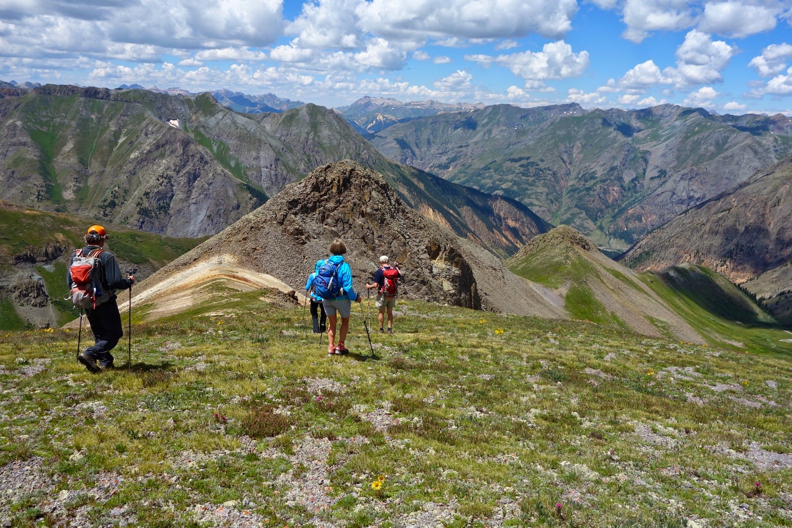
Route: Beginning at 11,700 feet, walk generally southeast up the dirt road to the Buffalo Boy Mine. Angle up to the ridge and go north-northwest to Galena Mountain. Returning, stay on the ridgetop to Point 13,214'. Go out-and-back to Canby Mountain. Back on Pt 13,214', go northwest on the ridge dividing Stony Gulch from Rocky Gulch. Peel off the ridge to meet the road and walk a short distance back to the start.

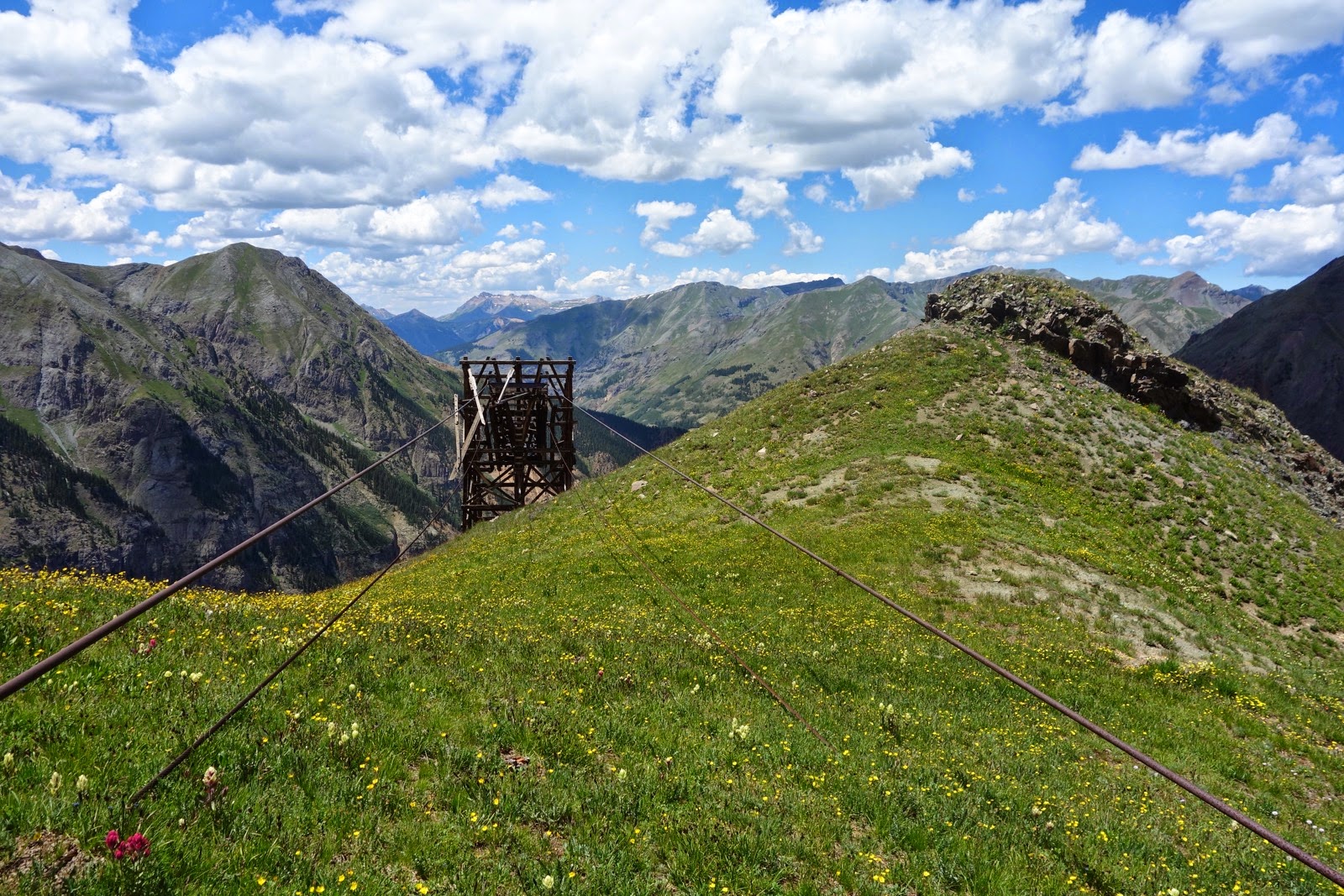
Buffalo Boy Mine: Heading generally southeast, walk up the road 0.9 mile to the Buffalo Boy Mine in the upper basin at 12,600 feet. Prospectors were after both silver and gold. You will find railroad tracks, and cables still strung between aerial tramway support structures. Behind all this is the return ridge from Canby.

The hopper holds a potential haul, big wheels spin, and a metal track retains its curved shape.

Watching for nails and missing boards, tour inside the tram house.

Galena Mountain: If you wish, you may take the 4WD track up to meet the ridge. It is most efficient to ignore this temptation and ascend on a rising traverse northeast to Galena's south ridge. Reach it at about 13,000 feet. The rolling ridge divides Cunningham Gulch on the west side, from Maggie Gulch on the east. Walking north, hit the highpoints either going or coming. In the center of the image below Galena is the right crest of what looks to be a double summit.

Crest Galena Mountain 2.7 miles from the trailhead. In this image looking south, Sheep Mountain is just left of center and Canby is right of center. If you prefer a much more direct approach to Galena, park at the trailhead for the Old 100 Boarding House. In 2007, I took the trail about 0.1 mile north of Sterling Gulch and then ascended steep grassy slopes northeast to 12,400 feet. Then I climbed north, gaining the ridge west of the peak.

Canby Mountain: Retracing your steps, You can see Crystal Lake in a cirque suspended above Maggie Gulch. Continue ridgetop to Pt 13,214', image right. With the exception of rocky highpoints, the gentle ridge walk is exclusively tundra.

In 2008, I climbed Canby from Stoney Gulch, beginning 0.3 mile north of the pass at 12,400 feet. We barged our way up the steep, loose slope, gaining the ridge 0.2 mile northwest of Canby. If you prefer a brute force, inelegant route up mountains, this one is for you.

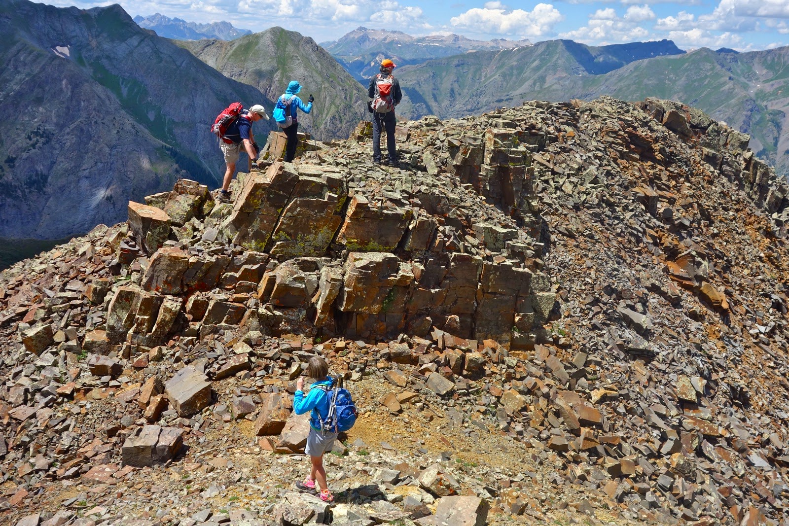
Ridge Between Stoney and Rocky Gulches: Return to Point 13,214' and turn left/west. Descend northwest on the ridge for about a mile. The first knob, pictured, is a fun Class 2+ scramble. Note: If you'd rather climb two 13'ers without putting a hand down, this ridge may be skipped. Merely go back as you came until you cypher a pleasing route back to Buffalo Boy. With an luck, you left your vehicle there!
Buffalo Boy Mine is a 4 wheeling destination so you may see vehicles.

The ridge has just enough rock play to make it fun. Its premier location presents fantastic views all the way along.
Cross paths with the abandoned aerial tram in a mile. Here we dove down to Rocky Gulch. However, you could just as nicely play out the ridge a bit more and finish beside the creek very near your vehicle.
Our spontaneously chosen route fortuitously took us through the best wildflower fields of the day, rivaling the finest of the summer. Indian paintbrush were as colorful and plentiful as they get. This little arrangement features queen and king's crown, elephant heads, alpine avens, and paintbrush.

Be bird watchful. I have seen a juvenile golden eagle with chevrons on its wings, a mature golden, a bald eagle, and ptarmigan tracks with wing prints on snow.
4 comments:
So. Years ago I biked and hiked up to Buffalo Boy Mine. I continued on to the highest point that could be reached by a rough 4wd trail to double track. At the top was an unmarked grave and a deadend / high point that stopped at a point facing north at a line of high peaks. Do you know what ridge I was on? I think by reading your narrative that I was near Galenas Mountain on a ridge near its apex. Correct me if I'm wrong please.
Yes! I just looked at my old photos and sure enough, I have a picture of the grave site. South of you was Canby Mountain and to the north was the rolling tundra-covered ridge. Galena is a small effort from where you were standing. There are two numbered points between the grave site and Galena, a double summit.
By looking at your map, it appears that I was on the ridge closest to Canby, with Galena to the north. So I'm guessing the 2track follows up on a vague line east to where the line (hiker trail only) on your map goes north to Galena, or a short distance south to Canby, right? Anyway, thanks for your quick response. It took me a little to get back online and see this page again.
You got it. If you get a chance, return and climb both peaks--pleasure in the tundra. Debra
Post a Comment