Travel: In Durango, zero-out your trip meter at the corner of East Animas Road, CR 250, and Florida Road, CR 240. Go north on CR 240. At 12.0 miles (Helen's Store), continue straight on CR 243, following the sign to Lemon Reservoir. In 13.7 miles reach Lemon Dam. Drive on a gravel road along the east side of the lake, passing a campground. At 19.1 miles the road splits. (To the left is Transfer Campground.) Turn right on FSR 597, East Florida Road. For the next very slow 10.7 miles, the road is rocky and riddled with large potholes requiring 4WD, high clearance. After rain, the potholes are ponds. The track climbs steadily but is not steep or exposed. At 25 miles, pass a series of clearings chock full of orange sneezeweed, encircled by heavy conifer and aspen forests. At 27.4 miles go right, avoiding FSR 597C. At 29.2 miles bear right again, avoiding FSR 597D. At 29.6 miles go left at an unnamed fork. Reach generous trailhead parking at 29.8 miles. The rough road will leave you feeling like a bobblehead doll. Allow 1:30 to 2:00 from Durango.
Distance and Elevation Gain: Sheridan is 12.0 miles roundtrip with 2,450 feet of climbing. The east rim return to Crevasse is 13.5 miles total with 3,050 feet of vertical.
Time: 6:00 to 8:00 depending on route
Difficulty: Fast trail, off-trail; navigation moderate (plenty of opportunities to get lost out there); no exposure; Class 2+
Maps: Lemon Reservoir; Vallecito Reservoir; Columbine Pass, Colorado 7.5' USGS Quads; Weminuche Wilderness, Trails Illustrated #140
Latest Date Hiked: September 22, 2019
Quote: There are always flowers for those who want to see them. Henri Matisse
The wooded east slope of Sheridan Mountain plummets over 4,000 feet to Vallecito Creek. North of the peak granite slabs rise to Sheep Mountain, 13,070'. Unseen to the west is City Reservoir and the Florida River watershed. This shot was taken from Peak 12,490' on Endlich Mesa.
Several vehicles will inevitably be parked in the trailhead lot. The EMT is popular with backpackers for whom wonderful possibilities exist. Trek north to Columbine Pass. From there it is a quick drop into Chicago Basin, the basecamp for remote 14'ers and high 13'ers.
The trail is eroded, braided, and somewhat ambiguous. However, there are cairns leading due east from the trailhead, elevation 11,280 feet. Spur 534 contacts the EMT coming up from the south in 0.6 mile. If you have confidence in your navigation abilities just shy of 0.4 mile leave the spur and go northeast through a well-spaced forest to intersect the trail at 0.9 mile.
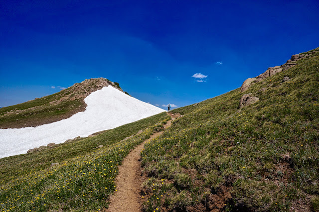
The ridge is broad and treed for the first mile. The trail utilizes an old road. Orange sneezeweed is the predominant flower in July.
The trail traipses through a rich field of dusky, rosy paintbrush and elegant death camas. Be careful not to brush against this ultra poisonous plant. The San Juan's startling, jagged horizon is continuously visible from the mesa: Pigeon, Turret, Eolus, Windom, Sunlight, Jupiter...
In 1.4 miles, at Point 11,958', the trail drops 80 feet down a limestone outcrop. Lining the path are lilac Colorado tansy asters, an uncommon plant on the species-of-concern list.
At the base of the knob follow the trail carefully through willow patches bearing northeast. Judging from the braided wildcat trails many travelers stay on the stone rib and end up too far west. The EMT heads northeast toward open tundra country on the east side of the mesa. In this image the Weminuche Wilderness boundary sign is buried by snow. (This sign was gone in 2019 but the two posts are there.) Look afar for the tall cairns that mark the EMT. (THW, photo)
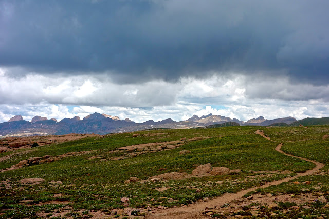
The hike crosses five miles of uninterrupted tundra. In the ever-nearing distance are monumental peaks.
Limestone transitions to 1.46 billion year old crystalline Eolus Granite. The medium to coarse-grained porphyritic biotite-hornblende quartz monzonite covers 100 square miles in the southern Needle Mountains. The igneous formation developed below the surface as magma and is dated from when it hardened into rock. The smooth trail is a linear sculpture as it meanders through pink, spheroidal boulders. Great slabs mound up from the grass. Ascend gradually to Pass 12,300' at four miles. (THW, photo)
This vantage point affords the first view of Sheridan Mountain, the double prominence image-center. From the pass, the trail drops 300 feet. I have contoured off-trail along the west slope of Point 12,470', image-right, but I got cliffed out and had to drop back down to the trail.
At 4.7 miles there is an unsigned junction, shown below. The formal Endlich Mesa Trail descends left/north to City Reservoir in Upper Park. To reach the peak, continue straight on the "Sheridan Mountain Spur Trail." This elk, sheep, and human multi-thread contours around Point 12,442', image-center.
On the north side of Point 12,442', a secondary trail goes west to City Reservoir. Reach the Sheridan saddle, elevation 12,060 feet, at 5.5 miles. Leave the trail and climb the somewhat steep south ridge of the mountain on crushed granite.
There is a false summit after 520 feet of climbing. Either go around it on the west or through the top boulders. Drop 50 feet to a saddle and climb again to a second inconsequential bump before seeing the actual peak. Sheridan has a welcoming stone stairway that leads directly to the zenith at six miles. Judging from the peak register the summit is rarely visited. (THW, photo)
The unexpected greets you. To the north are glaciated sheets of granite interspersed with water pockets. Heading the great divide are Amherst, Organ, Emerson, and Sheep Mountains. (THW, photo)
To the northwest, the mind-numbing Needle Mountain lineup is closing in and calling.
East Rim of Endlich Mesa to Crevasse
Twice I've been caught in the rain returning from Sheridan. Once, the storm was severe dropping hail and torrents of water, lightning flashing so close I felt like a sitting duck for miles. If there is no threat of electrical storms seize the opportunity to travel along the very edge of Endlich Mesa. It adds only 1.5 miles and 600 feet of elevation gain.
From the summit retrace your steps for two miles back to Pass 12,300'. Leave the trail 0.2 mile south of the pass and climb the soft northwest ridge of Peak 12,490'. Ridges emanate east from the mesa in a surprisingly chaotic manner. There is a fine view of Sheridan from this legal summit.
Stay close to the edge and within moments you will discover reason enough for the extra effort. In the foreground are spheroidal fins and spires. The dark and severe north face of Point 12,450' contrasts with the soft forms of the crenelations. You could throw a rock from here and hit the EMT. Yet, from the path there is no indication of the wonders at the rim. (THW, photo)
Summiting Point 12,450' is recommended for those who relish knife ridges.
The journey to Point 12,270' affords a view of Vallecito Reservoir in its entirety. Talus blocks lead to Point 12,305'. Then the ground is calm and uniform, covered in small tan plates. We were fortunate to be here as the snowpack was melting making ephemeral sculptures out of tightly-bonded cornices. The limestone caprock of Crevasse is seen in the near distance. Climb the short broken wall. (THW, photo)
Crevasse is one of the most unexpected and wildest places in Colorado...and well named. The whole summit block is breaking apart leaving a puzzle-like maze of cracks up to 20 feet deep. The surface is composed of 350 million year old Leadville Limestone. It overlies structurally weaker Ouray Limestone of the Devonian age (400 million years ago). The Ouray collapsed under the weight of the overburden, causing the Leadville to fracture. The cracks have widened with erosion. One billion years of Earth history is missing between the Ouray Limestone and Eolus Granite. (THW, photo)
The deepest and widest fissures are toward the south. Jump the narrow slashes and zigzag around wide gashes. Eventually, work your way to the west side of the mountain. (THW, photo)
There are multiple ways to return to the EMT. We stayed above the willow line while moving north. Then we dropped west into a lush basin filled with alpine buttercups. We rejoined the trail at the wilderness boundary.
Following are some of the flowers blooming in late June, from lowest to highest in elevation: native honeysuckle, current, geyer onion, western and edible valerian, columbine, kittentail, orange sneezeweed, elegant death camas, Jacob's ladder, glacier lily, fairy candelabra, candytuft, mouse ear chickweed, draba, alpine avens, rosy paintbrush, alp lily, moss campion, sulfur paintbrush, old man of the mountain, marsh marigold, American bistort, sky pilot, purple fringe, snowball saxifrage, alpine clover, deep rooted spring beauty, mat penstemon, and aromatic phlox.


4 comments:
Thanks for the description. I live in Bayfield and have been up the EMT several times but only for short hikes. Your narrative helps out with the details of going further up the trail!
Great pics also!
Wow, I treasure Crevasse in my memories as a teenager going to school in Durango in 1976- 77 and I remember a USGS marker up top there marking the spot . A classmate, and I ventured that way to Elk hunt in D creek Spent one night on Crevasse in a snowstorm and then hunted the next day. The next day I called my Dad and Brother to come to Durango, from Broomfield to help us with packing . What a great memory but a very unforgiving territory ! Would love to get back there as this memory is only 48 years old and still treasure every moment and would love to talk to a historian in the area about casings and arrowheads I found on top of purgatory mountain ski area, in the area of lost souls from the Spanish explorers ! I bet I wouldn't recognize Durango ! Thank you for the post ! Jim
Jim, Thank you so much for sharing your lively, youthful memories of Crevasse with Earthline readers. I can identify because happy memories of being in the mountains as a little kid pop into my head all the time! Debra
Wow ! Thank you Debra for the input and the connection to your readers as I'd love to learn more about the areas we used to hike around Durango when I was going to college there 76 - 77 . I and 3 other friends went to college at that time and I still keep in contact with them and will forward any info I get to them for stories and then fact one of them was very interested last night and asked me how the heck did you get this info on Crevasse ? I will have to ask my Daughter how to get on this blog with a newsletter or whatever you all talk about ? Not sure if it's just talking about hiking or maybe hunting and fishing are included ? but we did it all around Durango as we didn't study much as we were too busy in the outdoors ! We all just crammed for test's and the only computer programming class I took at Fort Lewis was punching out cards and feeding them into a computer so I'm a little illiterate and again will ask my Daughter how to get on this blog or newsletter you all put out ! I still remember all the Cokenee Salmon running out of Lemon Reservoir on my 3 trips there to Crevasse . There is also a way to take horses down into D Creek as we did in 77. Thank you all for this connection ! Jim Fretz Estes Park, Colorado.
Post a Comment