Travel to Horse Gulch Trailhead: From East 8th Avenue, turn east on 3rd Street. Park in the designated lot on the right.
Travel to Skyridge Trailhead: From Goeglein Gulch Road, turn east on Jenkins Ranch Road and drive 1.3 miles to the trailhead on the right.
Distance and Elevation Gain: The loop and spur to Point 7,954' is 9.7 miles with 1,700 feet of elevation gain. The thru-hike to Skyridge, including the spur, has the same vertical but is only 7.5 miles. Options for lateral trail bailouts are given below.
Time: The loop will take 4:30 to 6:30. The thru-hike is about an hour shorter.
Difficulty: Trail; no exposure; navigation moderate. Please stay on established trails.
Maps: Durango East, Colorado 7.5 USGS Quad or Apogee Mapping; Durango Trails Interactive Maps
Quote: To learn something new, take the path that you took yesterday. John Burroughs
As seen from Smelter Mountain, Raider Ridge forms a natural boundary on the east side of town. Horse Gulch is the strike valley between the hogback and Crader Ridge.

Route: It is 4.9 ridgetop miles from the southern end of Raider Ridge to Point 7,954' on the Smokejumper Trail. The loop includes a spur to the highpoint and returns on the Sugar Trail to Horse Gulch Road. The thru-hike leaves the hogback on the Skyline Trail, descending west. The trail system is elaborate; principal lateral trails are described. For brevity, I have omitted several trails in the maze toward the southern end of the ridge, the Ball Lane Connector, and Power Line Trail which runs along the western base of the escarpment.

Horse Gulch Trailhead
From the parking lot at 6,600 feet, walk east up Horse Gulch Road, a mixed-use dirt track. In winter, the shaded initial segment, shown, is the coldest, snowiest, and slickest part of the hike.

Zipline
Zipline has two entrances. Pass by the first trail joining from the left unless you'd like to see the old quarry where rock was mined for the courthouse and fairgrounds. In just over half a mile, go left on another Zipline branch. The track heads west, following the contour around the southern end of the ridge to eventually link with Power Line Trail.
Half Ridge (alternative route)
Reach the base of Snake Charmer 0.7 mile from the trailhead and hook a sharp right. Alternatively, just feet beyond Snake Charmer, an abandoned rock strewn road intersects Zipline. If you are a ridge purist, scale this steep pitch (Half Ridge) which some people call Babyhead Hill.

Half Ridge levels out at the southernmost knob on Raider Ridge. From this perspective at 7,100 feet, there is a stunning vista of the La Plata Mountains, Perins Peak, and a super sweet view of the south end of town. The trail crashing off the ridge on the east is Flame Out; ignore it. Half Ridge continues and in 0.2 mile Snake Charmer comes in on the right.

Snake Charmer
We will be accessing the ridge via Snake Charmer, a half mile, one way, downhill mountain bike track. In 2013, trail foreman Tyson Swasey of Moab worked with Trails 2000 crew leaders and community volunteers to construct the progressive course. While there are alternative lines with varying degrees of difficulty, there is no easy route down this technical, steep descent. Hikers beware! Bikes have the right of way--be ready to leap clear of the track. If this makes you squeamish, use Rocky Road or Half Ridge instead.

Catch serious air on ledge drops and stone jumps.

Flagstones were laid so expertly the trail looks like a backyard patio. This stonework bridge incorporates an historic decorative block.

Bikers careen down rock-armored terrain and ride the rocks around banked corners.

While alternative routes tame the course slightly, everyone rides down this slickrock slab. Hikers head up slightly to the right.

Medicine (bikes only)
At 1.3 miles pass by the beginning of another downhill ripper. The half mile track takes off from Snake Charmer at a weathered boulder 100 yards from the top of the ridge. The Gravity Council, a Trails 2000 advisory group, and volunteers reconstructed Medicine in 2015. Grady James and Dusty Bender were trail crew leaders.
Bikers typically access the ridgeline via Rocky Road before hucking down Medicine. This biker, stopped by the lens, is actually going about 20 mph. I captured him just before he went airborne. Momentum is necessary for survival. Hikers are strongly advised to avoid this trail.

Medicine finishes on a slab slide into Horse Gulch, 0.9 mile from the trailhead.

Snake Charmer intersects the ridgeline at 1.3 miles. Turn north and roll with the landscape. Politely spaced piñon and Rocky Mountain juniper don't interfere with the continuously evolving westward visual field.
Rocky Road (lateral trail bailout option)
Rocky Road intersects Raider Ridge at 1.7 miles at the top of the "Black Hill Climb." You can't miss this junction because the surface is covered with a soft black coal/shale mix. Geologically, Raider is composed of the Mesa Verde Group. At this location the Menefee Formation is holding up the ridgecrest.
Bikers use Rocky Road to access the ridge. Likewise, it is the easiest and safest choice for hikers. If you are short on time, descend this track to create a classic loop.

The lateral trail descends southeast for half a mile to Horse Gulch Road. A dirt track winds through rocky passages.

The trail splits 0.1 mile from the bottom. The right branch is EZ which accesses lower Medicine. The left branch is the shortest route to the road. It enters Horse Gulch 0.3 mile north of The Corral and one mile from the trailhead.

Extended Ridge
Continuing north from the Rocky Road junction, the next trail segment is Extended Ridge. The constricted and stony spine is the most technical part of the whole trail system and mountain biking is rated Advanced/Expert.
A grove of ponderosa line the west side of the backbone. The ridge is edgy and, while it falls away sharply, the trail platform is generous.

Rollers follow one after another. Top one and see the next. Pictured is Point 7,536'.
Rocky Road (north entrance, lateral trail bailout option)
The north end of Rocky Road leaves the ridge at 2.5 miles in the saddle south of Point 7,536'. This track, 1.4 miles long, makes a descending traverse to the southwest through open terrain. The surface smooths when the trail cuts through big sagebrush. The image below looks up the trail and east to Crader Ridge. Upon reaching the Black Hill Climb, Rocky Road goes left downhill to the Horse Gulch Road.

Hyper Extended Ridge
North of the Rocky Road junction the ridge trail is called Hyper Extended Ridge. In 2008, Mary Monroe, executive director of Trails 2000, negotiated access from Jake Dalla so it could be used for the Single Speed World Championships. The City of Durango purchased the property in 2012.
The trail zigs and zags up the next knoll east of the ridgeline. North of Point 7,536', it is more rugged, and more delightful. Walk along the sandstone rim. Gaps in the rim rock are filled with boulders maneuvered into place to create passage for bikes. Many riders will hike-a-bike across the slanted blocks.

Exposed on the ridgecrest is the Cliff House Formation distinctive for its yellow hue.

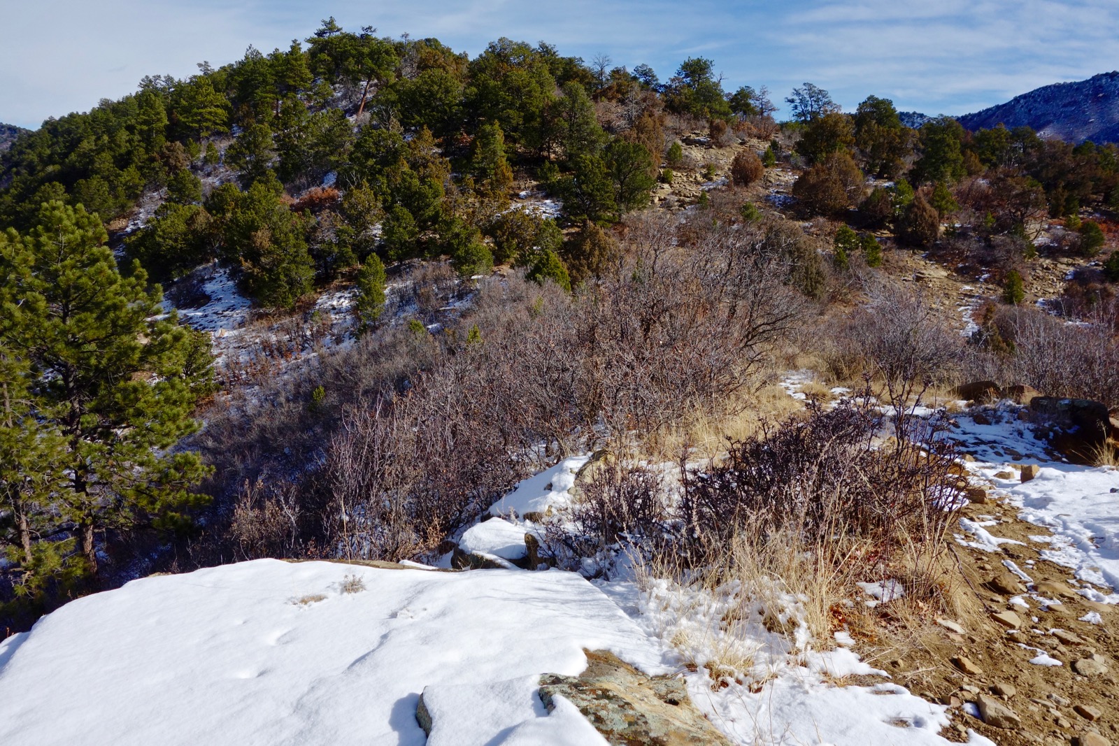
Point 7,897' can be glimpsed in the distance. The south entrance to Sugar Trail leaves the ridge shy of this hilltop. Keep going!

Point 7,897'
At 4.1 miles, stand on the most popular viewing platform on Raider Ridge. It is the highest prominence south of the Skyline Trail. Capstones flare into the sky.

The lookout provides a comprehensive view of Animas River oxbows, the Animas City Mountain cuesta, and the La Plata Mountains.


Four trails come together at elevation 7,800 feet, 4.2 miles into the hike: Hyper Extended Ridge (south); Skyline (west); Smokejumper Trail (north); and Sugar (east). The intersection resides in a Douglas and white fir forest on BLM property. Our trek to the highpoint of Raider goes out Smokejumper and returns to this junction. Roundtrip, the spur adds 1.4 miles and 250 feet of vertical.
Smokejumper Trail
Smokejumper was built by Trails 2000 and a host of volunteers in late autumn of 2017 to honor Durango native Joseph Philpott. Joe died in an avalanche in 2013 at age 27. At that time he worked as a smokejumper based in Boise, Idaho. The Philpott family placed a commemorative plaque 0.3 mile out the trail on a knoll at 7,880 feet. It's attached to a boulder with a permanent view from the valley floor up the eastern front of the La Plata Range.
Walking north on the ridgecrest trail is glorious--now we can go further than ever before. You can see Missionary Ridge topped by Baldy Mountain and the far end of the river valley encircled by high peaks. Ponderosa are a whole order larger than elsewhere on the ridge, giants really. Wind in the trees creates a song only pines know how to sing.

The trail zips down the knoll on sculpted banked turns and out onto the open ridge.

At 0.7 mile from the four-way, crest Point 7,954'. A few steps north of the highpoint suspended rimrocks thrust into nothingness.

BLM property continues for another 0.6 mile should you chose to continue. The rib is thin so trail builders didn't have much room to work. They ran the trail over a rocky flange. A sign, "Leaving Public Lands" indicates where trail users should turn around.

Back at the four-way junction, loop hikers will go east on Sugar Trail; thru-hikers will go west on Skyline Trail.
Sugar Trail
The curious name is derived from an acronym, SHGR, Skyline to Horse Gulch Road. Mary Monroe hatched the idea to connect the popular treadways. Daryl Crites designed and built the trail in 2015 with a Trails 2000 work crew. In 2017, the moderate link from the four-way was added to bypass the boulder-covered ridgetop. This super sweet trail is rated intermediate for mountain bikers. It is a 1.6 mile, multi-use, two-way track with an average eight percent grade.
Leave the ridge on banked swooping turns. The wide dirt path progresses southerly passing by large yucca and big sagebrush at Gulch level.

The junction with Horse Gulch Road is marked with a massive cairn atop a shale heap 2.3 miles from the Horse Gulch Trailhead.

Go around the pink gate. This image looks back at one biker among many on this December afternoon heading up to well-liked Sugar.

Horse Gulch Road (La Plata County Road 237) has its charms. In winter, rabbit brush has gone to creamy seed, golden grasses are backlit, red willow fill the ditches. In autumn of 2017, the county brought in heavy equipment and alleviated deep ruts in the road while doing storm water management. They plan to revegetate. Pass The Corral 0.7 mile from the trailhead.

From the four-way junction the pathway drops 820 feet over 1.9 miles to the Skyridge Trailhead. This pathway is close to perfect--packed dirt with almost no rock, roomy enough to pass, gentle grade, and ceaselessly beautiful. Skyline carries a steady stream of bikers, runners, hikers, and dogs.
Near the top the Douglas fir are as big as their old-growth ponderosa companions. That says a lot because the ponderosa appear taller than the mountains!

Wind down the west-facing slope through boulders cut loose from cliffs above. The vista is constantly shifting as the elevation drops. This image was captured on an open corner. Left of City Reservoir is Hillcrest Golf Club. Perins Peak, Durango's prized landmark, forms a natural boundary on the west side of town.

The Power Line Trail leaves on the left 0.3 mile from the Skyridge Trailhead. Power Line begins as a trail but transitions to a two-track. It is popular with bikers who use it as a vital link in the Horse Gulch trail system. Power Line is an informal cross-country ski trail in winter months.
Arrive at your destination amongst big sagebrush.
No comments:
Post a Comment