Essence: The appeal of Cochise Head resides with its appearance--great globs of volcanic stone fashioned by erosion and weathering into the form of a human face gazing skyward. Achieving the airy summit is difficult. The trail is fragmentary, cairns are too few to rely on, and the route is steep, loose and overgrown. It took raw desire and perseverance to see this hike through. The climb is well covered by trip reports. I'm throwing this one in the mix primarily to document the terrain's characteristics in 2022. This hike is for proven navigators; perhaps our exploits and blunders will be useful for future hikers. From the crest there is a circular vista with ranges rippling away into Southeast Arizona and the New Mexico Bootheel. Cochise Head is in the northern sector of the Chiricahua Mountains. It
is accessed through Chiricahua National Monument but lies outside the
park in the Coronado National Forest.
Travel: From Wilcox drive southeast on AZ-186 East for 31 miles to the signed turnoff for Chiricahua National Monument, AZ-181 East. Measure distance from the entrance station (closed in 2022). Bonita Canyon Drive rises through mind-bending rhyolite pinnacles. Pass the visitor center and campground. Park on the left in a paved pullout with an Ancient Stream Beds placard at 5.4 miles. This is 0.25 mile up the road from the actual trailhead, the dirt track to King of Lead Mine. There were no fees or passes required to enter the park in 2022.
Distance and Elevation Gain: 8.4 miles; 3,100 feet of climbing
Total Time: 6:00 to 8:00
Difficulty: Trail, off-trail; navigation challenging; Class 2; no exposure; hike on a cool day, dress defensively, and carry all the water you will need.
Map: Cochise Head, Arizona 7.5' USGS Quad; or Chiricahua National Monument, 7.5' produced by USGS with the National Park Service
Date Hiked: February 1, 2022
Biographical Note: Cochise "having the quality and strength of oak," c. 1805-1874, was the Chiricahua-Apache chief and warrior during the Apache Wars, 1861-1872. With the encroachment of Mexican and American settlers on traditional lands Cochise led raids on both sides of the border. The U.S. government offered
Cochise and his people a reservation in the southeastern corner of
Arizona Territory if they would cease hostilities. Cochise agreed, only to die two years later. His friends lowered his body and weapons into a
rock crevice in the Dragoon Mountains, location unknown.
Cochise was buried in the rocks above one of his favorite camps in Arizona’s Dragoon Mountains, now called Cochise Stronghold.
Only his people and Tom Jeffords knew the exact location of his resting place, and they took the secret to their graves.
Read more at: https://www.aaanativearts.com/cochise-bio
Read more at: https://www.aaanativearts.com/cochise-bio
Quote: I saw the angel in the marble and carved until I set him free. Michelangelo
This unusual perspective on Cochise Head was taken from the Indian Creek-Bonita Canyon divide. (Thomas Holt Ward, photo)

Route: From Bonita Canyon Road, walk north to King of Lead Mine. Continue on the track east to the southern end of the Horse Trail. Head north to Wood Canyon Saddle where the Horse Trail ends. (The ridge route is an alternative to the sidehill segment of the Horse Trail.) Climb northeast off-trail to the west ridge. Flank pillars and walls on the north. Upon reaching the saddle east of the crest, ascend west to the summit.

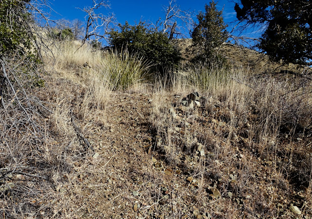
From the parking pullout, elevation 6,280 feet, walk west down Bonita Canyon Drive for not quite a quarter mile. We saw cougar scat in a couple of locations. Look north for a preview of the rolling grassy hills soon to be traversed and their occasional outcrops. (THW, photo)

Turn right and walk a few passes down to a locked gate, easily skirted. The shaded forest of Bonita Park opens to sun-drenched Arizona oak, alligator juniper, piñon, manzanita, mountain mahogany, and beargrass.

The road is a phenomenal assist bearing the hiker steadily into the hills. There is a sense of peaceful ease in this initial segment. Turn around for a view of Point 6,875' and the fire lookout on Sugarloaf Mountain. (THW, return photo)

Arrive at the King of Lead Mine at 1.4 miles, 6,920 feet. The mine was discovered in 1900. Underground production lasted from 1924 to 1970. Commodities mined were lead, silver, zinc, gold, and copper. Stay with the road as it hooks sharply south.

The track ascends for less than a tenth of a mile, turns east, descends briefly, and then rises to a ridge at 1.7 miles, 7,020 feet. The small knoll to the south is a landscape marker.

Upon arriving on the ridge, leave the road and turn north on a faint trail marked with cairns. This is a can't-miss juncture so be watchful. According to Chiricahua Mountains Hiking Trails this is the southern end of the old Horse Trail to Wood Canyon Saddle. It is no longer maintained. They write, "As of August 2018, this trail has had some of its deadfall removed, and
is reasonably well-marked with rock cairns and flagging, but it remains
quite faint and does still have deadfall and overgrowth, as well as
several confusing points with forks and disappearing tread." In 2022 there was no flagging.
The Horse Trail begins by climbing north on the east slope of a small hill, shown. A few large limestone cairns hearken to a bygone era.

It's only 0.3 mile from the start of the Horse Trail to the next ridgeline (and navigation juncture) but it is easy to lose the trail as we did, both going and coming. The 223,000 acre Horseshoe Two Fire in 2011 did considerable damage throughout this region. Head an eastward ravine at about 7,200 feet and then make for the ridge, shown.

Crest the eastward ridgeline at 2.0 miles, 7,220 feet. This location affords a superb look at Earth's monument to Cochise. Beginning from the left, facial features are: chin, lips, whiskers, nose, forehead and eye socket (below the ridgeline). The highpoint is on the nose, climbed from the saddle between the nose and forehead.

Horse Trail/Sidehill Route
Two routes leave from the ridge, the sidehill route and the ridge route. The Horse Trail is the standard (and some would argue easier) choice so I will explain that first. In general, what remains of the trail bears north, swings in and out of two eastward ravines, crosses a west fork of Indian Creek, and ends at the Wood Canyon Saddle. The trail is disconcertingly invisible as it tracks the contour in this photo.

To stay on the Horse Trail, go west up the ridge to elevation 7,260 feet and look for a fallen tree with a square stone in the root ball, pictured. The trail picks up again just uphill of this natural marker. The path is not obvious at first; insist on finding it. The thin, seldom used treadway is fairly clear 70 to 80 percent of the way. You will have to link together existing segments. Our track on the map above is nearly true to the trail.

We took the Horse Trail on our return. The image below is fairly typical of the challenge. As you approach the west fork of Indian Creek the trail descends on short switchbacks for 100 feet. It is 0.8 mile from the ridge to the west fork crossing.

Ridge Route
This is an alternate route. Initially, we couldn't locate the Horse Trail. We were attracted
by the idea of a ridge hike anyway so we just headed directly west. This route adds just 0.1 mile but another 320 feet of vertical. We topped the first point at 7,500 feet, gave up a little ground, and claimed the second point at 7,580 feet. We took in some far flung views, snapped a unique take on Cochise Head, and then began the 600-foot crashing plunge to the west fork. There was plenty of rubble with varying degrees of stability. Cows kept us company as we made a somewhat tedious descent. Bottom line: I'm glad we explored this alternative route but I would not repeat it.

We met up with the Horse Trail at the west fork crossing at 6,900 feet. The two routes reunited, cross the creek (most likely dry) and follow the Horse Trail north to Wood Canyon Saddle, pictured.

There are two signs at Wood Canyon Saddle. The Horse Trail sign is resting on the ground, scorched and illegible. None of the three trails posted on the sign pictured are visible on the ground. (THW, photo)

From the saddle, the climb to the summit must be considered a route even though a few scrapes of trail remain in the higher reaches. Bear north-northeast and climb the first of four grassy rollers, Point 7,138'. Footing is good on crushed rock. Yucca, beargrass, and oak are easy enough to dodge. Give up 80 feet to the final saddle at 3.2 miles, 7,060 feet. The approach is over with one mile remaining. Stay with the ridge until it melds into an open slope and then aim for the east ridge of the mountain. Negotiate a maze of shrubs on chipped and broken rock. The incline gets progressively steeper. Trekking poles are helpful.

For the Class 2 route we knew we needed to flank the pillars and walls on the north until we came to a saddle between the nose and forehead. But just where was that saddle? Trip reports didn't translate well (for us anyway) once we were within the
rock. For much
greater detail, you might find the Chiricahua Mountains Hiking Trails helpful but the path is overgrown and the cairns they refer to are mostly gone. There are many braids and false trails going to the walls. This image shows the first stone feature, the chin, at about 7,700 feet.

We hugged this massive rock structure right up against the wall. It was steep and brushy with no sign of recent use. We encountered snow patches at 7,800 feet that were quite slick.

This free-standing, volcanic spire had a dramatic presence. We circled the blade. (THW, photo)

Our attempts to skim along the walls proved impossible. So we backed off for a time and then went back to the ridge to probe between pillars. All the while, we were looking for the alternate scramble route to the top that we had read about. All the options we found were technical.

Now and then we found fragments of a social trail lightly cairned but overgrown in places by young trees. Below, is a welcome stretch of clear trail through a talus yard.

We were elated to come around a wall into the opening pictured below. So this was the saddle between the nose and forehead. Even with all our misguided probing, it was only 0.3 mile from the chin to this point. This image looks east to the forehead.

We held our altitude at 7,940 feet and wrapped around to the south until a reasonable slope to the west was presented. It was less than 200 vertical feet to the summit. After all our thrashing around, the final climb up the backslope was a breeze. We scampered up through bedrock, scree, and brush.

Alight on the summit at 4.2 miles. We had anticipated an all-stone dome much like Dos Cabezas but this tiny perch was covered in talus and grass. The land drops away radically on three sides with domed towers directly below. In the heart of every explorer there is a desire to actualize an elegant and efficient route; I would enjoy returning to perfect this one. We made a lot of minor navigation mistakes, even climbed a ridge unnecessarily (no regrets!). It took us four hours to reach the summit. On the return we did a better job of route finding, far from perfect, and it took three hours. The peak register was damaged and needs replacing.

Cochise Head has a whopping 1,933 feet of prominence so the views are outstanding. Look south into a deep-velvet forest and snow-chilled Chiricahua Peak, the highpoint in the range at 9,759 feet. (THW, photo)


Wonder is everywhere. Ephemeral seedheads contrast with carved monuments of stone. (THW, photo)

Cochise Head from Heart of Rocks Loop, 2014.

4 comments:
Used to live in Chiricahua National Monument as a child in the 1990s. My parents worked for NPS. My dad took me up Cochise Head twice when I was 10 and 11. Very great read and never have seen a trip report of it. Wondered how conditions were since the 2011 fire. Thanks for all the trip reports!
-Ben
You climbed Cochise Head as a kid? That's impressive. And you lived in the Monument? With that cred, I am honored that you enjoy reading Earthline. Debra
It seemed like a strenuously normal adventure at that age, being that the Monument was literally my backyard. Garfield Peak was behind my house and we'd scramble it semi-regularly. The Monument was the most remote place I ever lived. Bussing in to Willcox for school 5 days/week and going to Tucson for errands and big grocery runs 2-3x/month got old. Nonetheless, I had a lucky childhood. I didn't know it at the time just how abnormal it was.
My mother has lived in Tucson the past 10 years and we visit annually (will be there in two weeks). I've become acquainted with the Santa Catalinas since she lives in the Catalina Foothills and have really enjoyed the area. I'll be commenting on your trip reports of the area soon.
I just learned of your blog from a trip report on NWhikers.net from someone who referenced you doing adventures in the Tucson area. I live in Portland, OR and we pine for places like the Southwest come this time of year. Your extensive cataloging of the region and all the effort and time are impressive. The honor is all mine to have found Earthline and read of your experiences and empathize with our shared ones.
Thank you for sharing memories of your childhood in the Monument with Earthline readers, Ben. I look forward to any comments you wish to share while hiking around Tucson. Debra
Post a Comment