Essence: Peak 6,883' is adjacent to monolithic Baboquivari Peak, visible over vast distances in Southern Arizona. The mountain is a reasonable objective for non-technical hikers who would like to get as close to Baboquivari as possible without climbing it. This hike approaches the peak from the east via Thomas Canyon. While enjoyable, it is not a simple endeavor. The rutted and rocky, rugged road to the trailhead is the first challenge. The marginal trail through Thomas Canyon to the saddle west of the peak
is braided and difficult to follow consistently. The peak climb is off-trail and scrappy, with a rise of 503 feet. Walk in the presence of a force so powerful it is the focal point of cosmology for the Tohono O'odham People. The hike begins on private land with a public easement and transitions to
public land administered by the Bureau of Land Management. The headwall of Thomas Canyon and Peak 6,883' are within the 2,065-acre Baboquivari Peak Wilderness designated in 1990. The
Baboquivari--Peak 6,883' divide is on the boundary with the Tohono O'odham Nation.
Note: October, 2025, We have heard that the road through Santa Margarita Ranch has been closed due to private land restrictions. We will update when we have specifics.
Travel: There is a Chevron station on the Ajo Hwy, AZ 86, at Three Points, Robles Junction. Drive south on AZ 286 (toward Sasabe) through the Buenos Aires National Wildlife Refuge. It is about 30 miles to mile marker 15.8, just past a big pullout on the west side of the highway. Turn west on an unsigned road and measure distance from there. Cross a cattle guard. The graded dirt road takes direct aim at Baboquivari Peak. There is plenty of dispersed camping. At 2.6 miles go right at the split. At 3.4 miles open and close the gate. Beyond the gate the serious 4WD road is at the limit of most vehicles. You will need high clearance for ruts and beefy tires for large, sharp rocks. At 4.8 miles a sign posted by Santa Margarita Ranch reads, "Private Property. Access is granted but can be revoked at any time." At the next branch, go left. Open and close a second gate. There are several opportunities to park if you've had enough. At 5.6 miles drive down into a hole and cross a wash. Expect desert pinstriping on your vehicle. We parked in a pullout on the right at the top of a rise at 6.9 miles. This is the last opportunity to camp. If you got this far, you could drive another 0.6 mile to the end of the road. A gate blocks further vehicular travel at 7.5 miles.
Travel: There is a Chevron station on the Ajo Hwy, AZ 86, at Three Points, Robles Junction. Drive south on AZ 286 (toward Sasabe) through the Buenos Aires National Wildlife Refuge. It is about 30 miles to mile marker 15.8, just past a big pullout on the west side of the highway. Turn west on an unsigned road and measure distance from there. Cross a cattle guard. The graded dirt road takes direct aim at Baboquivari Peak. There is plenty of dispersed camping. At 2.6 miles go right at the split. At 3.4 miles open and close the gate. Beyond the gate the serious 4WD road is at the limit of most vehicles. You will need high clearance for ruts and beefy tires for large, sharp rocks. At 4.8 miles a sign posted by Santa Margarita Ranch reads, "Private Property. Access is granted but can be revoked at any time." At the next branch, go left. Open and close a second gate. There are several opportunities to park if you've had enough. At 5.6 miles drive down into a hole and cross a wash. Expect desert pinstriping on your vehicle. We parked in a pullout on the right at the top of a rise at 6.9 miles. This is the last opportunity to camp. If you got this far, you could drive another 0.6 mile to the end of the road. A gate blocks further vehicular travel at 7.5 miles.
Distance and Elevation Gain: From the end of the road, 5.8 miles; 2,700 feet
Total Time: 4:30 to 6:00
Difficulty: Trail, off-trail; navigation moderate; Class 2+ with no exposure; catclaw and other thorny plants, wear long pants. Carry all the water you will need and hike on a cool day.
Map: Baboquivari Peak, AZ 7.5' USGS Quad
Latest Date Hiked: January 28, 2025
Total Time: 4:30 to 6:00
Difficulty: Trail, off-trail; navigation moderate; Class 2+ with no exposure; catclaw and other thorny plants, wear long pants. Carry all the water you will need and hike on a cool day.
Map: Baboquivari Peak, AZ 7.5' USGS Quad
Latest Date Hiked: January 28, 2025
Elder Brother told the Tohono O'odham to remain where they were in that land
which is the center of all things. And there the desert people have always lived. They are living there this very
day. And from his home among the towering cliffs and crags of Baboquivari, the
lonely, cloud-veiled peak, their Elder Brother, I'itoi, spirit of goodness, who
must dwell in the center of all things, watches over them. Bernard L. Fontana
Poem:
Poem:
I am blowing along and
running on the earth, running
on the mountain. What can
happen to me? On windy
rocks I came out and then
went in all directions and
reached the ends of the
earth. I'itoi
running on the earth, running
on the mountain. What can
happen to me? On windy
rocks I came out and then
went in all directions and
reached the ends of the
earth. I'itoi
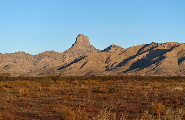
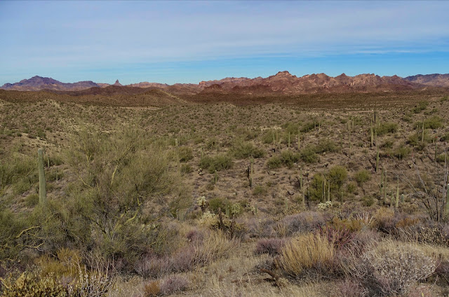
Baboquivari Peak elicits reverence and respect from all who come into its presence. Peak 6,883' is the neighboring prominence to its right.

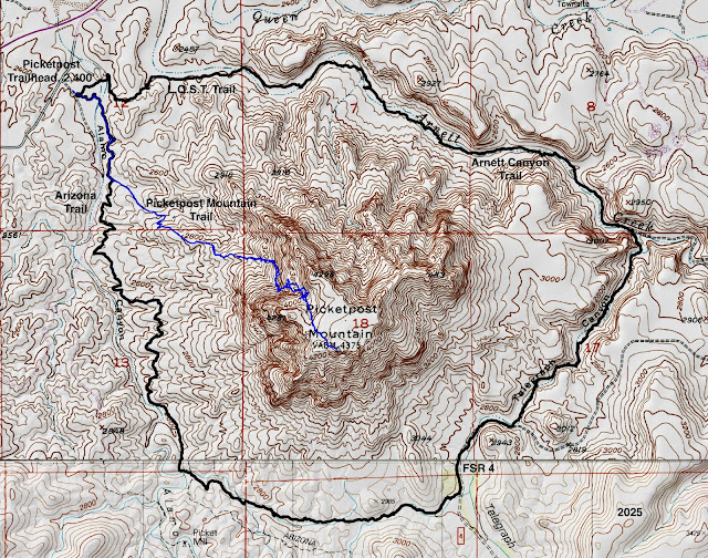
Route: Hike north-northwest through Thomas Canyon to elevation 5,300 feet. Pull out of the canyon and hike up a series of switchbacks bearing north and then northwest to the saddle at 6,380 feet. Braids and haphazard cairns make it difficult to stay on course. Ascend the west ridge of Peak 6,883' off-trail. Return as you came.

We parked in a pullout at the top of a shallow hill. The hike is on private land for the first 1,000 feet of vertical. We are fortunate that the land owner has granted a public easement through the property.

After three months without rain in Southern Arizona, Baboquivari Peak was shrouded in clouds. We wondered if the sun would shine on the reason we came. (Thomas Holt Ward, photo)

Whether walking or driving, look to the left of the road to see the Clemente Windmill. The blades have fallen away and a bird's nest made with large sticks is resting on the hub. (THW, photo)

The road ends 7.5 miles from AZ 286. Hiking distances are calculated from the end of the road, elevation 4,380 feet. There is an unusual and slick system for opening and securing the gate behind you.

No one had been driving recently to the ranch on the two-track past the gate. In 2005, I did this hike solo. The ranch was active at that time and the access road was considerably better than it is now. At 0.4 mile, hikers are directed to stay on the trail passing by an old stone structure, home, and outbuildings. (THW, photo)
The corral fence is constructed with juniper logs stuffed between pairs of pipes. I've seen hundreds of examples of creative corral construction across the American West and this is one of the best.

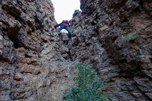
This image was shot just beyond the ranch. Twenty years ago there was effectively no trail to the saddle and I simply stayed in the wash for the entire distance (steep and loose on the headwall). In 2025, a footpath bears north-northwest along the streamway up Thomas Canyon. An effort is being made to standardize the trail. Cairns are helpful at the many creek crossings (dry on our hike), foliage is trimmed, and braids are blocked. Nevertheless, expect to lose the trail now and again clear to the saddle.

The geology in the Baboquivari Mountains is complex. Peak 6,883' is composed of older Mesozoic sedimentary and volcanic formations. The Mesozoic Era lasted from about 252 to 66 million years ago. The trail goes right by a gorgeous purple conglomerate boulder that is likely in the Mesozoic section, shown. Baboquivari Peak is composed of Baboquivari Granite, an excellent climbing stone. It is a much younger rock from the Tertiary Era, 66 to 2 million years ago.

The riparian corridor is lush and heavily shaded with mature Arizona oak. In 2005, wildflowers were abundant. At 1.0 mile look up to the right and you will see arches in a thin, linear dike.

Dikes run on the surface throughout the range. They form a striking pattern of irregular crisscrossing--white stripes contrasting with the darker slopes they intrude. Dikes are always much younger than the formation that contains them. Below, a dike is running up and over the summit of Peak 6,883' on a sunny day in February, 2024. The dike is Tertiary in age, possibly made of Baboquivari Granite. (THW, photo)

At elevation 5,320 feet, the route hauls out of the drainage and onto an open slope to the east. A large cairn and purple bedrock stained with white streaks are the clue that you have arrived at this location.

Ascend east for 0.1 mile and then watch for the trail to turn due north. The open hillside has a totally different feel. Walking is easy through golden grasses dotted with sotol. The cairned route even has a series of short switchbacks. We lost the trail momentarily and it was exceedingly steep going straight up the slope. Make every effort to stay on track. (THW, photo)

The riveting dark mass of Baboquivari is directly across the ravine.

At 6,000 feet, the trail splinters. Between my partner and I, we have negotiated this headwall pitch four different ways, three of them cairned. On our ascent we went straight up the sheer, high-angled bedrock, the outcrops seen below. It is slippery and exposed. On our return, we skirted below the outcrops, shown. The least problematic course is to favor the high route above the outcrops. It is depicted on the map provided. In 2005, I just clawed my way up the ravine directly to the saddle (and slid repeatedly).

Gain the saddle west of Peak 6,883' at 2.5 miles, 6,380 feet. Baboquivari was completely hidden by low hanging and drifting clouds. The summit of Peak 6,883' is a short 0.4 mile from the saddle with roughly 500 feet of climbing. Standing on the saddle looking east, there are two promising prominences. Peak 6,883' is on the right. Mount the west ridge.

If you walk straight up out of the saddle, at 6,600 feet there is a survey marker on top of a pipe planted in a rock pile.

Placed in 1926, it marks the intersection of Section Numbers 13 and 14. These numbers are depicted in red on the topographical map. Very cool for map nerds.

Elevation accumulates rapidly. This image looks down into Thomas Canyon and south to double-humped Mildred Peak. The Baboquivari Mountains continue south to the US-Mexico border. (THW, photo)

There are no serious obstacles. But the pitch is steep and cluttered with broken rock, boulders, bedrock, and tree interference. Attend to every footfall. Cobble together a route that works for you.
We were elated when the clouds parted and Baboquivari was bathed in sunshine. (THW, photo)

As noted previously, a dike rolls right over the summit. The fine-grained igneous stone has a beautiful sheen. I chose a Class 3 finish but there are Class 2+ options.

We climbed through a clef and onto the elongated summit ridge.

Below, I am approaching the northwest end of the summit. To get a proper feel for the mountain walk the entire length of the crest. (THW, photo)

Arrive on the summit at 2.9 miles. Legendary hiker Bob Martin (1920 - 2008) placed the peak register on March 14, 1989. We have been honored time and again to follow Bob around the American West, if only via summit registers. (THW, photo)

Awash in the powerful presence of "Waw Giwulk" it is understandable why the mountain is the center of Tohono O'odham cosmology and home of the creator, I'itoi.

Looking northwest, the gap barring access to the subsidiary peak is invisible. The highpoint in the splintered pink set is Point 6,328'. The black horn, image-left, is Point 6,386'.
Mundo Perdido is due north on the principle divide.

Look southeast down the dike that was visible from the depths of Thomas Canyon.

Back in the saddle we looked for a cairn indicating a standard route down but found none. This time we experimented and took a series of trails beneath the slippery bedrock slide. That solidified the conclusion that the best route stays above the outcrops. All three of the alternate routes coalesce at 6,000 feet. United, the informal trail provided an effortless descent back into the canyon.
Smitten with the Baboquivari range, we returned in February to explore more prominences along the divide. Awakening light burnished the peaks.