Thursday, October 15, 2015

Willis Creek Narrows and Bull Valley Gorge: Grand Staircase-Escalante National Monument

Essence: Two radically different hikes in Navajo Sandstone slim canyons. Both drainageways emerge from the Pink Cliffs in Bryce Canyon National Park, cleave the White Cliffs, and flow into Sheep Creek, a tributary of Paria River. Willis Creek is a gentle, flat-bottomed, fluted corridor with serene sandstone walls. A trickle stream flows over gravel. This hike is favored by families. Bull Valley Gorge is a storm-carved slot, dark and deep. The floor of the gash is often slathered in thick, slimy mud and interspersed with pools. Obstacles clutter the passageway. For experienced canyoneers.
Travel: For those traveling south on Cottonwood Canyon Road, Skutumpah Road is 2.8 miles from Utah State Route 12; turn right/south. If you are coming from Kodachrome Basin State Park, drive south to Cottonwood Canyon Road and turn right/north. Skutumpah Road is 4.3 miles ahead. Zero-out your trip meter at the intersection of Cottonwood and Skutumpah (pronounced: Scoot-em-pa!) The condition of this dirt road varies greatly. If it is in good shape, 2WD with good clearance should reach the trailhead. However, the road can have deep ruts and it is very steep in places. In three miles, cross Sheep Creek. At the junction with 530 at 5.5 miles, bear left. The large parking lot for Willis Creek is on the right in 6.2 miles. The Bull Valley Gorge Trailhead is just before the bridge crossing the gorge at 8.0 miles. There is room for only two vehicles but there are pull-outs in the area. Carry the water you will need; it is not available at either trailhead.
Distance and Elevation Gain: Willis Creek Narrows: 3 to 5 miles, 250 feet of vertical. Bull Valley Gorge: 3 to 6 miles depending on route; 570 feet of climbing.
Time: Half day hikes
Difficulty: Willis Creek Narrows, Trail, off-trail; navigation easy; Class 1 walking. Bull Valley Gorge, social trail, off-trail; navigation moderate; scrambling in the slot with one Class 3+ move; flash flood hazard in both canyons
Maps: Bull Valley Gorge, UT 7.5 Quad, Trails Illustrated No. 714 Grand Staircase, Paunsaugunt Plateau
References: Willis Creek, Hiking Grand Staircase-Escalante and the Glen Canyon Region, by Ron Adkison. Bull Valley Gorge, Hiking and Exploring the Paria River, by Michael R. Kelsey.
Date Hiked: October 15, 2015
Quote: Even if I get stuck in a routine of mortal existence, I'm aware of immortal patterns going on all around me.  
Craig Childs

Willis Creek Narrows (THW, photo)

Route: Both hikes begin from Skutumpah Road and go east-southeast toward Sheep Creek. Willis Creek is an out-and-back. Bull Valley Gorge utilizes a south rim social trail for those turned back by the obstacle in the upper canyon. 

Willis Creek Narrows: 
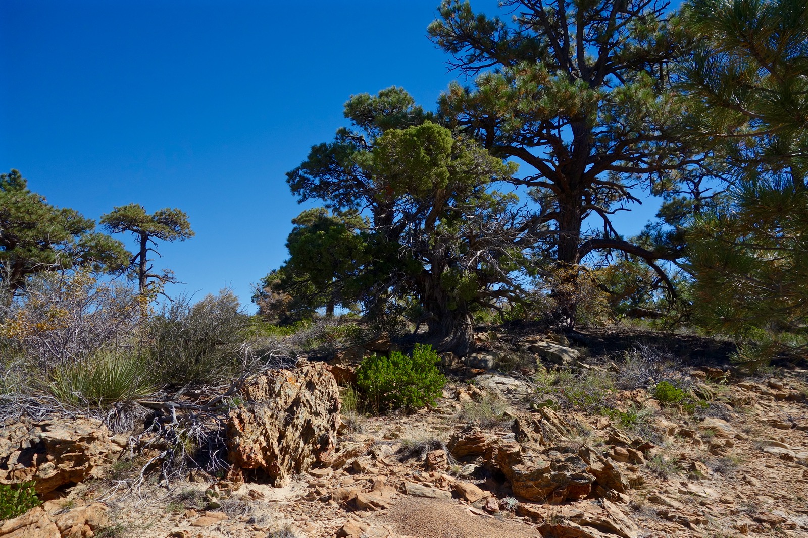
When we arrive, there are 18 vehicles in the parking lot with room for more. There are two ways into the wash from the trailhead, elevation 5,980 feet. Cross the road and walk directly in the streambed, dodging a small, sculptural pouroff. Or, follow the trail on the north side of the wash. It drops into the shallow canyon at 0.1 mile.

The silty stream is easy enough to hop over. Or, splash downstream in river shoes. The canyon is immediately sinuous and constricted.  Navajo Sandstone, the predominate formation on the Colorado Plateau, is the premier slot builder. Willis Creek is accessible, accommodating, and therefore popular.  (THW, photo)

Temperate, ethereal narrows are interspersed with sunny stretches. As the stone peels back, classic Western shrubs and trees fill in the gaps. (THW, photo)

Water has patiently cleaved constricted corridors 200 feet deep.

The canyon is purely elemental: stone, sand, water, sky.  (THW, photo)

At 1.3 miles watch for an arch downcanyon-left. We dub it Pagoda Arch. (THW, photo)

At 1.4 miles, Averett Canyon comes in downcanyon-left. Walls are 300 feet high at this juncture. Local lore has it that a fella by the name of Elijah Averett was gunned down in this canyon in 1866 while pursuing Indian marauders. Walk up the side canyon a very short distance to a barrier fall. A bypass may be possible if you really want to explore Averett. We turn around as the narrows dissipate at 2.0 miles. Now I wish we'd gone just another half mile to the confluence with Sheep Creek.

Bull Valley Gorge:
At the trailhead, elevation 6,075 feet, Bull Valley Gorge is 144 feet deep with a gap of just over three feet. In the mid-1940's, a crude bridge was built across the span linking Bryce Valley with Kanab and Johnson Canyon.

The gorge played the big bully with us, primarily because of mud. Recent flash floods left walls slimy to six feet, mud oozed over the tops of our boots, we waded through knee deep pools. Soon we were encased in mud. Since Bull Valley Gorge only runs when it rains, save this slot for a dry spell.

For the standard route, from the trailhead, walk upcanyon on the right/north side of the slot. The path hangs above the abyss so be mindful. The incision is jump-across narrow. The trail and canyon intersect at 0.5 mile.

Step in and walk down the crack. In less than 0.2 mile a chockstone with a ten foot drop halts progress. In dry conditions, this obstacle can be downclimbed. A Jerry-rigged and questionable webbing and rope system is attached to the wall, shown. Tall people can span the gap. On this day, we can't get leverage because of the mud so we turn back to exploit options. The standard route is an out-and-back as far as you wish in the gorge.

Here's a view of the obstacle from below.

I am emerging from the canyon and returning to the trailhead. (THW, photo)

Absent information, we decide to walk the rim looking for a way down in. Cross the road and walk east on the south side of the gorge. Soon we are on a workable social trail with sporadic cairns guiding through the piñon-juniper forest.

Kelsey (referenced above) notes several near-vertical entrance points, none of which are terribly appealing. 

A little over a mile from the trailhead, elevation 6,140 feet, we come to a promising, substantial side gully marked with cairns. It is steep but the footing is good all the way to the floor of Bull Valley Gorge, 5,770 feet. This image looks up the 0.3 mile gully.

We are delighted. Gigantic boulders at the bottom of the declivity are decorated with cairns but this juncture is unmistakable. Walk upcanyon into beckoning darkness.

The ventricle is strewn with large boulders interspersed with clean-channel walking. Scrambling is easy.

The defile is big on drama. I feel as if I am in Dante's depthless Deep. (THW, photo)

Now 0.8 mile upcanyon from our entrance, we are directly underneath the bridge. In 1954, three men from Cannonville and Henrieville died when their pickup stalled on the south side of the bridge. It rolled backwards and wedged into the narrow slot. Look up. The truck is clearly visible today about 50 feet beneath the bridge. (THW, photo)

In another 0.3 mile, we reach the chockstone that turned us back earlier. If you can bust up the obstacle, your hike is almost over. We give it a shot before retracing our steps downcanyon. We continue past the gully exit and shortly the canyon widens. Here we turn around and walk back on the rim. (THW, photo)

Our total mileage was 6.0. We intended to do a loop: walk down Bull Valley Gorge, up Sheep Creek, out Willis Creek, and back on the road to our car, about 15 miles. However, we mucked around so long in Bull Valley Gorge, we simply drove to Willis Creek Trailhead and did the out-and-back described above.

An important note from author Steve Allen about protecting endangered National Monuments in Southern Utah. 

Tuesday, October 13, 2015

Lick Wash to No Mans Mesa: Grand Staircase-Escalante National Monument

Essence: A hike for people rooted in the American West. Begin in sculptural Lick Wash, a Navajo Sandstone rift in the White Cliffs of the Grand Staircase. Cross Park Wash valley with old old sagebrush, a ranger's cabin, and stock trails. Climb an historic, rough trail to high and dry, pristine No Mans Mesa. No glitz on this Western heritage hike.
Travel: For those traveling south on Cottonwood Canyon Road, Skutumpah Road is 2.8 miles from Utah State Route 12; turn right/south. If you are coming from Kodachrome Basin State Park, drive south to Cottonwood Canyon Road and turn right/north. Skutumpah Road is 4.3 miles ahead. Zero-out your trip meter at the intersection of Cottonwood and Skutumpah (pronounced: Scoot-em-pa!) The condition of this dirt road varies greatly. If it is in good shape, 2WD with good clearance should reach the trailhead. However, the road can have deep ruts and it is very steep in places. In three miles, cross Sheep Creek. At the junction with 530 at 5.5 miles, bear left. Pass the Willis Creek Trailhead in 6.2 miles and Bull Valley Gorge at 8.0 miles. There is a sign for the Lick Wash Trailhead at 18.0 miles. Turn left and drive 0.1 mile to the parking area.
Distance and Elevation Gain: 12 miles minimum; 1,500 feet of climbing or more
Time: 6:00 to 8:00, longer to explore the mesa
Difficulty: Off-trail; navigation moderate; Class 2+ with moderate exposure on the climb to No Mans Mesa
Maps: Deer Spring Point; Deer Range Point, UT 7.5 Quads; Trails Illustrated No. 714, Grand Staircase Paunsaugunt Plateau
Date Hiked: October 13, 2015
References: Hiking and Exploring the Paria River, by Michael R. Kelsey, 1998.
Hiking Grand Staircase-Escalante & the Glen Canyon Region, by Ron Adkison, 2011.
Quote:
Home, home on the range,
Where the deer and the antelope play;
Where seldom is heard a discouraging word
And the skies are not cloudy all day.
--Dr. Brewster Higley, 1873

Cowboys rounding up cattle in October.

Route: Descend southeast through Lick Wash. Walk northeast between Calf Pasture Point and No Mans Mesa on an old two-track and stock trail through Park Wash valley. Climb a weakness in the White Cliffs on the northern end of No Mans Mesa using remnants of the old Jepson Goat Trail.

Lick Wash is overlooked and sparsely visited. There were no footprints beyond the Lick narrows. Sign in at the trailhead register. Either walk down the wash or use the trail from the parking area, elevation 6,280 feet. It cuts off meanders while threading through classic Western vegetation: rabbit brush, sagebrush, and piñon-juniper.

The canyon narrows abruptly at 0.2 mile. Old growth ponderosa pines contrast with weathered, storm-carved sandstone. (THW, photo)

Early morning, the canyon is bone chilling cold. Short interludes of narrows glow in Autumnal dawnlight. (THW, photo)

 Fir and ponderosa are as tall as stone. (THW, photo)

The canyon is exquisite, absolutely beautiful. Episodes of deposition have left finely delineated horizontals in Navajo Sandstone, the most prominent rock layer on the Colorado Plateau.

Emerge from the constricted passageway at 1.1 miles. After a three-day storm, progress is quick on firm sand and cobbles. Mesa rims soar 900 feet above in a series of buttresses. At 2.5 miles, No Mans Mesa comes into the view corridor, rising 1,200 feet above Park Wash. Note an intriguing side drainage, downcanyon-right. This is an enchanting side trip if you have time on your return.

At 4.0 miles, Lick Wash passes the southeast tip of Calf Pasture Point. This is shortly beyond the large alcove shown below, left of the wash.

At elevation 6,000 feet, just as you pass east of the point, watch for a stock trail leaving the wash on the north side. It makes directly for a large sage flat. We have looked the area over carefully; this is the best place to leave the wash.

The path intersects an old road at 4.1 miles. Calf Pasture Point is almost 900 feet overhead. The Utah-blue sky and formidable White Cliffs predominate. This cliff series is but a riser in the Grand Staircase which climbs north out of the Arizona Strip.

Walk north on the two-track through the Park Wash valley. This benign drainageway keeps the two noble mesas forever separated. Artemisia tridentata is gnarled and chest tall. We are here when the rabbit brush blooms and little else--just a few patches of desert gilia, Indian paintbrush and orange globemallow.

The LeFevre Cabin is on the left tucked under a cliff at 4.5 miles. The plywood cabin dates to the 1960's yet it has a 19th century stove. Find a diminutive juniper branch corral.

Pass a fence line at 4.8 miles. At 5.1 miles, leave the road and cross Park Wash, elevation 6,000 feet. Use a stock trail to buck up the steep bank. Plunge east through tangled sage to the base of the northern end of No Mans Mesa, shown below. Here is the only weakness in the otherwise impenetrable barrier wall encircling the mesa.

In 1927, Lewis Jepson built a trail for his goats up through this break to the mesa top. For six weeks, and again in the spring of 1928, goats grazed on the mesa. Oral history conjectures that Jepson was hiding his sizable herd from the gaze of bankers who had a lean on him. Lack of water sent him packing and the mesa has not been grazed since.

We spread out but can't find any sign of Jepson's trail until we gain the first platform at 6,200 feet. Just plow up the steep, talus-strewn debris field.

On the platform, find the cairned route that guides up the rubbly slope and straight into the cliffrock at 6,525 feet.

The route traverses from one break in the rampart to another, weaving up the steep slope. There are some solid stone steps and plenty of loose rock. It is unfriendly if you get off-route. In 2015, the way was subtly marked with cairns. The exposure is mild to moderate.

Notice the path Jepson chiseled for his goats on a sloping boulder.

Pause to take in the Pink Cliffs of Bryce Canyon and Park Wash well below. (THW, photo)

Pass through the old wire gate and fence that restrained the goats and top out at 6,840 feet, 5.7 miles. No Mans Mesa is remarkable. It has that wonderful feel of a place that's been truly left to itself. There are no footprints and no weeds. It is sublimely silent. Walk to the eastern edge for an expansive look at the upper Paria River Canyon and the distant dome of Navajo Mountain.

From the western precipice look down on Park Wash. Lick Wash is in the trench bounded by Deer Spring and Calf Pasture Points.

The huge mesa is five miles long and almost two miles wide. The highpoint is on the southwest edge at 7,218 feet. As indicated on the map, we didn't have time to explore. I plan to return for an extended stay in order to walk the entire mesa rim.

Remnants of the Carmel Formation cap the mesa. Here is but a smattering of the plants we saw on the northern end: ponderosa pine, piñon-juniper, sage, rabbit brush, yucca, manzanita, euphedra, snake weed, prickly pear, penstemon, gilia, and native grasses.

We reluctantly leave this haven of profound peacefulness. Downclimb on the cairned path, returning as you came.

About 2.5 miles from the trailhead, we can't resist the aforementioned side canyon that comes into Lick Wash from the south. Its floor is made of fine-grained silver sand. We squeeze through a shoulder width slot. A pool lies on the other side of a chockstone. Next time. (THW, photo)

Still in the side canyon, we climb a log resting on sandstone to gain access to a bench on the west side of the slot. Sheets of slickrock fan out from the escarpment below Deer Springs Point. Vegetation pockets are spiked with tall trees. We play around briefly, wishing we had all day.

In Lick Wash a hawk screeches at us repeatedly. Ravens chatter incessantly as we pass. Smart birds love to talk.

An important note from author Steve Allen about protecting endangered National Monuments in Southern Utah. 

Sunday, October 11, 2015

Wire Pass to Buckskin Gulch Trailhead: Paria Canyon-Vermilion Cliffs Wilderness

Essence: Permits are available at the trailhead. While Coyote Wash (Wire Pass) is commonly traveled, Buckskin Gulch upstream of the confluence is sparsely visited. Slots and narrows diminish a mile north of the junction. Explore a hidden and fantastical sandstone world east of the wash.
Travel: At mile marker 25.7 on U.S. Route 89, about five miles west of the Paria Contact Station, turn south on House Rock Valley Road. Conditions on this dirt road vary widely but a 2WD vehicle with moderate clearance can usually reach either trailhead.  Buckskin Gulch Trailhead is 4.5 miles down the road; Wire Pass Trailhead, 8.4 miles. While we began at the Wire Pass Trailhead, this out-and-back may be done in either direction. A shuttle will save half the distance. Trailheads have pit toilets but no water.
Fees: Permits for day hiking can be obtained at the self-serve pay station in the parking lot. The fee is $6.00 per person/dog.
Distance and Elevation Gain: 13 miles roundtrip minimum, additional to explore "Pink Pocket;" roughly 500 feet of elevation gain
Time: 6:00 to all day
Difficulty: Extreme flash flood hazard. Hike only on a severe-clear day. Trail, off-trail; navigation easy; mild scrambling in Coyote Wash; no exposure; mud and pools are common;
Maps: Pine Hollow Canyon; West Clark Bench, UT 7.5 Quads; Trails Illustrated: Paria Canyon, Kanab No. 859
Latest Date Hiked: October 11, 2015
Quote: Light is the language of God. Gregory David Roberts

Buckskin Gulch. (THW, photo)
  
Route: Begin at the Wire Pass Trailhead. Walk east down Coyote Wash to Buckskin Gulch. Turn upcanyon/north, and continue to the Buckskin Gulch Trailhead. Detour and explore Pink Pocket, a wonderland of sandstone.

Obtain your day-use permit. Leave the stub on your dash; this parking lot is heavily patrolled since it is the staging area for day hiking in Coyote Buttes North and backpacking in Paria Canyon. From the trailhead, elevation 4,880 feet, cross the road. Either walk in the bed of Coyote Wash or use the trail on the south side.

Early morning, we enjoy peaceful solitude. The Big Four keep company: piñon-juniper, rabbit brush pumping out the wattage in October, and three species of sage in bloom. (THW, photo)

At 0.6 mile, the Coyote Buttes North trail branches right. Leave the trail; stay in the wash. It is flat, rubble free, and lovely. Walls slot up at 1.4 miles.

There are two sets of narrows in the  0.3 mile preceding the confluence. Enter the scalloped passageway. Rosy sandstone shimmers with captured, sunflexed light.

Scramble down a chockstone obstacle with a seven foot drop. Every step through fluted sinuosity is unique and yet nothing is surprising. The union of water and stone creates predictable patterns. (THW, photo)

The slot takes a break in the sun and then tightens up again.

As we approach the confluence the finger canyon is dark, vertical, and hushed with anticipation. I am in love with Coyote. (THW, photo)

At 1.7 miles, emerge at the nexus. Common in significant locations, petroglyphs adorn the base of the southwest wall. Find a 40 foot wavy line and bighorn sheep. Around the corner are more images. (THW, photo)

Here, our route turns upcanyon/left. However, if your passion is slots, I recommend you spend the day in Buckskin Gulch downcanyon and return through Coyote Wash as you came. It is 10.8 miles from here to the Paria River confluence. Please link to my earlier Buckskin/Paria entry for images and text on Earth's longest (and prettiest) traversable slot canyon.

Going upstream toward Buckskin Gulch Trailhead, the constricted corridor runs half a mile. The floor is 8-20 feet wide, the walls are 30 to 100 feet tall. (THW, photo)

The canyon opens gradually, the narrows concluding 0.9 from the confluence at mile 2.6. Conical sandstone structures are captivating. (THW, photo)

To visit Pink Pocket turn right/east into a broad sandy wash at 4.2 miles. Note: if your goal is to spend the day in Pink Pocket, start at the Buckskin Gulch Trailhead and walk 2.0 miles down the wash before going east. The image of the juncture below was taken while walking downstream. The conical point is the landscape marker for the side trip. Slog through deep sand for 0.2 mile. The wash flares from an easily scaled natural stone barrier. Emerge in a slickrock world of exhumed desert sand dunes. We gave the area the informal name Pink Pocket because it is reminiscent of White Pocket with a color adjustment.

The ancient dunes, exposed by uplift and erosion, are Navajo Sandstone, the most prominent rock layer on the Colorado Plateau. Walk on slickrock with characteristic polygonal cracks. On this day, we spent only an hour in Pink Pocket. We returned in April, 2016 and explored all day. First, we climbed the dome, elevation 5,220 feet, south of the entrance. From its crest, Coyote Buttes is visible in the south. We were attracted to the bench made exclusively of turtleback weathering mounds so we went there next.

From there, we found a slope with colorful and complex cross-bedding. This image looks back on the 5,220 foot dome. (THW, photo)

We walked along the slopes of The Dive attracted by huge fin sheets. While these are easy to avoid, Pink Pocket is covered with tiny, fragile fins that mustn't be crushed underfoot.

These outrageous fins are north of the entrance. (THW, photo)

Stupefying fins going every which way cover this knob.  (THW, photo)

Return to Buckskin Gulch and continue upcanyon. The Portal is at mile 5.8 without the side trip. There is a petroglyph panel featuring bighorn sheep upcanyon-right about 100 yards before the narrow passage. We checked out a side canyon coming in from the east; it walls up in 0.4 mile.

Past the Portal, a wide open flat flanked with Vermilion colored globular rock mounds precedes the Buckskin Gulch Trailhead. This is at 6.5 miles without side trips. If you planted a shuttle vehicle, this ends your hike. We are grateful for a second pass through this visually sensational landscape. It is good fortune to be walking on rapidly drying mud instead of tiresome soft sand. The Dive rises high in the east. The highly textured cross-bedded walls are polychromatic.

Our canyon eases into its business of narrowing in fits and starts. Typical of the renowned segment of Buckskin beyond Coyote, even here the canyon floor is uncommonly clean. The vertical, fluted walls have a natural, pleasing orderliness. (THW, photo)

Walk on jets of sunlight. (THW, photo)

We enjoy complete solitude until we arrive back at the confluence with Coyote Wash. There, the canyon was beset with scads of people. Nevertheless, the mystical and inexplicable power of this Earth rift, the luminous quality of ventricle light, prevailed and it always will.