Travel: For those traveling south on Cottonwood Canyon Road, Skutumpah Road is 2.8 miles from Utah State Route 12; turn right/south. If you are coming from Kodachrome Basin State Park, drive south to Cottonwood Canyon Road and turn right/north. Skutumpah Road is 4.3 miles ahead. Zero-out your trip meter at the intersection of Cottonwood and Skutumpah (pronounced: Scoot-em-pa!) The condition of this dirt road varies greatly. If it is in good shape, 2WD with good clearance should reach the trailhead. However, the road can have deep ruts and it is very steep in places. In three miles, cross Sheep Creek. At the junction with 530 at 5.5 miles, bear left. Pass the Willis Creek Trailhead in 6.2 miles and Bull Valley Gorge at 8.0 miles. There is a sign for the Lick Wash Trailhead at 18.0 miles. Turn left and drive 0.1 mile to the parking area.
Distance and Elevation Gain: 12 miles minimum; 1,500 feet of climbing or more
Time: 6:00 to 8:00, longer to explore the mesa
Difficulty: Off-trail; navigation moderate; Class 2+ with moderate exposure on the climb to No Mans Mesa
Maps: Deer Spring Point; Deer Range Point, UT 7.5 Quads; Trails Illustrated No. 714, Grand Staircase Paunsaugunt Plateau
Date Hiked: October 13, 2015
References: Hiking and Exploring the Paria River, by Michael R. Kelsey, 1998.
Hiking Grand Staircase-Escalante & the Glen Canyon Region, by Ron Adkison, 2011.
Quote:
Home, home on the range,
Where the deer and the antelope play;
Where seldom is heard a discouraging word
And the skies are not cloudy all day.
--Dr. Brewster Higley, 1873
Cowboys rounding up cattle in October.

Route: Descend southeast through Lick Wash. Walk northeast between Calf Pasture Point and No Mans Mesa on an old two-track and stock trail through Park Wash valley. Climb a weakness in the White Cliffs on the northern end of No Mans Mesa using remnants of the old Jepson Goat Trail.

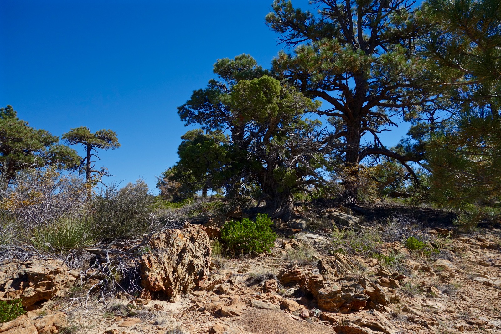
Lick Wash is overlooked and sparsely visited. There were no footprints beyond the Lick narrows. Sign in at the trailhead register. Either walk down the wash or use the trail from the parking area, elevation 6,280 feet. It cuts off meanders while threading through classic Western vegetation: rabbit brush, sagebrush, and piñon-juniper.

The canyon narrows abruptly at 0.2 mile. Old growth ponderosa pines contrast with weathered, storm-carved sandstone. (THW, photo)

Early morning, the canyon is bone chilling cold. Short interludes of narrows glow in Autumnal dawnlight. (THW, photo)

Fir and ponderosa are as tall as stone. (THW, photo)

The canyon is exquisite, absolutely beautiful. Episodes of deposition have left finely delineated horizontals in Navajo Sandstone, the most prominent rock layer on the Colorado Plateau.

Emerge from the constricted passageway at 1.1 miles. After a three-day storm, progress is quick on firm sand and cobbles. Mesa rims soar 900 feet above in a series of buttresses. At 2.5 miles, No Mans Mesa comes into the view corridor, rising 1,200 feet above Park Wash. Note an intriguing side drainage, downcanyon-right. This is an enchanting side trip if you have time on your return.
At 4.0 miles, Lick Wash passes the southeast tip of Calf Pasture Point. This is shortly beyond the large alcove shown below, left of the wash.

At elevation 6,000 feet, just as you pass east of the point, watch for a stock trail leaving the wash on the north side. It makes directly for a large sage flat. We have looked the area over carefully; this is the best place to leave the wash.

The path intersects an old road at 4.1 miles. Calf Pasture Point is almost 900 feet overhead. The Utah-blue sky and formidable White Cliffs predominate. This cliff series is but a riser in the Grand Staircase which climbs north out of the Arizona Strip.

Walk north on the two-track through the Park Wash valley. This benign drainageway keeps the two noble mesas forever separated. Artemisia tridentata is gnarled and chest tall. We are here when the rabbit brush blooms and little else--just a few patches of desert gilia, Indian paintbrush and orange globemallow.

The LeFevre Cabin is on the left tucked under a cliff at 4.5 miles. The plywood cabin dates to the 1960's yet it has a 19th century stove. Find a diminutive juniper branch corral.

Pass a fence line at 4.8 miles. At 5.1 miles, leave the road and cross Park Wash, elevation 6,000 feet. Use a stock trail to buck up the steep bank. Plunge east through tangled sage to the base of the northern end of No Mans Mesa, shown below. Here is the only weakness in the otherwise impenetrable barrier wall encircling the mesa.
In 1927, Lewis Jepson built a trail for his goats up through this break to the mesa top. For six weeks, and again in the spring of 1928, goats grazed on the mesa. Oral history conjectures that Jepson was hiding his sizable herd from the gaze of bankers who had a lean on him. Lack of water sent him packing and the mesa has not been grazed since.
We spread out but can't find any sign of Jepson's trail until we gain the first platform at 6,200 feet. Just plow up the steep, talus-strewn debris field.

On the platform, find the cairned route that guides up the rubbly slope and straight into the cliffrock at 6,525 feet.

The route traverses from one break in the rampart to another, weaving up the steep slope. There are some solid stone steps and plenty of loose rock. It is unfriendly if you get off-route. In 2015, the way was subtly marked with cairns. The exposure is mild to moderate.

Notice the path Jepson chiseled for his goats on a sloping boulder.

Pause to take in the Pink Cliffs of Bryce Canyon and Park Wash well below. (THW, photo)

Pass through the old wire gate and fence that restrained the goats and top out at 6,840 feet, 5.7 miles. No Mans Mesa is remarkable. It has that wonderful feel of a place that's been truly left to itself. There are no footprints and no weeds. It is sublimely silent. Walk to the eastern edge for an expansive look at the upper Paria River Canyon and the distant dome of Navajo Mountain.

From the western precipice look down on Park Wash. Lick Wash is in the trench bounded by Deer Spring and Calf Pasture Points.

The huge mesa is five miles long and almost two miles wide. The highpoint is on the southwest edge at 7,218 feet. As indicated on the map, we didn't have time to explore. I plan to return for an extended stay in order to walk the entire mesa rim.
Remnants of the Carmel Formation cap the mesa. Here is but a smattering of the plants we saw on the northern end: ponderosa pine, piñon-juniper, sage, rabbit brush, yucca, manzanita, euphedra, snake weed, prickly pear, penstemon, gilia, and native grasses.
We reluctantly leave this haven of profound peacefulness. Downclimb on the cairned path, returning as you came.

About 2.5 miles from the trailhead, we can't resist the aforementioned side canyon that comes into Lick Wash from the south. Its floor is made of fine-grained silver sand. We squeeze through a shoulder width slot. A pool lies on the other side of a chockstone. Next time. (THW, photo)

Still in the side canyon, we climb a log resting on sandstone to gain access to a bench on the west side of the slot. Sheets of slickrock fan out from the escarpment below Deer Springs Point. Vegetation pockets are spiked with tall trees. We play around briefly, wishing we had all day.

In Lick Wash a hawk screeches at us repeatedly. Ravens chatter incessantly as we pass. Smart birds love to talk.
An important note from author Steve Allen about protecting endangered National Monuments in Southern Utah.
No comments:
Post a Comment