Friday, June 30, 2017

Jura Knob, 12,614': Durango's Four-Season Mountain

Essence: All but 3.5 miles are on gentle-grade trails. Short scramble at summit block turns the knob into a real mountain. Popular four-season trek for locals. Route features incomparable views of Engineer Mountain, Jura's southern neighbor. New in 2017! Descend north from Jura Knob and walk the ridge encircling the Deer Creek basin. Climb Peak 12,594' (E3) and E4 and finish at the Deer Creek Trailhead.
Travel: From Durango, drive north on US Route 550 for 35 miles to Coal Bank Pass. Continue for one mile to mile marker 58. Park on the right side of the highway at a generous turn-out. Allow 45 minutes from Durango.
Distance and Elevation Gain: Coal Creek Trailhead to Pass Trailhead, 9.7 miles with 2,700 feet of climbing; 11.0 miles if you walk  back to your vehicle on US 550.
Coal Creek Trailhead to Deer Creek Trailhead, 9.0 miles with 2,900 feet of vertical. Hitchhike back to your vehicle or add 1.4 miles and 600 feet of uphill on the highway.
Time: 5:00 to 6:00
Difficulty: Trail, off-trail; navigation moderate; One Class 3 pitch with mild exposure
Map: Engineer Mountain, Colorado 7.5' USGS Quad, or Apogee Mapping
Latest Date Hiked: July 11,2023
Quote: The simple things are also the most extraordinary things, and only the wise can see them. Paulo Coelho, The Alchemist

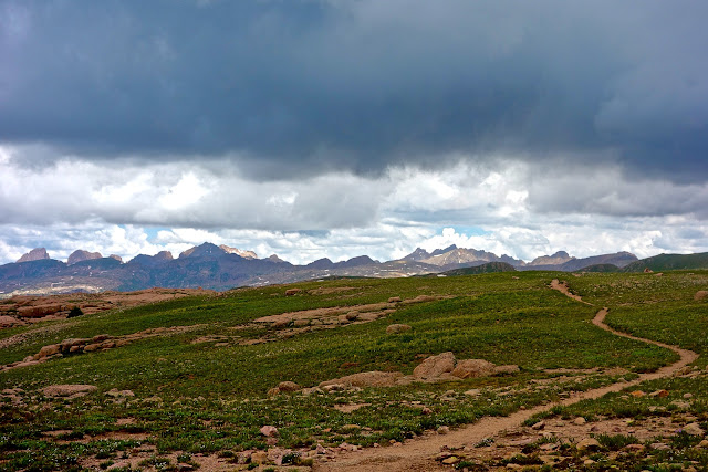
Jura Knob, left of center, appears after a mellow approach inspiring the thought, "Oh! I'm climbing a mountain after all."

Route: The black-line route is the standard loop hike to Jura Knob. Begin on the Coal Creek Trail, summit Jura Knob, and finish at the Pass Creek Trailhead. The hike works equally well in the opposite direction. Engineer Mountain is an optional side trip from this loop. The blue-line route descends from Jura Knob to the north, goes over Peak 12,594' (E3), Point 12,569' (E4), and stays on the ridge until it intersects the Deer Creek Trail. To climb Jura Knob from the Engineer Mountain Trail see the Molas Pass to Coal Bank Pass thru-hike. [2021 Note: the Pass Creek Trail is now called simply the Pass Trail.]

From mile marker 58, walk downhill on US 550 for 0.1 mile. Cross the road and find the lopsided sign for the Coal Creek Trail at 10,200 feet. The thin track scraped into a steep slope suspended above the two-lane rises steadily. Soon the path is swallowed by a subalpine fir forest and the road is forgotten. Loopy switchbacks are lined with limestone. Heavy timber gives way to sporadic trees at 11,200 feet, 2.2 miles. It is as smooth and easy as any 1,000 foot gain can be.

Engineer Mountain arises and remains a dominate presence for the duration. Columnar shafts snatch light. Luminescence shifts continuously, captivating the observer.

The Coal Creek Trail multi-threads and disappears overtaken by boisterous corn husk lily. If you lose the trail climb north for 0.15 mile and you will find it once again on an easterly ridge at the saddle west of Point 11,662'. Go west and reach the junction with the Deer Creek Trail at 2.6 miles. 2020 Note: The Coal Creek Trail is newly popular with mountain bikers and is impossible to miss.

If you are doing the blue-line route and wish to avoid the US 550 disconnect you may hike up the Deer Creek Trail to this location but it is steep, loose, and sun drenched. 2020 Note: These charming signs are now missing.

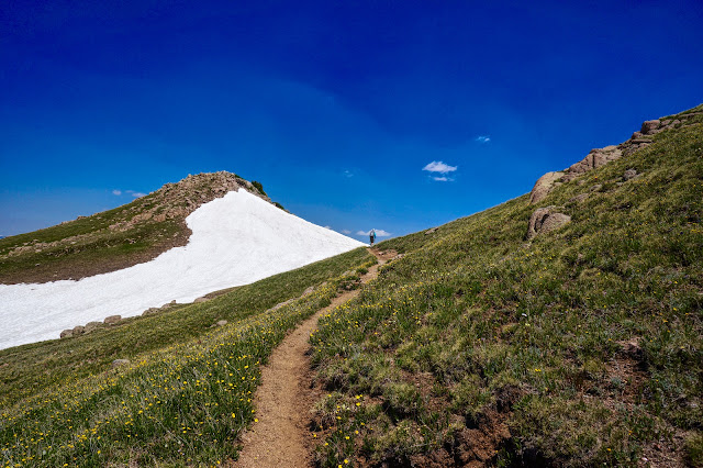
Continue west on the Coal Creek Trail for a few paces. Leave the trail and climb right/north up a short grassy pitch to meet the south ridge of Jura Knob at 12,000 feet. The ridge is a broad, wide-open expanse. Follow it to the false summit, shown. Walking is pleasant through a grassy landscape with almost no rock underfoot. (THW, photo)

Cross a band of whimsical white sandstone.

The summit structure presents as a cliff intruding through a red band. The crest is a relatively thin layer of grey rock. Local geologist John Bregar commented on Jura's rock formation. "The cliff band that is the crux of climbing Jura Knob is within the Cutler Formation. Though most of the Cutler consists of red alluvial sediment washed down from the Uncompahgre Mountains, there is much variability in that sediment--some layers are relatively find-grained and soft, other layers are coarse sand and gravel.  Often the coarser sediments are more resistant to erosion and form cliffs while the softer sediments erode more easily to form the overlying and underlying slopes. There can even be an occasional limey bed within the Cutler, probably representing a temporary lake deposit. The summit of Jura Knob is made up of some of those limey deposits."

The ridge narrows just before the crux. Snow lingers late and accumulates early.

Upon reaching the red layer, stay on the ridgetop until you are forced to leave. Climb the remaining crumbly section on the right as shown. There is mild exposure here.

The crux is a single, seven foot hoist up the Class 3 "Corner Wall." It is located on the right/east side of the prominence. This is the easiest attack point. Some people may need a boost because, while handholds are good, footholds are stingy. The pitch is too much for dogs.

Next is a short and delightful block scramble and then a soft ridge walk to the summit at 4.2 miles. The crest is roomy and even though Jura is not the tallest mountain around, its singular location affords a sweeping vista of loftier peaks. Looking north, Vermilion Peak, 13,894', is just left of center in this image with Fuller Peak to its right. Rolling Mountain is image-left and the Twin Sisters are on the right. (THW, photo)

Jura Knob looks over the massive rock glacier on the north slopes of Engineer. The singular terrace of Grayrock Peak and Graysill Mountain is to my right. (THW, photo)

Black-line loop to the Pass Trailhead
Scramble down Corner Wall facing the rock. Shorter people may need a spot. Descend the south ridge as you came. Approaching the southern end, avoid any temptation to drop off to the right. Instead, as shown on the track above, make for the 12,000 foot knoll. There you will see the Deer Creek Trail 100 feet below at 5.8 miles. Go right/west and at 6.2 miles, come to a junction with the Engineer Mountain Trail. Turn left/south. Cross more green loveliness and enter a rich stand of conifers. The trail climbs lazily until it meets the Pass Trail at a 4-way junction at 7.2 miles, 11,720 feet.

Here, our route turns left/east. However, if you are tempted to climb Engineer Mountain, 12,968', this is a fine opportunity. Simply turn right/west, shortly reach Social Rock, and carry on from there. This option will add 1.5 miles roundtrip and 1,250 feet of climbing.

The Bus Stop is a few paces down the Pass Trail and a favorite place for a break. From here, the trailhead is 2.4 miles down a well-engineered ultra popular trail for hikers and mountain bikers.

As you descend the trail, watch to your left for a final view of Jura Knob. The groomed dirt path is guarded by old and stately fir and spruce trees. At 8.3 miles, find a spur that hooks right and goes to a brook where queen's crown thrives. Pass a perfectly round pond at 8.6 miles. The pleasant grade is accomplished by sinuous switchbacks. Just before reaching the highway, in mid-summer the trail is engulfed by some of the best wildflowers in Colorado.

Reach the Pass Trailhead at 9.7 miles. If you must walk down the highway to the Coal Creek Trailhead, this will be the most dangerous segment of your hike so take care. 

Blue-line route to the Deer Creek Trailhead
The terrain drops softly from Jura's summit on the north ridge; utilize a social trail through broken limestone. The Colorado Trail is quite close to the northwest. Pass east of two small ponds and simply follow the ridge as it swings east to ascend Peak 12,594' (E3). The saddle is at 12,220 feet making this ridge roller a legal summit. Climb the uniform gentle slope and crest at 5.4 miles. (THW, photo)

Be sure to look over the north side into a seldom visited basin south of the Lime Creek drainage. We saw (and heard) the largest herd of elk any of us had ever witnessed--200 strong at least.

The east side of Peak 12,594' has a cliff band equivalent geologically to Jura. However, the Class 2+ downclimb is without challenge. This image looks back at the scramble. The flower in the foreground is the uncommon Colorado tansy aster. We tracked four other somewhat rare flowers in this region: ivesia (mousetail), townsendia (Easter daisy), mountain dryad, and physaria (bladderpod).

The final prominence, Point 12,569' (E4), is easily gained. From there the ridge broadens as it moves south. To the east lies the Weminuche Wilderness cluttered with quirky and preposterous peaks in the Needle Mountains.

 Look back on the Deer Creek basin and ridge. (THW, photo)

There is more than one route down to the Deer Creek Trail. We followed a southeast rib somewhat steeply through a healthy fir and spruce forest. The east-bearing trail is well-established and obvious. Just be sure to intersect the trail before it begins making switchbacks at 10,700 feet pointed south. Plunge through an aspen forest, the trees old and tall, vibrant green leaves fluttering.

If you are hitchhiking back to the Coal Creek Trailhead, walk up the highway to the next bend where there is a sizable pull-out to strengthen your chances of getting a ride.

Jura is commonly climbed in winter when it is indisputably more challenging. Approach the peak via either the Coal Creek Trail or Pass Trail. I prefer the latter because there is usually a beaten track up to Engineer Meadow. It is 11 miles out-and-back. We generally stash snowshoes at the crux. Corner Wall is dicier in the winter; it holds ice and snow. The exposure is amplified. The potential for avalanche exists at several places along the way. Figure 6 to 7 hours.

Wednesday, June 28, 2017

Sheridan Mountain, 12,795'; Crevasse, 12,311', Via Endlich Mesa

Essence: Pleasant, fast trail hike across a gently rolling and expansive tundra-topped mesa straddling the Florida River and Vallecito Creek drainages. Steep, enjoyable climb to the peak at the north end of the mesa. Uninterrupted views of the quirky and preposterous Needle Mountains are superlative. Return on the crenelated east rim of Endlich Mesa to Crevasse whose limestone skin is breaking apart. Outrageous hike on top of the world is worth the jarring, slow drive to the trailhead.
Travel: In Durango, zero-out your trip meter at the corner of East Animas Road, CR 250, and Florida Road, CR 240. Go north on CR 240. At 12.0 miles (Helen's Store), continue straight on CR 243, following the sign to Lemon Reservoir. In 13.7 miles reach Lemon Dam. Drive on a gravel road along the east side of the lake, passing a campground. At 19.1 miles the road splits. (To the left is Transfer Campground.) Turn right on FSR 597, East Florida Road. For the next very slow 10.7 miles, the road is rocky and riddled with large potholes requiring 4WD, high clearance. After rain, the potholes are ponds. The track climbs steadily but is not steep or exposed. At 25 miles, pass a series of clearings chock full of orange sneezeweed, encircled by heavy conifer and aspen forests. At 27.4 miles go right, avoiding FSR 597C. At 29.2 miles bear right again, avoiding FSR 597D. At 29.6 miles go left at an unnamed fork. Reach generous trailhead parking at 29.8 miles. The rough road will leave you feeling like a bobblehead doll. Allow 1:30 to 2:00 from Durango.
Distance and Elevation Gain: Sheridan is 12.0 miles roundtrip with 2,450 feet of climbing. The east rim return to Crevasse is 13.5 miles total with 3,050 feet of vertical.
Time: 6:00 to 8:00 depending on route
Difficulty: Fast trail, off-trail; navigation moderate (plenty of opportunities to get lost out there); no exposure; Class 2+
Maps: Lemon Reservoir; Vallecito Reservoir; Columbine Pass, Colorado 7.5' USGS Quads; Weminuche Wilderness, Trails Illustrated #140
Latest Date Hiked: September 22, 2019
Quote: There are always flowers for those who want to see them. Henri Matisse

The wooded east slope of Sheridan Mountain plummets over 4,000 feet to Vallecito Creek. North of the peak granite slabs rise to Sheep Mountain, 13,070'. Unseen to the west is City Reservoir and the Florida River watershed. This shot was taken from Peak 12,490' on Endlich Mesa.

Route: The bulk of the distance is quickly made on the Endlich Mesa Trail (EMT). Only the final half mile and 700 feet of vertical is off-trail. If weather is favorable, return on the east rim of Endlich Mesa ascending four numbered points to Crevasse before rejoining the trail.

Several vehicles will inevitably be parked in the trailhead lot. The EMT is popular with backpackers for whom wonderful possibilities exist. Trek north to Columbine Pass. From there it is a quick drop into Chicago Basin, the basecamp for remote 14'ers and high 13'ers. 

The trail is eroded, braided, and somewhat ambiguous. However, there are cairns leading due east from the trailhead, elevation 11,280 feet. Spur 534 contacts the EMT coming up from the south in 0.6 mile. If you have confidence in your navigation abilities just shy of 0.4 mile leave the spur and go northeast through a well-spaced forest to intersect the trail at 0.9 mile. 

The ridge is broad and treed for the first mile. The trail utilizes an old road. Orange sneezeweed is the predominant flower in July.

The trail traipses through a rich field of dusky, rosy paintbrush and elegant death camas. Be careful not to brush against this ultra poisonous plant. The San Juan's startling, jagged horizon is continuously visible from the mesa: Pigeon, Turret, Eolus, Windom, Sunlight, Jupiter...

In 1.4 miles, at Point 11,958', the trail drops 80 feet down a limestone outcrop. Lining the path are lilac Colorado tansy asters, an uncommon plant on the species-of-concern list.

At the base of the knob follow the trail carefully through willow patches bearing northeast. Judging from the braided wildcat trails many travelers stay on the stone rib and end up too far west. The EMT heads northeast toward open tundra country on the east side of the mesa. In this image the Weminuche Wilderness boundary sign is buried by snow. (This sign was gone in 2019 but the two posts are there.)  Look afar for the tall cairns that mark the EMT. (THW, photo)

The hike crosses five miles of uninterrupted tundra. In the ever-nearing distance are monumental peaks.

Limestone transitions to 1.46 billion year old crystalline Eolus Granite. The medium to coarse-grained porphyritic biotite-hornblende quartz monzonite covers 100 square miles in the southern Needle Mountains. The igneous formation developed below the surface as magma and is dated from when it hardened into rock. The smooth trail is a linear sculpture as it meanders through pink, spheroidal boulders. Great slabs mound up from the grass. Ascend gradually to Pass 12,300' at four miles. (THW, photo)

This vantage point affords the first view of Sheridan Mountain, the double prominence image-center. From the pass, the trail drops 300 feet. I have contoured off-trail along the west slope of Point 12,470', image-right, but I got cliffed out and had to drop back down to the trail.

At 4.7 miles there is an unsigned junction, shown below. The formal Endlich Mesa Trail descends left/north to City Reservoir in Upper Park. To reach the peak, continue straight on the "Sheridan Mountain Spur Trail." This elk, sheep, and human multi-thread contours around Point 12,442', image-center.

On the north side of Point 12,442', a secondary trail goes west to City Reservoir. Reach the Sheridan saddle, elevation 12,060 feet, at 5.5 miles. Leave the trail and climb the somewhat steep south ridge of the mountain on crushed granite.

There is a false summit after 520 feet of climbing. Either go around it on the west or through the top boulders. Drop 50 feet to a saddle and climb again to a second inconsequential bump before seeing the actual peak. Sheridan has a welcoming stone stairway that leads directly to the zenith at six miles. Judging from the peak register the summit is rarely visited. (THW, photo)

The unexpected greets you. To the north are glaciated sheets of granite interspersed with water pockets. Heading the great divide are Amherst, Organ, Emerson, and Sheep Mountains. (THW, photo)

To the northwest, the mind-numbing Needle Mountain lineup is closing in and calling.

East Rim of Endlich Mesa to Crevasse
Twice I've been caught in the rain returning from Sheridan. Once, the storm was severe dropping hail and torrents of water, lightning flashing so close I felt like a sitting duck for miles. If there is no threat of electrical storms seize the opportunity to travel along the very edge of Endlich Mesa. It adds only 1.5 miles and 600 feet of elevation gain.

From the summit retrace your steps for two miles back to Pass 12,300'. Leave the trail 0.2 mile south of the pass and climb the soft northwest ridge of Peak 12,490'. Ridges emanate east from the mesa in a surprisingly chaotic manner. There is a fine view of Sheridan from this legal summit.

Stay close to the edge and within moments you will discover reason enough for the extra effort. In the foreground are spheroidal fins and spires. The dark and severe north face of Point 12,450' contrasts with the soft forms of the crenelations. You could throw a rock from here and hit the EMT. Yet, from the path there is no indication of the wonders at the rim. (THW, photo)  

Summiting Point 12,450' is recommended for those who relish knife ridges.

The journey to Point 12,270' affords a view of Vallecito Reservoir in its entirety. Talus blocks lead to Point 12,305'. Then the ground is calm and uniform, covered in small tan plates. We were fortunate to be here as the snowpack was melting making ephemeral sculptures out of tightly-bonded cornices. The limestone caprock of Crevasse is seen in the near distance. Climb the short broken wall. (THW, photo)

Crevasse is one of the most unexpected and wildest places in Colorado...and well named. The whole summit block is breaking apart leaving a puzzle-like maze of cracks up to 20 feet deep. The surface is composed of 350 million year old Leadville Limestone. It overlies structurally weaker Ouray Limestone of the Devonian age (400 million years ago). The Ouray collapsed under the weight of the overburden, causing the Leadville to fracture. The cracks have widened with erosion. One billion years of Earth history is missing between the Ouray Limestone and Eolus Granite. (THW, photo)

The deepest and widest fissures are toward the south. Jump the narrow slashes and zigzag around wide gashes. Eventually, work your way to the west side of the mountain. (THW, photo)

There are multiple ways to return to the EMT. We stayed above the willow line while moving north. Then we dropped west into a lush basin filled with alpine buttercups. We rejoined the trail at the wilderness boundary.

Following are some of the flowers blooming in late June, from lowest to highest in elevation: native honeysuckle, current, geyer onion, western and edible valerian, columbine, kittentail, orange sneezeweed, elegant death camas, Jacob's ladder, glacier lily, fairy candelabra, candytuft, mouse ear chickweed, draba, alpine avens, rosy paintbrush, alp lily, moss campion, sulfur paintbrush, old man of the mountain, marsh marigold, American bistort, sky pilot, purple fringe, snowball saxifrage, alpine clover, deep rooted spring beauty, mat penstemon, and aromatic phlox.

Saturday, June 17, 2017

Helmet Peak, 11,969', to Rush Basin

Essence: A short out-and-back that provides a unique perspective on the La Plata Mountains from the westernmost peak in the range. Huge views into the wide-open west from this humble peak out there all by itself. Helmet is the launch point onto a two-and-a-half mile ridgeline traverse to Rush Basin, a hidden high alpine cirque.
Travel: From the US 550/160 intersection in Durango, travel west on US 160 for 24.7 miles to the signed Echo Basin Road (Mile Marker 58.6) and turn right/north on MC 44. Zero out your trip meter. Stay on the main road, passing old homesteads and hay meadows. In 2.4 miles pavement turns to gravel and transitions to FSR 566. The roadbed deteriorates at 3.8 miles where winter plowing stops. The track climbs steadily through scrub oak to a cattle guard at 6.4 miles. Directly east is The Hogback. Grazing ceases and on the other side of the guard are acres of blooming mule's ears in early summer. At 6.8 miles take the right fork, staying on FSR 566. Climbing, the road passes through an aspen forest, the floor covered in wildflowers. At 8.0 miles the road forks again; turn right. 4WD with HC and sturdy tires are needed on the choppy track. Turn right/south on FSR 322 at 10.3 miles and cross a talus field at 11 miles. Go over a little pass, elevation 10,951 feet, between The Hogback and Helmet Peak. Park on the rocky parking platform at 11.5 miles. Allow 1:00 to 1:15 from Durango.
Distance and Elevation Gain: Helmet Peak: 2.0 miles round trip with 1,020 feet of climbing. Total for the peak and Rush Basin: 6.8 miles with 2,770 feet of climbing.
Total Time: 2:00-3:00 for Helmet, 5:00 for a leisurely walk to Rush Basin
Difficulty: Off-trail; moderate navigation; no exposure.
Maps: Rampart Hills; La Plata, Colorado 7.5 USGS Quads
Latest Date Hiked: June 17, 2017 
Quote: There is a way that nature speaks, that land speaks.  Most of the time we are simply not patient enough, quiet enough to pay attention to the story.  Linda Hogan

A hiker glissades down the Helmet Peak summit cornice. Hesperus Mountain is on the left and Rush Basin is nestled under Spiller Peak. (THW, photo)

Route: Helmet Peak is due east of the parking platform at 10,960 feet but rock glaciers and spectacular west-face cliffs prohibit a direct approach. Ascend southeast to Saddle 11,580'. Climb the south ridge to the summit and return as you came. For the optional walk to Rush Basin head northeast over three numbered points. Return on a prominent bench before regaining the ridge.

From the parking area at 10,960 feet, unbounded views disappear into the blue distance. The town of Mancos is 4,000 feet below on the valley floor. Point Lookout identifies Mesa Verde National Park and to its right is Sleeping Ute Mountain.

Just beyond the platform the road does a triple split. Take the upper left branch through a talus field.

In 0.1 mile leave the road and launch east-southeast up a slope with a consistent pitch. Follow the glades in the spruce-fir forest keeping the prominent rock glacier rolling off Helmet Peak just to the left/north. There is a maze of roadways on the west-facing slope and you will cross abandoned tracks several times. Reach the treed saddle, elevation 11,580 feet, in 0.7 mile. There is a small opening revealing the western massif of the La Plata range. Gibbs Peak, 12,286', is image-center.

The summit is just 0.3 mile off with 400 feet of climbing remaining. Ascend the Class 2 south ridge, a mix of dirt and talus. A social trail comes and goes; just stay near the ridgetop.

Crest Helmet Peak at one mile.

Situated west of the principle range, the summit provides a unique perspective on westerly faces. On the skyline from the left: Hesperus Mountain, Lavender Peak, Mount Moss, Spiller Peak, Middle Babcock, Burwell Peak, and Gibbs Peak.

Off-image,  Lone Cone is a solitary thrust to the northwest; the San Miguel Mountains are a triple threat; El Diente Peak, Mt. Wilson, and Wilson Peak form a bulky cluster of fourteeners; and Lizard Head juts radically. (THW, photo)

The American West is home and in this moment the sense of cavernous space overwhelms.The Colorado Plateau extends south and west until it falls off the curve of the world. Due west is The Hogback. The first time I climbed Helmet we started west of The Hog to add interest, mileage, and elevation. We climbed a total of 3,650 feet by parking on FSR 566 and dropping through shrubs and deadfall into Hells Hole. After gaining the ridge, we bashed and thrashed our course in a spectacularly and constantly cluttered forest for almost four miles across The Hog. I do not regret it but neither do I recommend it. Of course, hours into the trek, we crossed the very road where your car will likely be parked. In this image, the rock glacier runs right into The Hogback. (THW, photo)

Rush Basin
The ridgetop cross over to Rush Basin adds 4.8 miles and 1,750 feet of climbing. Snowfall during the winter of 2016/2017 was exceptional. We planned to walk to Rush Basin but the ridge, basin, and bench were covered in deep snow. (THW, photo)

To reach Rush Basin simply follow the ridge from Helmet to the northeast, shown. Drop off the summit on a grassy slope, crossing an old wagon road. From the minor saddle at 11,420 feet climb and tag Point 11,490' at 1.5 miles. Continue past Point 11,522', and go over the highest prominence of the hike, Point 12,201' at 3.1 miles.  

The stark and colorful ridge is appealing as seen from the Rush Basin Bench in autumn. There is some easy scrambling on the ridge and the 260 foot descent to the shared saddle with Spiller Peak. (THW, photo)

Descend another 100 feet into the basin at 3.4 miles, elevation 11,840 feet. The west ridge of Spiller Peak, 13,123 feet, rises over the tundra-bound lake, headwaters of the East Mancos River. The most direct route up Spiller is from Rush Basin. Gain the 12,500 foot saddle between Spiller and Burwell Peak (image-right) and climb the south ridge. (THW, photo)

To return, walk southwest on the irresistible and alluring bench, a tableland that rests between the out-going ridge and the river canyon well below. Resist bench suck and climb back to the ridge in about 0.9 mile when the land is just starting to drop off the contour. Further on the gravel-covered hard pan slope is ultra steep. Avoid it. (In 2017, a wildcat trail materialized on the bench and continued to the ridge west of Point 12,201'.) This image was taken from Point 12,070', a thin westerly ridge between Gibbs and Burwell. It provides a superior view of the lake, bench, and ridge to Rush Basin. Helmet is off-image to the left. (THW, photo)

Retrace your steps over the top of Helmet Peak.

Below, Helmet Peak presides over a riot of mule ears on FSR 566.

Helmet's western escarpment is seen from the air in May, 2011.