Travel: From Tucson's Skyline Drive, go north one mile on Alvernon Way to the Richard McKee Finger Rock Trailhead. Park in a large lot on the left. There is a drinking faucet but no other facilities. No dogs.
Distance and Elevation Gain: 7.0 miles; 3,250 feet of climbing
Time: 5:00 to 7:00
Difficulty: Trail, off-trail; navigation challenging; for experienced Class 3 scramblers; mild exposure
Map: Tucson North, AZ 7.5 Quad, or Pusch Ridge Wilderness, Coronado National Forest, USDA Forest Service, 1:24,000
Latest Date Hiked: November 28, 2016
Pusch Ridge Wilderness Bighorn Sheep Closure: It is prohibited to travel more than 400 feet off designated Forest Service trails from January 1 through April 30, bighorn sheep lambing season. The off-trail portion of Pontatoc Ridge is off-limits during that time period.
Quote: In certain landscapes, the planet reveals its skeleton. I come here for this reason, walking the bones of the earth. There are no ambiguities other than what I bring with me, and even those begin to wear away in this place.
Craig Childs
Lower Pontatoc Ridge begins with the rawboned gendarme, Point 5,391', and descends to familiar Pontatoc Point 5,080' before sliding to a halt in Sonoran lowlands. (THW, photo)

Route: Hike the old Pontatoc Canyon Trail to its end. Climb to Saddle 5,140' and explore Point 5,391'. Backtrack to trail's end to bypass the gendarme and scale the ridge. Climb Pontatoc Point 5,080' from the unconventional northeast side. Then, stay on the ridge to elevation 3,200 feet. Divert back to the Pontatoc Trail. Caution: Do this hike as described in the clockwise direction to prevent a dangerous and ambiguous downclimb at Point 5,391'.

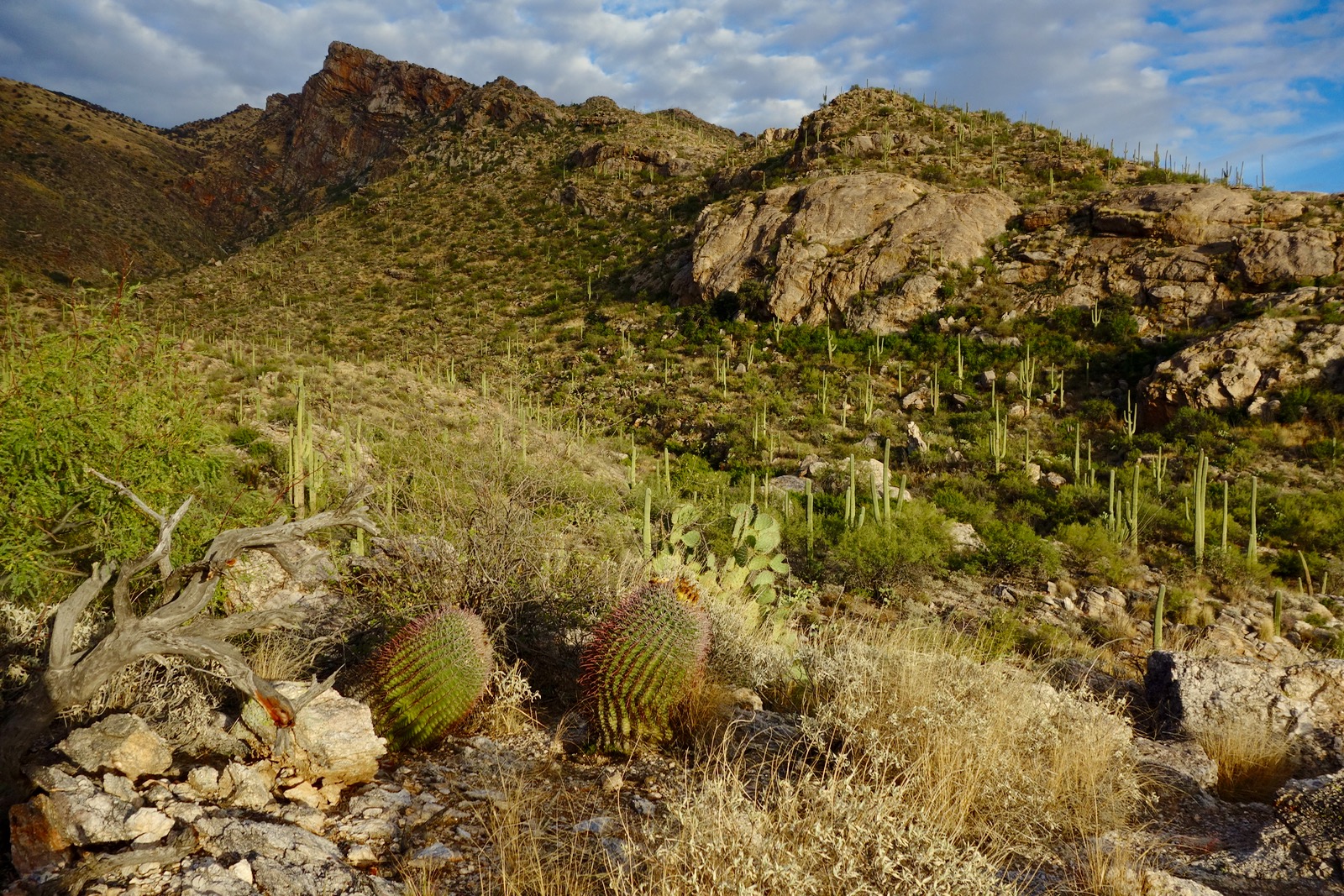
From the Finger Rock Trailhead at 3,060 feet, immersion in the Sonoran landscape is immediate. The slope of the Pusch Ridge incline syncs perfectly with the human traveler. I feel a sense of gladness and incredulity while walking on a thread of bedrock. At the signed junction in 0.1 mile, Finger Rock Trail #42 branches left. Proceed straight on Pontatoc Trail #410.

At 0.5 mile, note a gorilla trail branching toward the base of Pontatoc Ridge. If you get lucky, you'll peg this on the return. The trail goes over two small ridges before crossing Pontatoc Canyon at 0.7 mile. Occasionally, there is water in the wash but don't count on it. Reach a signed junction at 0.9 mile. Pontatoc Ridge Trail #411 goes off on a hard right (renamed the Garnet Trail in 2025). Stay on Pontatoc Trail #410, formerly called the Pontatoc Canyon Trail. For information on the ridge trail and caves, see the end of this post.

The Pontatoc Canyon Trail initiates on the southeast side of the drainage, rising with the canyon. Locate the Old Spanish Mine caves in this image near the top of the imposing cliff.

At 1.4 miles, 3,600 feet, the trail crosses to the northwest side of the wash. It soon moves away from the drainage and makes short switchbacks up the east-facing slope. The primitive trail is thin with grass in the track. Watch for it. The angle is typical Pusch Ridge steepness. My attention is diverted by the distinctive horizontal striations adorning the Pontatoc escarpment.
Cross a grassy hillside on the contour before switchbacking down into the Amphitheater at 2.2 miles. A side draw comes in from the north to merge with Pontatoc Canyon before they plunge united into a trench. The track crosses the convergence on Catalina Gneiss and goes up the east side for a tenth of a mile before crossing back to the west. The Amphitheater is quite beautiful, a turn-around for many judging from the neglected trail beyond this point.

Back on the northwest side, shindaggers encroach on the path as it climbs the slope directly across from Pontatoc Point. From this vantage, get a sneak preview of the bypass around Point 5,391', shown. Locate the skyhole in the gap. Our route aims for the window before scrambling on its right to the spine.

The final segment of the Pontatoc Canyon Trail has degenerated into a route. In 2013, the trail was discernible but now even the platform has been absorbed back into the earth. The trail has languished because it doesn't go to a destination proper. Bear northeast on the grassy, rounded ridge, watching for faded orange flagging and occasional cairns marking the underutilized track. The ribbons are tied to ocotillo and the masts of spent agave. Be vigilant. The GPS track is good on the map above. All assistance ceases in the final 0.2 mile. Walk south, right down the minor ridge and you will come to the End Of Pontatoc Trail sign at 3.1 miles, elevation 4,960 feet. This location is at the base of a small ridge, just below where two drainages converge. Note that the rest of this loop is off-limits during bighorn lambing season.

For those who do not wish to go to the saddle or mess around on the gendarme, our route returns shortly to this location. To reach Saddle 5,140', cross the drainage and locate a game/social trail that directs toward the saddle. It's not a big deal if you can't find it; the saddle is just a tenth of a mile past the sign. This premier location is the launch point for upper Pontatoc Ridge to Little Kimball (Point 7,123') and Mount Kimball.
It is conceivable that technical climbers or superb scramblers can scale Point 5,391'. We were repelled by the exposure and general difficulty. We scouted the nose seen in the image below before scooting around the southeast side. We turned around after being tempted by an exposed, steep ramp. If you do summit this well-armored gendarme, downclimbing into the southwest gap looks improbable. (THW, photo)

For the bypass, return to Saddle 5,140' and back down to the End Of Pontatoc Trail sign. Subtract 0.7 mile from this hike if you don't go to the saddle and poke around on the gendarme. The next goal is to get back on the ridge at first opportunity. The image below, taken on another hike, illustrates the challenge. After careful scrutiny, I expect that our route is the only passage to the ridgecrest. Directions follow.

From the sign, walk down the southeast side of the canyon. Once under the gendarme, barge up the steep slope to the base of the big obstacle.

In the defile west of the wall, squeeze past trees up the steep crack angling right. Then move left at the base of the caprock.

Locate the arch-like opening in the gap between the gendarme and main ridge. Climb into the hole if you wish and see that you are on a serrated knife comprised of towers: the route is just below. Go slightly right and do a Class 3 scramble. In this image, my friend is topping out.

Gain the spine at 4.1 miles, 5,340 feet. Stand on big blocks of rock while looking back on the climber's crack, seen below. The gap between the gendarme and the ridge is implied in this image. It would be quite difficult and ill advised to attempt to find the one-and-only access crack going in the opposite direction. (THW, photo)

Going down-ridge, big boulders and manzanita quickly give way to unimpeded walking with stellar views. (THW, photo)

Go over a small roller and down to the Pontatoc Point saddle at 4,840 feet. Looking at the image below, there is nothing tricky about summiting the point, Class 2. Mount the steep slope, a grass mix, staying left/southeast of the bedrock nose. Pass distinctive white stones with natural orange and red paint.

Arrive at familiar Pontatoc Point, 5,080 feet, at 4.6 miles. For those who have stood here many times, it is deeply satisfying to have reached the crest from the northeast. This image looks back on the approach ridge.

On a perfectly clear 150 mile day, swing around to take in: the Santa Catalina Mountains, the Rincons, Whetstones, Santa Ritas, Baboquivari Peak, the Tuscon Mountains, on and on it goes. In the background of this image locate The Tombstone, Prominent Point, and Finger Rock Guard. Closer, is Linda Vista Ridge and Point 5,730'.

Employ the social trail initially upon leaving Pontatoc Point since it holds to the ridge. Leave it and climb the first prominence shown, an easy Class 2 scramble. If at any point you've had enough off-trail travel, the use trail crosses the ridge in numerous places and bailout options are abundant.

Have fun on the razor sharp knife. There is mild exposure here but the ledges at foot level are generous.

The image below shows the knife run-out and the next prominence. The trail crosses in the saddle between them at 5.3 miles, 4,120 feet. If you are not a ridge purist, I recommend getting on the trail here. Past this point, be patient with the backbone. Boulders are nonsensically jumbled up, shindaggers and prickly pear are abundant.

This image looks back on the ridge, taken from the knob seen in the image above at 4,180 feet. (THW, photo)

Below the knob, the divide splits. Move right/southwest to get on the proper ridge, pleasant and broad-topped. Walk through a teddybear cholla forest. Watch out in the nursery! (THW, photo)

The ridge trail at 3,500 feet is handy and on point so make use of it to 3,360 feet where the trail switchbacks way to north. Leaving it once again, walk on globs of rock. Just above a private home, cut down to the canyon on big, open slabby stone. Cross the wash and ascend 100 feet to intersect the Pontatoc Trail within half a mile of the trailhead.
Pontatoc Ridge Trail (2025, Garnet Trail) and Caves
The Pontatoc Ridge Trail is well documented on the web. At the signed junction at 0.9 mile, hang a hard right on trail #411. This was once called the Old Spanish Mine Trail. The path follows the 3,400 foot contour 0.3 mile to the southwest ridge of Pontatoc Point. The track commences a glorious hike up the spine with exquisite views of Pusch Ridge and the deep yonder.
Reach the End Of Trail sign at 2.4 miles, 4,300 feet. Beyond is the protected area for bighorn and date restrictions apply. To reach Pontatoc Point, make a lateral traverse on a fine social trail to the ridge and ascend to 5,080 feet.
The Old Spanish Mines are dug into a shelf on the precipitous cliff. To reach them, at the End Of Trail sign, continue on a wildcat trail that clings to the northwest face of the escarpment. The path is steep, loose, and exposed. It is a Class 3 scramble into the mines.
Carry a strong, trustworthy light. No one is sure what the miners were extracting. About one hundred yards in, the cave becomes all crystals, all around, even on the floor to a degree. They are not anything that would drive a rockhound crazy, but they are unusual and kind of eerie in the light of a headlamp.
Entrance into the only mine with non-technical access. (THW, photo)

Looking out from the mine portal. (THW, photo)

In February, 2025, the Coronado National Forest redirected and extended the Pontatoc Trail system. The upper Pontatoc Trail links with the Finger Rock Trail near Linda Vista Saddle creating the potential for a 7.0 mile loop with 2,600 feet of elevation gain. The instantly popular circuit highlights two radically contrasting landscapes. The Finger Rock Trail, confined within a constricted canyon, is steep and notorious for its boulder-cluttered platform. The spectacular upper two miles of the new Pontatoc Trail is a buff dirt footpath with a carefully managed grade. The old Pontatoc Canyon Trail appears to have been abandoned above elevation 4,360 feet. The Pontatoc Ridge Trail has been renamed the Garnet Trail.

2 comments:
The GPS track shows the trail making a jog, as visualized on the map, below the "ON" in Pontatoc, at around 4000 ft. This route is off the actual trail and looked a bit gnarly to me. In fact the trail drops down to the confluence of the two drainages, then climbs just 10s of feet and parallels the main drainage this time on the south side of the canyon. After just 100 yards or less, the trail then recrosses the canyon and heads up to join what is shown on the GPS track. Parts of this trail are constructed and as long as you can find the initial route down, it's straightforward.
The last, upper section of the trail, from after the last crossing until the "end of trail" sign, was fairly easy to follow in December 2018. There are a few cairns, which help. The last 100 yards was not obvious but by then its clear where you are going so it doesn't matter.
Thanks for the nice suggestion of this hike. I enjoyed it!
Thank you for posting your intriguing comment. I will check it out the next time I am up there. Debra
Post a Comment