Travel: Measure from Cortaro Road and Silverbell Road. Travel north 1.9 miles and turn left on Continental Reserve Loop (the north entrance). Turn right on Pima Farms Road at 2.4 miles. At the stop sign turn left on Scenic Drive (the only choice) at 3.1 miles. At 3.5 miles turn right, go through a beautiful fence, and park at Sanctuary Cove. Donations requested. Alternatively, to begin hiking at the Saguaro National Park boundary, continue on Scenic Drive to its end in a tenth of a mile. Park on the right where the road turns to dirt. No fees, no dogs.
Distance and Elevation Gain: 6.8 miles; 2,800 feet of climbing; your statistics may vary; carry more water than you think you will need.
Total Time: 4:30 to 6:30
Difficulty: Trail, off-trail; navigation somewhat challenging; Class 2+ with mild exposure on Safford's subsidiary peak
Map: Trails Illustrated, Saguaro National Park, No. 237
Latest Date Hiked: April 6, 2019
Poem:
Whole symphonies…
live between
here and a distant whatever-we-look-at. Richard Hugo
From the backslope of Panther Peak the two rounded summits of Safford create a distinctive sombrero appearance. Both mountains are composed of various volcanic formations which geologists refer to as Tucson Mountain Chaos. (Thomas Holt Ward, photo)

Route: Begin either in Sanctuary Cove or at the National Park Service trailhead (blue-line route) and hike to the saddle east of Safford. Hook around to the south of Safford and then head north to the west ridge. Climb the peak and then return to Safford's north shoulder. Leave the trail and traverse west to Panther Peak. (While the yellow-line route will tempt you, it may not go. See Mojave Ben's comments at the end of this post.) Return to the Panther and Safford saddle and drop steeply in a north-facing draw to the desert floor. Hike east and rejoin the incoming route, finishing in Sanctuary Cove. Note: this topographic map has 20 foot contours.

It is a granted privilege to use the Sanctuary Cove trails to access Saguaro National Park so be respectful and consider leaving a small donation in the designated box. There are no trailhead signs--a short trail links the parking lot with a dirt road going west toward the chapel.

Alternatively, the blue-line route begins at the end of Scenic Drive. Walk through a fence and get on the Scenic Trail. It is 1.2 miles to the saddle.

Viewed from the trailhead it is clear why Safford is informally named Sombrero.

Safford Peak, 3,563'
This description begins in Sanctuary Cove, elevation 2,220 feet. The road narrows to a trail once past the All Creeds Chapel.

Beautifully stenciled steel signs identify common Sonoran plants.

The trail braids in 0.4 mile. I learned later that the established path continues straight ahead a tenth of a mile before making a very long switchback (purple line on the map above). It will be a better experience for both you and the land to stay on the principal trail. Not knowing it was a shortcut we hung a left at the branch and went up a very steep pitch to rejoin the main track as it rises to the north ridge of Safford. This image looks south to the east saddle where the routes meet from the alternate trailheads.

Both Safford and Panther Peaks are visible from the ridge. (THW, photo)

Reach the east saddle at 0.9 mile, 2,650 feet. When I climbed Safford in 2012, there were multiple braids hence forth but now the trail is clearly defined as it bears west up a steady grade and brittlebush give it their all.

At 1.2 miles, 2940 feet, arrive on the north shoulder of the mountain. Take careful note of this little flat; it is where the traverse to Panther takes off after the Sombrero climb. The peak trail turns south and pitches up to flank the mountain at the base of the east wall. In early April, Ajo lilies were growing amongst rocks right on the trail platform.

The footpath wraps around to south side of mountain. We were grateful for this thin thread clinging to pitched slopes. There is some braiding in here and hikers have wandered too far downhill on the return; stay at the base of the cliffs. As the trail pivots the view is ever-changing and never-ending. Behind me are the Tortolita Mountains. (THW, photo)

A line of elder statesmen stand between us and Wasson Peak and its companion Amole Peak. (THW, photo)

The trail gives up 150 feet and then swings northwest to initiate the climb to the west ridge. Make every effort to stay on the cairned route.

Gain the west ridge at 3,400 feet and turn east. Punch through a gap in the armored summit ridge. Those who enjoy rock play will be elated with this mountain.

The higher of the two prominences is south.
Crest the surprisingly roomy Safford summit at 1.7 miles after 1,420 feet of climbing. There were many notebooks in the peak register, an ammo-box chained to a rock. "Tip of the hat to you," wrote my hiking partner while pulling up one of many sitting stones. A private plane out of the Marana Regional Airport buzzed the top twice and tipped his wing. He flew off and it was still and silent. We felt a sense of deep calmness perched so high above the urban world. Having looked at Sombrero from Wasson Peak over the years it was rewarding to reverse the perspective.

There is mild exposure on a short quasi-knife leading to the subsidiary peak. The holds are good and strong but if it makes you uneasy, skip it. (THW, photo)

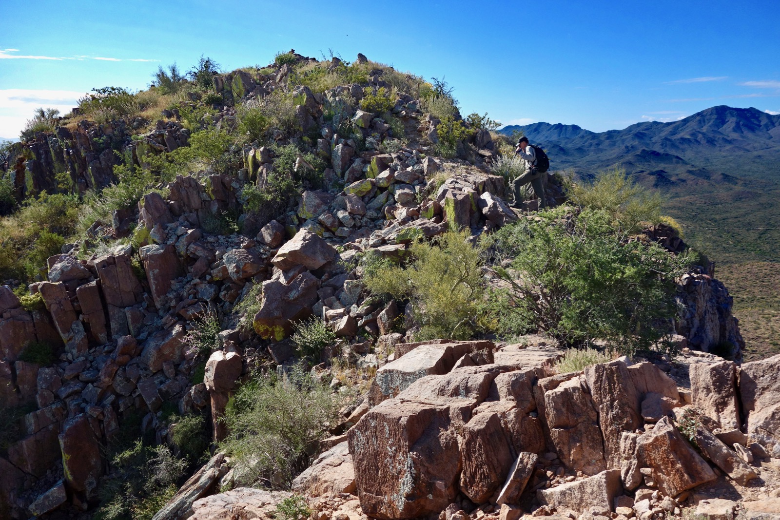
Getting over to Panther via the west ridge is harder than it looks with Class 5 obstacles. Therefore, we decided to traverse at the base of the crags, shown.

Panther Peak, 3,435'
Retrace your steps to the north shoulder of Safford at 2.3 miles. Spring flowers in 2019 were outrageous and the little flat was covered in fire-orange Mariposa lilies. (THW, photo)

The traverse to the Safford and Panther saddle is pretty straightforward. You will give up about 200 feet no matter how you work it. Head a ravine at 2,920 feet. Then track under Safford's north wall, staunch, silent, and full of personality. It was shady and moist so the plant community was thriving and a canyon wren was singing out its descending cascade of laughter.

The brush thins beyond the wall. Start climbing once again and top the minor rock band, shown.

Now you will get a good look at the last scarp east of the Panther saddle. The most efficient route would be to track right under the rampart but it is troubled with cliffs. Instead, we ascended a slope that turned out to be magnificent. There were breccia slabs and resurrection moss growing in the cracks.

From the rim we had a bird's-eye-view of the Panther Peak Boulders. Mountain Project claims it is, "One of the most concentrated collections of boulder problems in Southern Arizona."

From the precipitous perimeter we looked across to the (unexpected) trail climbing the Panther backslope.

On the south edge we dropped through a weakness in the cliff band. It put us on a comfortable ledge above the bouldering garden and right under the barrier wall with its strong presence.

Drop to the saddle at 3,040 feet. Panther Peak is a classic cuesta, an asymmetrical ridge with an escarpment north, west, and south, and a long and mellow backslope. The trail up the east ramp is well trodden. Desert globemallow and brittlebush enliven the way through barrel cactus, saguaro, and palo verde.

Crest the mountain at 4.0 miles. Panther Peak has a big, broad summit with resting rocks poised on the brink of the precipice. It was so good to be here after looking at this peak multiple times from Safford and Wasson. The quarry at Twin Peaks is one of several in the Marana area.

Back to the Trailhead
Return to the saddle. We could have doubled back on the traverse route but we wanted to experience more territory so we dropped into the draw that heads north from the saddle. The north rampart of Panther is to the west and there are outcrops on the east. We were surprised and delighted to find a distinct social trail.

The unnamed trail plunges steeply. There are cairns on big boulders in the lower reaches.

On the bajada look east to locate the low point in the Safford north ridge where we will close the loop.

Intersect an equestrian trail running along the fenced northern boundary of the national park at 5.1 miles, 2,250 feet. Walk east passing by a saguaro super nursery residing below the draw on the desert floor.

In spring, hedgehogs crank out brilliant blossoms. (THW, photo)

It is a fast traipse across the desert. At 5.9 miles the trail passes through a locked gate at the park boundary. Standing between a locked gate and a trail closed sign we were mystified. Why is there a social trail in the draw, an established treadway on the desert floor, and then abandonment? We started up the slope to the north ridge and soon stumbled on a cairned route with signs of recent use.

We hit the north ridge trail at elevation 2,560 feet. This image was shot at the junction looking north, 0.1 mile south of the NPS boundary.

Back in Sanctuary Cove we walked into the open chapel. After a day of communion with the earth we appreciated the plain and simple construction and peaceful ambience. (THW, photo)

8 comments:
I tried making this hike work yesterday, and failed. Specifically I could not make the yellow line part of the route go. There are barrier cliffs on the east side of the drainage below the cliffs that the yellow route is supposed to follow, and I could not get down them. In fact the 3100 ft contour seems to go right across the face of those cliffs. Perhaps they can be passed above, but that looks like the black route and I didn't have enough confidence of my ability to follow that. Daylight was getting short so I backtracked to the main Safford trail and back out.
Don't get me wrong, it is beautiful and good travel on the north side of Safford, and maybe I will come back to Panther using those trails you found, that would be a good and easy day hike.
Ben, I am so grateful for your comment/correction. I'm sorry I gave you (and other readers) a bum steer. I made some corrections and referenced you above the map. Debra
I should add.. thanks much for posting these hikes and descriptions. Went on your described Saddleback hike today and really enjoyed it. I have been hiking around Tucson for years and really appreciated your insights into off-trail routes, this is hard to find.
Sweet. Thanks, Ben. You just made my day. D
I'm glad; you totally deserve it! And the area is pretty enough that we're going back tomorrow to see if we can use the trails you found to access Panther, for an easy day.
Good luck getting up Panther. You sure are covering some fine territory. D
So I did go up Panther today, following your exit route in reverse. I was a bit worried about finding the trail ascending off the equestrian trail, and had put some waypoints in my GPS based on looking at the satellite images, but needn't have stressed it. Nice double gateway cairns at the beginning of the trail and it was excellently cairned the who way up - what a clever and scenic route up to the Panther/Safford saddle! It's a real gem and makes easy work of what looks like a tough ascent.
Also while up there on the Panther side I looked back at the route from Safford and suggest that it may be possible to make the traverse just a bit higher than the yellow line shown on your map. That line seems to pass right through a cliff band, and I'd tried to pass below it. On the contrary, it may be possible to pass above that cliff band, and below the highest band, which you can't see as you traverse over. No guarantees and it looks a rather brushy (cholla) but maybe it goes. This is a really beautiful area and of course was saw no one once off the Safford main track. Thanks again for posting it, gave us two days of fun!
I'm glad you made it up Panther. Your comments are collaborative and helpful. D
Post a Comment