Travel: West of I-10, Speedway Boulevard becomes Gates Pass Road at the intersection with Camino de Oeste. Take Gates Pass Road up and over the pass. The David Yetman West Trailhead is 0.4 mile west of the pass at a sharp 15 mph turn. Pull into a small paved lot on the left. No facilities, no fees. Dogs are not permitted on trails.
Distance and Elevation Gain: 5.4 miles; 1,900 feet of climbing for both peaks. Bren alone is 4.1 miles with 1,450 feet of vertical.
Total Time: 3:00 to 4:30
Difficulty: Trail, off-trail; navigation moderate; Class 2+; no exposure
Map: Trails Illustrated, Saguaro National Park, No. 237
Date Hiked: April 3, 2019
Poem:
Instructions for living a life.
Pay attention.
Be astonished.
Tell about it.
--
Pay attention.
Be astonished.
Tell about it.
--
Bren Benchmark and Golden Gate Mountain are companion summits. They are the northernmost peaks in the southern block of the Tucson Mountains. The Yetman Trail rises to the pass between them. This image was shot from Bushmaster Peak and looks down on Gates Pass Road, the access corridor through the mountains.
(Thomas Holt Ward, photo)

Route: While Bren has been climbed from every aspect there is one best route which we discovered as we hiked along. From the trailhead hike south on the Yetman Trail. Leave the treadway and head east to the Bren and Peak 3,520' saddle taking either the black-line, off-trail shortcut or the blue-line, on-trail option. Walk southeast on the spur to Peak 3,520'. Ascend the east ridge of Bren on a cairned route. Retrace your steps or descend off-trail on the northeast ridge. Continue around the north side of the mountain back to the trailhead. Correction: This map reflects my standard approximation to derive Peak 3,530'. I have since learned that the peak has an official height of 3,520 feet and the informal name, Second Ridge.

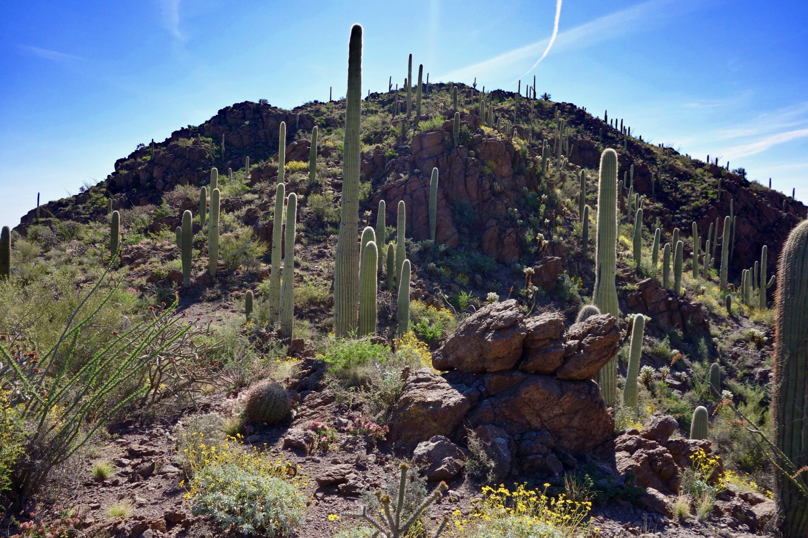
The hike begins at the David Yetman West Trailhead, elevation 2,960 feet. The Yetman Trail heads south along the west side of Bren Benchmark, shown. Begin with a gentle climb on a wide, well pounded trackway. Crude stone steps rise in consort with the boulder-filled landscape. Immersion in the Sonoran Desert is immediate. Signature saguaros are everywhere along with palo verde, ocotillo, jojoba, barrel cactus, prickly pear, teddybear and buckhorn cholla.

Mount the pass, elevation 3,182 feet, in just over 0.4 mile. One individual reported a successful climb on the west slopes. It was steep and loose. Plus, it's teddybear cholla land out there.

Seen from the pass, the three mountains in the distance are Peak 3,380' on Bobcat Ridge, Little Cat Mountain, and Cat Mountain. The standard route up Golden Gate Mountain begins about 0.1 mile south of the pass.

Our next objective was to walk east to the saddle between Bren and Peak 3,520'. We were figuring the hike out as we went and didn't discover a trail servicing the saddle until it was too late. So at 0.8 mile, elevation 2,980 feet, we left the Yetman and hiked off-trail east-northeast while crossing a couple of small ravines and keeping a bead on the saddle. The open bajada was pleasant enough but if you prefer to stay on-trail, remain on the Yetman for another 0.3 mile and branch left. It will only cost you 0.6 mile and an extra 100 feet of climbing.
In about 0.4 mile our shortcut linked with the established trail. The path tracks along the north side of a small ravine. There are some mesmerizing volcanic features exposed in the drainage including purple stone and water carved bedrock.
The geology of the Tucson Mountains is a jumbled mass of volcanics. Limestone, granite, rhyolite, and schist are found amongst volcanic ash-fall tuff and breccia. The pattern is so confusing and incongruous the formal geologic name for the region is Tucson Mountain Chaos. Examples of all these formations may be seen throughout the hike.

Reach the first of two saddles in close proximity at 1.3 miles, 3,170 feet. We considered climbing Bren via the southeast ridge from this saddle, shown.

Peak 3,520' (Second Ridge)
We decided to climb the ridge behind us, east-southeast, to get a better look at our options. Soon, we stumbled on a cairned trail that skirts the rocky base of the spine on its north side and then gets right on top.
It was a fabulous, low-key walk along the ridge seen from Tuscon just north of Bobcat Ridge. We spotted fresh cougar scat and tracks. It was so beautiful we just kept on going to the highpoint.

The spur is 1.3 miles roundtrip with 350 feet of vertical. The summit features sit-upon rocks and a rusty ammo box with a peak register placed in 2009. About a dozen people sign each year, mostly devoted fans from the Tucson Estates and the Cat Mountain Hiking Club. We were pretty thrilled to discover this pleasing little unexpected mountain. Look out over the southern Tucson Mountains; the Santa Catalina, Rincon, and Santa Rita Mountains; and Baboquivari and Kitt Peaks. (THW, photo)

This ridge is an extension of Bren's southeast ridge. In this image you can see the Yetman Trail coming through the pass between Golden Gate Mountain and Bren. (THW, photo)

Returning, we got a good look at our options for ascending Bren and decided we'd give the low-angle east ridge a try.

Bren Benchmark, 3,988'
At 2.6 miles we were back on the saddle and turned north on the trail which soon arrives at the neighboring saddle west of Point 3,339'. It drops about 50 feet into a drainage and then climbs 200 feet to Bren's east ridge. At 3.0 miles, elevation 3,310 feet, we left the trail and headed up the ridge. We soon found one cairn and then another all leading with deliberation toward the peak--we'd stumbled on the standard route. The path winds around the brush on a mellow grade through open country. (THW, photo)

Rising on volcanic slabs and bedrock is ideal. Cairns take the guess work out of the journey and we are grateful to whomever did us this favor.

At 3,700 feet do a short stint of ridge traveling before it melds into the east slope of the mountain. Make a rising traverse over to the northeast spine and climb the remaining 200 feet to the summit ridge. We walked out to the southeast knob for an excellent look at Second Ridge. That's Cat Mountain down the way. (THW, photo)

Looking down on the southeast ridge, it looks like a viable route but it is considerably steeper.

Walk northwest to the summit. The only Class 2+ of the day is a 50 foot downclimb into a notch.

Reach Bren Benchmark at 3.7 miles after what has to be described as a friendly, moderate hike. We couldn't locate a peak register in the vicinity of the large summit cairn. Look way down on Gates Pass and trailhead parking, and north to Wasson Peak, the highest mountain in the range. The cluster of white buildings is the Arizona-Sonora Desert Museum. (THW, photo)

All the drama is on the west face of Golden Gate Mountain but even from the east it is deserving of its beautiful name. The established route climbs the swale beneath a ridgeline block, image center-left, and then does a rising traverse north to the summit ridge with its multiple knobs.

The Santa Catalina Mountains are nothing short of glorious above the city of Tucson. (THW, photo)

When leaving the peak go back through the notch and descend the upcoming trail for 0.2 mile to elevation 3,840 feet. If you want a mellow descent retrace your steps. Curious to learn more about this mountain, we went down the northeast ridge. It was pretty easy compared with most off-trail ridges. It wasn't too steep and there were lots of boulders to mess around in. But it was a teddybear mine field. It's hard to avoid getting bit by those determined little hitchhikers. The trail is located at 3,240 feet in the light-colored stone at the base of the ridge in front of a couple of short knobs.

At 3,460 feet we pivoted west to get around an outcrop. (THW, photo)

Head west on the footpath to the saddle south of Point 3,454' at 4.8 miles. A trail branches to Gates Pass Road. Stay on the track as it bears southwest while wrapping under the north slopes of Bren.

There was an enticing view of Bushmaster Peak and Point 4,063' on the other side of Gates Pass Road. Those two went on the wish list and we climbed them the next week along with Tower Peak.

At 5.2 miles, we hung a sharp right onto a good shortcut trail making a beeline to trailhead parking.
After a wet winter there was a big bloom in the spring of 2019. Brittlebush was having a banner year and so was pricklepoppy. We noted evening primrose, larkspur, fairyduster, trailing windmill, Ajo lily, scorpionweed, desert rosemallow, desert globemallow, blue gilia, wild hyacinth, desert chicory, pinstock phacelia, verbena, desert marigold, Santa Catalina Mountain phlox, and Engelmann's hedgehog cactus. Rock hibiscus was especially startling in contrast with Tucson Mountain Chaos. (THW, photo)

1 comment:
Nice report.
Post a Comment