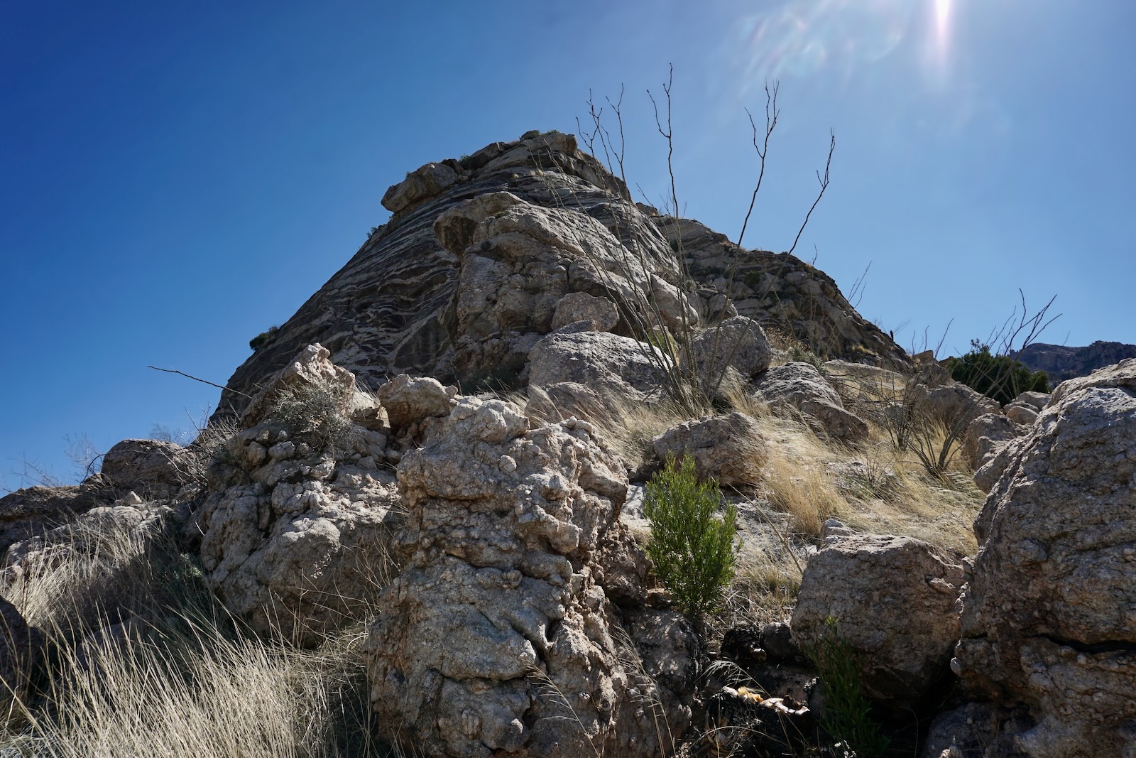
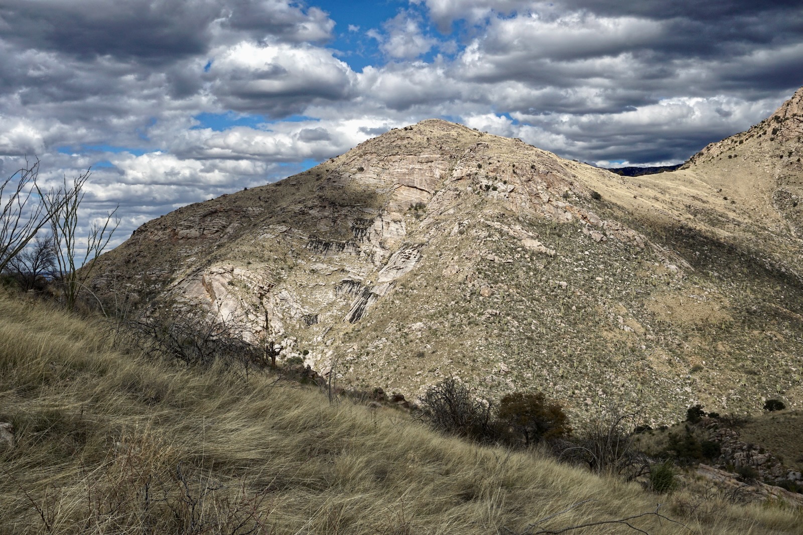
Essence: Point 4,262' is an unranked prominence southwest of Buster Mountain on the divide between Alamo and Dead Horse canyons. With a rise of 242 feet, the little mountain is actually quite impressive with a banded Catalina Gneiss summit block. Tucked in beneath the great monoliths of Pusch Ridge, the vista is even more unfathomable and mystical than the perspective from Buster. The climb is gradual on maintained and social trails for most of the distance. Visit a stunning
grotto absolutely filled with monkeyflowers. Desert mountaineers can opt to approach on the northwest ridge. On the return, explore the Dead Horse Canyon cascades flowing over granite sheets. Photographers are advised to be on the summit in the afternoon for best lighting. This highly pleasurable, repeat hike to "Buster's Buddy" is a homecoming for fans of Pusch Ridge. The hike begins in Catalina State Park and transitions into the Pusch Ridge
Wilderness managed by the Coronado National Forest.
Travel: The park is located at 11570 North Oracle Road, Arizona State Route 77,
in the city of Oro Valley north of Tucson. From the entrance station drive 0.5
mile and turn left into a paved lot. This is beyond the turnoff for the campground and just past the picnic area. Vault toilets and water are available another mile out the park road at the main trailhead parking.
Distance and Elevation Gain: 7.9 miles; 1,750 feet
Total Time: 4:00 to 6:00
Difficulty: Trail, off-trail; navigation moderate; Class 2 with no exposure; carry more water than you think you will need; hike in winter months to avoid scorching temperatures and rattlesnakes.
Map: Oro Valley, AZ 7.5' USGS Quad
Date Hiked: December 23, 2022
Total Time: 4:00 to 6:00
Difficulty: Trail, off-trail; navigation moderate; Class 2 with no exposure; carry more water than you think you will need; hike in winter months to avoid scorching temperatures and rattlesnakes.
Map: Oro Valley, AZ 7.5' USGS Quad
Date Hiked: December 23, 2022
Catalina State Park: Visit the website for information on fees, hours and campground.
Pusch Ridge Wilderness Bighorn Sheep Closure: It is prohibited to
travel more than 400 feet off designated Forest Service trails from
January 1 through April 30, bighorn sheep lambing season. Point 4,262' is off-limits during that period. Dogs are allowed in the park
on leash but not in the wilderness.
Quote: A walk in nature walks the soul back home. Mary Davis
Point 4,262' might be overlooked entirely were it not for its striking all-stone summit. Stand on the crest and marvel at the diverse granite features towering overhead on the Pusch Ridge wall. (Thomas Holt Ward, photo)
Quote: A walk in nature walks the soul back home. Mary Davis
Point 4,262' might be overlooked entirely were it not for its striking all-stone summit. Stand on the crest and marvel at the diverse granite features towering overhead on the Pusch Ridge wall. (Thomas Holt Ward, photo)
Route: Cross the park road and hike south crossing braids of
Sutherland Wash. Turn southeast into Alamo Canyon. Branch onto another park
trail and switchback to the rim of Dead Horse Canyon. At 1.8 miles, segue
onto a wildcat trail continuing southeast to the "Monkeyflower Grotto."
Ascend off-trail northeast to Saddle 4,020'. Climb the southeast ridge
of Point 4,262'. The blue-line route on the northwest ridge is shorter
but more demanding.

Point 4,262' is visible to the southeast from the parking lot. Cross the road and step onto a pounded trail, elevation 2,700 feet.

The footpath cuts across the Sutherland Wash flood plain. Within the first quarter mile it crosses multiple channels which may or may not be flowing. Enter the mouth of Alamo Canyon and cross the stone-filled creek bed at 0.6 mile. Trails spinoff; stay near the streamway. The 2020 Bighorn fire burned sporadically sparing the magnificent
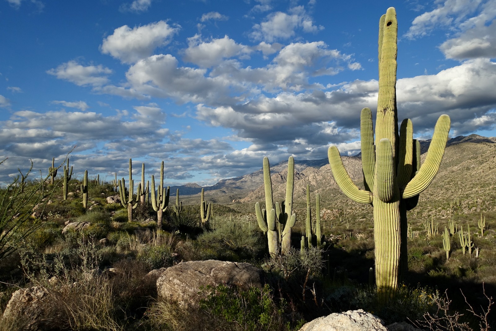
saguaros in the Alamo corridor. Hallmark of Catalina State Park, here
they are thriving on steep rubbly slopes. The Alamo's power to cut through the alluvial fan is impressive.

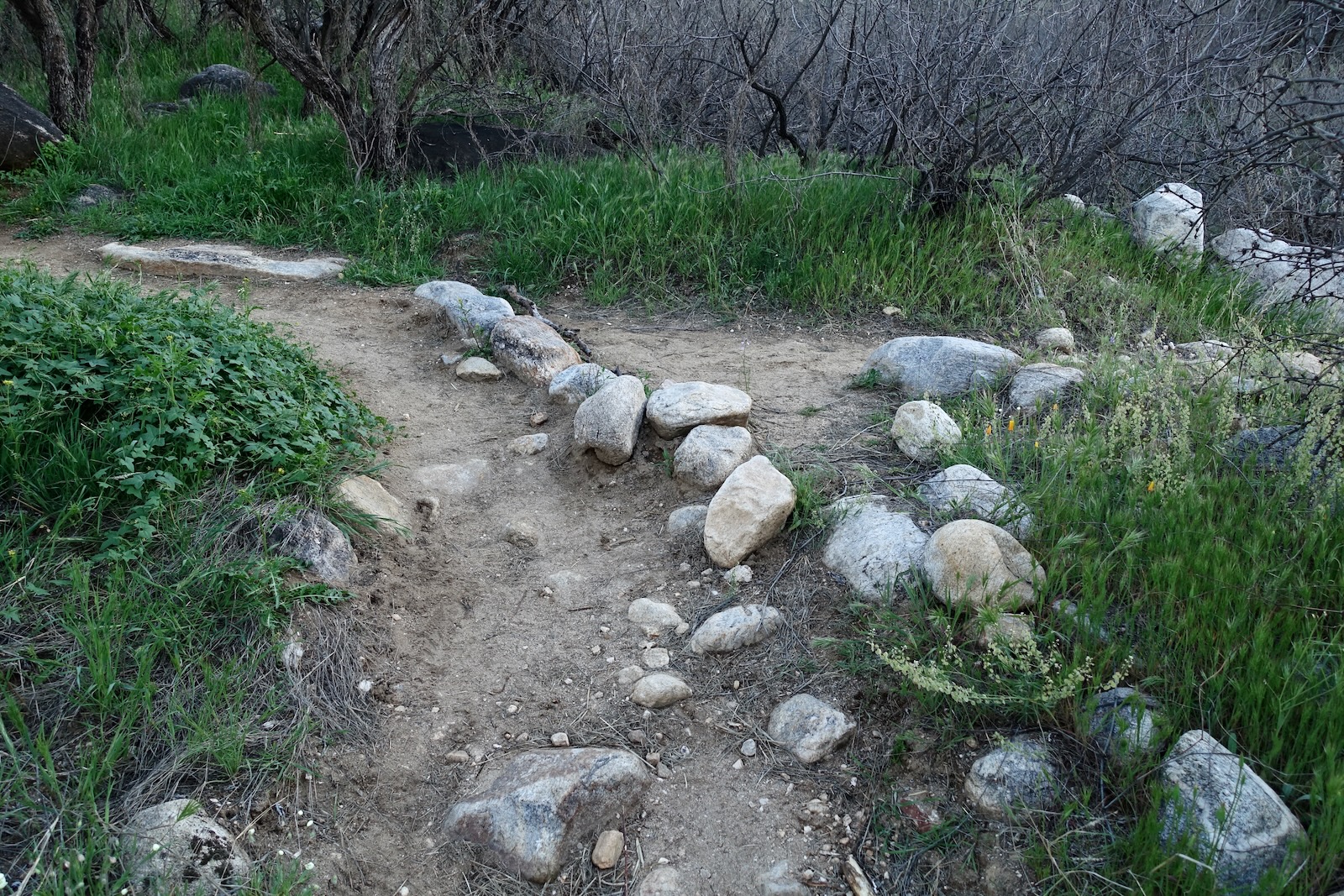
Reach the confluence with Dead Horse Canyon just shy of one mile. Dead Horse is not named on the Oro Valley topo but it is noted on Forest Service and Trails Illustrated maps. This route travels up the Dead Horse Canyon corridor for the next 2.3 miles. Just past the confluence there is a crucial junction. The trail up Alamo Canyon bends slightly to the left. Leave it, making a hard right by stepping over a row of stones, shown. Immediately cross the Dead Horse wash.
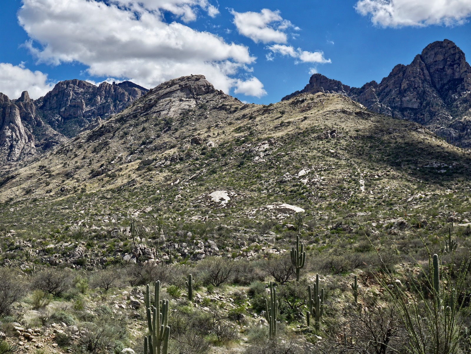
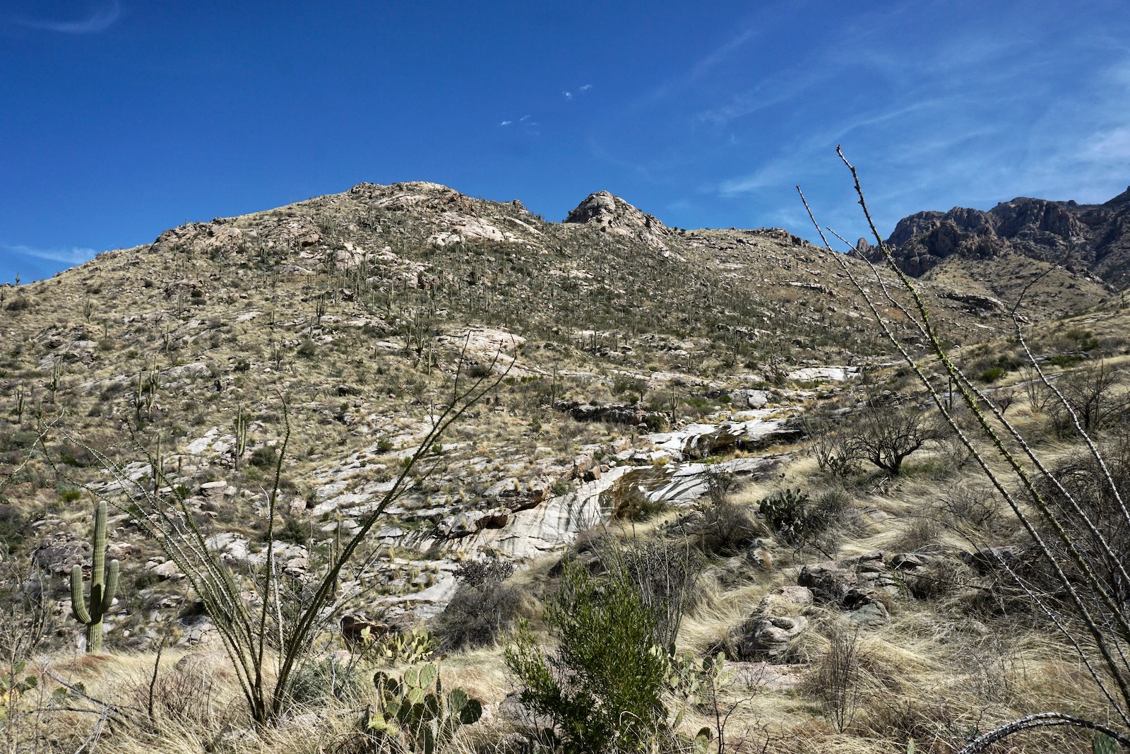
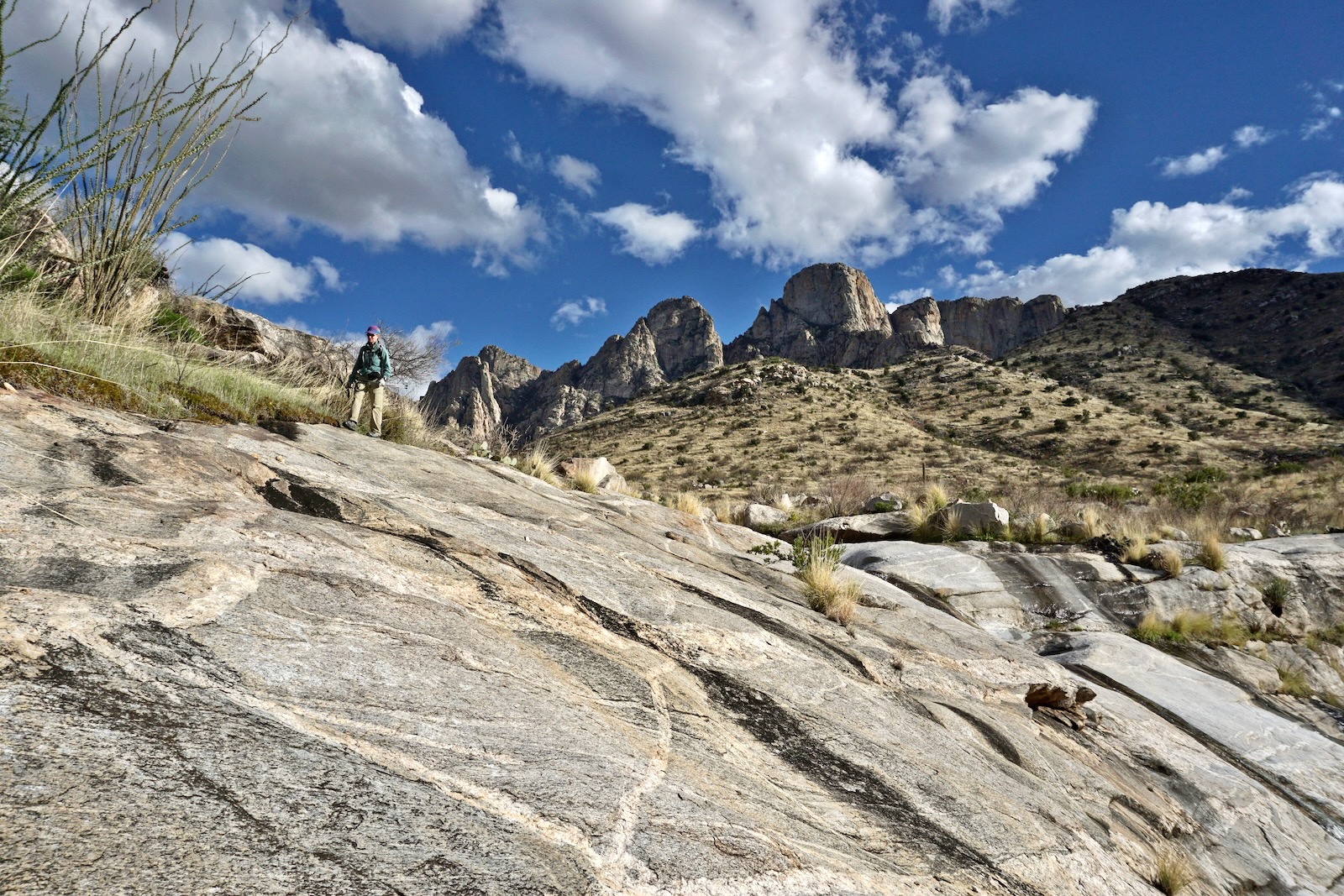
The route is on a maintained park trail for the next 0.8 mile. It makes tight switchbacks up a slope and levels off upon gaining the canyon rim. Instantly, views are insane. Below, low-lying Buster Mountain is foreground-left and Point 4,262' is to its right. As for the monsters in the background, if you need help with orientation, Table Mountain is image-right. (THW, photo)

The treadway points south tracking a few steps away from the canyon's rim. Below, saguaros living on the rim look positively radiant in evening light.
At 1.8 miles, the trail branches. The park trail goes off to the southwest. Avoid this branch. Keep going for a few more paces and the trail splits again at a large cairn. Go left/east onto the wildcat path, shown.


In a tenth of a mile the slim thread bends back south. Those climbing the northwest ridge (the blue-line route on the map above) should begin looking for a reasonable launch point. My partner climbed the northwest ridge with a friend so I'll have him describe their route. This option should be reserved for hikers with ample off-trail experience. It is both steep and brushy.
Leave the trail at about 3,140 feet. Cross the wash and aim for the middle of the ridge. Take advantage of scattered slabs for pleasant ascending. (THW, photo)

The pitch steepens before a flatter section at 3,860 feet. Keep climbing until it becomes uncomfortably steep. Our plan was to scale the cliff but there wasn't a Class 3 scramble. Advanced rock climbers might have more success. Get as close to the obstacle as you can, ideally right up against the wall. The image below shows where we initiated the work-around to the right/south. (THW, photo)
This image was shot from the trail. It looks up at the bypass beneath the banded escarpment armoring the summit. It is brushy against the cliff and the hillside is steep. Stay within arm's length of the wall. The terrain improved as we started up the draw and made for the southeast ridge arriving not far from the summit. (THW, photo)

Continuing on the black-line route up Dead Horse Canyon, the imposing granite faces and sheer walls of Pusch Ridge draw ever closer. Having climbed many of the monoliths over the years, they are old friends and here we were, right at their feet.

The image below shows the northwest ridge and the Dead Horse Canyon wash. At 2.5 miles, 3,400 feet, the trail comes very close to the upper end of the cascade series. This is where the cascade option initiates on the return. The path is braided and confusing in here. Heading up-canyon, the trail stays right/southwest of the drainage. (THW, photo)
The trail moves away from the stream and climbs a grassy hillside. Go with it, following cairns in the grass.

After returning to creek level, at 3.0 miles a side canyon joins up-canyon right. In 2022, the trail was washed out in there. If you lose it as we did, look for it on top of a horizontal boulder slab, image-center. Now we were right under Table Tooth (left of Table Mountain). From this perspective it looks like a substantial flat-faced monolith. Unless you'd been up there you wouldn't know it is actually a fin five feet wide! This whole experience was beyond thrilling, downright intoxicating. It felt I was about to smack my forehead against the wall.

At 3.2 miles, 3,760 feet, you have a choice. You can continue another 0.1 mile to the Monkeyflower Grotto or go directly to Saddle 4,020'. For the shortcut, simply cross the creek and ascend the swale off-trail, our return route.

The informally named Monkeyflower Grotto is stuffed with an exorbitant number of floral cascades draped over rocks. Multiple rivulets keep them thriving. The wildcat trail ends here leading me to wonder whether the person trimming the trail loves this grotto as we do. (THW, photo)
Climb the flower wall moving up and out of the canyon to the north.

Ascend a grassy slope on a natural ramp. The saddle comes into view to guide you.

Gain the saddle at 3.5 miles, 4,020 feet. Rising from the depths of Alamo Canyon, Buster Mountain is a heaving dome of granite. (THW, photo)
Standing on the Alamo-Dead Horse divide, I was enveloped in a phantasmagorical, dream-like landscape. (THW, photo)

The final approach is gradual. Climb to the false summit through organic boulders. The crest now in sight, it is heart-wrenchingly beautiful. (THW, photo)

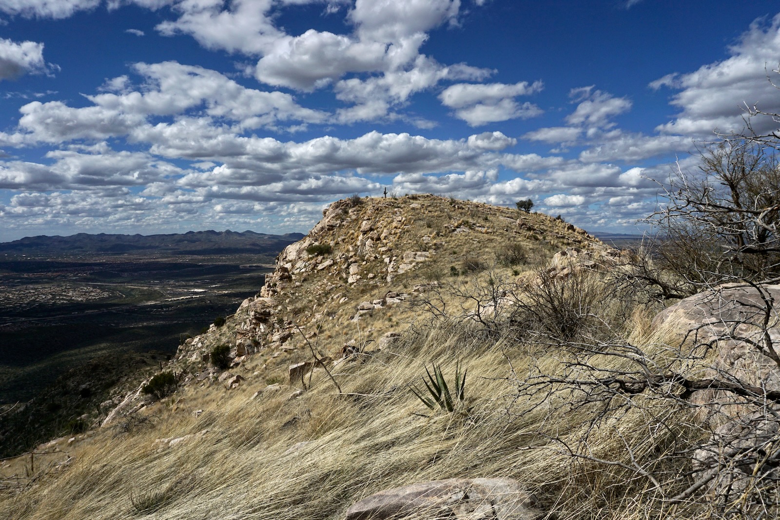
Arrive on the broad summit at 3.9 miles. The north face crashes to the desert floor opening a wide-swing view of the Tucson Mountains, the Tortolitas, and way beyond. (THW, photo)

The reason we came and will keep on coming is the savagely ragged lineup to the southeast. The visual drama is an order of magnitude higher than even Buster's offering. We stood breathless and deeply embraced by beings made of Wilderness Suite granite, each with a different form and character. Below, right to left, are Table Mountain, Table Tooth, and Peak 5,985' (one of the Wolves Teeth). Dead Horse Canyon incises the alluvium.

There is a lot to parse in this image. The Molar (image-right) is east of the Wolves Teeth. Three domes favored by climbers are image-left. Point 6,079', Wilderness Dome, is the tallest in back; Leviathan is on the left out front; and Solitude is on the right. Consult Mountain Project for climbing routes at the domes. Mount Kimball, 7,258', is the treed summit behind the crags.

This image honors the lone saguaro, scorched but alive after the Bighorn Fire swept through the range burning 120,000 acres. (THW, photo)

We gave some thought to descending on the northwest ridge, shown. However, we would have contacted Dead Horse Canyon below the cascades we wanted to explore. So we descended on the southeast ridge and took the shortcut back to the trail.

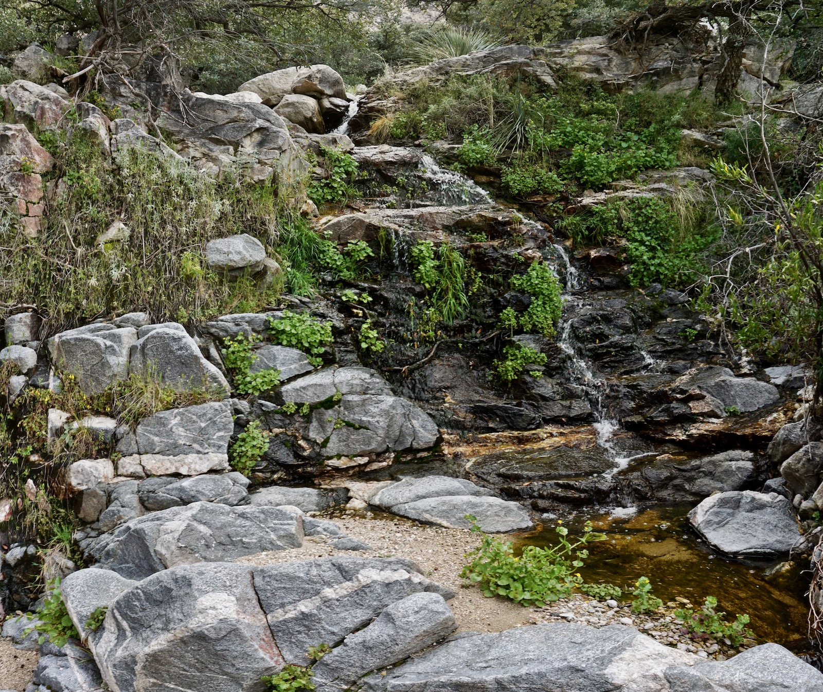
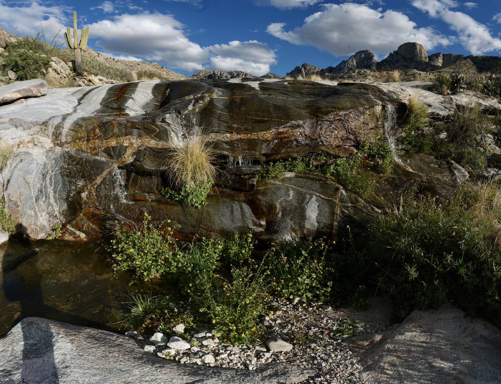
Dead Horse Canyon Cascades
We left the trail at 3,400 feet and walked down the principle waterway for half a mile. This highlight added 0.1 mile overall. The creek bed steps down in a series of low-angled granite slabs, one after another. (THW, photo)
The bedrock is water-scoured clean accentuating brilliant, swirling quartz veins. (THW, photo)

Glide down sheets of stone. We've explored many canyons in the Santa Catalina Mountains and this short stretch is one of the finest. (THW, photo)

Water spills over a wall. We were fortunate to be there when water was flowing and talkative. (THW, photo)
We left the canyon at an easy bailout at 3,160 feet. We stepped up a brown wall with resurrection moss and located the trail close by.

Clouds lifted and luminous peaks shimmered in evening light. (THW, photo)

Catalina State Park is renowned for wildflowers. This desert anemone hosts a visitor. (THW, photo)

Point 4,262' is a humble mountain that practically disappears in front of its dramatic backdrop. Now that you know what you're looking for, you can see it from the park's entrance station.

2 comments:
We enjoyed this hike quite a bit. It is everything Debra says it is. It is fun as the trail gradually deteriorates so you need to have sharp eyes and do some route finding - but there is always some evidence of human passage to follow all the way to the top. A few navigation notes. The turn to the left after the head of Dead Horse Canyon isn't quite as described, with some confusing "maybe" trails. Just look for a clear path to the left with a decent sized cairn (but cairns come and go) - this is not hard to follow if you use a GPS. Next up is where the trail comes close to the "Cascades". The trail will pull you toward a very pretty polished granite dam across the creek bed. Don't do it! Stop and look around a bit there - the path takes a sharp right but the rock surface doesn't offer much visual evidence of such until you've travelled 10 feet or so. If you don't see tread and/or cairns, you've off route in this part.
Thank you, Chris, for your comment. The navigation is indeed nuanced so it's good to have the perspective of another set of eyes on the route. Debra
Post a Comment