Essence: Hike to two ranked summits in the Huachuca Mountains, Ramsey Peak and Peak 8,712'. Divert briefly from the Crest Trail to unranked Pat Scott Peak. There are several possible approaches to the three mountains spinning off the Crest Trail. We began in Ramsey Canyon because the Hamburg Trail got a rave review in the July, 2022 issue of Arizona Highways. In December we walked through a red maple sanctuary in the company of the largest Arizona sycamores known to man. Shadows were cold and lingered all day in the canyons. Most of the 4,400 feet of vertical is gained on the long approach through Ramsey and Pat Scott canyons. Ramsey Peak gets points for being the third tallest mountain in the Huachucas but it looks better from afar than up close. There is no spur trail and the summit ridge is covered in thick brambles that obscure the view and are difficult to push through. Peak 8,712', just 25 feet shorter, was our favorite of the three. Hike on private land for one mile through the Ramsey Canyon Preserve and pass
into the Miller Peak Wilderness managed by the Coronado National Forest.
Travel: In Sierra Vista, from the intersection of Buffalo Soldier Trail and AZ 92, drive south on AZ 92 for six miles. Turn right on Ramsey Canyon Road and continue 3.5 miles to the Ramsey Canyon Preserve parking lot at the end of the road.
Distance and Elevation Gain: 14.0 miles; 4,400 feet
Total Time: 7:00 to 9:30
Difficulty: Trail, off-trail; navigation moderate; Class 2 with no exposure
Distance and Elevation Gain: 14.0 miles; 4,400 feet
Total Time: 7:00 to 9:30
Difficulty: Trail, off-trail; navigation moderate; Class 2 with no exposure
Red Tape: A permit is required to park and hike through the Nature Conservancy's Ramsey Canyon Preserve. Check the website for hours of operation and fee. The parking lot is locked when the Preserve is closed. Parking is not allowed on Ramsey Canyon Road. You may park at Ramsey Canyon Inn B&B for a fee. Or, park at the trailhead for the Brown Canyon Trail, another pathway into Ramsey Canyon without the red tape.
Map: Miller Peak, AZ 7.5' USGS Quad
Date Hiked: December 3, 2024
Quote: Ô, Sunlight! The most precious gold to be found on Earth. Roman Payne
Map: Miller Peak, AZ 7.5' USGS Quad
Date Hiked: December 3, 2024
Quote: Ô, Sunlight! The most precious gold to be found on Earth. Roman Payne
The shear force of Ramsey Peak cannot be denied. Below, the armored limestone bastion manifests its might as seen from Peak 8,712'. (Thomas Holt Ward, photo)
Route: Hike southwest up Ramsey Canyon on the Hamburg Trail. Transition onto the Pat Scott Canyon Trail and bear west to the junction with the Crest Trail. Which of the three peaks you climb and in what order is up to you. We hiked south on the Crest Trail and took a faint spur to Peak 8,712'. Then we walked north on the Crest Trail and took a short side trip to Pat Scott Peak before continuing north to the boundary with Fort Huachuca. There is no established trail southeast to Ramsey Peak. We stayed on the ridgeline going out but tracked to the north of the ridge on our return. Note: The contour intervals are 25 feet on the Miller Peak quad.
Route: Hike southwest up Ramsey Canyon on the Hamburg Trail. Transition onto the Pat Scott Canyon Trail and bear west to the junction with the Crest Trail. Which of the three peaks you climb and in what order is up to you. We hiked south on the Crest Trail and took a faint spur to Peak 8,712'. Then we walked north on the Crest Trail and took a short side trip to Pat Scott Peak before continuing north to the boundary with Fort Huachuca. There is no established trail southeast to Ramsey Peak. We stayed on the ridgeline going out but tracked to the north of the ridge on our return. Note: The contour intervals are 25 feet on the Miller Peak quad.
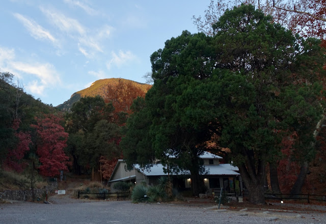
Ramsey Canyon and peak are named for Frank Ramsey, pioneer, prospector, and cowboy who lived in the canyon in the late 19th century. Nelson Bledsoe gifted the property to the Nature Conservancy in 1975. The Conservancy's mission is to "...preserve the plants, animals, and natural communities that represent the diversity of life on Earth." Below, the east slopes of Ramsey Peak are glowing in dawn twilight.
The Ramsey Canyon Preserve Trailhead is out the back door of the Nature Conservancy, elevation 5,550 feet.
Ramsey Canyon attracts birds (and birders!) from all over North America. In December, the birds were scarce and we were encased in silence and solitude for the entire hike. Ramsey Creek is an important tributary of the San Pedro River. We visited during an extended dry spell and there was no water flowing in the streamway. We were bereft of the murmuring and playfulness of water. The diversity of plant life in the riparian canyon included Arizona white oak, Arizona madrone, Schott's yucca, silver leaf and Emory oak,
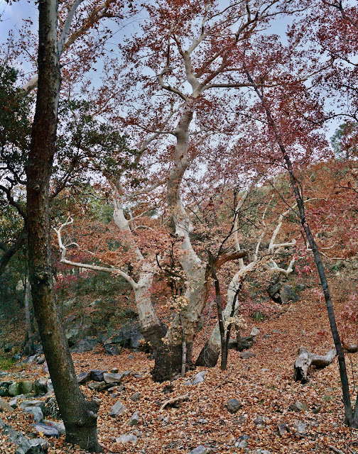
alligator juniper, Chihuahua pine, Apache pine, velvet ash, and bigtooth maple. The Arizona sycamores rivaled the finest specimens we'd seen in the canyons of southern Arizona. (THW, photo)
Bear southwest on an abandoned road tracking Ramsey Creek on its south. A well-preserved log cabin was built by the James family in 1902.
Tree rings in this sycamore date it to about 1760. Lighting for photographs was difficult because sunlight never made it down into the canyon as we passed through. (THW, photo)
Transition onto the Hamburg Trail at 0.5 mile. The path leaves the creek and doesn't return to its side for almost a mile. I have to think there is some constriction in the canyon the miners found prohibitive. So let the climbing begin. Stair risers are constructed with logs, railroad ties, lumber, and boulders.
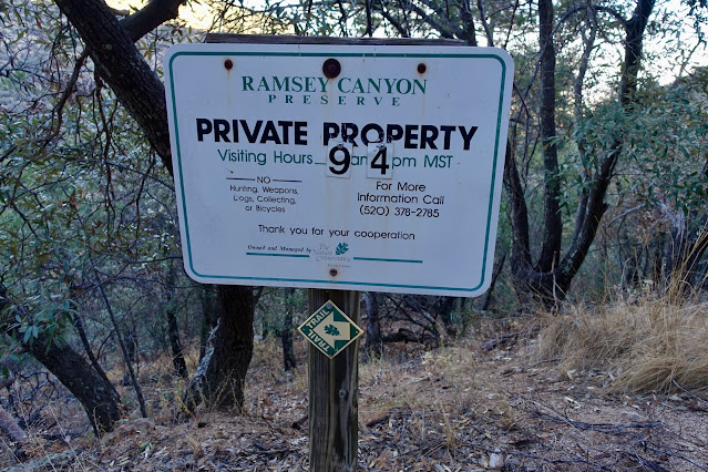
The trail soon branches. Go toward the Overlook. A series of numbered benches, presumably for folks on a more leisurely venture, break the steady moderate climb. At 0.8 mile pass out of the Ramsey Canyon Preserve and into the Coronado National Forest. As this sign implies, the hours of the Preserve vary throughout the year. If your vehicle is in their parking lot, remember you are unlikely to get this hike completed in seven hours when the gate is locked.
The bare rock Overlook at 1.05 miles, 6,275 feet, features an expansive view into the upper canyon. There is a hint of the tiered cliff profile on Ramsey Peak. Even when shrouded from the sun the vista point is dramatic and worth a brief pause. (THW, photo)
The Overlook is a turnaround location for casual hikers. There are a host of signs all pointing in the same direction. There is no choice except to continue or return. Having passed the constricted gorge, the trail makes for the creek, giving up 175 feet to cross the waterway at 6,100 feet. Early on a December morning nocturnal drainage poured on the chill.
The footpath adheres to the creek gaining elevation in a friendly manner. I have to wonder if crossing back and forth innumerable times would be difficult or even impossible if Ramsey Creek was running full blast. At 1.7 miles the Brown Canyon Trail came in on our right. While this is a viable alternative to hiking through the Preserve, it would add miles to the already long hike. This is a canyon that is accustomed to flowing water. There was thick moss on the rocks, lichen on the tree trunks, and stands of vibrant green horsetails. The red maples were past prime but still blasting out brilliance.
At 2.5 miles, stay on the Hamburg Trail as the Comfort Spring Trail branches left to eventually connect with the Carr Peak Trail.
Ramsey Canyon ends (in name anyway) when it splits at 2.7 miles, 6,825 feet. The Hamburg Trail bears south into Wisconsin Canyon, yet another route to the Crest Trail. Leave the Hamburg Trail here and take the right branch into Pat Scott Canyon on the eponymous trail.
Just past the junction is mining debris associated with the Hamburg mines. Henry Hamburg had 20 copper and gold claims in upper Ramsey Canyon near the junction of Pat Scott and Wisconsin canyons. One hundred tons of recorded production were extracted between 1900 and 1914.
Not far beyond was a miner's corrugated shack falling to ruin. South facing slopes were covered in blue agave while the canyon floor remained downright cold. A Coues white-tail deer took off running. We could see Ramsey Peak 1,200 feet directly above forming the north wall of the canyon. It was incredibly quiet. No sound. Leaves floated on a spring-fed puddle.
The canyon is long and linear, pushing back into the range for miles. At 7,650 feet the trail turns south and initiates the "Pat Scott switchbacks." They are painless, maintaining a mellow grade. We moved up into the land of green, green conifers, both saplings and tall mature trees. It's a healthy forest. After being encased in the canyon for 3,000 feet the view of Ramsey filled me with a sense of excitement and anticipation.
It was a pleasure to see rock outcrops on the east slope of Pat Scott Peak.
It felt like a privilege to be there, all by ourselves, on a trail built so long ago. At 4.7 miles, a large cairn marks a sharp turn to the south. Our long approach in the canyon was concluding. Wind whistled through the pines as we closed in on the principal ridge in the Huachuca Mountains. Arrive on the ridge top at 4.8 miles, 8,475 feet. (THW, photo)
It is 0.8 mile roundtrip with about 250 feet of gain to Peak 8,712'. It is well worth the minimal effort. Head south on the Crest Trail. In just 0.2 mile search for a rock pile indicating the turnoff for the summit.
There is no established path but a social trail comes and goes. It is a pleasant little climb up the southwest ridge--no obstacles, no big rocks, no brush, just native grasses.
Summit Peak 8,712' at 5.2 miles. Elevation gain to this point is 3,400 feet. The best views of the day are from this location with its 325 feet of prominence. The feature photo for this post of Ramsey Peak was shot from this mountain. Carr and Miller peaks are in the immediate southeast. Look down on the canyons we came up. That's an impressive haul. (THW, photo)
I recall being astounded by the sheer numbers of blue agave on the Carr Peak Trail. Somehow these plants exist in a state of complete perfection, not a single blemish. (THW, photo)
The range drops off to the west into the San Rafael Valley and State Natural Area, headwaters of the Santa Cruz River. The river bears south into Sonora, Mexico before making a U-turn, reentering the United States and flowing through Tucson. (THW, photo)
Back at the junction with the Pat Scott Canyon Trail, hike north on the Crest Trail 0.4 mile to the Pat Scott Peak trail. On this segment the Crest Trail is underutilized. It was faint in stretches with grass growing in the track and sporadic cairns in random places. Even out in the big wide open, as the Winter Solstice drew nigh it looked like the sun was setting all day long. (THW, photo)
At about 6.0 miles look around for the hint of a spur trail going to Pat Scott Peak. It's an itty-bitty out and back. From the Crest Trail the summit is but a few paces with about 60 feet of ascent. Blue agave and red rock accent the cairned trail.
The prominence has a rise of 125 feet. In spite of its small stature there were entries in the peak register--perhaps hikers like us who checked out the summit because it has an intriguing name. Patrick Scott was a prospector who searched for mineral riches in the Huachuca Mountains. There was a decent view of Peak 8,712', shown, from the treed crest but a poor view of Ramsey Peak.
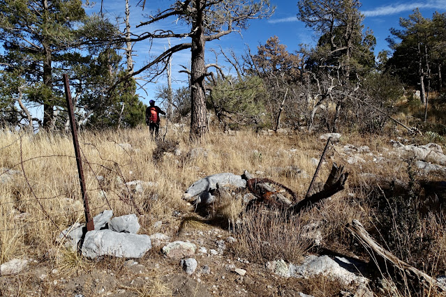
The footpath got even more obscure as we continued our journey north on the Crest Trail. We left the trail at 6.5 miles, 8,400 feet, on a broad flat. We had read that a spur trail ran from Fort Huachuca Gate 2 to the peak. The Fort is a United States Army Installation established in 1877. Okay, that goes back! If there is a gate or a trail we found neither. So we did what we always do without advance information. We followed the ridge. We were hoping to walk on the limestone rim of the summit ridge. We suffered a rare poor outcome. Therefore, we searched out a better return route paralleling the ridge on the north. Follow along and decide how you want to tackle this rather unpleasant passage. Below, my partner is heading for the west ridge of a roller east of the flat. I refer to it as the Red Ball because it's composed of red stone.
We stayed on the Forest Service side of the fenced boundary with the military range. We advanced on the Red Ball distinguished by a softly rounded form, red boulders, and perfectly spaced trees.
From the top of the roller, 6.8 miles, about 8,612 feet, we realized we were going to have to give up 100 feet to get down to the Ramsey saddle. On our return we flanked the Red Ball on the north.
In the saddle we went through an opening in the barbed wire fence that was clearly deliberate. We were on a very faint social trail. We did a poor job following it on our way out because we so wanted to walk on the limestone rim. Since that was NOT fun, we did a better job following the path on our way back. Notice the contact zone with the limestone blocks.
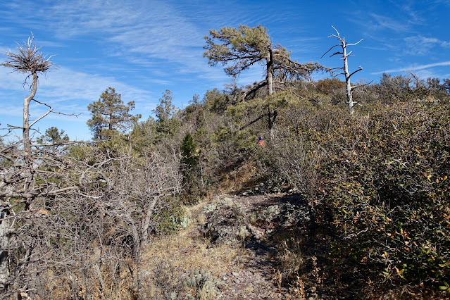
Sticking to the ridge we got all tangled up in mountain mahogany, a stiff-branched shrub that threatened to prohibit passage. It took 45 minutes just to go 0.6 mile from the saddle to the summit.
Boxed in by vegetation the mountain looked to be impossibly far away. It was so much worse than this image implies. (THW, photo)
We were able to walk along the rim for a few ecstatic yards. But we were soon forced off by foliage.
We arrived on the crest of Ramsey Peak at 7.5 miles. The summit cairn was mounted on a cluster of limestone boulders. Judging from the peak register, visitors are rare, mostly people from the Southern Arizona Hiking Club. Ramsey has a prominence of 675 feet but mountain mahogany had a hold on the high point, obliterating the view. (THW, photo)
Ramsey is a rare peak that is much nicer to look at from a distance than to experience up close. The image below was taken from the Carr Peak Trail in 2021. It is easy to see why we insisted on climbing it.
Our return route is our recommended route. Sadly, it means giving up on the rim walk. We tracked the ridgeline on its north, between 40 and 60 feet off the top. There was no hint of a trail to begin but it was easier and faster than the snarled ridge. We stumbled on a rudimentary social trail as we approached the fence. It's impossible to know if it was a hiker's path or a migrant route because the ground was littered with trash.
We went back through the opening in the fence and discovered a wildcat trail working both sides of the fenceline as it headed toward the flat. It flanked the Red Ball on the 8,500 foot contour.
The view to the north opened for the first time revealing Huachuca Peak framed by two magnificent Apache pines. (THW, photo)









3 comments:
The final section of the hike to Ramsey Peak is more manageable if you skip the ridgeline and instead hike along the forested but steep north side, parallel to but slightly below the ridge. Then make a final turn north and hike up the 25 yards or so to the peak. Hiking up via Sunnyside Canyon on the west side of the Huachucas is essentially the same distance and elevation gain as via Ramsey/Pat Scott Canyons and eliminates the time limitations of Ramsey Canyon Preserve's hours.
final turn *south
Fabulous! Thank you for sharing your best route up Ramsey. It confirms what we suspected and stumbled on as we returned from the summit. Approaching from Sunnyside Canyon is an excellent suggestion. I so appreciate both comments. Debra
Post a Comment