Travel: From Tucson, drive north on Oracle Road, AZ-77. Pass Ina Road and turn right on Magee Road. Go 1.5 miles to the Iris O. Dewhirst Pima Canyon Trailhead. Or, from Ina Road take Christie Drive north for 1.4 miles and turn right on Magee. The generous, paved lot is on the right. There is a drinking faucet but no other facilities.
Distance and Elevation Gain: 8.1 miles; 3,700 feet of climbing
Total Time: 7:00 to 9:00
Difficulty: Trail, off-trail; navigation challenging; Class 3 on The Cleaver with mild exposure; wear protective clothing. The creek in Pima Canyon is often dry so carry all the water you will need.
Maps: Tucson North; Oro Valley, AZ 7.5' Quads; or, Pusch Ridge Wilderness, Coronado National Forest, USDA Forest Service, 1:24,000
Latest Date Hiked: December 8, 2018
Pusch Ridge Wilderness Bighorn Sheep Closure: It is prohibited to travel more than 400 feet off designated Forest Service trails from January 1 through April 30, bighorn sheep lambing season. Bighorn Mountain and The Cleaver are off-limits during that time period. No dogs, ever.
Personal Note: We intended to summit The Cleaver in 2015 after a day on Table and Bighorn Mountains but ran out of water. We blindly thrashed down to Pima Canyon from the Cleaver-Bighorn saddle and got thoroughly slashed. We made another attempt a few days later from Pusch Peak but could not locate a scrambler's route through the cliffs. My partner gave it a try from Linda Vista but the nasty brush on the northwest side is even worse. To make it a sure thing, this time we climbed Bighorn on our proven route, had a joyful celebration on The Cleaver, and then ferreted out a route back to Pima Canyon from the Pusch Peak-Cleaver saddle that bears repeating.
In Memoriam: Pete Cowgill, 1925-2019, Founder of the Southern Arizona Hiking Club, 1958. Coauthor with Eber Glendening (1935-1997), The Santa Catalina Mountains: A guide to the trails and routes.
Quote: By endurance we conquer. Sir Ernest Shackleton
The Cleaver is the informal name for Point 4,910'. Seen from Oro Valley during the golden hour it is clear why old-timers call it Little Bighorn. Bighorn Mountain is on the left and Pusch Peak is image-right. (Thomas Holt Ward, photo)

Route: Walk two miles northeast up the Pima Canyon Trail. Leave the trail, cross the wash, and ascend north on a ridge and then an open slope to the Bighorn-Table Mountain saddle. Hike west and summit Bighorn. Descend an open slope southwest to the Cleaver-Bighorn saddle. Flank The Cleaver on the northwest. From the Pusch Peak-Cleaver saddle, climb the blade. To return to Pima Canyon get clear and east of the gully system at first opportunity and then descend on patches of open rock back to the trail.

Pima Canyon Trail
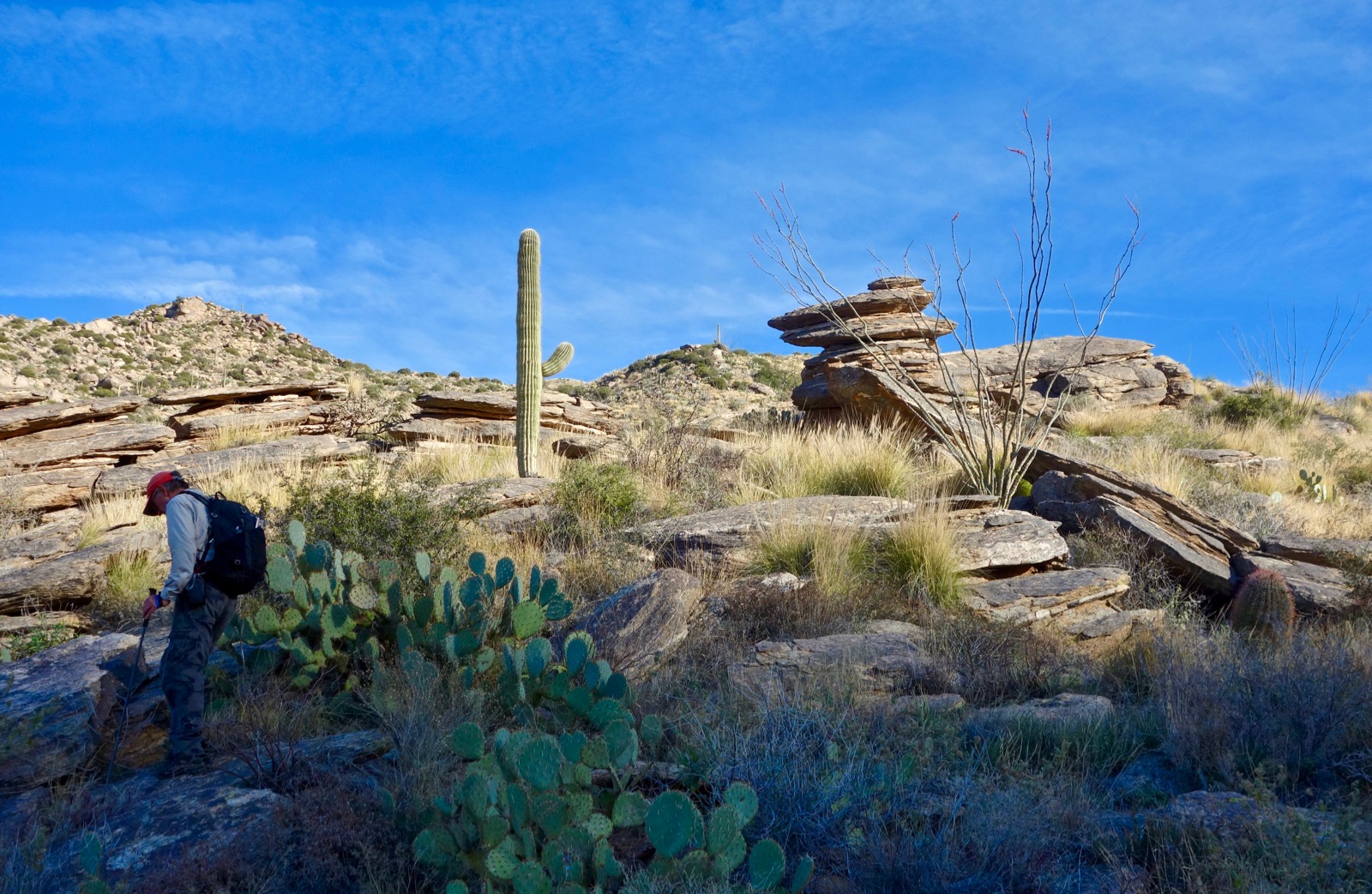
From the trailhead, elevation 2,920 feet, make speedy progress up the exquisitely beautiful Pima Canyon Trail. A lovely cristate saguaro lives above the trail at 0.55 miles. It is often overlooked.

On our most recent hike a squadron of javelina crossed the trail about the time Table Mountain came into view. For elaboration on this segment of trail, see Pima Canyon to Finger Rock Canyon via Mount Kimball.

The view opens to The Cleaver in just over 1.5 miles. It's pretty obvious why this ridge remnant cannot be denied. (THW, photo)

If you want to skip Bighorn Mountain and just do the out-and-back to The Cleaver, leave the path and cross the canyon at 1.7 miles, 3,360 feet. The landmark for this juncture is an old cottonwood tree, shown. Brush cover is forgiving right here. Work your way uphill using the images and description found toward the end of this post. Sure, you can bash your way up there but you'll pay for it. Finesse matters. (THW, photo)

Bighorn Mountain
For those climbing Bighorn (if you haven't, you are in for a treat), leave the trail at 2.1 miles, about 3,480 feet. This is just past the unmarked turnoff (not an obvious trail) for Rosewood Point and Prominent Point West. Don't just settle for any old place or you will get torn up. The crossing should look rather appealing. Be sure you have a bead on the stone ramp on the opposite side of the creek, shown, and on the climbing ridge. Terrain is open near the bottom of the gneiss sheet. Soon, the mix of boulders and vegetation requires some patience. Tiptoe through and around prickly pear, ocotillo, catclaw, saguaro, and shindagger.

Staying on the ridge, you will know you are on course when you pass a natural cairn at 2.6 miles, 4,180 feet.
The ridge is punctuated by three knobs. Below, my partner is standing on the first at 4,240 feet. Lose about 30 feet and then climb to the second.

As you follow the ridge around from the second knob the grade eases for awhile. The image below was shot from the third knob at 4,660 feet. If there is any chance you will be returning this way turn around and memorize the descent route. Aim for the golden hill, image-center. Rosewood Point is image-right. (THW, photo)

Above the third knob the ridge gets absorbed into the east slopes of Pusch Ridge. Walk due north up the hillside and you will nail the Bighorn-Table saddle. The shindaggers are a significant impediment on this passage and progress slows. Look east for a glimpse of the Wolves Teeth and Table Mountain. Strong, experienced desert hikers with sufficient daylight, food, and water may be able to climb Table, Bighorn, and The Cleaver in one long day. (THW, photo)

We intersected the ridge at 3.4 miles just west of the saddle, elevation 5,350 feet. Bighorn Mountain, approximated at 5,660 feet just makes the 300 foot lift from its neighbor's saddle to qualify as a ranked peak. It is a grassy stroll from here to the summit. Dodge the oak, juniper, bear grass, and sotol. The metamorphic gneiss transitions to granitic gneiss. You will find quartz veins and pegmatite clusters with chunks of mica and feldspar, along with nuggets of quartz.

Be sure to walk rather near the cliff edge for the best vista points overlooking Oro Valley and back to Table Mountain with its big wall drama.

Bighorn's linear summit ridge is composed of a big pile of weathered granitic blocks. Below, I am standing at the east end where there are views of Table Mountain, Samaniego Peak, Mount Lemmon, and Mount Kimball. (THW, photo)

Reach the highpoint over on the west end at 3.9 miles after 3,000 feet of vertical. From here our ultimate goal, The Cleaver, is visible. This is a stunning location significantly higher than Pusch Peak. Mountains roll out and away from the Pusch Ridge lineup: the Santa Rita Mountains, Baboquivari Peak, Wasson Peak, Picacho Peak, and the Tortolita Mountains.

The Cleaver
Work your way down the subtle southwest ridge of Bighorn aiming for the base of The Cleaver, shown. The hillside is somewhat cluttered with boulders, grasses, and cactus. A rock rolled out from under me and I did a spectacular fall onto a clump of shindaggers. The embedded spines made me even more determined to reach my goal. (THW, photo)

Upon reaching the Cleaver-Bighorn saddle, elevation 4,700 feet, we debated whether to flank the blade on the southeast or northwest. The Pima Canyon side with its steep talus slope composed of debris flaked from The Cleaver looked tedious and loose. It proved to be a good choice to do the 0.2 mile bypass on the Oro Valley side.

It took us about half an hour to make this passage in complicated terrain. Hold close to the cliff base. The bench is a sloping shelf that sits above a significant cliff band (see the opening image) but it feels safe. The total drop from one saddle to another is 200 feet.

We discovered a micro ecosystem in the cool shade. This rock mustard was a new flower for us. (THW, photo)

The approach is over upon arrival on the Pusch-Cleaver saddle at 4.75 miles, 4,500 feet. This moment was exhilarating for us after our numerous failed attempts. It took us half an hour each way to and from summit. It is 0.25 mile up the blade with 400 feet of climbing. There have been injuries over the years on The Cleaver; it should be tackled only by proven, desert scramblers. This image depicts the two, Class 3 pitches. The first is about 12 feet high and we took it right up the center. (Find the orange hat.) The holds are solid and beefy. The second pitch is a few paces further on, located just left and below the first saguaro.

Holds are meager on the eight-foot wall. My partner is grabbing a well-polished nib with his right hand. It was out of reach for me and I needed a hand.

Having looked at The Cleaver from Pusch Peak (see the end of this post) we anticipated a super narrow ramp but it is relatively wide with little sense of exposure. It is a rather steep scramble up through stable, weathered granite boulders and bedrock. The stone glistens prettily, desert vegetation is beautiful, bighorn scat is common--it is a delightful climb on the wedge.

The blade tapers to a sharp and somewhat spooky zenith that falls away into thin air on three sides. It is every bit as thrilling as I anticipated. Find a secure place to rest amongst the boulders. This image looks back on Bighorn Mountain. (THW, photo)

Point 4,910' only rises 210 feet from the Bighorn saddle so it is not a legal summit. But there is a peak register in a rusted Band-Aid container placed by the Southern Arizona Hiking Club in 1986. I have found very few registers dating back over 30 years on Pusch Ridge. They referred to the point as Little Bighorn. One to two parties sign in each year. (THW, photo)

The vista is fabulous from this relatively short but well-placed summit. Eastward is the Tombstone and ridge to Prominent Point West.

Return to Pima Canyon
Back on the saddle, it is a 1,100 foot drop over 1.1 miles to the Pima Canyon floor. Having been thrashed by vegetation in this region before, our intention was to locate a decent route back to the trail. The one I am presenting worked nicely but it is hiker's choice. If you are fully armored, you can just barge down at random. Our aim was to get out of the gully system at first opportunity and then to stay on the east side of the draw. Looking at the image below, our initial bearing was the open grassy field left of image-center. That bearing got us to where we could cross the east-side gully. To begin, stay as far left as you can but below the steep block fields. Rock composition on the upper hillside is loose and crumbly but it soon transitions to firm igneous stone.

Two washes bifurcate the basin. To cross the eastern gully we walked on and just below the slanted slab, shown. Work along the base of the cliff on a ledge that gets somewhat narrow, then hook around the last little wall.

This image looks back at the slab and cliff band above the ravine.

This image shows the gully system. Once clear, just go from one open patch of rock to the next

I hope these images are helpful for those of you who are going directly to The Cleaver. (THW, photo)

It took us 1.5 hours for this segment. We took our time and avoided brushy entanglements. Cross the canyon floor at 3,400 feet, 6.4 miles. It is an open crossing near the old cottonwood tree mentioned earlier. The runout on the buff Pima Canyon Trail is deeply satisfying.
Pusch Peak to The Cleaver Attempt
This image shows The Cleaver from the summit of Pusch Peak. In 2015, we descended 200 feet southeast from Pusch Peak and then dropped another 400 feet east to the top of the cliff band above The Cleaver saddle. We worked southeast down another 480 feet looking for a non-technical route. There is a weakness via a drainage at 4,320 feet that will get you into the Pusch-Cleaver draw. I know the traverse can be done because a climber in the peak register on The Cleaver had come from Pusch and was going on to Table. Awesome! (THW, photo)

This image looks up at the lower Pusch Peak cliff band from the Cleaver saddle. (THW, photo)

No comments:
Post a Comment