Essence: Brinkley Point is a solitary stone knob on the Sabino-Palisade divide. The hike begins on the Box Camp Trail and then diverts to traverse southwest on a wooded ridgetop out to the point. John Brinkley, a long-time ranger in the Santa Catalina Mountains beginning in 1945, is credited for creating the trail, now lost to time and neglect. This rugged hike of solitude leads to one of the most exceptional viewpoints in the range. Note that most of the elevation gain is accumulated on the return. The hike lies within the Pusch Ridge Wilderness and the greater Coronado National Forest.
Travel: On the Catalina (Mt. Lemmon) Highway, pass by the Palisade Visitor Center and begin a
downhill stretch. The signed trailhead is on the left just past Spencer
Canyon Campground, Mile Marker 21.4. The parking lot holds a dozen cars. No
facilities, no fees, no water, no dogs.
Distance and Elevation Gain: 7.2 miles; 2,050 feet
Total Time: 4:45 to 5:45
Difficulty: Trail, off-trail; navigation moderate; Class 2+; mild exposure on the summit block; hike on a cool day; carry all the water you will need; brushy, wear long pants.
Maps: Mount Bigelow; Mt. Lemmon, AZ 7.5' USGS Quads
Date Hiked: November 27, 2021
Historical Note: In 1948, John Brinkley married a young woman who lived in Tucson but often stayed at one of the three cabins in Summerhaven. They lived at the Palisade Ranger Station and on the Mount Bigelow Lookout Tower. Brinkley gave his life to the range; he knew every canyon, every rock. But he never walked if he could ride a horse. The story goes that he built the trail and rode out to Brinkley Point frequently. While his trail is gone, you will likely find evidence of log cutting to clear a passage for his mule Bea or his horse, Lucky. (Bowden, Charles. Frog Mountain Blues. The University of Arizona Press, 1987.)
Quote: Without the Santa Catalina Mountains, Tucson is just another city in a nation of urban islands. We do not know who we are until we look at the mountain. We have not been able to resist our hunger for the huge stone wall that frames our lives. Charles Bowden
Brinkley Point is a weathered block of Catalina Granite. The land drops radically away from the spectacular viewing platform. Look deeply into Sabino Canyon and its tributaries, and upwards to the fractured and remote peaks of the Santa Catalina Mountains. (Thomas Holt Ward, photo)
Route: Descend southwest on the Box Camp Trail to the junction with the Box Spring Trail. Head northwest through Box Camp to the Sabino Canyon divide. Leave the trail and ascend west over Point 7,529'. At about 7,240 feet, transition west to stay on the primary ridge. Hike southwest, passing over Point 7,185' and on to Brinkley Point.

From the trailhead on the north side of the parking lot, elevation 8,020 feet, the pathway climbs gently west while contouring below Spencer Peak. The land and our experience of it has changed markedly since we hiked the Box Camp Trail in March, 2020. I wrote, "Thriving in the Montane Fir and
Pine Forest life zone are Arizona pine, southwestern white pine, Douglas
fir, white fir, and gambel oak. The trees are big, the air is cool." Tragically, in June of that year, a lightning strike ignited the Bighorn Fire on Pusch Ridge. By July, it had incinerated 119,987 acres. The fire roared through this region scorching patches of forest and leaving green crowns elsewhere.
The trail weaves through a community of weathered Catalina Granite boulders, hard to the touch but soft in form. They reminded us of the block fields seen within the Wilderness of Rocks at roughly the same elevation on the north side of Sabino Canyon.

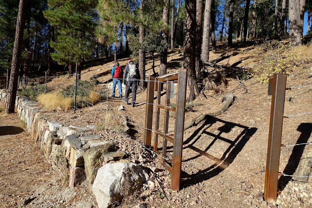
Cross into the Pusch Ridge Wilderness at 0.3 mile. Rise up to 8,120 feet and then begin the descent to the Box Spring Trail. To
the northwest is Cathedral Rock, Wilderness of Rocks, Marshall Peak, Lemmon Rock Lookout, and Mt. Lemmon's westward ridge.

The footpath rolls off the ridge to the north and crosses a fork of Palisade Canyon at 1.1 miles. Monkey flowers were blooming in moist soil in late November. The channel drops, rocks with veins of quartz and banded gneiss step down, and water spills in small cascades. The fire swept through the gorge and damaged our favorite double-trunked alligator juniper.
The route to Brinkley Point utilizes a small stretch of the Box Spring Trail. The junction at 1.8 miles, 7,520 feet, is not marked with a sign or a cairn. Post fire, the path is so subtle we blew by it once and could easily do so again if distracted. The secondary trail drops off to the right, northwest.

The trail passes through a pine flat, site of the old Box Camp, named by early trail users who nailed boxes to trees for storage of food and other goods on trips into the high country. It is located on a large, pleasant flat with big views through the trees. The Bighorn Fire ravaged Box Camp. See the Box Camp Trail post for a contrasting image.

The pathway beyond Box Camp is easy to lose. Walk northwest, cross the Palisade tributary at 2.0 miles, and ascend to a low saddle on the Sabino Canyon divide (elevation 7,380 feet), less than 0.1 mile beyond Box Camp. If you are considering a side trip to Box Spring, I must caution you. The trail is gone and the tangled brush is almost impenetrable.
The route to Brinkley Point is 1.5 brushy, off-trail miles from here. To start, bear west out of the saddle and climb over Point 7,523'.

Go over or around the globular behemoths on the undulating ridgetop.

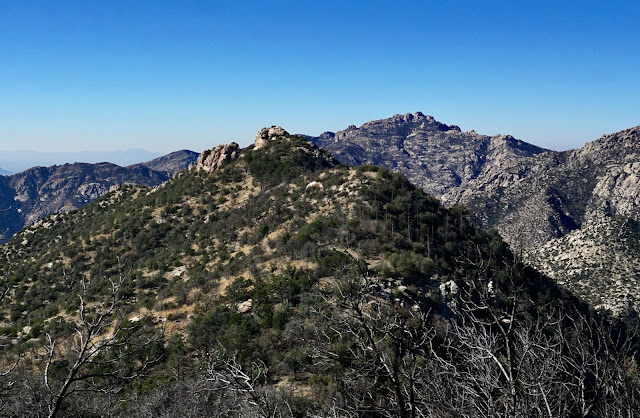
Views from the divide are enthralling. This peninsula of stone is suspended 900 feet above Sabino Canyon.

Ascend over this roller, a landmark indicator that the ridge transition is imminent.

Top the bump at 2.5 miles and get a good look at Brinkley Point's location on the primary ridge. The current ridge fades as it drops off to the south. We left the ridge at 7,460 feet and descended to the right/west, losing a good 200 feet. It's not critical where you initiate your transition but do so by 7,400 feet. It is a fairly steep pitch through a forest of Arizona alligator oak. Below, my friend (small figure, pink hat) is standing where he left the ridge crest.

Follow the primary ridge the rest of the way out to the point. At 2.7 miles, we actually stumbled on brief remnants of Brinkley's trail. Climb over Point 7,185' (where the feature image at the top of this post was shot). Descend to the saddle at 6,940 feet, giving Brinkley Point 159 feet of prominence.

Large quartz chunks have eroded from the intrusive igneous granite. The stone sphere sparkles with crystals. The standard route to the cap is on the north side.

Exposure is mild while climbing the natural staircase.

Surmounting Brinkley Point is intense, exhilarating, and unexpected. Land just falls away to reveal an intimately familiar landscape from an entirely new and lofty perspective. Below, I'm on the tipoff looking at Thimble Peak and Blacketts Ridge strung above Sabino Canyon. The sky was lamentably hazy. (THW, photo)

It took us 2:20 to cover the 3.6 miles out to the point which is typical. Elevation gain was 450 feet, less than a quarter of the total. Brinkley doesn't get a lot of visitors; only three parties signed in 2021, including the Huachuca and Green Valley hiking clubs.

Curiously, the benchmark claims the elevation is 7,073 feet. But the Mt. Lemmon USGS topographical map pegs it at 7,099 feet, the accepted height.

A great mass of neighboring rocks tempt as the ridge plummets to the West Fork of Sabino Canyon. On the other side of the trench are McFall Crags and Rattlesnake Peak.

West is Sabino's headwater canyon, Lemmon Canyon, the ridge bearing the Mount Lemmon Trail, and of course, Cathedral Rock.

According to Charles Bowden, Ranger Brinkley had a sixth sense for the Catalinas. When people got lost in the mountains he would direct the search party or find the lost person while Search and Rescue was still getting suited up in Tucson. This image looks back on the undulating access ridge with Sabino Canyon to its left. I like the idea of honoring John Brinkley by walking in his footsteps, or rather in the steps of his steeds. (THW, photo)

No comments:
Post a Comment