Essence: A rampart by definition is a defensive wall of a castle or city. Rampart Hills, seen from US 160, features a long line of spires composed of a coarse-grained igneous granitic, specifically monzonite. Living synergistically with the stone are ancient, gnarled limber pines. Vast tracks of aspen on the western slopes of the La Plata Mountains are known to set the world ablaze in autumn. I have explored the Ramparts several times and have experimented with different routes. The loop described is my favorite. It combines 4WD track and off-trail hiking. There is one unavoidable plunge and ascent between the South and North Rampart. Rampart Hills is within the San Juan National Forest.
Travel: From the US 550/160 intersection in Durango, travel west on US 160 for 24.7 miles to signed Echo Basin Road (mile marker 58.6) and turn north on CR MC 44. Measure distance from there. At 2.4 miles, stay straight as pavement turns to gravel. At 3.3 miles, cross a cattle guard and transition to FSR 566. The track climbs steadily through scrub oak to a cattle guard at 6.4 miles. Directly east is The Hogback. Go down a small hill. At 6.7 miles, branch left on FSR 331. At a circular corral transition to FSR 331D and cross a small drainage. Coming up the other side, FSR 331D turns sharply south at 6.9 miles. There is plenty of parking on the right. This is just before the large parking area for Ramparts Loop Trail #166. With the exception of the last 0.1 mile, roads are well graded and suitable for 2WD vehicles with moderate clearance.
Distance and Elevation Gain: 5.7 miles; 1,000 feetTotal Time: 3:00 to 4:00
Difficulty: Forest Service Roads and off-trail; navigation moderate; Class 2; no exposure; brushy, wear long pants
Map: Rampart Hills, Colorado 7.5' USGS Quad
Latest Date Hiked: November 13, 2021
Quote: Autumn is a second spring when every leaf is a flower. Albert Camus
Granite towers along the south rim of Rampart Hills frame a fleeting, variegated, autumnal tapestry. (Thomas Holt Ward, photo)

Route: Several Forest Service roads bisect Rampart Hills, shown on the map below. Hike south and then west on the rim of the South Rampart. Descend north into the rift between the Ramparts and cross the Ramparts Loop Trail. Ascend onto the North Rampart and hike west along the rim. Return east on FSR 331C. Blue-line option: hike off-trail south to Point 9,415', the highpoint of Rampart Hills. From the 4-way junction, finish the loop by walking south on FSR 331. Rampart Hills has two distinct districts. By convention they are called South and North even though Southeast and Northwest would be more accurate.

First, sort out the proper start point, elevation 9,200 feet. It is not the Ramparts Loop Trail which heads west from the main parking lot. Rather, hike south on unsigned FSR 331D. The image below was shot from parking. It looks back FSR 331D coming toward the camera and the circular corral.

The smooth road hangs above an east fork of the West Mancos River, entrenched to the south with unusually tall aspen arising from the waterway.

At 0.35 mile the road splits, shown. Take the left fork, staying on unsigned FSR 331D. Signed FSR 331D1 goes to the west end of the South Rampart but misses the rim.

The track swings west to edge the rim of South Rampart. The surrounding forest is a mix of Douglas fir, ponderosa, aspen, and Gambel oak. The road ends at 0.9 mile. The hike is off-trail from here all the way to the west end of North Rampart. Walk to the rim and find a faint social trail heading west. Stay as close to the cliffs as you are comfortable. Views to the south and west are phenomenal. Below, the Chuska Mountains rise over Mesa Verde and Point Lookout. Sleeping Ute is further west. On a clear day, Shiprock is visible.

Menefee Mountain is south of US 160. See the Mancos Trails Group for information on the Menefee Mountain Wilderness Study Area and directions for hiking to the 8,832-foot summit. (THW, photo)
Growing on both ramparts are massive limber pines, a Rocky Mountain white pine species. Sculpted by wind and time these trees may easily be 1,000 years old. They have a few defining characteristics. Their needles grow in bunches of five, cones are up to six inches long, and flexible branches can be bent back on themselves. Contorted trees cling to boulders in a synergistic embrace. The magnificent tree shown below lives on the one-mile promontory. (THW, photo)

The spires, pillars, and crenelations of Rampart Hills are seen in their full glory from the promontory. (THW, photo)

The terrain will force you back into the interior briefly. You may even encounter the end of FSR 331D1 at Point 9,299'. At first opportunity return to the cliff edge to locate a distinctive rock stack at 1.4 miles, one of the most playful features of this hike. The isolated, stepped stack is exposed on the west side so be mindful, especially if you intend to pile a bunch of people up there as we have.

The next objective is to transition from the South to North Rampart. There is no established route. Wrap around Point 9,299' on the west and then look for a pleasing place to initiate your plunge into the rift between the Ramparts. The 260-foot descent (9,240 to about 8,980 feet) is forested and fairly steep. Reach the bottom at another east tributary of the West Mancos River at 1.8 miles. Typically, there is some water in the creek supplying wide-girth aspen. Cross the Ramparts Loop Trail and then climb north-northwest up the other side. If lucky, you will stumble on the slanted bedrock slab, shown. Climb no higher than 9,280 feet. (THW, photo)

Now bear west. Descend into and out of a swale and then angle southwest toward the rim. The ideal route traverses over sheets of smooth bedrock hosting an old ponderosa forest with generously spaced trees.

Now on the very rim of the North Rampart, begin searching for the balancing rock at 2.6 miles. You must hook off the rim a tad to see the delicate, miniature multi-stack.

The topography is stunning, particularly looking east through a cluster of pillars to Helmet Peak. (THW, photo)

Sitting and climbing boulders are everywhere.

This image looks back on South Rampart and the plunge into the rift. (THW, photo)

Hover near the edge clear to the end of North Rampart at 3.3 miles for a vantage point west to the Abajo and La Sal mountains and northwest to Lone Cone.

Locate FSR 331C for the easiest return route. (You can't miss it.) It begins northward and then swings east with distant views of the San Miguel Mountains. Walking is fast so stay with the road even when it curves temporarily to the north.
The track skims the north side of Point 9,415' coming within 80 vertical feet and a quarter mile of the highpoint of Rampart Hills. The blue-line option depicted on the map above leaves the trail at 4.8 miles and heads south to the crest. We approached the prominence from the south and got severely tangled in snowberry shrubs. The north approach appears to be better. There are splendid views of Hesperus Mountain from the softly rounded, aspen topped dome.
(THW, photo)

The views of the western front of the La Plata Mountains are almost as good from FSR 331C. Below, the field of vision spans from Hesperus to Spiller Peak. A dusting of snow accentuates the color patchwork in lower elevations. We saw a golden eagle soaring high overhead. I have no explanation for the slash piles of aspen except that the living forest was sadly stressed. (THW, photo)

Pass through a gate just before the 4-way intersection at 5.2 miles. Northwest is FSR 329, northeast is Box Canyon. Go right on FSR 331, shown. It's just half a mile north to the trailhead.

Shy of the circular corral there is an easy shortcut to the parking area. (THW, photo)

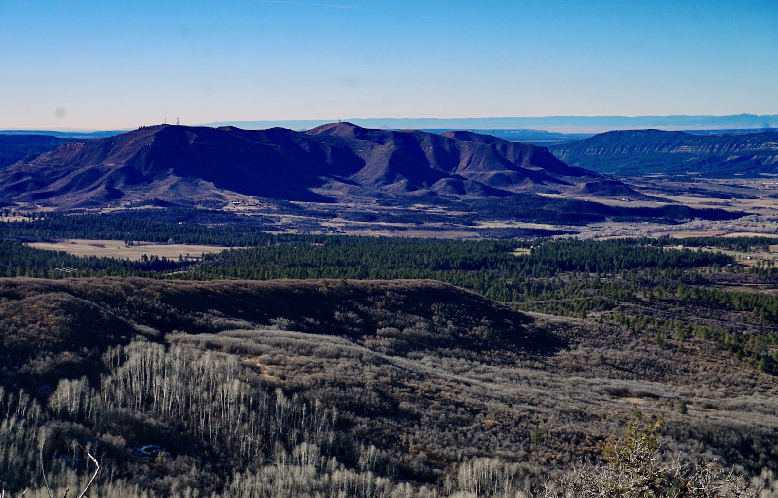
The high visibility and distinctive nature of Rampart Hills piques the curiosity of locals. This shot was taken from Echo Basin Road. (THW, photo)

No comments:
Post a Comment