Essence: The Galiuro Mountains are wild and remote. The drive to any trailhead is a commitment. Launch into an extensive trail network on routes established in the late 19th and 20th centuries. In 2022, the unmaintained trails of yesteryear were returning to their natural state. The path to Kennedy Peak was faint, signs were on the ground, brush and fallen timber were intense, and navigation was difficult. Proficient map reading skills are required to summit. The block-fault range has two principal ridges running north-south. Kennedy Peak is located on the divide east of Rattlesnake Creek and is accessed by the East Divide Trail. The mountain is north of, and second in stature to Bassett Peak, the highpoint in the range. With a prominence of 969 feet, Kennedy lifts 3,400 feet off the Sulphur Springs Valley. Ascend from semi-desert grasslands, through a piñon-juniper and oak woodland, and into a mixed conifer forest. The summit offers a near-and-far perspective on the complexity of the immediate range, and the sky islands of southern Arizona. This hike of solitude is within the 76,317-acre Galiuro Wilderness, managed by Coronado National Forest.
Travel: From I-10 in Wilcox, take Exit 340, Fort Grant Road. Measure distance from the signal at the end of the eastbound offramp and drive north. Turn left at Ash Creek Road, 17.6 miles, staying on pavement. Sulphur Springs Valley is bound by the Galiuro and Pinaleño mountains. Industrial agriculture is evidenced by massive greenhouses and pecan groves. At the next stop sign, 20.5 miles, turn right staying on Fort Grant Road. At the hamlet of Bonita, 29 miles, go left at the stop, following the sign for Klondyke, Bonita-Klondyke Road. Reset your trip meter and drive northwest on the wide, graded, 40 mph dirt road. Turn left onto Deer Creek Road, FSR 253, at 18 miles. Reset your trip meter, and cross a cattle guard. The road is good for 4.5 miles and then it will be rutted if wet. There is a rocky patch at 5.4 miles. Cross a cattle guard at 6.0 miles. At 6.5 miles, a sign directs drivers to continue on the road to the trailhead. (If you wish to hike Kennedy from this old trailhead, see China Peak.) Park at 6.9 miles in a circular turnaround with four campsites shaded by cottonwoods. There are fire grills but no water, no picnic tables, and no outhouse. Share the space with cattle. 2WD with moderate clearance and reasonably tough tires will make the trailhead. Allow 2.5 hours from Kolb Road and I-10 in Tucson.
Distance and Elevation Gain: 11.0 miles; 2,900 feet of climbing
Total Time: 6:00 to 8:00
Difficulty: Trail unmaintained and hard to follow; navigation challenging; Class 2 with no exposure; dress defensively; carry all the water you will need.
Map: Kennedy Peak, AZ 7.5' USGS Quad
Date Hiked: March 17, 2022
Difficulty: Trail unmaintained and hard to follow; navigation challenging; Class 2 with no exposure; dress defensively; carry all the water you will need.
Map: Kennedy Peak, AZ 7.5' USGS Quad
Date Hiked: March 17, 2022
History: For a summary of the natural and human history in the Galiuro Mountains consult, Guns and Gold: History of the Galiuro Wilderness, by John P. Wilson, 1977.
Quote: A trail through the mountains, if used, becomes a path in a short time, but, if unused, becomes blocked by grass in an equally short time. Mencius
Quote: A trail through the mountains, if used, becomes a path in a short time, but, if unused, becomes blocked by grass in an equally short time. Mencius
The Galiuro Mountains are composed of rocks known as Galiuro Volcanics. Lava flows and ash fall deposits create peculiar and fascinating formations. Driving toward the range on Deer Creek Road, Kennedy Peak presents the welded tuff crenelations found on its north face.

Route: From the Kennedy Peak Trailhead, hike southwest on the East Divide Trail to Oak Creek. Ascend south to the Point 7,390'-Kennedy Peak saddle. Continue on the East Divide Trail bearing southeast. At the Kennedy Peak spur, climb east to the peak.

The hike begins at the northern terminus of East Divide Trail No. 287, elevation 4,900 feet. Don't be fooled--the summit is a solid 5.5 miles from this trailhead.

Open and close the gate and head south-southwest on the trail. Below, a cottonwood and mountains lie in repose.

This is wide-open, grassy foothill country. Cairns from a bygone era lead the way. Walk on ash flow tuff and broken sheets of rhyolite. At 0.6 mile, a worn wooden sign marks a junction with a trail that disappeared long ago. Given the flora, the rock, the historic remnants, it is quintessential west. Below, Kennedy Peak is image-center.

Stout agave bore into the hillside. 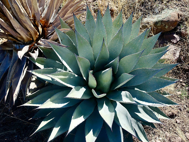

Drop into a shallow drainage then ascend lazily to a ridge separating two forks of Deer Creek at 1.1 miles, 5,300 feet. A couple of equestrians led the way up the braided trail.

Hike southwest along the ridge. Critical note! At 1.3 miles, 5,400 feet, the trail branches. For Kennedy Peak, take the left fork. This junction is all too easy to miss. The signpost was lying on a rock pile and the more trodden trail continued straight ahead. The left thread was subtle at best.

A confirming sign is 50 feet ahead: East Divide Trail No. 287. Again, the mileage is weirdly wrong; Kennedy Peak is 4.2 miles afar. (Thomas Holt Ward, photo)

Effort and concentration are required to stay the course as the trail disappears in places. Cairns are helpful but sporadic. We didn't have a GPX file for the hike but we did have a topo map and consulted it frequently. Use distinctive Point 6,376', shown, as your landscape marker in this lower region.

The route pivots around the cliff-wrapped prominence on its north.

The path curves south and flanks the west side of Point 6,376' before turning west to cross two tributaries of Oak Creek. The ascent to this point is barely noticeable but flora has transitioned from semi-desert grassland to a woodland with alligator and Utah juniper, mountain mahogany, mesquite, acacia, and oak. Below, Kennedy Peak is right of center. The route climbs to the saddle on its west.


Cross the second drainage at 2.5 miles and enter the Galiuro Wilderness. At 2.8 miles we passed a post with no sign. The trail that went north from this point appears to be extinct. Below, aptly named Rockhouse Peak tops the western wall of Oak Creek.

Reach the main fork of Oak Creek in a shaded wood at 3.2 miles. The East Divide Trail makes a 90 degree turn from southwest to southeast. We pondered this for some time because the trail beyond the posted sign was invisible at first. Scrounge around for it on the east side of the watercourse. The proper distance to Kennedy is 2.3 miles. (THW, photo)

The next 1.2 miles is the most difficult segment of the hike. The footpath has not been maintained and it is hard to decipher. In fact, it is disappearing. Climb over or crawl under deadfall. The passage needs pruning. Plowing through hedges of thorns is unavoidable.

There are no perennial waterways in the range. Cross the dry stream several times. A beautiful breccia boulder beside the trail is composed of pebble and boulder-sized clasts cemented together by a fine-grained matrix.

The route thankfully climbs out of the drainage at 4.0 miles, 6,000 feet and switchbacks up a slope on the west side of the north ridge of the Kennedy massif. Look up to see the irregular towers, gargoyles, and monoliths that forced the trail off the ridgeline. The Point 7,390'-Kennedy saddle is pictured below.

Walking on tuff at 6,500 feet is an appealing reprieve but short-lived.

We lost the trail at 6,600 feet and spun around for 30 minutes searching for it. The Kennedy topo indicated we needed to cross the creek but the trail was obscured by fallen timber at the crossing. We transferred to the west side and scoured the territory until we found the faint path. The trail will lead you to the saddle so don't go anywhere until you locate it. (John Bregar, photo)

This image looks east from the trail to the radical formations on the north ridge.

The trail switchbacks up the north slope through a mixed conifer forest with ponderosa, Chihuahua and Mexican white pine,
Douglas-fir, and Arizona cypress. (John Bregar, photo)

Reach the saddle on the East Divide at 4.9 miles, 7,180 feet. On a clear trail, the hike to this point would have been a moderate effort and we would have climbed Point 7,390' for a unique perspective on Kennedy Peak. But our challenge was not over and we stayed true to our primary purpose. (John Bregar, photo)

At the saddle the East Divide Trail turns southeast. Follow it for another 0.2 mile to the Kennedy Peak spur at 7,240 feet. The sign was down so we propped it up in a pile of rocks. We dug the historic Douglas Canyon sign out of the soil. How quickly things fade away.

There was not even a hint of a trail leaving from the spur. We made slow progress through boulders and manzanita. There was much to appreciate: lichen-covered tuff, breccia, and a ridge crowded with blue agave. We happened upon a trail at 7,400 feet which made the final climb a breeze.

We alighted on the roomy, open crest at 5.5 miles. Between the back-to-nature trail and our old school paper map, it felt like a navigational achievement. The peak register was buried in the summit cairn. A year had passed since the last entry. (THW, photo)

The benchmark was missing but the No. 2 reference mark is east of the crest.

The 22 mile-long East Divide Trail extends south to Paddy Benchmark, Sunset Peak, Bassett Peak (image-right), and beyond.

Spinning clockwise, the Rincon Mountains lift another 1,000 feet skyward in the southwest.

Mount Lemmon and the enrapturing Santa Catalina Mountains are to the west.

Within the range, look west across the Rattlesnake corridor to Grassy Ridge bearing the West Divide Trail.

The Mount Graham International Observatory atop the Pinaleño Mountains is visible in the east. To be precise, the observatory is located on Hawk Peak just west of Mount Graham, 10,724'. (THW, photo)

We thought we'd have better luck following the spur trail back to the junction but it faded out in 0.1 mile. Nevertheless, with the route dialed we were able to return to the trailhead in under three hours, a full hour faster than the ascent.
These funky mailboxes are located at the junction of the Bonita-Klondyke and Deer Creek roads.

No comments:
Post a Comment