Essence: The Cave Basin Trail extends north from the Middle Mountain massif, the divide between Vallecito Creek and the Los Pinos River. The old treadway rises up through wooded country ravaged by beetle kill onto a limestone plain. Cairn-hop through the tarn-bejeweled alpine to the Dollar Lake Overlook where the trail ends. The expansive view extends from 14ers in the Needle Mountains to the Continental Divide. The contact between sedimentary limestone and metamorphic gneiss is testament to geological forces that have sculpted the San Juan Mountains over the eons--volcanic, glacial, tectonic, and inundation by sea. There is an option to launch off-trail on the return to visit limestone sinkholes in Cave Basin. The hike begins in the San Juan National Forest and soon passes into the Weminuche Wilderness.
Travel: From Durango, drive north on Florida Road (CR 240) for 14 miles. CR 243 continues straight to Lemon Reservoir. Turn right, staying on CR 240, immediately crossing the Florida River. In three miles (at the bottom of "Helen's Hill") turn north on CR 501 and measure distance from there. The road goes along the west side of Vallecito Reservoir. At 9.6 miles turn right staying on CR 501. In one mile, make a 90-degree left turn on Middle Mountain Road, FSR 724. The gravel road winds up through an aspen-conifer forest with meadows and dispersed camping. The surface is rough in places but 2WD with sturdy tires should make the trailhead. At 20.6 miles, park in a large pullout on the right, across the road from the Cave Basin Trailhead. No facilities. Allow 50 minutes from the intersection of CR 240 and 501.
Distance and Elevation Gain: 12.7 miles; 2,450 feet. (Your mileage will likely vary.) It is 10.6 miles to the Overlook and back.
Total Time: 6:00 to 8:00 depending on route
Difficulty: Trail, off-trail; navigation moderate; Class 2 with no exposure
Maps: Trailhead, Vallecito Reservoir; minor segment, Columbine Pass; primarily Emerald Lake, Colorado 7.5' USGS Quads
Date Hiked: July 22, 2023
Quote: The mystery is what prompted men to leave caves, to come out of the womb of nature.
Stephen Gardiner
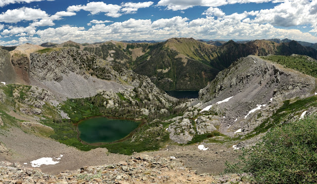
As seen from the Overlook, Dollar Lake, 11,595', is cradled in a cirque at treeline. The outflow spills eastward into much larger Emerald Lake, a contributor to the Los Pinos River.
Route: Hike generally northeast on the Cave Basin Trail to 12,000 feet where the pathway fades. Hold a northeast bearing to the Dollar Lake Overlook. The Cave Basin Trail does not pass through Cave Basin! Hikers confident with off-trail travel can explore the sinkholes in Cave Basin on the return.
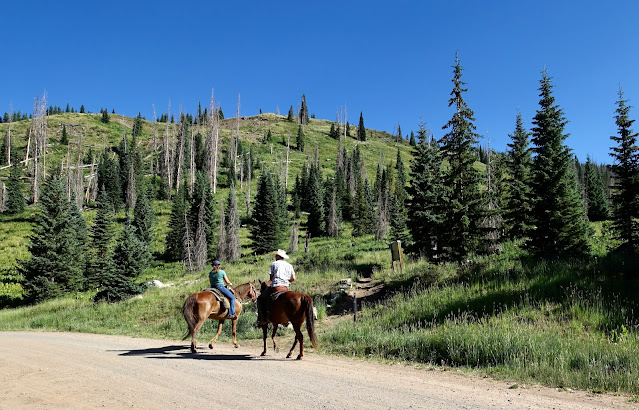
The trailhead, elevation 10,720 feet, is on the north side of Middle Mountain Road. Cave Basin Trail #815 is open to hikers and equestrians but closed to motos.
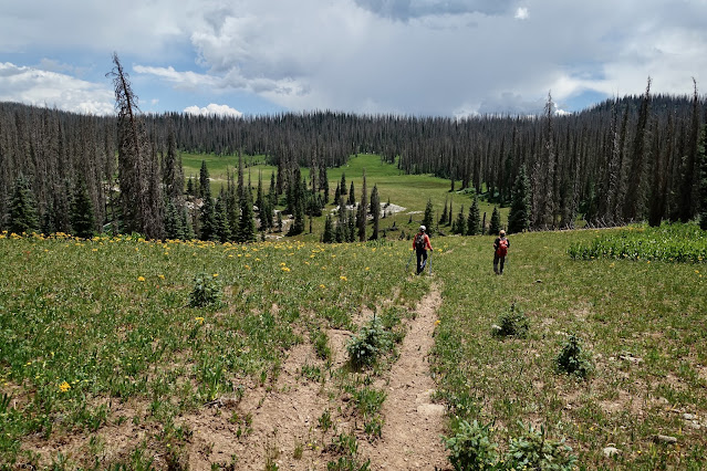
Cross South Bear Creek at 0.2 mile. The broad pathway wanders gently uphill. After a heavy winter in 2023, wildflowers were exceptional. The showiest bloomers were orange sneezeweed, osha, corn husk lily, delphinium, and arrowleaf senecio. Young spruce and fir were alive but most of the forest elders were standing dead from beetle kill. It was both dispiriting and aesthetically displeasing.
A limestone passage composed of weathered blocks welcomes travelers into the Weminuche Wilderness at 1.4 miles, 11,440 feet.
The trail goes briefly downhill and crosses a wide-open meadow. Pass an assemblage of limestone jigsaw pieces, a solid slab to begin, then fractured and separated by repeated freeze-thaw.
Traverse another expansive meadowland at 2.7 miles. This is where we left the trail to launch explorations in Cave Basin on our return. The first trailside sinkhole is at 3.1 miles in a limestone outcrop. The entrance to the cave is so narrow it doesn't tempt.
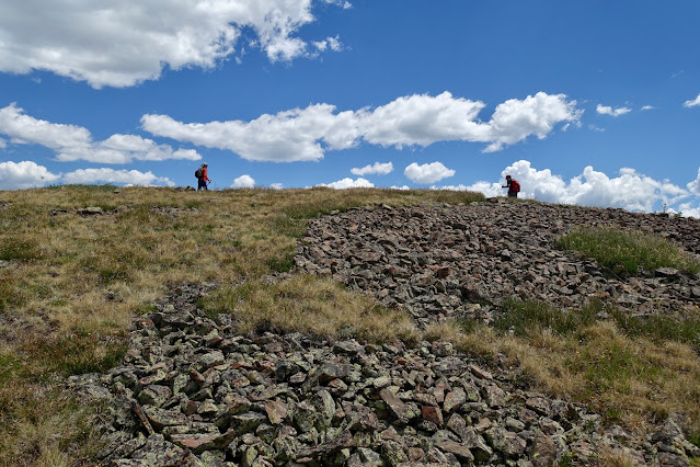
Walk over a limestone plain framed by a linear outcrop at 3.6 miles, 11,720 feet. From 550 to 60 million years ago the San Juan Mountains were flooded by shallow seaways. The limestone seen throughout the hike was laid down during this period of sedimentary deposition. The rounded summits ahead include a couple of San Juan 13ers. They are northwest (and accessible) from the Overlook which is just off-image on the right. (Thomas Holt Ward, photo)
Walk over fractured slabs.
The visual field opens at tree limit. The view corridor to the left is San Juan spectacular. Table Mountain is obvious and looks a little out of place. The land to its west plummets into Vallecito Creek, the principal water carrier for the summits lined up in this image. From the left: Sheep Mountain, Peak 13,105', Emerson, Amherst, and (conical) Organ mountains. North of Johnson Creek are: Echo Mountain, McCauley Peak, Grizzly Peak, Jupiter Mountain, and the 14ers, Windom and Sunlight peaks. (THW, photo)
The trail lingers just long enough to plow through an extensive willow patch. Below, the Dollar Lake Overlook is horizon-center.
At 12,000 feet the trail becomes dispersed and elusive. But no matter. Hold the north-northeast bearing and in time you'll get a visual on the Overlook. We were able to cairn hop for the most part on the ascent but wandered all around on our way down. We followed curiosity and pleasure for this was our favorite segment of the hike.
Small, sky-reflecting tarns filled every depression in the tundra. Views of faraway ranges made it all the more exquisite.
Below, the Overlook is image-right. We approached from the green ramp on the west.
It was an effortless, obstacle-free lift to the crest.
Reach the Dollar Lake Overlook, 12,360', at 5.3 miles after 1,800 feet of elevation gain. It is crazy beautiful as you top the rounded point and see waves of mountains flowing off to the east. Dollar Lake is in full view but much larger Emerald Lake reveals but a glimpse. The green divide east of Emerald Lake is a lineup of 12ers. The flat-topped summit at image-center is Peak 12,495' (adjusted by LiDAR to Peak 12,519'). Peak 12,520' (Emerald Benchmark) is the neighboring ranked summit to the north.
Dollar Lake is a destination for backpackers. We couldn't make out a trail but most of the route is visible below. From the Overlook, descend southeast into the saddle and then work down a stony slope to the lake. (THW, photo)
Graham and Granite peaks are on the divide east of the Los Pinos River.
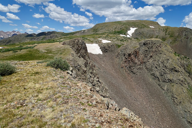
The Overlook is composed of 1.8 billion year old crystalline, metamorphic Irving Formation Gneiss. Perhaps the very oldest rock in the San Juans, it was exposed in the most recent San Juan uplift. As the San Juan dome rose, the limestone shifted out of position but remained at the surface. I was reminded of the rings of limestone seen in the Molas Pass area. On this hike we walked right on top of the contact between the eons and forces of on-going earth formation. It is an exceedingly powerful place. (THW, photo)
It looks like you could hike forever on the tundra-clad slopes to the northwest. It would be a simple matter to ascend Point 12,961'. A friend climbing all the San Juan 13ers just kept on walking and summited a couple further up the ridge.
We were delighted to spot a large herd of elk with frisky calves on the south slopes of Point 12,961'.
(Jana Goldstein, photo)
Returning, we wandered back to where the trail solidifies at 12,000 feet. We recrossed the limestone plain. Of note, elegant death camas was thick on great swaths of land at around 11,700 feet. If you come across this plant and have a dog with you, leash it. Brushing up against death camas has sickened many canines (and humans). Ingesting it is fatal within minutes. (THW, photo)
Hikers with off-trail navigation skills may wish to explore Cave Basin. We left the trail in a vast meadow east of Point 11,662', at 8.0 miles, 11,420 feet. Walk southeast through a large opening in the trees. We stumbled on pieces of social trail.
We aimed for the limestone outcrop, shown, and intersected the neglected historic pack trail seen on the Emerald Lake topo at 8.6 miles.
The old stock driveway proved useful as we headed south toward the sinkholes.
Watch for shallow depressions throughout the basin. The sinkhole pictured below was west of the trail at 8.8 miles. We dropped into the bowl and discovered an ecosystem with limestone-favoring, moisture-loving wildflowers. (THW, photo)
We crossed the west tributary of Cave Basin Creek at 9.1 miles.
My partner spent two hours previously exploring sinkholes in Cave Basin. The primary cave and a cluster of three sinkholes are south of the creek crossing. We aimed for the boulder seen below between the two hikers.
Holding our trajectory, at 9.4 miles we arrived at the largest cave in the area.
We were able to stoop and wiggle our way into the damp cavern for about 20 feet before the squeeze backed us out. (Jana Goldstein, photo)
We found three more sinkholes at the southeast end of the basin, each with distinctive characteristics. The spooky sinkhole pictured below presented a 15-foot drop straight down to a flat floor and a tunnel heading north. Careful!
The next opening was a slot three feet high going straight back. Spelunkers only!
The last sinkhole we examined had a uniform conical shape with a crawl space opening.
We retraced steps across the west tributary of Cave Basin Creek and then at 10 miles, initiated a shortcut back to the trail. We held a west-northwest bearing for 0.7 mile saving 1.3 miles.
There was considerably more deadfall than the last time my partner took the shortcut in 2020. It is a rather rough 340-foot climb back to trail.
This is a hike of contrasts. Look out over mighty San Juan peaks, walk across expansive highland flats, and peer into mysterious subsurface depths. Contemplate the eternity of stone and the fleeting blossoms of the corn husk lily.
(THW, photo)










No comments:
Post a Comment