Essence: Summit Peak is in a remote quarter of southern Colorado. The drive is a commitment for which the mountain amply compensates. The peak is on the Continental Divide and on the boundary between the San Juan and Rio Grande national forests. It is the tallest point in Archuleta County and the South San Juan Wilderness. LiDAR raised its elevation to 13,304 feet with a rise of 2,737 feet. Three ridges meet on the apex of the peak. The standard route approaches on the Treasure Creek Trail and pitches up tundra-clad southern slopes to the east ridge. The north and west faces of the peak are juggernauts of vertiginous walls, couloirs, and monoliths composed of friable volcanic breccia. Ascending on the east ridge cliff edge and extending the rim walk with a free-range descent on the southwest ridge was the highlight of the hike.
Travel: Lacking driving instructions, we tried three different routes. The only reasonable approach is on FSR 380, suitable for 2WD vehicles with sturdy tires. See the end of this post for a description of two options for dedicated 4WD vehicles. FSR 380 is located off US 160 roughly midway between Wolf Creek Pass and the town of South Fork. At mile marker 178.8, turn south at the sign, "National Forest Access, Park Creek Road, Summitville," and measure distance from there. The basic instruction is simple: stay on graded and graveled FSR 380 for roughly 22 miles to FSR 243. FSR 330 to Summitville branches left at 14.5 miles. Stay straight (slightly right) to continue on FSR 380. The Elwood Cabin is down off the road on the left shortly before the Elwood Pass track comes in on the right at 17.8 miles. At 22.0 miles, crank sharply to the right onto FSR 243. Treasure Creek Trailhead is another 2.8 miles afar at the end of FSR 243. The road narrows to 1.5 vehicle width and rock is embedded on the road surface. The road parallels Treasure Creek, popular with anglers. Our odometer tends to underestimate mileage.
Distance and Elevation Gain: 7.8 miles, 2,400 feet. The southwest ridge ramble adds 1.0 mile and 150 feet.
Total Time: 5:00 to 6:30, depending on route
Difficulty: Trail, off-trail; navigation moderate; Class 2 with mild exposure
Map: Summit Peak, Colorado 7.5' USGS Quad
Date Hiked: July 23, 2024
Quote: Alpine tundra has a beginning-of-the-world quality, a sense of sparseness and lucidity...It is a land of contrast and incredible intensity, where the sky is the size of forever and the flowers the size of a millisecond. The only objects larger than small are boulders. Ann Zwinger, Land Above the Trees
The approach to Summit Peak and its southern slopes present as much tundra as you can take in. When we first saw the mountain from Blackhead Peak it presented as a uniform, green ramp. We had no idea its rim was shattered, laying bare fascinating rock features. Walk along the edge to simultaneously experience two radically different worlds. (Thomas Holt Ward, photo)

Route: Walk south on the Treasure Creek Trail following a south fork of Treasure Creek. The trail cranks north and becomes sporadic for the next mile through the forest. Break out into the alpine and find the trail once again as it wraps north around an intervening ridge. Intersect the Continental Divide Trail and walk south around the east ridge of Summit Peak. Climb the southern slope to the east ridge. Walk the edge to the high point. Return as you came or descend on the southwest ridge to UN Point 13,020'. Return to the Continental Divide Trail to rejoin your upcoming track.

Treasure Creek Trail #710 extends for 3.1 miles from the trailhead at elevation 10,940 feet, to the Continental Divide Trail. Drop south from the parking platform and cross a three-log bridge suspended over Treasure Creek.

Plow through a field of corn husk lily and monkshood. The forest has been ravaged by beetle-kill. It is both disheartening and aesthetically displeasing. Thankfully, the Forest Service maintains the Treasure Creek Trail but they can't keep up and you will be hopping over some fallen timber.

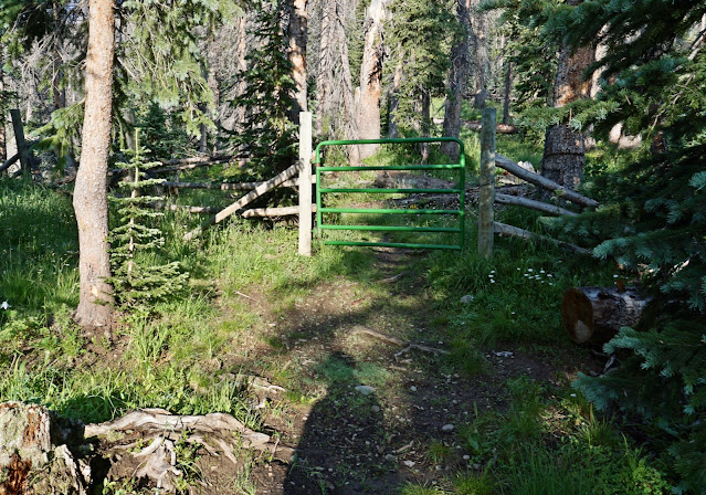
Open and close a green gate at 0.3 mile. (THW, photo)
The trail tracks high above the pool-and-drop south fork gorge. (THW, photo)

Bust out of the trees into a verdant, subalpine meadow. Veronica was blooming at peak. Train your eyes to see the inconspicuous, dainty blue flowers on stems about four inches tall. Robust cairns marked the thin trail.

At 1.1 miles, 11,220 feet, the trail hooks a switchback and bears northwest, climbing gently through the decimated forest. Strangely, the footpath went from pounded to elusive. You can see our inconsistent track on the map above. We stopped frequently and searched for the trail. The image below was shot at 1.7 miles where the trail crosses the only significant drainage running east to the south fork. We saw a lot of elk droppings and occasional bear and mountain lion scat.

All the brilliant white flowers were showy: Coulter's erigeron, geranium, yarrow, and osha. Below, the pathway is hemmed in by great masses of arrowleaf senecio and mountain bluebells.

Emerge from the timber and arrive at a landmark boulder seen below at 2.0 miles, 11,840 feet. The boulder has a clean face with lichen draped on its head. The route bypasses the intervening ridge seen below on the north. Standing at the boulder, hikers with sharp eyes will be able to see the trail materializing in the talus. Stay a little high toward the left to avoid the bog in the swale. (THW, photo)

The trail appears clearly once again in the rock pile as it goes over the low shoulder of the ridge. (THW, photo)

We could hear Treasure Creek running 400 feet below as we rounded the ridge. The trail is significantly braided as it turns south but eventually coalesces. There is no mistaking Summit Peak when it reveals itself at last. It is a structure of magnificent beauty, its north ramparts are raw, blunt, and broken. (THW, photo)

North of Summit on the Continental Divide is The Unicorn and Montezuma Peak. We fully intended to integrate them into a circuit on this hike but thunderheads gathered quickly so we left them for another day. Stav is Lost has an excellent description of a loop incorporating all three peaks. Meanwhile, we were swallowed by an immense span of tundra on the linear tipping point of the continent. (THW, photo)

The landscape was covered in elk prints and scat. We could smell the animals. And finally, we spotted a herd of cows and calves about 20 strong, grazing at the base of the mountain (image-lower-left).

Closing in on the rounded east shoulder of Summit, the Treasure Creek Trail ends at the Continental Divide Trail at 3.1 miles, elevation 12,560 feet. Turn south.

As soon as we got around the talus runout, seen below, we started mounting the south-facing slope of Summit at 12,600 feet. The east ridge is so appealing, it is a good strategy to contact it toward the east end to make it last as long as possible.

It's a 400-foot steep grunt to the east ridge but the footing is good and the views are insane. (THW, photo)

We gained the ridge at 3.7 miles, 13,000 feet. The Unicorn and Montezuma Peak were in the immediate north.

The peaks to the south present a mysterious world for us, having spent little time in the South San Juan Mountains. The air quality was poor given the wildfires burning across the American West.

Mounting the east ridge to the crest is thrilling. We stayed near the lip because the surface is flatter but hold a line that is comfortable for you. The alpine flowers pay no mind to the slant of the earth. Blooming happily on the inclined slope were sky pilot, snowball saxifrage, moss campion, alpine avens, purple fringe, and a vibrant purple mat penstemon.

All the peaks in the area are volcanic. Most of the rock was exploded
out of calderas somewhere in the vicinity. Because the eruptions were so
violent, lots of preexisting rock fractured and that rubble became
incorporated in the massive deposits of welded debris--volcanic breccia. Be cautious climbing the final pitch. The rim is overhung in places, evaporating into (literally) thin air. Breccia nodules can break off the rim. (THW, photo)

Mount the pointed apex of Summit Peak at 3.9 miles. The southern tundra ramp is united at the tiny point with three ridges. The vertical drop on all sides save one is unusual and dramatic. Summit Peak got onto our radar on our first hike in the South San Juan Mountains to Blackhead Peak, image-left. We could see the tundra incline from there and some locals from Pagosa Springs turned us on to Summit Peak.

The Summit benchmark and two reference markers were placed in 1936. All three brass disks are cemented to the top of foot-tall pipes. The peak register was stuffed with random sheets of paper. Of note, when contemplating the best route to The Unicorn we looked at
several trip reports. The majority of hikers retrace steps to the
Continental Divide Trail and approach from there. There is one report of
climbers descending the north ridge directly but it looked ludicrous
for hikers at our skill level. (THW, photo)

Since we were not going on to The Unicorn and Montezuma Peak as planned, we decided to explore the southwest ridge. It was too appealing to pass up. It proved to be a mellow and joyful descent route.

The ridge is scalloped with sharp edges. Again, it's best to stay a few feet off the friable rim. Everything about this free-range ramble was thrilling. There were absolutely no obstacles to negotiate.

We walked past an isolated, free-standing monolith. (THW, photo)

Looking back at Summit, I was deeply charmed by the union of opposites displayed in this image. It's hard to process the magic our earth pulls off by its very nature. It doesn't have to be this crazy cool, and yet it is.

A natural turnaround location was just ahead.

We climbed 100 feet to unnumbered Point 13,020' at 4.7 miles. Clearly, we could have kept exploring out on the tundra plain.

It is 4.1 miles back to the trailhead from our turnaround. Along the way we passed a patch of queen's crown providing nourishment to a Colorado native red-tailed bumblebee. (THW, photo)

Back on the Continental Divide Trail, we were surprised to see no backpackers or even hikers. But we did see a family of ptarmigans, a female with five chicks. They are hard to pick out in this image because they are dressed in their summer plumage. Always camouflaged, these members of the grouse family will change color and turn white in winter ensuring better protection from their predators in the snowy landscape.

Travel Alternatives: It took us three tries to find the best route to the trailhead. Our first attempt was the Elwood Pass option for dedicated 4WD vehicles. Measure distance from the signal in the center of Pagosa Springs. Drive east on
US 160 for 10 miles to mile marker 154. Just beyond the bridge over the West Fork
of the San Juan River, go east on FSR 667 and reset your odometer. Pass the Silver Falls guard station and trailhead at 7.7 miles. Ford a river
at 8.4 miles. At the junction with FSR 684, stay straight, following the sign for Elwood Pass, shown below. When the Elwood Pass track intersects FSR 380, turn right, 7.0 miles from the trailhead. We turned around at the bottom of Elwood Pass and reconsidered our options.

2 comments:
Solid! Dewa and i love running high miles in the Summitville area, so this sparks our interest fs! Thank you for being you! feeble ilg 🙏🏽
Steve, I am honored that you left this note on Earthline. I love that you run with your daughter. I am visualizing the two of you, so fleet of feet, you are simply skimming across the surface of the Earth. Oh joy! Debra
Post a Comment