Essence: Point 10,612' is the highest prominence on Hermosa Cliffs but it is eclipsed by popular Castle Rock, a half-day hike. This long-haul trek uses two of the three lateral trails that penetrate the imposing miles-long rampart. The hike moves south on the ridge via the Elbert Creek Road and the Pinkerton-Flagstaff, Dutch Creek Trails. Roll along above 10,000 feet for over 11 miles while looking out over the La Plata Mountains and San Juans. The Elbert Creek Trail was left untouched by the 416 Fire. However, falling scorched timber is a present and significant danger on the Goulding Creek Trail. Hikers are advised to consider an alternate route. This hike is close to Durango and was conducted during the Safer-At-Home period of the COVID-19 pandemic. All-day hikes were Nature's therapy. The hike is within San Juan National Forest.
Travel: A short shuttle is required. From Durango, drive north on US 550. The turnoff for the Goulding Creek Trailhead is on the left, one mile past Glacier Club. You won't see the small wooden "Goulding Trail" sign until you've made the turn. The road splits immediately. Go left on a rugged dirt road suitable for 2WD with decent clearance. Drop a vehicle in the circular lot 0.2 mile from the highway. Proceed north on US 550 to the Elbert Creek trailhead. In about six miles turn left at Needles Country Store, mile marker 46.2. Gas,
water and snacks are available. Trailhead parking is at the south end of
the commercial cluster, just north of a corral.
Distance and Elevation Gain: 17 miles; 2,900 feet of climbing for the thru-hike as described
Total Time: 8:00 to 9:30
Difficulty: Trail, minimal off-trail; navigation easy; no exposure assuming you stay away from the cliff on Point 10,612'
416 Fire: The fire started on June 1, 2018 adjacent to the D&SNG tracks at the bottom of Shalona Hill. It was contained on July 31 after burning 52,778 acres.
Map: Electra Lake, Colorado 7.5' USGS Quad or Trails Illustrated: Durango, Cortez #144
Date Hiked: May 22, 2020
Quote: Wherever we looked the land would hold us up. William Stafford
Drive a few miles, walk a few, and the landscape becomes fantastical. This image looks northeast from Point 10,612'. The Animas River is carving away in its canyon. Pigeon and Turret peaks are in the center of the stony disarray on the other side. (Thomas Holt Ward, photo)
Route: The map is divided into two segments for legibility. Hike northwest on the Elbert Creek Trail until it crosses Elbert Creek Road, FSR 581. Walk generally south on the road to the Dutch Creek and Pinkerton-Flagstaff trails. Bear east to Point 10,612'. While this description continues south consider an out-and-back to the high point.
When the Dutch Creek Trail splits off and heads southwest to the Lower Hermosa Trailhead, continue south on the Pinkerton-Flagstaff Trail. Go over Point 10,256'. Leave the Pinkerton and hike generally southeast on the Goulding Creek Trail to the trailhead.
Elbert Creek Trail
The Elbert Creek Trailhead, elevation 8,800 feet, is located on the south side of a working corral. The Forest Service issues grazing permits in the summer so close all gates behind you.
Enter a mixed evergreen forest and ford Elbert Creek at 0.3 mile. The crossing can be tricky when water is high but most of the time you can hop across or balance on a loose collection of logs.
The trail makes two long traverses through an aspen forest as it switchbacks up the
east-facing grade. Green and glorious, quaking leaves reflect light and cast shadows in the treetops and flickering shadows at your feet. Morning lit Castle Rock plunges straight down for over 700 feet before the angle of incline softens. (THW, photo)
At 1.2 miles, the path rounds the corner and tracks above turbulent Elbert Creek. On the south aspect, a few Douglas fir and Rocky Mountain juniper hang on
while aspen thrive. As the drainage narrows and shade thickens, so do
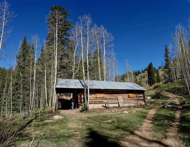
Engelmann spruce and subalpine fir. Cross a spring once channeled into a wooden flume. As the forest gives way to meadow, an historic line shack is reached at 1.8 miles, 9,800
feet. The chinked log building is the property of San Juan National
Forest. A sign is posted no trespassing. Sometimes the door is unlocked but the cabin is off-limits to the general public. Range riders occasionally bunk here in the summer. (THW, photo)
The turnoff for Castle Rock is 0.2 mile further up the trail. The spur adds two miles roundtrip. This hike advances northwest, staying on the Elbert Creek Trail. At 2.3 miles, pass through a dilapidated fence beneath a limestone band. Seen throughout the hike, the limestone is a member of the Hermosa Group. The formation is composed of alternating beds of limestone (deposited when sea levels were
high) and sandstone (deposited when sea levels were low) with
intervening layers of siltstone and shale. Besides sea level rise and fall, the rocks record glaciation in the
Pennsylvanian epoch 300 million years ago. (THW, photo)
In the image below, I am walking west and Elbert Creek is running below the trail through red willows. You could intuit my direction knowing the nature of north and south facing aspects. The slopes on either side of the creek receive the same amount of precipitation, have similar
soils, and experience the same temperatures. The south facing aspect receives more direct
sunlight so snow melts sooner and soil moisture evaporates faster. Plants are more drought
tolerant. Shady north facing slopes retain snow and hold moisture longer; this hill is packed with mature and healthy evergreen trees. (THW, photo)
We crossed Elbert Creek on a log at 2.6 miles. Soon the trail tracked along the base of a north facing slope and we walked on snow most of the way to Elbert Creek Road.
Elbert Creek Road, FSR 581
The trail crosses FSR 581 at a horseshoe bend at 3.2 miles. Elbert Creek Road begins in Hermosa Park and ends at the Dutch Creek and Pinkerton-Flagstaff trails. Weary of plowing through snow we walked generally south on the road for a fast 3.1 miles. Alternatively, stay on the Elbert Creek Trail for 1.7 miles. Take the Pinkerton-Flagstaff Trail southeast for 2.3 miles to the Dutch-Pinkerton junction.
In May, trees were down across the road and it hadn't been plowed so we
had it to ourselves. It was quite beautiful with softly rolling hills
and stands of healthy conifer. Roads dart off here and there so we
stopped often to check the map. Just stay on the main road and avoid the
gated spurs. You'll lose a minimal amount of elevation heading Line
Canyon and a couple tributaries. (THW, photo)
Dutch Creek and Pinkerton-Flagstaff Trails
The shared Dutch Creek and Pinkerton-Flagstaff trail intersects FSR 581 at 6.3 miles, 10,560 feet. Elbert Creek Road is blocked just beyond the trailhead. The multi-use trail is open to hikers, equestrians, and bicycles. It is closed to all motorized vehicles until the two trails branch five miles south. Open and close the gate and enter the Hermosa Creek Special Management Area. The
Hermosa Creek Watershed Protection legislation, passed by Congress
and signed by President Barack Obama in December, 2014, created both the
37,236-acre Hermosa Creek Wilderness and the SMA.
High Point 10,612'
The single track segues onto an abandoned road which heads east toward two points measured identically at 10,612 feet on the topo map. The first is a few steps off the track on a forested hillock. Back on the trail, we left it again at 7.5 miles. We could have cut off earlier but it was easy enough to walk overland through an open forest to another rounded crest with weathered surface limestone. Nearing the promontory, I could actually feel the precipitous drop approaching. It was inexplicable and primal.
Point 10,612' is 200 feet higher than Castle Rock but it doesn't have sitting ledges so you can't get as close to the 800-foot vertical drop. This startling and stunning overlook befits the highest point on the Hermosa Cliffs. On the San Juan skyline the Twilight Peaks in the West Needle
Mountains are on the left. Pigeon and Turret peaks upthrust at center with rounded Mount Eolus to their right. The abrupt west end of visually horizontal Mountain View Crest is image-right.
In 2020, Electra Lake was drained for maintenance. We gave thought to walking south along the cliff line but it is heavily treed and the edge is not well defined. Consider your options. We didn't know about the standing dead hazard on the Goulding Creek Trail so we continued south. The safest and shortest choice is simply to turn around and walk the 7.8 miles back to the Elbert Creek Trailhead. (THW, photo)
The land surrounding the Dutch Creek Trail was heavily logged.
The trail is open and lofty, remaining above 10,000 feet to the Dutch Creek junction. There are gorgeous views of the La Plata Mountains. (THW, photo)
We could see Missionary Ridge east of the Animas River. (THW, photo)
The trail swings to the west side of Point 10,340'. We got a visual of the Dutch Creek Trail descending in Stag Draw and Point 10,256' further down the Pinkerton. Eighty year-old arborglyphs are etched into large aspen.
Pinkerton-Flagstaff Trail
At 12.0 miles, the Dutch Creek Trail branches right. This route stays straight on the Pinkerton-Flagstaff Trail. From here to the Goulding turnoff expect to share the treadway with mountain bikers and motorized dirt bikes. The 19 mile Jones-Pinkerton-Dutch-Hermosa loop is popular with two-wheelers.
The 416 Fire swept up Navy Draw on the south side of Point 10,161'. Enter the burn zone. The well-engineered trail switchbacks up to Point 10,256' making the last climb of the trek relatively mellow.
Walk across the thinnest ridge line of the entire hike. The sandstone turned the earth red.
There's a lot of history on this ridge. Step over a steel bar cattle guard between a closed gate and herky log fence, 0.3 mile north of Goulding.
Goulding Creek Trail
The departure from the Pinkerton at Goulding is well marked at 13.8 miles. I began hiking the lateral trail, often with kids, in 2001 and have returned many times. It is especially beautiful in the spring (lime-green leaves), autumn (golden leaves), and even in early winter when the leaves have fallen and white aspen trunks are stoic.
The six subalpine meadows on the upper trail really make this hike and after the fire they are as beautiful as ever. In the highest meadow sits a log cabin with a four-foot saw and a corral that's been cobbled together repeatedly over the ages.
Venerable aspen have a strong presence as do old growth spruce. Goulding Creek runs beside the trail making a lively sound.
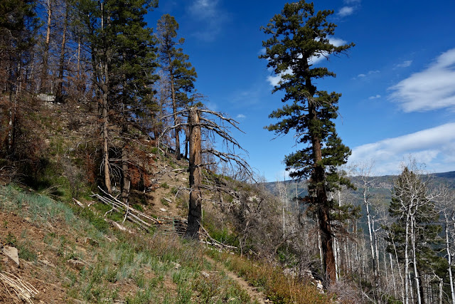
Evidence of the fire accelerated as we descended. Some spruce survived but many were destroyed. Fallen timber is all around. We saw a mature aspen crash to the ground 50 yards away. Open and close the gate at 9,400 feet, shown. The trail takes a dive and crashes down 1,500 feet over 1.6 miles.
Few trees were spared and most of the incinerated ones are still standing. On our windy day, I felt a sense of urgency to get the heck out of there. (THW, photo)
Wildflowers, oak, and aspen are making a comeback. (THW, photo)
We saw a good variety of wildflowers but the populations were sparse during a parched spring. Here's a list of blooming flowers in order of appearance: serviceberry, meadow rue, purple violet, white
peavine, candytuft, bluebell, marsh marigold, buttercup, white violet (shown),
larkspur, mahonia, heart leaf arnica, strawberry, fairy candelabra, purple vetch, geranium, golden smoke, western wallflower, Solomon's seal, black tip senecio, western clematis, baneberry, elderberry, primrose, wild iris, chokecherry, and lupine. (THW, photo)


No comments:
Post a Comment