Travel: The trailhead is nestled in a maze of roads. We drove around for almost an hour, gave up, and started hiking just off the highway. Following are instructions to the best starting point. From the intersection of CO 145 and the turnoff to Ophir, drive south on CO 145 for just 0.1 mile. Turn right/west on an unsigned dirt road just north of mile marker 64. Drive 0.2 mile to a four-way intersection and continue straight for 0.1 mile. Turn left. From here, it is 0.7 mile to the trailhead. You will pass a sign for Galloping Goose and some placards. At a three-way split, stay right. Park where the road hangs a downhill right turn at 9,000 feet, close to the Lake Fork bridge. 2WD should be sufficient when the road is dry. Otherwise, there are good places to park 0.2 mile from the highway.
Distance and Elevation Gain: 7.6 miles from the parking area near the bridge; 4,000 feet of climbing
Time: 5:00 to 6:30
Difficulty: Primarily off-trail; navigation challenging; one Class 3 wall with mild exposure
Map: Mount Wilson, Colorado 7.5 Quad
Date Hiked: September 17, 2015
Quote: The sun, with all those planets revolving around it and dependent on it, can still ripen a bunch of grapes as if it had nothing else in the universe to do. Galileo Galilei
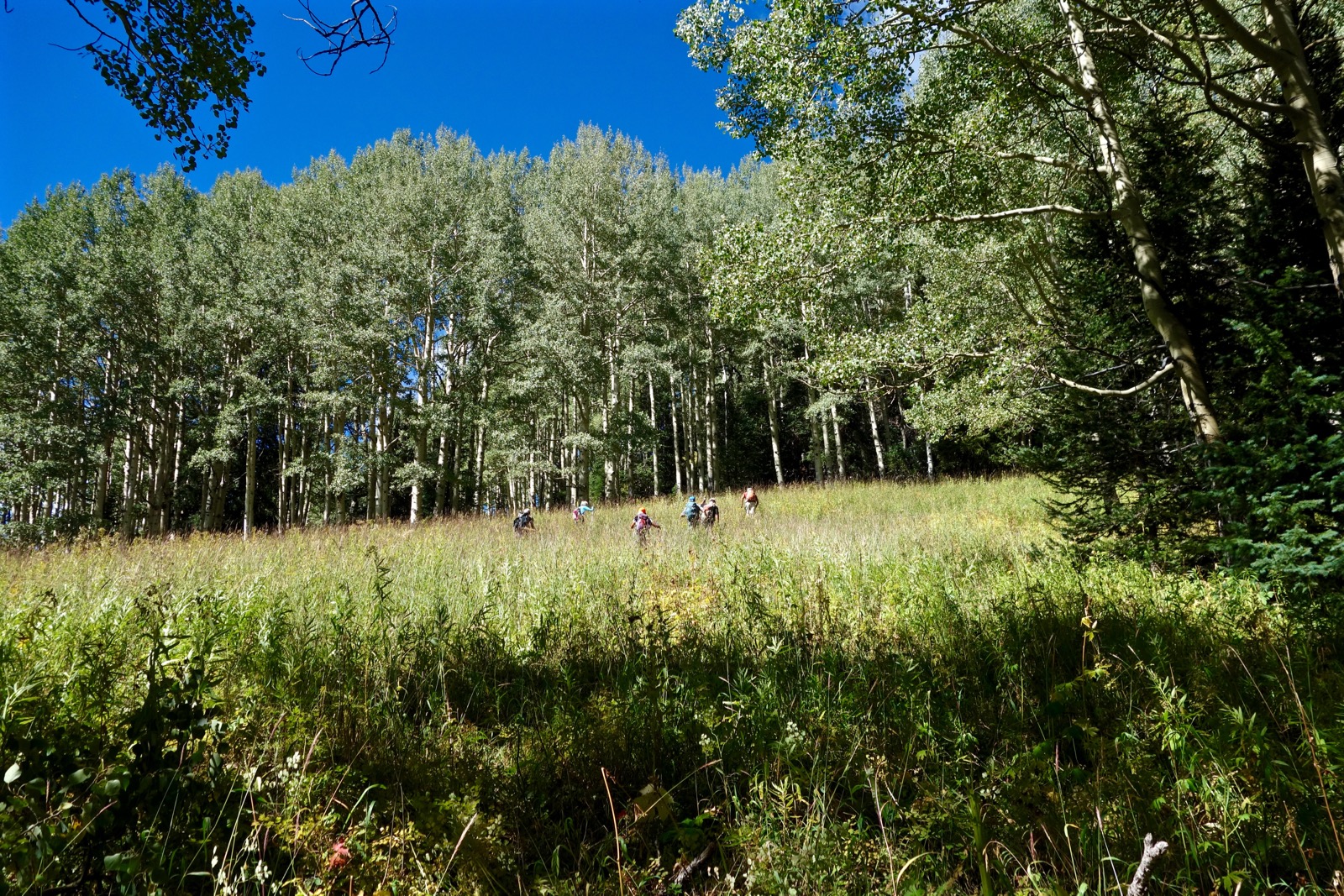
Sunshine Mountain, adorned with hikers, is oft neglected because its neighbors have loftier bragging rights.
(THW, photo)

Route: The blue-dot line is the access road to the start of the hike. Cross the Lake Fork and find a trail that switches west up the mountain's east ridge to a meadow at 9,760 feet. Now off-trail, locate and adhere to Sunshine's east ridge. Plow through thick woods to almost 12,000 feet where the alpine commences and the route becomes obvious.

After fumbling around on the wrong roads, we gave up and just started walking. Here, we are going down the proper (blue-dot) road. Driving will save 1.6 miles roundtrip. Notice the Galloping Goose sign and placards.

From the trailhead at 9,000 feet, walk south past barrier boulders to a substantial walking bridge spanning the lively Lake Fork of the South Fork of the San Miguel River.

The path swings north. At 0.15 mile, look for a faded green gate obscured by foliage on the left. Leave the Galloping Goose Trail. Go around the gate and find an overgrown trail. Keep your eye on an old roadcut to assist. This essential path switches up a steep hillside and pierces thick undergrowth. On the third switchback walking north, leave the roadcut and get on a footpath that hooks sharply southwest.

This trail makes a final switch northwest leading to a meadow at 9,760 feet, 0.7 mile. There is a survey benchmark in this meadow. It is a good idea to set a waypoint here. You must find this meadow on the journey home if you hope to locate the upcoming trail.
Off-trail, climb west-northwest on a soft ridge. Pass a confidence-inspiring cairn. Alas, you will have no further help through the woods. Looking at the map above, note that the summit ridge splits at its base. The route begins on the ridge that has a cliff band to the north.
Get your bearing and stick to it through dense trees. Use fragmentary game trails so long as they stay the course. It is much easier to stay on the soft ridge going uphill. Creating a GPS track while ascending will help guide your return.
Serious timber bashing is unavoidable in this vibrant and healthy forest. Aspen mixes with subalpine fir in the lower reaches.

At 10,280 feet, shift southwest/left onto the summit ridge. By 10,800 feet the ridge constricts and there is a consistent, workable game/social trail. A view corridor opens. This image looks east to Ophir.

Claim Knoll 11,360' at 2.4 miles and then give up 50 feet. From here, navigation is easy. Spruce remarkably persist to almost 12,000 feet. When Sunshine appears, you can actually see the summit.

Stay on the ridgecrest, working around little notches in the krumholtz zone. The approach is thankfully over at 12,080 feet, 3.4 miles. Scale the steep tundra slope. Rock embedded in the soil makes for ideal climbing. Stay near the right drop where there are plenty of features. A strong north wind threatened to blow us off so we shied away from the precipitous edge.

The slope steepens and becomes more rocky. Mount the 20 foot, easy Class 3 scramble on solid rock with excellent traction and good holds. (THW, photo)

An intriguing ridge connects Sunshine and Lizard Head.

Upon reaching a band of angular, choppy red rock, climb up the nose or bypass just off the ridge to the south.

The challenge finishes with a shallow but thin ridge with good rock. Summit at 3.8 miles and find the peak register. The vista is thrilling. Within three miles west are, from left, Mount Wilson, Gladstone Peak, and Wilson Peak. (THW, photo)

The gnarly jumble south is Pt. 12,669'. A weak use trail appears to head off in that seemingly impossible direction. Midway between Sunshine and Lizard Head is Peak 12,634', approached from the east.

The ridge descent has lavish views of Ophir, South Lookout (ripples on top), and the west side of the Ice Lake Peaks. San Bernardo Mountain, 11,861 feet, is just right of center in this image. (THW, photo)

Late in the season, bottle gentian and harebell were still going strong. There was plentiful evidence of elk. The Ophir Needles enthralled us while returning up the access road. There is little information available for climbing Sunshine Mountain. Two people in our group had waited decades for an opportunity to summit. I hope this entry will help you find your way up this sunny mountain.

Sunshine Mountain from San Bernardo Mountain, July, 2018. (THW, photo)

No comments:
Post a Comment