Travel: In a 4WD, high clearance vehicle turn west from US 550 into Purgatory Resort and measure mileage from there. Drive up the winding road and turn right on FSR 576 near the upper parking lots at a small brown building (0.4 mile). Turn right at 3.2 miles toward the Hermosa Creek Trail. At 8.7 miles, the spur to the popular mountain bike trail branches left and Hotel Draw and Bolam Pass are to the right. The road deteriorates. Ford Hermosa Creek at a shallow, distributed, and flat crossing at 10.2 miles. Avoid in high water. At 11.2 miles turn left on FSR 550 toward Hotel Draw. The dirt road narrows and is prone to developing very deep ruts. There is a small pullout and a sign for the Colorado Trail at 15.0 miles, Benchmark 10,419'. Allow 45 minutes to one hour from Purgatory.
Distance and Elevation Gain: 9.7 miles; 3,250 feet of climbing for three peaks. For Blackhawk Mountain only, 9.4 miles with 2,500 feet of vertical.
Total Time for three peaks: 5:30 to 7:00
Difficulty: Trail, off-trail; navigation moderate; Low Class 3 scrambling option with mild exposure on Blackhawk East Map: Hermosa Peak, Colorado 7.5' USGS Quad or Apogee Mapping
Latest Date Hiked: August 6, 2019
Quote: You never climb the same mountain twice, not even in memory. Memory rebuilds the mountain, changes the weather, retells the jokes, remakes all the moves. Lito Tejada-Flores
The appeal of the Blackhawk Mountain trio is clear from Hermosa Peak. Harts Peak, image-right, is an extension of Blackhawk Mountain and is not a ranked summit. Blackhawk East is the highest point on a long ridge, image-left, and the tip of Whitecap Mountain is southwest of the group.

Route: Hike northwest on the Colorado Trail to the pass between Blackhawk Mountain and Peak 12,402'. Leave the trail and climb west to Blackhawk Mountain. Bypass cliffs on the north ridge by dropping east and then ascend to Harts Peak. Return to the pass and climb east to Peak 12,402'. Descend on the south ridge back to the Colorado Trail.

Blackhawk Mountain, 12,681'
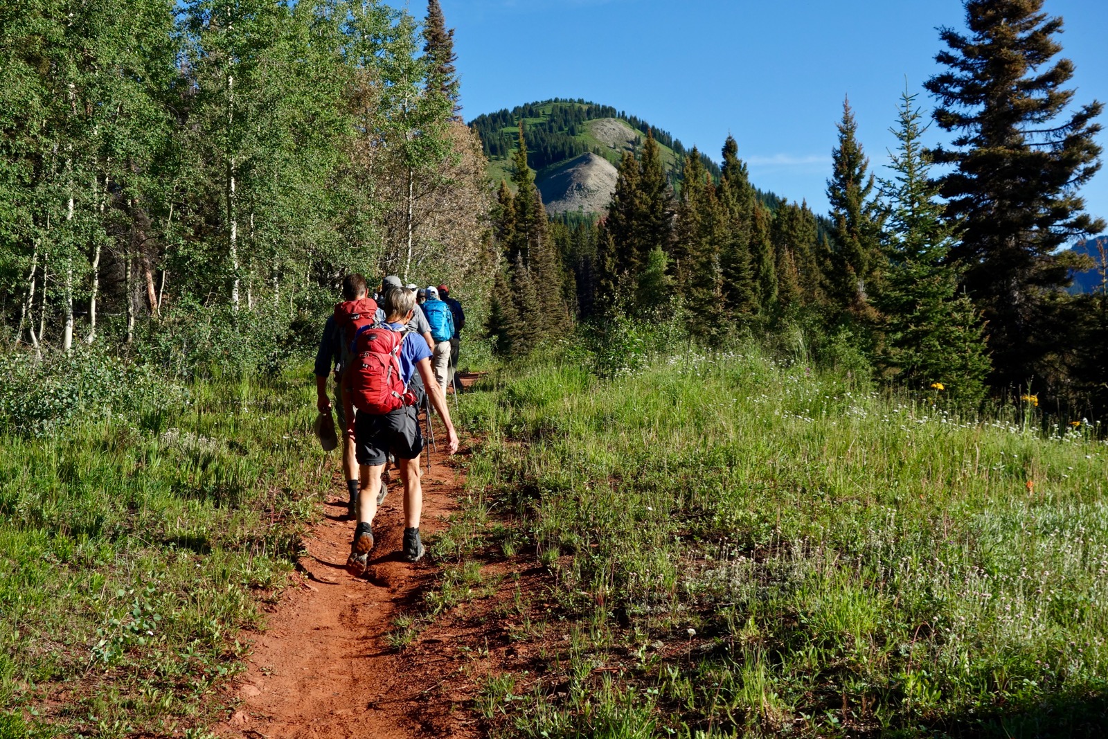
From the trailhead, elevation 10,400 feet, the Colorado Trail (CT) is open to hikers, equestrians, and bicyclists. I've done this hike four times now and every time the signage is different. This homemade sign was present in 2018 but unfortunately missing in 2019. Head north toward Denver.

The initial ascent is gradual. The vista opens eastward at 0.4 mile overlooking Graysill Mountain and Grayrock Peak. (Thomas Holt Ward, photo)

The CT hangs onto the 10,700 foot contour in healthy Douglas fir and spruce woods. Cross two side creeks and enter the Straight Creek draw. Here the wildflowers are head-tall and extravagant: corn husk lily, delphinium, osha, bluebell, cow parsnip, and fireweed. Hop across Straight Creek at 2.5 miles, 11,020 feet. In 2018, we shared the stream with a competitor in the self-supported, 500-mile Colorado Trail Race. The fastest time was four days, ten hours.

Pass through treelimit and enter the upper Straight Creek basin crossing the waterway again at 11,460 feet. The prominence on the west is UN 12,300' on the south ridge of Blackhawk Mountain. In August, bottle gentian are harbingers of autumn.

I have climbed Blackhawk, shown, from two different approaches. The standard (and easiest) route leaves from the pass, image-right. A couple of times I left the trail at 11,800 feet and went up the basin, image-left. It is the steeper choice. It puts you on the south ridge sooner. In 2018, elk had bedded down the night before leaving soft depressions in the flora.


It is a 30 minute hike from the pass to Blackhawk Mountain. The social trail soon dissipates. The informative sign seen below was missing in 2019.

Gain the south ridge just below the summit block.


Southwest is Whitecap Mountain and in the distance, the La Plata Mountains.

This image looks back to the summit from the north ridge. In 2018, a storm center-punched us and we made a mad dash down the east ridge back to the CT. In 2019, we went on to Harts Peak.

Harts Peak, 12,540'
There is a 120-foot cliff on the north ridge of Blackhawk that must be bypassed. This can be done one of three ways. The most challenging option is to walk out the north ridge to the brink of the cliff. Double back to the first weakness on the east and pitch down a steep slope. Then downclimb through gray rock until you can side hill to the Blackhawk-Harts saddle at 12,400 feet.

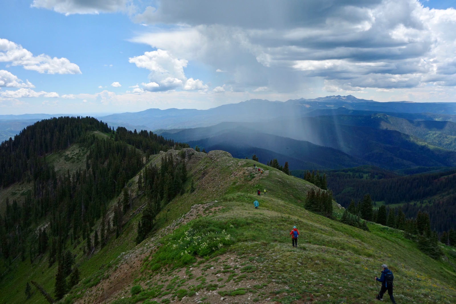
A more moderate choice is to descend north from the peak to the base of the band of red Cutler Formation. Drop east where the lead hikers are in the image below. Harts Peak is at the far end of the ridge just right of image-center.


The easiest route would be to descend on the south and then east ridge of Blackhawk to 11,980 feet. Watch for a social trail heading north. It comes and goes. This cut-across is the standard return route from Harts.

The headwall to the saddle is pitched so attempt to locate the wildcat trail. (THW, photo)

It is a nice walk on the bowed ridge to Harts Peak, shown, at 5.5 miles. The summit juts far to the north offering an exceptional view of Lone Cone. This snap looks south to Blackhawk, image-left. (THW, photo)

The town of Rico is over 3,700 feet below on the banks of the Dolores River. It was settled in 1879 as a silver mining district. The Rico Mountains have just five named peaks east of the river, the three described here plus Whitecap Mountain, 12,376', and Dolores Mountain 12,112'. (THW, photo)

Peak 12,402', Blackhawk East
Return to the pass on the CT at about 6.5 miles. Climbing Blackhawk East is more difficult than the previous effort so if you've had your fill this is the place to bail on the CT back to the trailhead. It is just over 0.3 mile from the pass to the summit, shown. There are two ways to maneuver on the lower ridge. If you are not a proven scrambler just slog up the very steep green slope for 420 feet to the crest. Twice in my field notes I wrote that the best part of the entire hike was the scramble up through the initial gray sill and Cutler Formation.

This group is climbing the gray sill for about 80 feet. The rock is pretty well seated but test your holds.

Next, scale the lower portion of the Cutler Formation.

I have not attempted to remain on the ridge past the point shown below. Transition to the green ramp. Footing is somewhat compromised by chipped rock.

In 2013, approximately 150 rosy finches circled the peak. In 2019, an electrical storm moved in and we lingered on top just long enough to put on rain gear. This image looks back at Blackhawk Mountain and Harts Peak from the summit.

The south ridge descent from Blackhawk East is a premier segment of this circuit. It starts off rather broadly then crimps with talus underfoot before opening again.

Re-enter the trees at Point 11,924', 7.7 miles, image-left. There is a subtle ridge split here. The most efficient and elegant route is to head south-southeast as indicated on the map above. In 0.2 mile, hunt around for the abandoned trail that went into upper Straight Creek basin before the CT reroute. If you don't locate it, simply work the ridge and intersect the CT one mile north of the trailhead.
No comments:
Post a Comment