Essence: The Chiricahua Mountains is the largest Sky Island in Arizona. Climb four prominences southwest of Chiricahua Peak, the high point in the range. Raspberry and Johnson peaks are ranked summits. Monte Vista Peak and Paint Rock do not meet the 300-foot prominence criteria. However, they are arguably the more engaging given the historic Monte Vista Lookout and the Class 4 wall on the summit block of Paint Rock. All four climbs are spurs from trails within the 87,700-acre Chiricahua Wilderness managed by the Douglas Ranger District, Coronado National Forest. Some of the footpaths were constructed by the Civilian Conservation Corps and deserve the highest trail rating. Most of the hike is sheltered within a diverse climax forest.
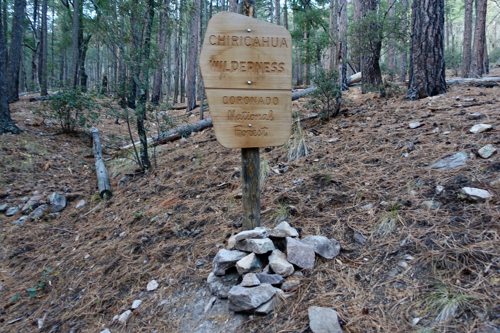
Travel: From the junction of AZ 181 and Turkey Creek Road, drive east on a wide dirt road prone to washboard. Pass Sanders Ranch, established in 1892. Cross a cattle guard at 5.2 miles and the road narrows. Watch for deer and turkeys. At 8.3 miles enter the Coronado National Forest, FSR 41. There is some rock on the road but 2WD with sturdy tires should make the trailhead. At 10.0 miles, Sycamore Campground is on the left with elder sycamore trees, picnic tables, bear boxes, trash cans, and a pit toilet. Fee required. At 10.9 miles the road ends in a turn circle with a parking pullout and sign for Morse Canyon Trail. No facilities, no water.
Distance and Elevation Gain: 11.5 miles; 3,800 feet
Total Time: 7:30 to 9:00
Difficulty: Primarily Class 1 trail with Class 2+ off-trail spurs to peaks; navigation moderate; One Class 4 wall with exposure on Paint Rock; hike during snow-free months; ephemeral water sources, carry what you need.
Map: Chiricahua Peak, 7.5' USGS Quad
Date Hiked: December 6, 2023
Quote: When the aromatic savour of the pine goes searching into the deepest recesses of my lungs, I know it is life that is entering. Nan Shepherd, The Living Mountain
The Monte Vista Lookout is a 40-foot steel tower with a 14’x14’ metal cabin. Built in 1966, it replaced a 30-foot tower built in
1922 that in turn had replaced a crow’s nest tower dating to 1916. In 2003 it was placed on the National Historic Lookout Register. (Thomas Holt Ward, photo)

Route: This post recounts our hike but you may climb the prominences in any order and do as many as you wish. Ascend south on the Morse Canyon Trail to Morse Saddle. Hike east on the Turtle Mountain Trail (not indicated on signage) to the Crest Trail. Take a spur trail west to Monte Vista Peak. Hike east on the Crest Trail and divert to Raspberry Peak. Return to the Crest Trail and hike north to Paint Rock. Retrace steps to Morse Saddle and mount west to Johnson Peak. Descend on the Morse Canyon Trail back to the trailhead.

Morse Canyon Trail No. 43
In early December we spent a cold (and solitary) night at the Sycamore Campground. It was 33 degrees when we started up the Morse Canyon Trail, elevation 6,600 feet. Since the canyon is west of the high peaks in the range we didn't anticipate warmth from the Solstice sun until we mounted the ridgetop at Morse Saddle. Curiously, the trailhead sign implies Johnson Peak is accessible by trail. We saw no evidence of a trail to the summit.

The forested approach is more open and interesting that I anticipated. East of the creek is a vertical rhyolite wall with blue lichen. The mature forest is composed of ponderosa and Apache pine,
piñon and juniper, Douglas-fir, white fir, oak, and even stands of Engelmann spruce on north-facing slopes.
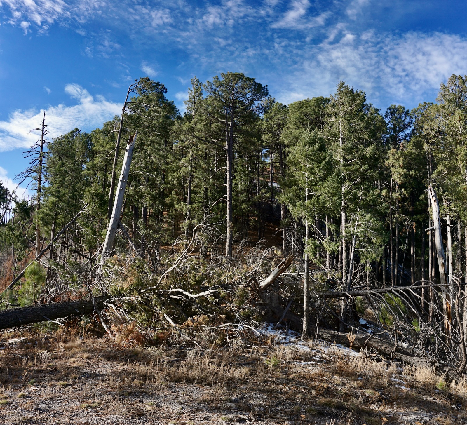
On May 8, 2011, the Horseshoe Two Fire started on the east side of the Chiricahua Mountains near the community of Portal. The fire burned a total of 223,000 acres within the range. While 100% of the acreage burned, damage was variable. Standing dead trees remain a threat so be aware, particularly on windy days.
At 0.4 mile cross to the east side of the main drainage, a south fork of Turkey Creek. The waterway was stone dry during our passage but the ford could be ripping and hazardous during spring runoff and monsoonal activity.

A juvenile horned owl flew by at eye level. The laminar flow of its wings enabling super silent stealth mode is the holy grail of an aviation wing.
The dirt path was softened with pine needles, suppressing undergrowth. The clean forest floor made for a whoosh-like slope in pine needle monochrome that matched the spent ferns beside the trail. The Forest Service has an extensive list of unusual flora you might see along the trail in summertime.
A generous trail platform was dug into the high-angled slope. Long lazy switchbacks hold a
steady, moderately steep grade. Block walls, artistic in their perfection, protect sharp turns on the admirably constructed trail. It's a remarkable piece of engineering. Beginning at elevation 7,550 feet, a couple inches of snow covered the trail on north exposures. Walk through a post-fire ponderosa nursery.

Head the canyon in 2.4 miles at Morse Saddle, elevation 8,540 feet, after 1940 feet of climbing. Half of the day's climbing accomplished, it is a rather long approach to our string of peaks. We reveled in solar warmth. While Johnson Peak is very near to the west, we decided to tack it on to the end of our four-peak day.
Monte Vista Peak and Lookout, 9,355'
Look east across Brushy Canyon to locate Monte Vista Peak and Lookout. I love the old (historic!) and inevitably askew signs on this hike. Looking at the image below, the trail to Pole Bridge skirts Johnson Peak on the south and then bears west. For Monte Vista Peak, turn east on the Turtle Mountain Trail, unsigned. All the trails discussed in this post are detailed in Chiricahua Mountains Hiking Trails.
.jpeg)
The grade mellows out on the divide. Bright green needles of young ponderosa and clumps of bunchgrass glisten in low-angle light. Massive root balls of fallen old growth giants lie beside the track. We are grateful for the trail as it makes a clean shot through locust thickets, the worst of the desert slashers.
Black bear scat was fresh. The prints of white-tailed deer were frequent. Snow is the great revealer and for many miles we shared the trail with mountain lions of all sizes--males, and females with cubs. Blood from a recent kill was on the trail and when we returned, fresh scat marked that spot. It is advisable to hike with a friend and to employ cougar protocol. Place the littlest person at the front of the line, not trailing. (THW, photo)

At 3.3 miles the trail swings to the southwest and climbs the northwest slope of Monte Vista Peak. Shafts of light penetrate and the forest is enveloped in quiet and stillness.

Reach a trail junction at 3.7 miles. The Crest Trail to Chiricahua Peak (plus Raspberry Peak and Paint Rock) continues east. The other sign on the post is shattered and illegible. For Monte Vista Peak keep going a few paces and watch for a trail hanging a hard right and ascending west up the east ridge. (THW, photo)

Only 100 feet of climbing remains on an idyllic trail.

Crest the broad and rolling summit of Monte Vista Peak at 3.9 miles after 2,760 feet of vertical. (THW, photo)

The Civilian Conservation Corps built the sturdy log Monte Vista Lookout Cabin. It was added to the National Register of Historic Places in 1988. The door is padlocked but the scale on the porch remains functional. This day pack weighed in at a hefty 15 pounds. (THW, photo)

The benchmark was placed in 1916. Back then the elevation was thought to be 9,373 feet. The Chiricahua Peak topographical map and Lists of John concur at 9,355 feet. The mountain has not yet been remeasured by LiDAR. The elevation found in the peak register offered a third opinion.

An old and tattered wooden sign requests that visitors refrain from climbing the tower. The stairs are open a few flights up to a locked gate.

With a prominence of 215 feet, Monte Vista is not a ranked summit. However, it is the southwest-most peak in the range over 9,000 feet. This image takes in the broad spectrum view to the west. Johnson Peak is image-right. It was named for A. T. Johnson who was stationed at the Lookout Tower in the 1920s and 1930s. (THW, photo)

Raspberry Peak, 9,420'
Return to the Crest Trail sign. For hikers whose sole intent is the Lookout, simply retrace your steps to the trailhead. For those going on to Raspberry Peak it can be confusing at the base of Monte Vista, a hub with three trails. Return to the Crest Trail sign at 4.1 miles and follow the sign toward Chiricahua Peak. The trail begins on the north side of the ridge. It soon swings back to the ridgetop at the 9,020-foot saddle. There's a great big jumbled pile of beautiful boulders on the southeast slope of Raspberry Peak. (THW, photo) 

There is no best way to approach the summit. Start searching for a route that works for you in the saddle. We followed the trail a bit further but it was not any friendlier. However you go, it's going to be brushy and troubled with deadfall, humongous boulders, and a respectable blockfield. We just bumbled our way up.
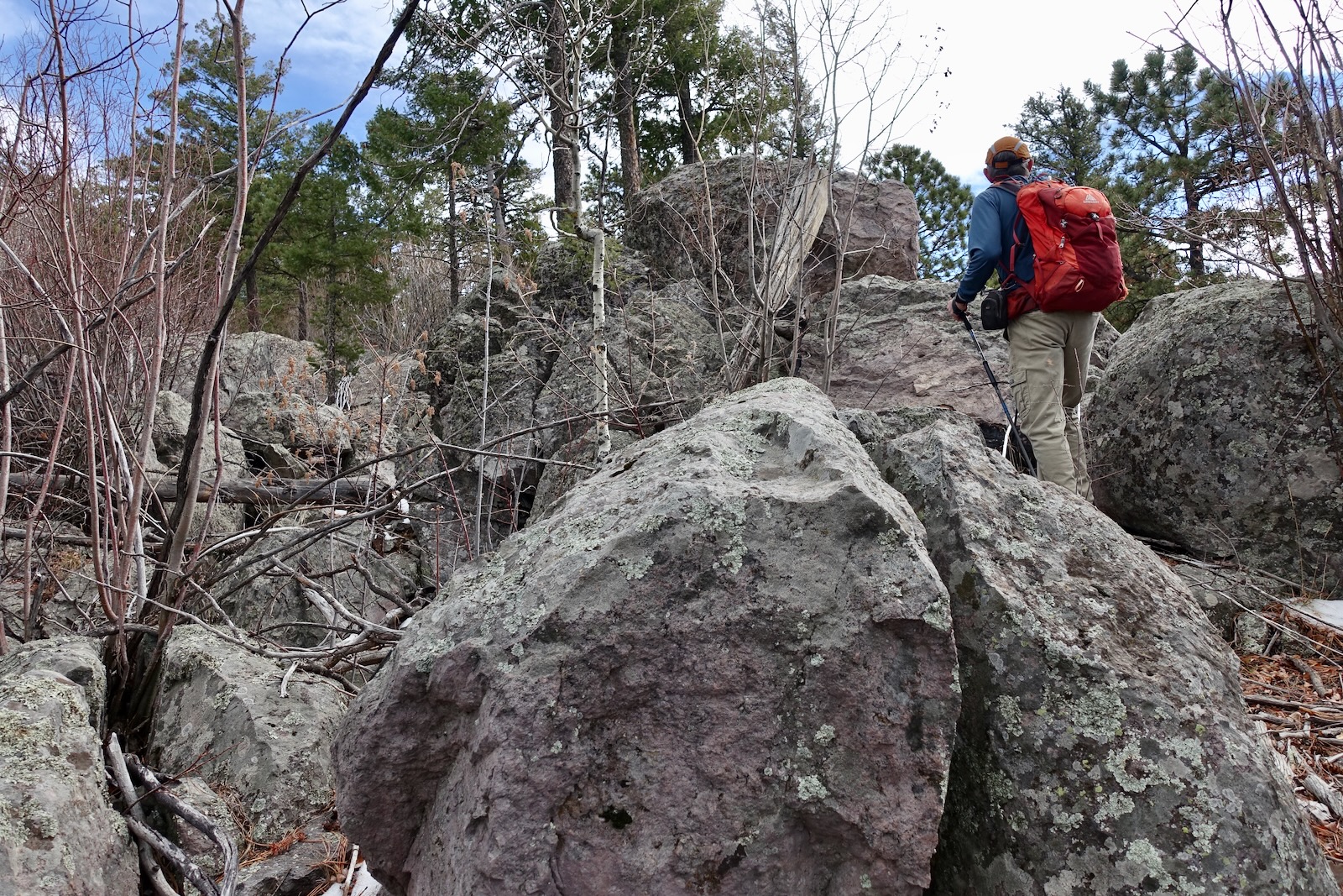
Reach the summit at 4.9 miles. With a rise of 400 feet, Raspberry is a legal peak. The register was in the summit cairn. This mountain is the highpoint of the hike but unfortunately you can't see much of anything because the crest is covered in opportunistic young aspen.

Paint Rock, 9,375'
This exceptional stony knob is located north of Raspberry Peak and south of Chiricahua Peak off the Crest Trail. Back up west a tad and look for a bailout down the north slope. It is free of large boulders but the ground is covered in chunks of gray rock and the aspen are so thick they impair travel. Soon enough you'll intersect the trail. Head north for about 0.6 mile.

Paint Rock looked like a righteous scramble. We hadn't researched the climb before the hike so we were caught by surprise. We left the trail prematurely but it was of little consequence. Head to the south end of the forbidding-looking cliffs that armor the peak.

Bearing west from the trail we tried the obvious first gully but it was a no-go so we sneaked around the gray rock, image-right, and went up the next opening.

We were pretty clueless at this point, but as it turned out, right on route. In just a few steps we were at a wide crack between cliff walls. We entered the crack where my partner is exiting on our return.

Pitch up the ultra steep chute. Use the wall on the right for secure holds. In this image I'm coming back down the crack. (THW, photo)

At the top of the chute, we worked left into another weakness that's not as steep or exposed. This deposited us at the summit block and crux. Surrounded by cliffs, we looked over all our options for scaling walls on the south face. Failing to find a Class 3 scramble we chose a clean, near vertical 20-foot wall, image-left.

My partner checked it out first to be sure we could make the summit from the top of the pitch. He then down-climbed to spot me. I dumped my pack and poles. Holds were rock solid but sparse. We can quibble about whether it is Class 3 or 4. I needed a series of spots going both up and down--my personal criteria for Class 4. Down-climbing the crux was more difficult than ascending. The non-technical pitch is a gift to scramblers.

The exposure is for the height of the wall only. Getting intimate with rock, ferreting out the moves, we live for this.

There are no further obstacles between the crux and the summit. (THW, photo)

Stand on the stone knob at 5.8 miles. With a rise of 155 feet the view isn't comprehensive but the lookout is free of trees. We searched for a different descent route without luck.
Super strong hikers could conceivably add Chiricahua Peak to the mix. It's right there, accessible by trail. It is the only peak in the neighborhood that has been measured by LiDAR. Elevation increased from 9,759 feet to 9,776 feet. With a whopping prominence of 5,163 feet, it ranks fourth in Arizona.
We climbed Chiricahua Peak from the Rustler Park Trailhead in February of 2015, just four years after the Horseshoe Two Fire. It didn't make the cut for Earthline because the hike failed to generate enough excitement. From my field notes: "The forest was entirely burned. We clambered over 20 fallen trees. We strolled through a burned forest on an endlessly contouring trail, never on, but always near, the highest rolling ridge in the range. We postholed in 18 inches of snow on the north ridge. It's a mound, not a peak. Two large cougar tracks were the most exciting part of the day." (Harsh!) Under more optimal conditions I'd like to return and hit all the high points along the divide. From this angle, Chiricahua has its share of interesting volcanic features.

Paint Rock might be a little guy but we are wildly enthusiastic about the prominence. It was our favorite and the only true stone peak of the four. In contrast, Raspberry and Monte Vista seen below are rolling hilltops.

Johnson Peak, 8,890'
Return as you came to Morse Saddle, 8.5 miles. Along the way are periodic glimpses of the mountain through the trees, especially from the northwest slope of Monte Vista. There is no trail that we could find up Johnson as the trailhead sign implies. To start, negotiate the fallen trees on the west side of the saddle. (THW, photo)
Ascend west on the very steep east ridge. Pine needles make the footing slippery. The slope is wondrously clean to start and then is troubled with deadfall. And yet, there is nothing difficult about this short and quick climb.

The ridge narrows to a pleasant, rocky stairstep. We shared the ridgeline with an unmaintained 4-wire barbed fence, image-left. It goes up one side of the mountain and down the other. We must have hopped over it 20 times.

Crest the fourth summit of the day at 8.8 miles. With a rise of 350 feet Johnson is a legal summit. From the small rocky top you must peer through openings in the trees to see ranges flowing outward. We got a hazy-day look into the mountains of Mexico. (THW, photo)

We managed to sight unmistakable Cochise Head in the northern sector of the Chiricahua Mountains. Achieving that singular summit was much more challenging than this four-summit hike.

Writing this post some weeks after completing the hike, just seeing Paint Rock in this photo elicits joyfulness.
(THW, photo)

Allow about an hour to return to the trailhead from Morse Saddle. The trail is so smooth, you can make good time. By mid-afternoon it was twilight in the canyon in December. We returned in a pool of shadow. (THW, photo)

No comments:
Post a Comment