Essence: This massive, full-day hike explores two of the unranked features on the headwall of Pima Canyon and the ridge traverse from Pima Saddle over Point 6,953' to Mount Kimball. The Molar is the informal name for the most easterly of the four Wolves Teeth, accessed via a short spur off the Pima Canyon Trail. The Class 3, somewhat exposed climb is optional. Point 6,500' is a short hike west of Pima Saddle. This stunning viewpoint is accessible to all hikers. I'd always assumed that the traverse from Pima Saddle to Kimball was a pipe dream but once we began the climb it unfolded beautifully with no serious obstacles--a first-order triumph! The mile-long traverse is not a shortcut to Mount Kimball; it is suitable for desert mountaineers familiar with Pusch Ridge challenges. Trail hikers, please see Mount Kimball, 7,258': Pima Canyon to Finger Rock Canyon. The hike is within the Pusch Ridge Wilderness managed by Coronado National Forest.
Travel: From Tucson, drive north on Oracle Road, AZ-77. Pass Ina Road and turn right on Magee Road. Go 1.5 miles to the Iris O. Dewhirst Pima Canyon Trailhead. Or, from Ina Road take Christie Drive north for 1.4 miles and turn right on Magee. The generous, paved lot is on the right. There is a drinking faucet but no other facilities.
Distance and Elevation Gain: Point 6,500' and the Kimball traverse is 13.8 miles, 4,900 feet; The Molar adds 0.3 mile roundtrip, 320 feet.
Total Time: 8:30 to 11:00; The Molar adds about one hour.
Difficulty: 12 miles on-trail; Class 2+; no exposure (The Molar, Class 3 with moderate exposure); I recommend 5 liters of fluids, minimum; ideally, hike late fall through December 31.
Maps: Tucson North; Oro Valley, AZ 7.5' USGS Quads
Date Hiked: May 4, 2023
Difficulty: 12 miles on-trail; Class 2+; no exposure (The Molar, Class 3 with moderate exposure); I recommend 5 liters of fluids, minimum; ideally, hike late fall through December 31.
Maps: Tucson North; Oro Valley, AZ 7.5' USGS Quads
Date Hiked: May 4, 2023
Pusch Ridge Wilderness Bighorn Sheep Closure: It is prohibited to
travel more than 400 feet off designated Forest Service trails from
January 1 through April 30, bighorn sheep lambing season. This hike is off-limits during that period. No dogs.
Quote: I hold that a man should strive to the uttermost for his life’s set prize. Robert Browning
Quote: I hold that a man should strive to the uttermost for his life’s set prize. Robert Browning
Pima Canyon is encircled by a string of monoliths, pinnacles, and mountain blocks in the upper, cliff-forming unit of Wilderness Suite Granite. The Pima Canyon headwall extends east from Table Mountain, image-left, over the four Wolves Teeth: Table Tooth, Canine, Barrier Tooth, and The Molar, image-center. Off-image, the arc pivots at Point 6,500' and runs southeast over Point 6,953' to Mount Kimball. (Thomas Holt Ward, photo)

Route: Hike northeast on the Pima Canyon Trail for 5.2 miles. Leave the trail and climb northwest to The Molar. Return to the primary trail and take the spur to Pima Saddle. Hike north to Point 6,500'. From the saddle climb southeast over Point 6,953' to Mount Kimball. Return on the Pima Canyon Trail. See the end of this post for an optional creek walk on the return.

Pima Canyon Trail
From the Pima Canyon Trailhead, elevation 2,920 feet, the footpath threads through private land on a
thin easement bearing generally northeast making for the canyon. Cross into the wilderness just before the Pima Canyon Trail sign at 0.4 mile. I'm fond of this quirky sign. It's not a "Peak', it's a "Mount!" More importantly, the mileage is correct.

Diverse congregations of Sonoran flora evolve throughout the hike as it progresses through multiple biozones. The classic array starts up right away with a rich mix of saguaro, ocotillo, agave, staghorn cholla, brittlebush, and prickly pear. The crested saguaro at half a mile is my reassurance that, yes, I'm on the correct trail. Just past this signature saguaro, the trail is enveloped in
shade during winter months. Pima Canyon is notoriously brisk; dress
accordingly.

The first of numerous wash crossings is at 1.1 miles. During a wet winter, Pima Canyon's
drainageway can be flush with surface water but not always! Don't count on it as your water source. At 2.0 miles, The Cleaver cuts an irresistible force. The scramble up the blade is one of the finest in the range but the cactus-cluttered approach is a test of patience and pain tolerance.

The monoliths on the Pima Canyon headwall are visible from the lower canyon. Looking very far away are Barrier Tooth, The Molar, Point 6,500', and Valentine Peak.

At 3.0 miles, the footpath crosses a sheet of Catalina Gneiss with five
bedrock mortar holes. A few steps further on, veins of quartz incise a stone slab. The dam (image-center) was constructed in
the 1960s by Arizona Game and Fish. It was intended as a water source
for bighorn sheep and other wildlife. Casual hikers typically
turn around at the dam. Friends of Santa Catalina Trails maintains the pathway below the dam.
The trail above the dam was neglected for 20 years. Outslope Trail Solutions has been
working in partnership with the National Forest Foundation and
Coronado National Forest to repair trails within the Santa
Catalina Ranger District that were impacted by the Bighorn Fire of 2020. They did a major overhaul of the Pima Canyon and Finger Rock corridor trails in 2023. They realigned, improved the platform, cleared downed trees, and trimmed brush. The improvements were immediately apparent and truly helped us out. Thank you Eric Ruljancich and crew. (THW, photo)

At 3.8 miles the trail crosses over to the southeast side of the canyon and bucks up. For those doing the creek walk discussed at the end of this post, this is where you'll hop out of the wash and rejoin the trail. A guardian oak shades our traditional rest stop. (THW, photo)


Walk on sheets of bedrock along the edge of the canyon. This is one of my favorite trail segments, enhanced by rippling mosses.
Drop into a southeast tributary at 4.2 miles and then recross the main canyon on slabs of Catalina Gneiss. This is the upper end of the creek walk. Every time we come up this trail we talk over strategies for climbing Peak 5,985' (Barrier Tooth), shown. Friends who attempted the tower in 2023 backed off at a technical gap.

Every Pusch Ridge canyon has an exceptional vantage point. Arrive at "Pima Vista," 4.5 miles, elevation 5,060 feet. Stand on rock stacks for the best views down-canyon. We were especially enthralled with Valentine Peak. From the lower canyon Valentine looks like a solitary tower but from the north, it is the third step down from Prominent Point. The image below is illustrative of the steepness and difficulty of the climb.

Approaching the soaring tilted gneiss monoliths, the trail is suspended high above the canyon floor. I was grateful to the trail crew for stabilizing and widening the platform.

Cross the creek and the canyon tightens. Massive fallen boulders gather together in the bottom of the trench. The Madrean evergreen woodland biome hosts a verdant forest of alligator juniper, Arizona oak, piñon, and madrone.
(THW, photo)


Pima Spring,
5.1 miles, 5,580 feet, funnels through a cement encasement built into a grotto of permanent green. There was some flow in 2023 but it can be a disappointing trickle. The sign was in three pieces with the slightest trace of the original etching. The trail crosses over to the northwest side and resumes climbing. (THW, photo)

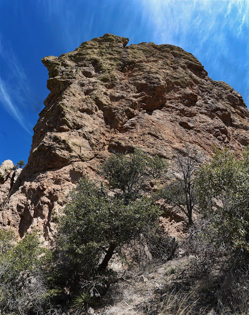
The Molar, 6,100'
The spur to the summit is 0.3 mile roundtrip with 320 feet of vertical. The Molar is elusive from the trail so you'll have to use some navigation savvy to figure out where to launch. The feature photo at the top of this post is instructive. The block seen below is the southwest wall of Point 6,500'; Pima Saddle is to its right. The first objective is to pitch north to the saddle between Point 6,500' and The Molar. We left the footpath at 5.2 miles, 5,780 feet. The first 100 feet to the saddle is nasty, to be honest. The steep, grassy slope is slippery with poor footing on chipped rock. It's hard to get purchase.

Stick it out and once you gain the ridge at 5,900 feet it's a delightful finish. Below, we are starting to climb west to The Molar. Behind us is the southwest wall and false summit of Point 6,500'. We toyed with the notion of climbing the prominence by working up the ridge but it looked uncertain and we rightly assumed it would be an easier approach from Pima Saddle. This photo is inserted for the ridge purists out there. (THW, photo)

These climbers are getting into the Class 3 series. Manzanita plays interference and some exposure is unavoidable. It's a happy little scramble.

This shot of Wilderness Dome was snapped from the rim rock near the summit. It's a little hard to make out sitting directly in front of Samaniego Peak. Leviathan and Solitude domes are in the triplet cluster. Mount Lemmon is the highpoint of the Santa Catalina Mountains sky island. (THW, Photo)

Chunks of pink and white quartz are scattered all over the unranked summit (rise, 200 feet). The ridgeline prominence has some of the best views in the range. Look north into Oro Valley and down-canyon to town and the Tucson Mountains. The perspective on Table Tooth is riveting. While it's a mere splinter sliced from Table Mountain, as my friend said, we look mental for climbing it.

To Pima Saddle


Move a little to the right away from the wall, working open ground and proceed up a draw. The ridgeline behind the bulwark becomes visible to the left. Gain the ridge and continue up, staying left of the rock pile seen below.


Walk on thin, flat crystal-infused plates while losing just a few feet to the saddle.


Towers soar above treetops directly below. (THW, photo)
Return on Pima Canyon Trail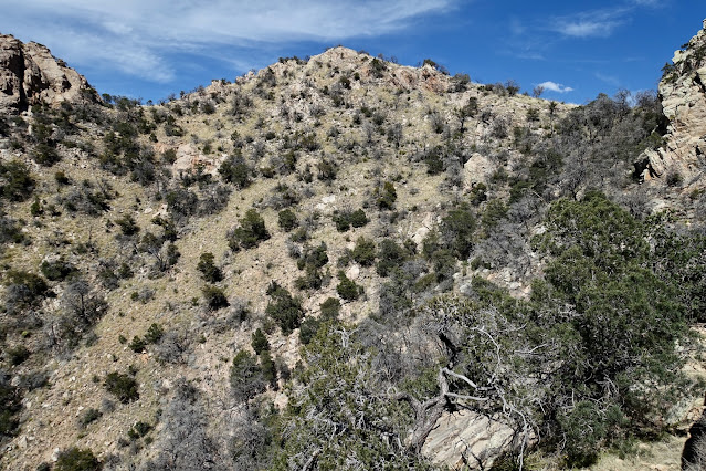
Springtime flowers on the forest flower amaze. (THW, photo)


As so often occurs at the soft end of the day when the earth is silent and still, I am filled with gratitude that this refuge exists adjacent to Tucson. As Craig Childs wrote, "Where else but the sprawling West are public lands laid out like a gift to silence and space, not privately owned and hurriedly filled, but managed with the thought that they’ll be here in the future?"

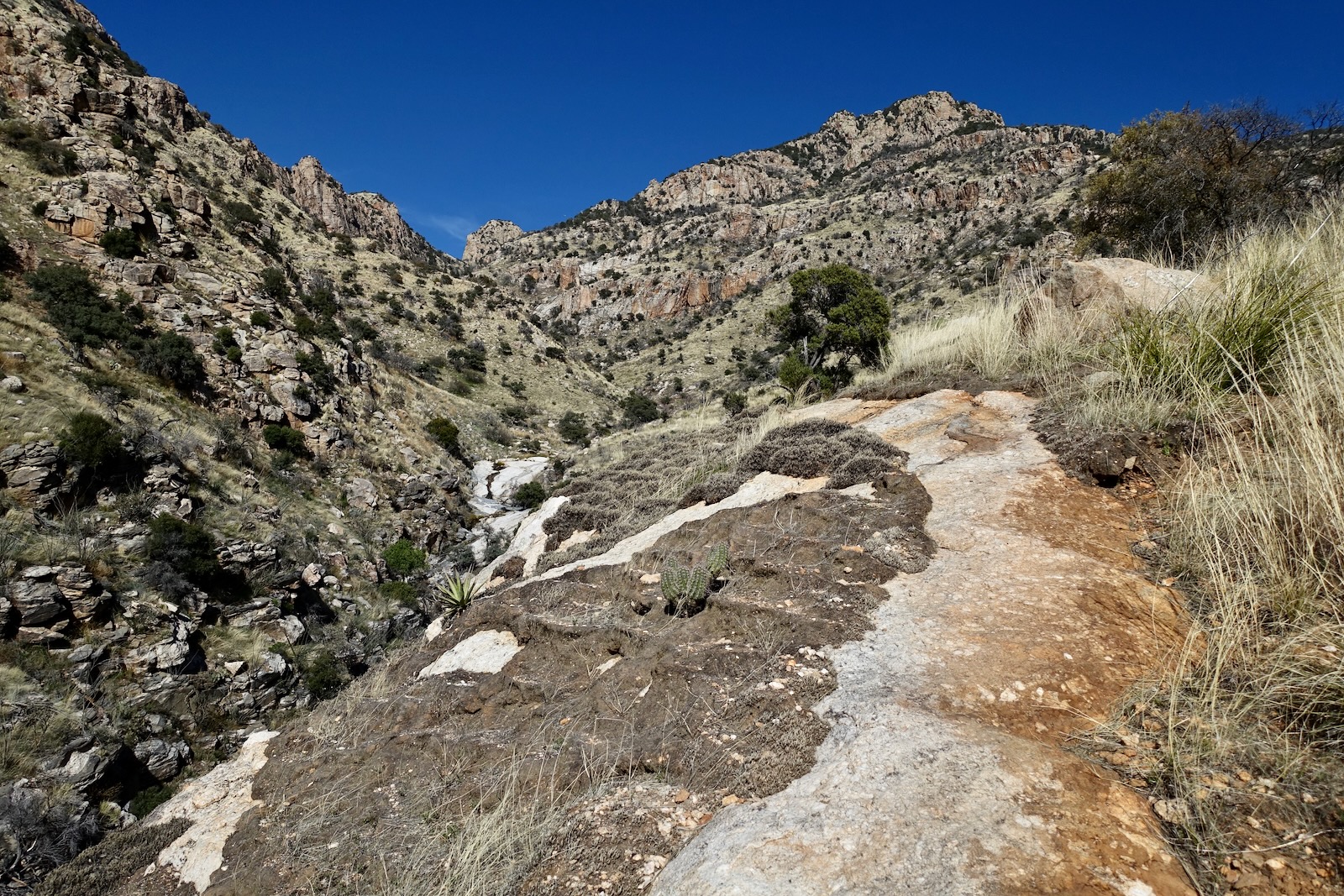
Back on the trail, the canyon grows tighter and more vertical. I am enthralled with the power and presence of the orange, southwest face of Point 6,500'. (THW, photo)

Reach the freehand torch stenciled sign for Pima Saddle at 5.5 miles, 6,180 feet. (Add 0.3 to subsequent mileages if you climbed The Molar.) The 0.1 mile spur trail was remarkably improved by Outslope Trail Solutions. It used to be a straight up slip and slide. Now switchbacks mitigate the steepness. Alight on the saddle at elevation 6,340 feet.

Point 6,500'
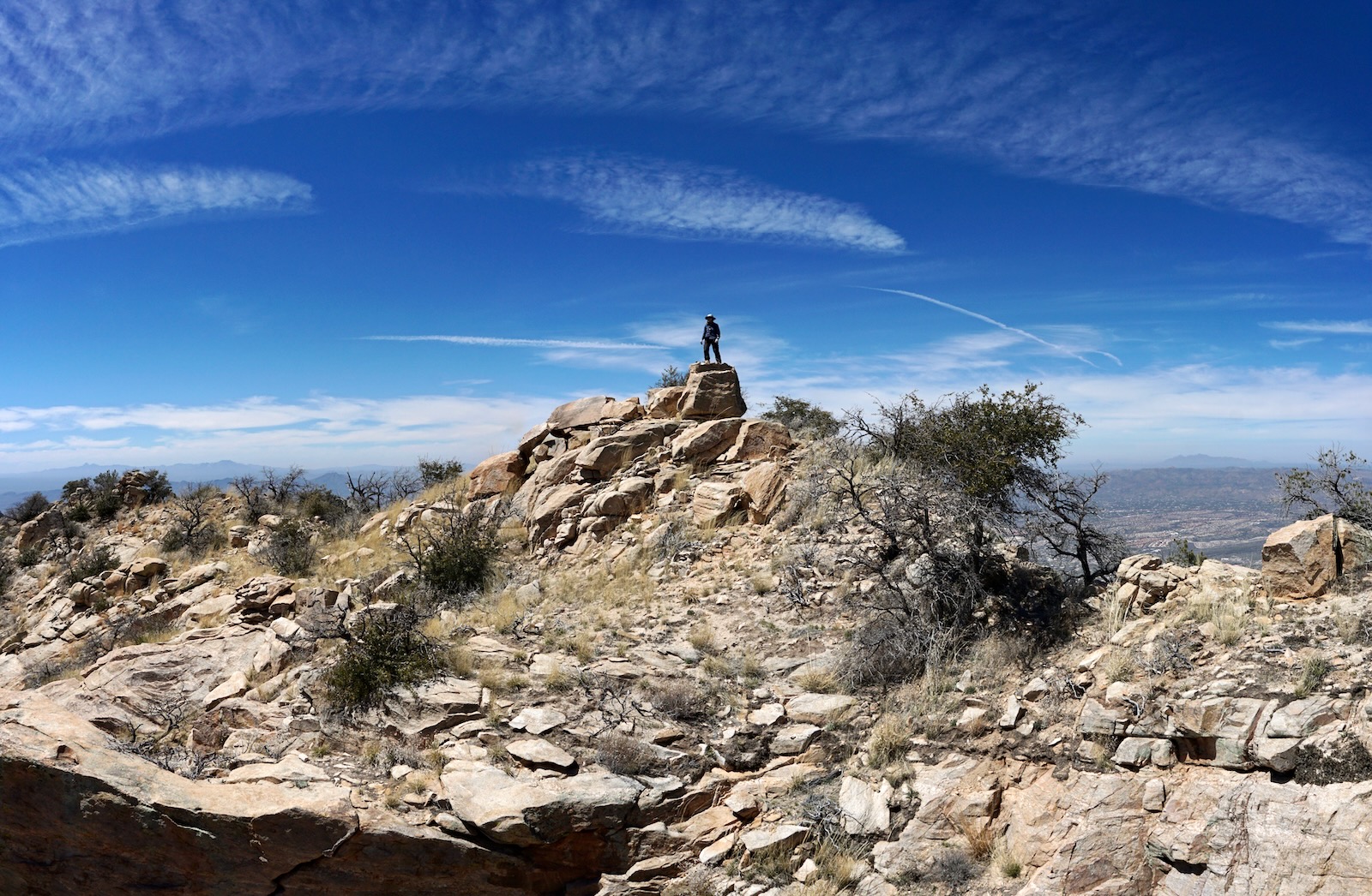
The elevation of the prominence was estimated using standard extrapolation. The spur is 0.3 mile roundtrip with 160 feet of vertical. It takes only ten minutes for the Class 2 stroll. A social trail gets you started. Go up and over the false summit to the highpoint, pictured.

If this is your turnaround (3,660 feet of vertical already!) the payback from this little point is immeasurable. It looks like a peak should. Big handsome boulders have squared off tops to stand on. Crystals glisten. It is the pivot point of the headwall arc and the terminus of the ridge to the west. The gem feels like a secret, safe place along the linear string of unforgiving spikes and monoliths. (THW, photo)
There are incomparable views of Pusch Ridge, the surrounding range, and out into the great beyond. The crest is convoluted so work the view opportunities by walking out to radiating points. From one, we looked practically straight down on Catalina State Park, Point 4,262', and Buster Mountain.
This image is for the ridge fanatics who'd like to clean the traverse from The Molar. It looks like a go from the west knob to the summit.

Pima Saddle to Mount Kimball Traverse
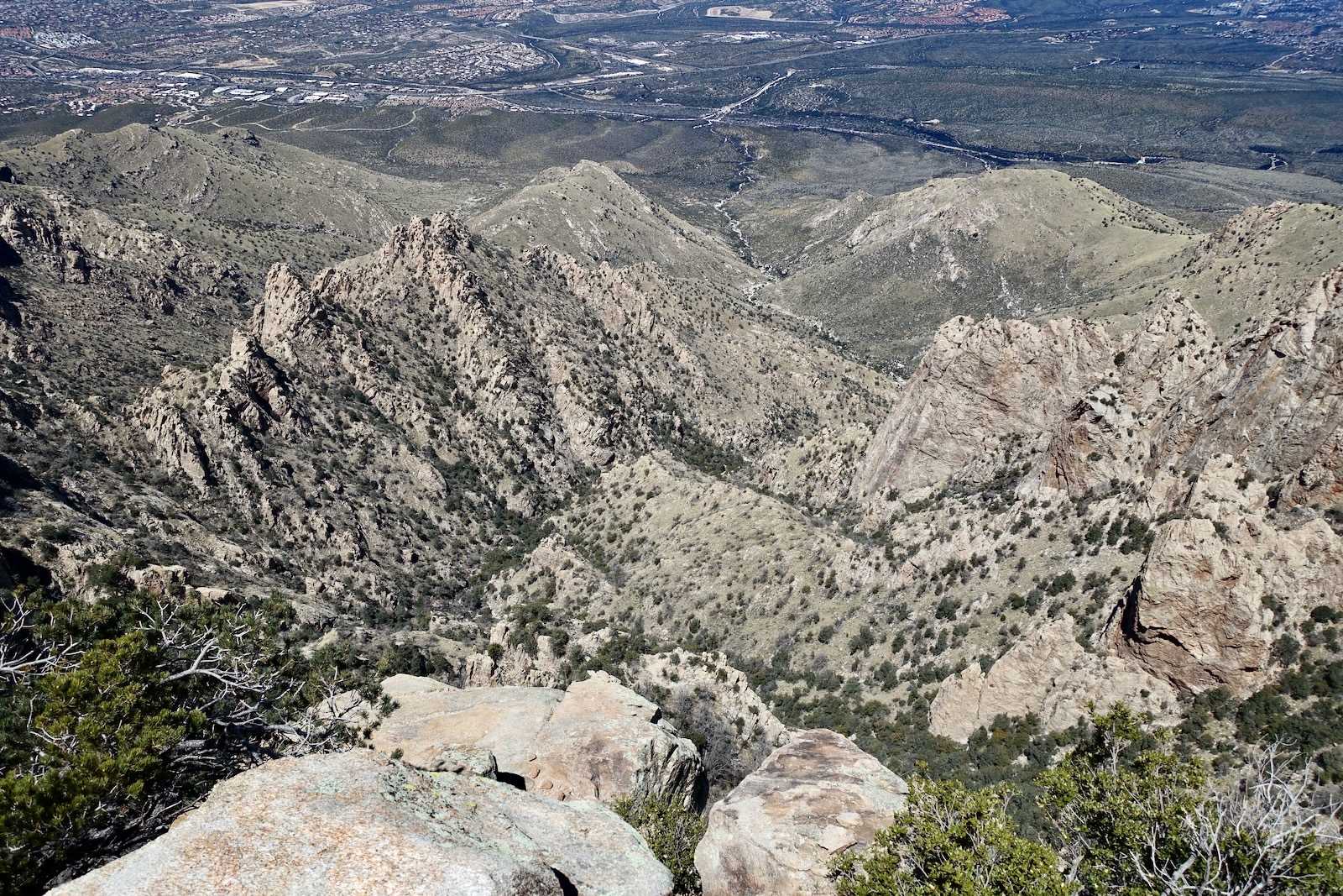
From Point 6,500', the traverse to Mount Kimball didn't look promising. We'd looked over the terrain from various vantage points in the past and figured our odds were poor. We had a big debate whether to even give it a try. We figured if we could dodge the initial major outcrop on the right we had a chance. We packed plenty of food and fluids in case we wanted to poke at it. We were back on Pima Saddle at 5.9 miles. The photo below shows the first part of the traverse from the saddle to Point 6,953'. (THW, photo)

The traverse is one mile and took us 1:15. The trek requires navigation skills and desert off-trail experience. Trail hikers should summit Kimball on the Pima Canyon Trail. To start, friction over rock flowing from the base of the outcrop on the right. Scoot around the bulwark hugging the cliff wall.

Move a little to the right away from the wall, working open ground and proceed up a draw. The ridgeline behind the bulwark becomes visible to the left. Gain the ridge and continue up, staying left of the rock pile seen below.

Instructions from here are simple: continue up the main ridge staying as close as possible to the centerline. There is a clear shot to the false summit of Point 6,953' at 6,740 feet.

The Bighorn Fire scorched the west face of the point. It remains fairly brushy; dress defensively.

As I top out on Point 6,953', 6.4 miles, Prominent Point and Finger Rock are to my southwest. Okay, so that's a lot of lift off the desert floor and we are not there yet! (THW, photo)

Walk on thin, flat crystal-infused plates while losing just a few feet to the saddle.

We were elated to see that Mount Kimball looked attainable. Continue working the ridge, bypassing the next centerline outcrop on its left.

That worked ideally, like everything else on this traverse so far.

There were continuous surprises and delights along the way.

We wove between trees, those alive and those tragically burned. More quartz lay exposed on the surface. We ran into the Pima Canyon Trail just upridge from the Finger Rock Trail junction, 6.8 miles, 7,240 feet. Success!
Mount Kimball, 7,258'
We arrived overjoyed on Mount Kimball at 6.9 miles after 4,700 feet of elevation gain. Turns out, this traverse wasn't that tough relative to the many others we've explored on Pusch Ridge. Below, Point 6,500' is down low on image-right and Point 6,953' is image-center.

Kimball is a wooded peak with a bare rock crest that takes advantage of its 1,118-foot rise. Growing in stature to the northeast are (from the right) Window Peak, Cathedral Rock, and Mount Lemmon.

Towers soar above treetops directly below. (THW, photo)

Return on Pima Canyon Trail
It is 6.9 miles back to the trailhead. Miles fly by on the overhauled trail. When the pathway cranks northeast at 6,240 feet we sorted out the extraordinary landscape. Overlooking the monoliths just before the Pima Saddle turnoff is both mystical and wondrous. Point 6,500' is shown below. Close the loop at the Pima Saddle sign, 8.3 miles.

Springtime flowers on the forest flower amaze. (THW, photo)

Creek Walk in Pima Canyon
We answered another years-long curiosity with a 0.4 mile creek walk on slabs of Catalina gneiss. We left the trail where it crosses the canyon at 4,680 feet and rejoined it at the next crossing at 4,340 feet. The water chorus changed harmonies with every footstep. (THW, photo)

Gray and white slabs slide into the streambed. (THW, photo)

A vertical wall with horizontal striping comes down to meet a water-scoured trough. This little reprieve was a highlight of the long hike. However, if you are spent, there's just enough boulder hopping to argue for saving this stretch for a day when you are fresh. (THW, photo)

This western narrow-mouthed toad was hanging out at the dam croaking away. (THW, photo)

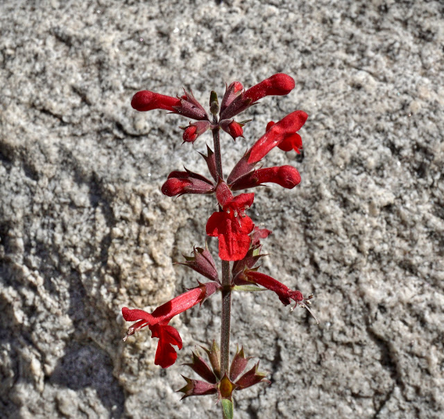
Perry's penstemon bloomed nearby. (THW, photo)

I'd repeat this trek in a heartbeat which is the greatest compliment a hike can earn.

As so often occurs at the soft end of the day when the earth is silent and still, I am filled with gratitude that this refuge exists adjacent to Tucson. As Craig Childs wrote, "Where else but the sprawling West are public lands laid out like a gift to silence and space, not privately owned and hurriedly filled, but managed with the thought that they’ll be here in the future?"

No comments:
Post a Comment